- Covington County, Alabama
-
Covington County, Alabama 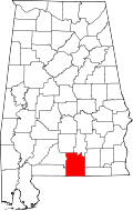
Location in the state of Alabama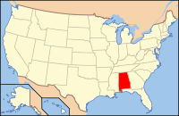
Alabama's location in the U.S.Founded December 17, 1821 Seat Andalusia Largest city Andalusia Area
- Total
- Land
- Water
1,043.86 sq mi (2,704 km²)
1,033.82 sq mi (2,678 km²)
10.05 sq mi (26 km²), .96%Population
- (2010)
- Density
37,765
36/sq mi (14/km²)Covington County, Alabama, is a county of the U.S. state of Alabama. Its name is in honor of Brigadier General Leonard Covington of Maryland. As of 2010 the population was 37,765. Its county seat is Andalusia.
Contents
History
- Covington County was established on December 17, 1821.
- The county was declared a disaster area in September 1979 due to damage from Hurricane Frederic and again in October 1995 due to Hurricane Opal.
Geography
According to the 2000 census, the county has a total area of 1,043.86 square miles (2,703.6 km2), of which 1,033.82 square miles (2,677.6 km2) (or 99.04%) is land and 10.05 square miles (26.0 km2) (or 0.96%) is water.[1]
Major highways
 U.S. Highway 29
 U.S. Highway 84
 U.S. Highway 331
 State Route 54
 State Route 55
Adjacent counties
- Butler County and Crenshaw County (north)
- Coffee County and Geneva County (east)
- Walton County, Florida (southeast)
- Okaloosa County, Florida (southwest)
- Escambia County and Conecuh County (west)
National protected area
- Conecuh National Forest (part)
Demographics
Covington County, Alabama Year Pop. ±% 1830 1,522 — 1840 2,435 +60.0% 1850 3,645 +49.7% 1860 6,469 +77.5% 1870 4,868 −24.7% 1880 5,639 +15.8% 1890 7,536 +33.6% 1900 15,346 +103.6% 1910 32,124 +109.3% 1920 38,103 +18.6% 1930 41,356 +8.5% 1940 42,417 +2.6% 1950 40,373 −4.8% 1960 35,631 −11.7% 1970 34,079 −4.4% 1980 36,850 +8.1% 1990 36,478 −1.0% 2000 37,631 +3.2% 2010 37,765 +0.4% Sources: "American FactFinder". United States Census Bureau. http://factfinder2.census.gov/faces/nav/jsf/pages/index.xhtml. through 1960 As of the census[2] of 2000, there were 37,631 people, 15,640 households, and 10,791 families residing in the county. The population density was 36 people per square mile (14/km2). There were 18,578 housing units at an average density of 18 per square mile (7/km2). The racial makeup of the county was 86.19% White, 12.35% Black or African American, 0.48% Native American, 0.17% Asian, 0.01% Pacific Islander, 0.17% from other races, and 0.62% from two or more races. 0.78% of the population were Hispanic or Latino of any race.
There were 15,640 households out of which 29.50% had children under the age of 18 living with them, 54.10% were married couples living together, 11.30% had a female householder with no husband present, and 31.00% were non-families. 28.60% of all households were made up of individuals and 14.10% had someone living alone who was 65 years of age or older. The average household size was 2.37 and the average family size was 2.90.
In the county the population was spread out with 23.50% under the age of 18, 8.10% from 18 to 24, 26.10% from 25 to 44, 24.30% from 45 to 64, and 17.90% who were 65 years of age or older. The median age was 40 years. For every 100 females there were 91.60 males. For every 100 females age 18 and over, there were 88.00 males.
The median income for a household in the county was $26,336, and the median income for a family was $33,201. Males had a median income of $27,453 versus $19,640 for females. The per capita income for the county was $15,365. About 14.10% of families and 18.40% of the population were below the poverty line, including 23.90% of those under age 18 and 19.20% of those age 65 or over.
Settlements
Cities and towns
- Andalusia
- Babbie
- Carolina
- Florala
- Gantt
- Heath
- Horn Hill
- Libertyville
- Lockhart
- Onycha
- Opp
- Red Level
- River Falls
- Sanford
Unincorporated communities
- Antioch
- Beck
- Beda
- Bethlehem
- Beulah
- Blairs
- Blue Springs
- Boston
- Boykin
- Brooks
- Cedar Grove
- Clear Springs
- Clearview
- Coldwater
- County Line
- Dunns
- Duvall
- Eoda
- Estothel
- Fairfield
- Flaco
- Five Points
- Friendship
- Green Bay
- Harmony
- Howells
- Huckaville
- Loango
- McRae
- Opine
- Rawls
- Red Oak
- Rome
- Rose Hill
- Stanley
- Stedman
- Straughn
- Valley of Shiloh
- Wiggins
See also
- National Register of Historic Places listings in Covington County, Alabama
- Properties on the Alabama Register of Landmarks and Heritage in Covington County, Alabama
- Covington County Website
References
- ^ "Census 2000 U.S. Gazetteer Files: Counties". United States Census. http://www.census.gov/tiger/tms/gazetteer/county2k.txt. Retrieved 2011-02-13.
- ^ "American FactFinder". United States Census Bureau. http://factfinder.census.gov. Retrieved 2008-01-31.

Butler County and Crenshaw County Escambia County and Conecuh County 
Coffee County and Geneva County  Covington County, Alabama

Okaloosa County, Florida Walton County, Florida Municipalities and communities of Covington County, Alabama Cities 
Towns Babbie | Carolina | Gantt | Heath | Horn Hill | Libertyville | Lockhart | Onycha | Red Level | River Falls | Sanford
 State of Alabama
Topics - Index
- History
- Geography
- People
- Delegations
- Government
- Governors
- Lieutenant Governors
- Metropolitan Areas
- Visitor Attractions
- National Historic Landmarks
Regions Metros - Greater Birmingham
- Montgomery Metro Area
- Mobile Metro Area
- Huntsville Metro Area
Larger cities Counties - Autauga
- Baldwin
- Barbour
- Bibb
- Blount
- Bullock
- Butler
- Calhoun
- Chambers
- Cherokee
- Chilton
- Choctaw
- Clarke
- Clay
- Cleburne
- Coffee
- Colbert
- Conecuh
- Coosa
- Covington
- Crenshaw
- Cullman
- Dale
- Dallas
- DeKalb
- Elmore
- Escambia
- Etowah
- Fayette
- Franklin
- Geneva
- Greene
- Hale
- Henry
- Houston
- Jackson
- Jefferson
- Lamar
- Lauderdale
- Lawrence
- Lee
- Limestone
- Lowndes
- Macon
- Madison
- Marengo
- Marion
- Marshall
- Mobile
- Monroe
- Montgomery
- Morgan
- Perry
- Pickens
- Pike
- Randolph
- Russell
- Shelby
- St. Clair
- Sumter
- Talladega
- Tallapoosa
- Tuscaloosa
- Walker
- Washington
- Wilcox
- Winston
Categories:- Alabama counties
- Covington County, Alabama
- 1821 establishments in the United States
- Populated places established in 1821


Wikimedia Foundation. 2010.