- Monkstown, County Dublin
-
Monkstown
Baile na Manach— Suburb of Dublin — Location in Ireland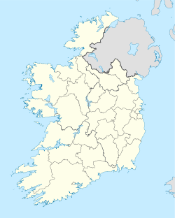
 Monkstown
Coordinates: 53°17′38″N 6°09′13″W / 53.2938°N 6.1537°WCoordinates: 53°17′38″N 6°09′13″W / 53.2938°N 6.1537°W Country Ireland Province Leinster County Dun Laoghaire-Rathdown Government - Dáil Éireann Dún Laoghaire - EU Parliament Dublin Population (2006) - Urban 6,369 Time zone WET (UTC+0) - Summer (DST) IST (WEST) (UTC-1) Area code(s) 01, +353 1 Irish Grid Reference O221292  Monkstown showing to the left Monkstown Church, Dublin (Church of Ireland) and St. Patricks Church (Roman Catholic) to the right
Monkstown (Irish: Baile na Manach), historically known as Carrickbrennan (Irish: Carraig Bhraonáin), is an area in south Dublin, located in Dun Laoghaire-Rathdown County, Ireland. It is on the coast, between Blackrock and Dún Laoghaire. The DART stations of Seapoint and Salthill and Monkstown serve the area.
The lands of the Carrickbrennan estate form the greater part of the civil parish of Monkstown.
Monkstown is part of the Dáil Éireann constituency of Dún Laoghaire.
Contents
History
In 1539, King Henry VIII awarded the Monkstown lands to Sir John Travers, Master of the Ordnance in Ireland. John Travers lived in his Castle at Monkstown from 1557 to his death in 1562 and buried in the Carrickbrennan Graveyard where the property fell to James Eustace 3rd Viscount Baltinglass through his marriage to Mary Travers. In 1580, the Castle was used as a rebellion stronghold, after which it was awarded to Sir Henry Wallop, Vice-Treasurer of Ireland. The lands were later returned to Mary, the widow Baltinglass, who later married Gerald Alymer. On her death in 1610 the Castle was transferred to the Chevers family through the marriage of Mary Travers's sister Catherine to John Chevers, and the property passed directly to his second son Henry Chevers, who married Catherine, daughter of Sir Richard Fitzwilliam. Henry and Catherine Chevers lived here with their four children (Walter, Thomas, Patrick, Margaret).[citation needed]
Upon the death of Henry in 1640, the castle and lands were passed to Walter Cheevers. Walter and family were given command to vacate Monkstown in 1653 by the Cromwellian Commissioners, and transplanted to Killyan, County Galway. In 1660, Walter Chevers was restored to his estate at Monkstown Castle, until his death in 1678.[citation needed][nb 1]
Monkstown was later purchased by Bishop of Armagh Michael Boyle where his son Murragh, Viscount Blessington enlarged the castle making it one of the finest residences.[citation needed]
Until about 1800, Monkstown was a rural area of open countryside, dotted here and there with large houses owned by the merchants of Dublin. The Monkstown Church (Church of Ireland) had been built - but was smaller than the present church. Two rivers met in the area now called Pakenham Road. The river known as Micky Briens originated in Sallynoggin. A lake beside Monkstown Castle had one small island. The coastline was ragged and rocky, with a harbour stretching over 100 yards inland at the mouth of the aforementioned rivers, adjacent to the area now occupied by the West Pier. Dun Laoghaire (then called Dunleary, and later Kingstown) was then a small group of houses in the area of the Purty Kitchen, and the present area of Dún Laoghaire was an area of rocky outcrops and later, quarries.
Wednesday, November 18, 1807 was South Dublin's night of disasters. In an horrific storm, two sailing ships, the Rochdale and the Prince of Wales were blown on to the rocks, one at Seapoint and the other at Blackrock. About 400 lives in total were lost on that night, many of them washed up on the shore at Monkstown. The disaster was one of the factors which led to the building of Dun Laoghaire Harbour. Most of the victims were buried in Carrickbrennan Churchyard.
The building of Dun Laoghaire harbour gave an impetus to the area, and Montpelier Terrace was the first of many terraces built in the area. The coming of the railway in 1837 had a much greater impact. Firstly, it changed the topology of the coast, and secondly, it led to Monkstown becoming a commuter suburb of the city of Dublin. Most of the houses along Monkstown Road and the avenues north of that road were constructed over the next 30 years. The maps of 1870 show this phase completed, but the rest of Monkstown consists of mansions surrounded by extensive gardens. For the following 50 years there was little change. The post-war developments of Castle Park, Richmond, Windsor, etc. and the more recent developments of Brook Court, Monkstown Valley, and Carrickbrennan Lawn mean that there is little opportunity for further development.
Notes
- ^ The Shivers family of America trace their lineage to Thomas Chevers brother of Walter Chevers of Monkstown, through the Cromwellian warrant, authorized on 26 November 1653 for Captain John Whittey to transport the Thomas Chevers family to America.
Documentary references
- Monkstown is first mentioned in 1450; Tenants Cistercians at Carrickbrennan, Villa Monachorum.
- Carrickbrennan, or "Carigbrenna", features on the 1598 map "A Modern Depiction of Ireland, One of the British Isles" by Abraham Ortelius.
- Records of the Abbey of the Blessed Virgin Mary 1640.
- Forfeiting Proprietors under the Cromwellian Settlement 1657.
- In James Joyce's "The Dead," Gabriel Conroy and his wife Gretta live in Monkstown.
Noted buildings
 Monkstown Castle, viewed from the east.
 Monkstown Castle, viewed from the north.
Monkstown has two old established churches, Saint Mary's Church of Ireland (1831) and Saint Patrick's Catholic Church (1866), both on Carrickbrennan Road. Also established in the modern era are Saint John's Church of the Society of Saint Pius X located at Gamble's Hill, the Kingdom Hall of the Jehovah's Witnesses at Monkstown Farm, and the Meeting Hall of the Society of Friends at the junction of Packenham Road and Carrickbrennan Road. There is also the Friends Burial Ground (Quaker) located at Temple Hill just off Monkstown Road.
Monkstown Castle, which was probably built in the 12th or 13th centuries, was erected by the monks of the abbey of the Virgin Mary, near Dublin.
Monkstown is also noted for its beautiful coastline, which displays many historical buildings of the Georgian and Edwardian periods. One of the most notable buildings of the Salthill and Monkstown area is a Martello Tower, located at Seapoint beach.
Sports
Monkstown Lawn Tennis Club was founded in 1877. It was the first tennis club in Ireland.
Monkstown Football Club was founded in the village in 1883 before moving to Sandymount in 1901.
Monkstown (Dublin) Boxing Club was founded in 2004, their gym is situated in the newly built Mounttown Community Centre in Fitzgerald Park, in the Monkstown Farm Area.
Farm Utd Football Club was form in 1935, and uses part of the Monkstown Community Centre as its dressing rooms.
Culture
Monkstown has a locally known puppet theatre named Lambert Puppet Theatre, a family-run business. Every year the puppet theatre hosts an international puppet festival. It used to run series on national television, RTÉ. Michael Jackson once saw a puppet show in this theatre.
Comhaltas Ceoltóirí Éireann, an organisation promoting Irish culture (particularly Irish traditional music), has its headquarters in Monkstown, as does BirdWatch Ireland.
Education
A multi-denominational primary school, Monkstown Educate Together National School (METNS), a fee paying Congregation of Christian Brothers School, CBC Monkstown Park, and Holy Family National School are located in the Monkstown area. A Gaelscoil is also located in Monkstown, Scoil Lorcáin, teaching all classes through Irish.
St. Oliver Plunkett N.S is a school for children with a Specific Learning Difficulty (SLD). This school caters for children from a wide catchment area.
Christian Brother's College consists of two schools; an Independent preparatory school with over 200 students and a secondary school with more than 500 students. CBC caters for boys from junior infants through sixth year. It is to be demolished and rebuilt in the coming years.[1]
Transport
An Aircoach service starting in Dalkey links the area with Dublin Airport 24 hours a day.
People
Sir William Parsons, 3rd Earl of Rosse (1800–1867) lived at 1 Eaton Place, and built several telescopes, including the world's largest telescope in 1845 which remained the world's largest for the rest of the century. Using this telescope he saw and catalogued a large number of galaxies.[2]
Alfred Gresham Jones (1824?-1913) was an Irish architect who designed Merrion Hall on Merrion Street Lower, now the Davenport hotel, in 1862 and designed the villa Verona in Queen's Park in 1873. He lived at Queen's Park House from 1869-1872, at Clifton Lodge on Seafield Ave 1873-1876, at Villa Carlotta on Queen's Park 1886-1888, after which he emigrated to Australia.[3]
Richard Pigott (1835-1889) lived at 7 De Vesci Terrace. He was an Irish journalist, best known for selling the Pigott forgeries.[2]
Sir Howard Grubb (1844-1931) was a designer and maker of telescopes. He lived at De Vesci Terrace, and from 1925, at 13 Longford Terrace, which now bears a plaque.[2]
- The Edge.
- Chris DeBurgh.
- Sinéad O'Connor.
- Paul McGuinness.
- Malcolm Arnold.
- Gary Mason.
- Bláthnaid Ní Chofaigh
- Tim Pat Coogan
- D.J. Carey
- John O'Shea (humanitarian)
See also
References
- ^ Christian Brother's College Retrieved on 07-02-08.
- ^ a b c Tom Roche and Ken Finlay (2003). "Blackrock, Dun Laoghaire and Dalkey (Along the coast from Booterstown to Killiney)"
- ^ Alfred Gresham Jones on the Directory of Irish Architects
External links
- Holy Family National School
- Monkstown Educate Together National School
- "Monkstown Village"
- Comhaltas Ceoltóirí Éireann
- Cumann na nÓg
- Monkstown Parish Maps
Places in Dún Laoghaire–Rathdown County town: Dún Laoghaire Towns 
Villages Ballinteer · Ballybrack · Blackrock · Booterstown · Cabinteely · Carrickmines · Cherrywood · Churchtown · Dalkey · Deansgrange · Dundrum · Foxrock · Goatstown · Glasthule · Glenageary · Johnstown · Killiney · Kilmacud · Kilternan · Leopardstown · Loughlinstown · Monkstown · Rathfarnham · Sandyford · Sandycove · Sallynoggin · Stepaside · Stillorgan
Category:Mountains and hills of County Dublin · Category:Rivers of County Dublin · Category:Geography of County Dublin Categories:- Untranslated Irish place names
- Locations in Dublin (city)


Wikimedia Foundation. 2010.