- Copper Canyon
-
For other uses, see Copper Canyon (disambiguation).
 Copper Canyon
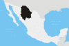
Copper Canyon (Spanish: Barranca del Cobre) is a group of canyons consisting of six distinct canyons in the Sierra Tarahumara in the southwestern part of the state of Chihuahua in Mexico. The overall canyon system is larger and portions are deeper than the Grand Canyon in neighboring Arizona.[1] The canyons were formed by six rivers which drain the western side of the Sierra Tarahumara (a part of the Sierra Madre Occidental). All six rivers merge into the Rio Fuerte and empty into the Sea of Cortez. The walls of the canyon are a copper/green color which is where the name originates.
Contents
History
The Spanish arrived in the Copper Canyon area in the 17th century and encountered the indigenous locals throughout Chihuahua. For the Spanish, Mexico was a new land to explore for gold and silver and also to spread Christianity. The Spanish named the people they encountered "Tarahumara", derived from the word Raramuri, which is what the indigenous people call themselves. Some scholars theorize that this word may mean ‘The running people'. During the 17th century, silver was discovered by the Spaniards in the land of the Tarahumara tribe. Some were enslaved for mining efforts. There were small uprisings by the Tarahumara, but to little avail. They were eventually forced off of the more desirable lands and up into the canyon cliffs.
Climate
The alpine climate of the mountainous regions of Copper Canyon has moderate temperatures from October to November and March to April. The bottom of the canyons is humid and warm and remains that way throughout the year. During the warmest months, April through June, drought is a chronic problem with little rainfall until July when the rainy season begins.
Flora and Fauna
The Sierra Tarahumara Occidental region contains some twenty-three different species of pine and two hundred different species of oak trees. Mexican Douglas-fir (Pseudotsuga lindleyana) trees cover the high plateaus in altitudes over 8,000 feet (2,400 m), but due to deforestation in the area, many species of wildlife are endangered. Cougars live in the remotest of regions and are rarely seen. After the summer rainy season these upper regions blossom with wildflowers until October. From 4,000–8,000 feet (1,200–2,400 m), oak trees grow in the huge forests as well as the more shade-tolerant types of trees. In the fall the forests become brilliant with color from Andean Alder (Alnus acuminata) and poplar (Populus spp.) trees. Brushwood and scrubby trees grow on the canyon slopes, which can accommodate the dry season. Huge fig (Ficus spp.) and palm trees thrive at the bottom where water is plentiful and the climate is tropical.
Threats to the Ecosystem
Due to increases in human population, there are many threats to the ecosystems of the Sierra Tarahumara Occidental region. The government funding to build a “tourist friendly” atmosphere poses threats to the environment and indigenous cultures. Roads have been built in the former isolated mountainous zones. Agriculture and grazing as well as the cutting of hardwoods and other trees for firewood has accelerated a soil erosion problem. Mesquite (Prosopis spp.) and Desert Ironwood (Olneya tesota) trees are cut and exported primarily to the U.S. for charcoal. Amapa (Tabebuia chrysantha) trees yield highly prized lumber for building and furniture making. Other trees are also cut and sold for their high-priced lumber. Over harvesting of the forests in the area has caused the extinction of the Imperial Woodpecker and Mexican Wolf. Approximately, 2 percent of the original old-growth forest remains.[citation needed] However, a massive forest-harvesting project in the region has been abandoned, for now, by the World Bank. The Mexican forestry department deemed these species of trees “legally protected,” but enforcement is difficult.
The government has taken measures to halt or slow down the cultivation of opium poppies and cannabis by spraying crops with herbicides, which threaten the populations of many different species. A large saturnid moth, Rothschildia cincta, are one of the species that are threatened by the spraying. Their cocoons are used by the Indian population for ceremonial purposes.
Open-pit mining for copper, gold and other metals not only produces air pollution from smelters, but has been linked to the serious decline of the Tarahumara Frog (Rana tarahumarae). Every river system has been dammed causing fresh water shortages in nearby desert communities. An enormous dam is being constructed on the Rio Fuerte, which poses major environmental problems and may lead to massive losses of tropical forest and habitats.
Conservation is underway, but remains informal and slow. Mexico has excellent environmental laws, but severely suffers from lack of financial support. Enforcement has been lax or non-existent. Agencies are actively trying to increase the protection for natural preserves.[citation needed]
Indigenous People
Copper Canyon traditional inhabitants are the Tarahumara or Rarámuri. With no official census, the population of the Tarahumara people probably ranges between 35,000 to 70,000. Many Tarahumara reside in the cooler, mountainous regions during the hot summer months and migrate deeper into the canyons in the cooler winter months, where the climate is more temperate. Their survival strategies have been to occupy areas that are too remote for city people, way off-the-beaten-path, to remain isolated and independent, so as to avoid losing their culture. Their diet is largely domestic agrarian, but does consist of meat from domesticated cows, chickens and goats, wild game, and freshwater fish. Corn (maize) is the most important staple of the Tarahumara’s diet. The Tarahumara people are known for their endurance running. Living in the canyons, they travel great vertical distances, which they often do by running nonstop for hours. A popular Tarahumara community race called “rarahipa,” is played by kicking a wooden ball along the paths of the steep canyons. Tourism is a growing industry for Copper Canyon, but the acceptance of it is debated in the local communities. Some communities accept government funding for building roads, restaurants and lodging to make the area attractive for tourists. Many other groups of Tarahumarans maintain their independence by living in areas that are as far away from city life as possible. Their way of life is protected by the mountainous landscape.
Tourism
There are many other ways to explore Copper Canyon such as hiking, biking, driving or horseback riding. The most popular way is by train, as the Ferrocarril Chihuahua al Pacífico or ChePe, runs along the main canyon called Canyon Urique, between Chihuahua and Los Mochis, on the Gulf of California.
The Chihuahua al Pacifico began in the late 19th century. The revolution, lack of funding, and the overall difficulty of building a railroad over such terrain hindered its completion until 1961. The railroad comprises 405 miles of rails with 39 bridges and 86 tunnels. The total trip takes approximately 15 hours and passes through towns, as well as the towering cliffs of the canyons. Along the railway, many Tarahumarans lay out their food, crafts and other wares for sale.
Mexico established the Parque Nacional Barranca del Cobre (Copper Canyon National Park) to showcase this remote area. The park is located in the municipalities of Batopilas, Bocoyna, Guachochi, and Urique.
Cities and towns
Among the villages located in or on the Copper Canyon are:
- Bahuichivo, ChePe train stop for Cerocahui, Urique, Piedras Verdes, Tubares
- Basaseachi, located near the pouroff of 840m Cascada Basaseachi in the Barranca Candameña. The towns and ranchos of San Lorenzo, Cahuisori, and Huahumar encircle the rim of the canyon, also home to Mexico's highest waterfall Piedra Volada (1200m). It is on the main Federal Highway 16 between Chihuahua, Chihuahua, and Hermosillo, Sonora.
- Batopilas, elevation 600m, a town on the Batopilas River at the bottom of a canyon; first established by the Spanish around 1632 to mine silver. It is located 30 km southeast of Urique.
- Bocoyna, 30 km east of Creel, and on the eastern escarpment of the continental divide. The nearby Rio Conchos flows into the Rio Bravo (Rio Grande). All other "Copper Canyon" rivers flow into the Sea of Cortez/Pacific Ocean.
- Cerocahui, 14 km S. of the train stop at Bahuichivo.
- Creel, atop the canyon and, at 2340m 8,000 feet (2,438 m) altitude, marking the highest point on the ChePe railroad route; a central point for commerce and tourism.
- Divisadero, situated between the Atlantic and Pacific Ocean watersheds on the ChePe railroad route; a key vista point with amazing views down into three of the canyons (del Cobre, Urique, Tararecua). The ChePe train allows a 15-20 minute stop for visitors to enjoy the view.
- Temoris, a dual town located 400m apart in elevation. The ChePe train traverses the valley 3 times including a mile long tunnel to gain elevation. Located on the Rio Septentrion, lower Temoris is at 1000m.
- Urique, 560m. Located at the bottom of the canyon rim below Bahuichivo, on the Urique River. It is 30 km NW of Batopilas, now connected by a rough road.
Popular culture
Copper Canyon was featured on Season 2 Episode 3, of Man vs. Wild on the Discovery Channel. It is also featured in Raramuri Tale,[1] a short film about a Raramuri boy, his mother and the timeless teachings of the Tarahumaras. Copper Canyon was also featured in the Film The Three Burials of Melquiades Estrada. Copper Canyon was also a destination in Motorcycle Mania 3, a feature that aired on the Discovery Channel, which featured Jesse James of West Coast Choppers riding with singer Kid Rock, on two custom-built motorcycles. In the Sierra Madre, a book by Jeff Biggers, looks at a Tarahumara village in the Copper Canyon.[2] Much of the nonfiction book Born to Run by Christopher McDougall takes place in Copper Canyon.
See also
- Piedra Volada Falls, Mexico's highest waterfall.
- Basaseachic Falls, Mexico’s second-highest waterfall.
References
- ^ raramuritale.co.uk
- ^ Biggers, Jeff. In the Sierra Madre. University of Illinois Press. pp. 208. ISBN 0252031016.
- Cassel, Jonathon F. Tarahumara Indians Naylor Co. 1969
- Disappearance of the Tarahumara frog. In Our living resources 1994, National Status and Trends Report. National Biological Survey, Washington, D.C.
- Fontana, Bernard L. Tarahumara: Where Night is the Day of the Moon. University of Arizona Press, 1997.
- Grant, Richard. "God's Middle Finger: Into the Lawless Heart of the Sierra Madre", 2008, ISBN 1416534407
- Hale, S.F., Schwalbe, C.R., Jarchow, J.L., May, C., Lowe, C.H. and Johnson, T.B
- Hart, John M. The Silver of the Sierra Madre: John Robinson, Boss Shepherd and the People of the Canyons. Tucson: University of Arizona Press, 2008.
- Kennedy, John G. "Tarahumara of the Sierra Madre: Beer, Ecology, and the Social Organization" 1978, ISBN 0882956159
- Lumholtz, Carl (1987) Unknown Mexico: Explorations in the Sierra Madre and Other Regions, 1890-1898. Vol 1. Dover Publications. pp 118–421. ISBN 0486253643
- McDougall, Christopher. "Born to Run: A Hidden Tribe, Superathletes, and the Greatest Race the World Has Never Seen." ISBN 0307266303, Knopf, May 2009.
- Merrill, William L. "Raramuri Souls: Knowledge and Social Process in Northern Mexico", 1988; ISBN 0874746841
- Pennington, Campbell W. "The Tarahumar of Mexico", 1996
- Roca, Paul M., Spanish Jesuit Churches in Mexico's Tarahumara, University of Arizona Press, Tucson, 1979, ISBN 0816506515
- Seedhead News (1991). Sierra Madre World Bank "development" or logging project? The Seedhead News Nos. 32 & 33: 1-11.
- Zingg, Robert, Behind the Mexican Mountains, University of Texas Press, Austin, 2001, ISBN 0292798083
 State of Chihuahua
Chihuahua (capital) Cities Ciudad Chihuahua • Ciudad Cuauhtémoc • Ciudad Juárez • Delicias • Parral
Municipalities Sights Basaseachic Falls • Casas Grandes • Copper Canyon • Cuarenta Casas • Cumbres de Majalca National Park • Piedra Volada • Sierra Madre Occidental
Categories:- Canyons and gorges of Mexico
- Chihuahua
- Landforms of Sierra Madre Occidental
- Regions of Northern Mexico
- Sierra Madre Occidental
- Visitor attractions in Mexico


Wikimedia Foundation. 2010.