- Currituck, North Carolina
-
For other uses of "Currituck", see Currituck (disambiguation).
Currituck, North Carolina — Unincorporated community — Location of Currituck in North Carolina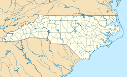

Coordinates: 36°26′23″N 76°0′19″W / 36.43972°N 76.00528°WCoordinates: 36°26′23″N 76°0′19″W / 36.43972°N 76.00528°W Country United States State North Carolina County Currituck Township Crawford Area - Total 2.2 sq mi (5.6 km2) - Land 2.1 sq mi (5.5 km2) - Water 0 sq mi (0.1 km2) Population (2000) - Total 716 - Density 337.2/sq mi (130.2/km2) Time zone Eastern (EST) (UTC-5) - Summer (DST) EDT (UTC-4) ZIP code 27929 Area code(s) 252 Currituck is an unincorporated community in extreme northeastern North Carolina, USA. Situated along the Currituck Sound, it serves as the county seat for Currituck County. Currituck is part of the Inner Banks region and is one of the state's few unincorporated county seats. The community harbors the Knotts Island Ferry, which provides free shuttles across the sound to Knotts Island. North Carolina Highway 168 (Caratoke Highway) and Courthouse Road are the community's most prominent roads. The Currituck Beach Lighthouse is not located on mainland Currituck, but is located across the sound on the Outer Banks.
As early as the mid-1700s the Currituck county seat was called Currituck Court House; the "Court House" suffix eroded away with the passage of time.
World famous Monster Truck and team Grave Digger Is based in the township, with the Digger's Dungeon shop located here.
Contents
Geography
Currituck is located at 36°26′23″N 76°0′19″W / 36.43972°N 76.00528°W (36.439774, -076.005478). According to the United States Census Bureau, ZIP Code 27929 has a total area of 2.1 square miles (5.6 km²), of which 2.1 square miles (5.5 km²) is land and 0.0 square miles (0.1 km²) is water.[1]
Climate
Currituck lies in a humid subtropical climate zone and experiences four discernible seasons. It receives an average of 48.2 inches (1,220 mm) of precipitation each year, with the wettest season being July. In January 1985, Currituck experienced its lowest recorded temperature at -2°F, while the hottest temperature was 107°F in July 1942.[2]
Climate data for Currituck, NC Month Jan Feb Mar Apr May Jun Jul Aug Sep Oct Nov Dec Year Average high °F (°C) 52
(11)55
(13)63
(17)72
(22)79
(26)86
(30)89
(32)88
(31)83
(28)74
(23)65
(18)56
(13)71.8
(22.1)Average low °F (°C) 32
(0)34
(1)40
(4)48
(9)57
(14)66
(19)70
(21)69
(21)63
(17)52
(11)43
(6)36
(2)50.8
(10.5)Precipitation inches (mm) 4.4
(112)3.28
(83.3)4.03
(102.4)3.07
(78)4.14
(105.2)4.31
(109.5)5.59
(142)5.47
(138.9)4.55
(115.6)3.32
(84.3)2.97
(75.4)3.07
(78)48.2
(1,224)Source: The Weather Channel[2] Demographics
Currituck is neither an incorporated area nor a census-designated place, all the data is for the ZIP code 27929. As of the census of 2000, there were 716 people and 306 households residing in the community. The population density was 286.4 people per square mile (130.2/km²). The racial makeup of the community was 97.6% White, 0.6% African American, 0.6% Asian, 1% from other races, and 0.6% from two or more races. Hispanic or Latino of any race were 2.1% of the population.[1]
In the community the population was spread out with 23.9% under the age of 18, 60.6% from 18 to 64, and 15.5% who were 65 years of age or older. The median age was 42.6 years. The population was 52% male and 48% female.[1]
The median income for a household in the community was $49,917, and the median income for a family was $53,542. The per capita income for the community was $22,264. About 7.9% of families and 7.4% of the population were below the poverty line.[1]
References
- ^ a b c d "27929 zip code Currituck". BrainyZip. 2009. http://www.brainyzip.com/zipcodes/27/27929.html. Retrieved June 1, 2009.
- ^ a b "Monthly Weather Averages for Currituck, North Carolina". Weather.com. The Weather Channel. http://www.weather.com/outlook/travel/businesstraveler/wxclimatology/monthly/graph/27929?from=36hr_bottomnav_business. Retrieved 2009-06-06.
Municipalities and communities of Currituck County, North Carolina County seat: Currituck Unincorporated
communitiesBarco | Carova Beach | Coinjock | Corolla | Currituck | Grandy | Gregory | Harbinger | Knotts Island | Jarvisburg | Mamie | Maple | Moyock | Point Harbor | Poplar Beach | Poplar Branch | Powells Point | Sanderling | Shawboro | Sligo | Spot | Waterlily
 Categories:
- Populated places in Currituck County, North Carolina
- Unincorporated communities in North Carolina
- County seats in North Carolina


Wikimedia Foundation. 2010.