- Mattoon Township, Coles County, Illinois
-
Mattoon Township — Township — Location in Coles County Coles County's location in Illinois
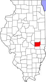
Coordinates: 39°28′40″N 88°24′41″W / 39.47778°N 88.41139°WCoordinates: 39°28′40″N 88°24′41″W / 39.47778°N 88.41139°W Country United States State Illinois County Coles Established November 8, 1859 Area - Total 36.13 sq mi (93.57 km2) - Land 36.13 sq mi (93.57 km2) - Water 0 sq mi (0 km2) 0% Elevation 715 ft (218 m) Population (2000) - Total 16,184 - Density 447.9/sq mi (173/km2) Time zone CST (UTC-6) - Summer (DST) CDT (UTC-5) ZIP codes 61928, 61938 GNIS feature ID 0429340 Mattoon Township is one of twelve townships in Coles County, Illinois, USA. As of the 2000 census, its population was 16,184[1].
Contents
Geography
According to the United States Census Bureau, Mattoon Township covers an area of 36.13 square miles (93.6 km2).
Cities, towns, villages
- Mattoon (west half)
Extinct towns
- Lane Acres
- Lipsey
- Magnet
- Wabash Point
Cemeteries
The township contains these two cemeteries: Calvary and Dodge Grove.
Major highways
 Interstate 57
 US Route 45
 Illinois Route 16
 Illinois Route 121
School districts
Political districts
- Illinois' 15th congressional district
- State House District 110
- State Senate District 55
References
- "Mattoon Township, Coles County, Illinois". Geographic Names Information System, U.S. Geological Survey. http://geonames.usgs.gov/pls/gnispublic/f?p=gnispq:3:::NO::P3_FID:0429340. Retrieved 2010-01-10.
- United States Census Bureau 2007 TIGER/Line Shapefiles
- United States National Atlas
External links
Municipalities and communities of Coles County, Illinois County seat: Charleston Cities Charleston | Mattoon | Oakland

Villages Townships Ashmore | Charleston | East Oakland | Humboldt | Hutton | Lafayette | Mattoon | Morgan | North Okaw | Paradise | Pleasant Grove | Seven Hickory
Unincorporated
communitiesFootnotes ‡This populated place also has portions in an adjacent county or counties
Categories:- Townships in Coles County, Illinois


Wikimedia Foundation. 2010.