- Interstate 96
-
Interstate 96
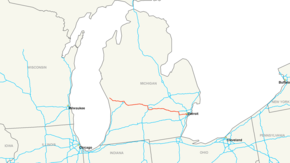
I-96 highlighted in redRoute information Maintained by MDOT Length: 192.032 mi[1] (309.046 km) Existed: 1959 – present Major junctions West end:  US 31 in Norton Shores
 US 131 in Walker
 I-196 in Grand Rapids
 I-69 near Lansing

 I-496 / US 127 in Lansing
 US 23 in Brighton


 I-275 / I-696 / M-5 in Farmington Hills
 I-275 / M-14 near Livonia
 US 24 in Redford
 I-94 in Detroit
East end:  I-75 in Detroit
Highway system Main route of the Interstate Highway System
Main • Auxiliary • BusinessMichigan State Trunkline Highway System
Interstate • US • State←  M-95
M-95M-96  →
→Interstate 96 (I-96) is an intrastate Interstate Highway that is entirely within the US state of Michigan. Its western terminus is at an interchange with US Highway 31 (US 31) and Business US Highway 31 (BUS US 31), on the western boundary of Norton Shores southeast of Muskegon. Its eastern terminus is at I-75 near the Ambassador Bridge in Detroit. From Detroit to Grand Rapids, it parallels Grand River Avenue, never straying more than a few miles from the deleted US 16.
The Wayne County portion of I-96 was originally named the Jeffries Freeway from its eastern terminus to the junction with I-275 and M-14 and was signed as such until Michigan removed proper names from Interstate guide signs in the 1980s. Though many area residents still refer to the freeway as the Jeffries, the portion within the city of Detroit was renamed by the state legislature as the Rosa Parks Memorial Highway in December 2005.[2]
Contents
Route description
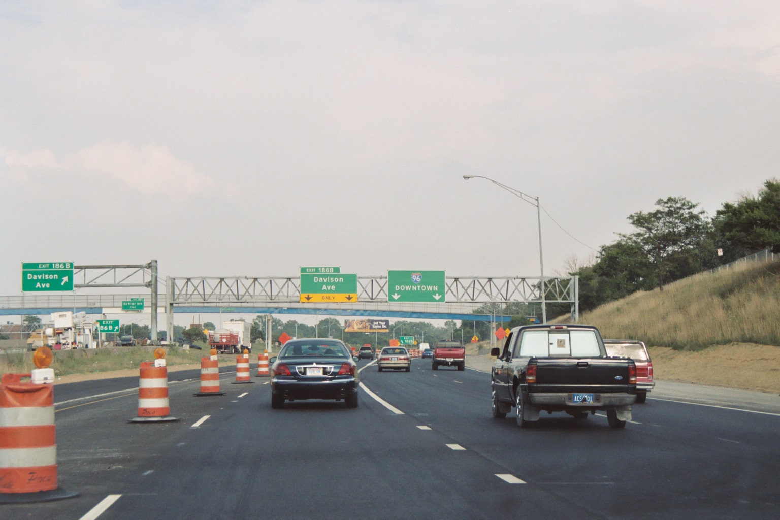
 I-96 east at Davison Avenue, the east end of the local/express split
Interstate 96 begins with a three-quarter cloverleaf interchange with US 31 in Norton Shores, Michigan, near Muskegon. From the start, the highway has a grassy median and 2 lanes in each direction. I-96 starts off by traveling southeast for a distance of around 10 miles (16 km) until it reaches Nunica. At this point, it turns in an east-southeastern direction for 25 miles (40 km) until it reaches the city of Grand Rapids. Shortly before reaching Grand Rapids, I-96 intersects US 131 and crosses over the Grand River for the first time. About 3 miles (4.8 km) after passing US 131, I-96 travels south for around 3 miles (4.8 km) until the junction with I-196, a branch route of I-96 which begins in Grand Rapids and terminates at I-94 near Benton Harbor. For the next 10 miles (16 km), I-96 travels in a southeast direction. During this section, the highway currently has weave–merge lanes which expand the freeway to 4 lanes at points. After leaving Grand Rapids, I-96 runs due east for approximately 25 miles (40 km). I-96 then turns southeast near Portland, crosses over the Grand River for a second time, and continues in a southeast direction for 18 miles (29 km). I-96 then merges with I-69 outside of Lansing, and the two highways run concurrently for the next 6.5 miles (10.5 km) traveling due south. While I-96 is cosigned with I-69, I-496 branches off the highway and travels through Lansing until it meets I-96 again south of Lansing. After I-69 splits off I-96 southwest of Lansing, I-96 has a short 2-mile (3.2 km) leg where it travels southeast, after which it travels east-southeast for approximately 30 miles (48 km). Near Farmington, I-96 turns southward and merges with I-275; I-696 branches off at this junction and runs east to I-94. I-96 is co-signed with I-275 for about 7.5 miles (12.1 km). In Livonia, I-96 splits off of I-275 and turns eastward towards Detroit. After the Outer Drive exit, express lanes begin in both directions. Three miles (4.8 km) from where I-96 enters Detroit is a massive interchange with M-39 (Southfield Freeway), which is called "Malfunction Junction" by some locals. I-96 turns southeast here and enters Detroit, where it becomes known as the Rosa Parks Memorial Freeway. I-96 intersects I-94 within Detroit. Two miles after the I-94 interchange, I-96 reaches its eastern terminus at I-75 (Fisher Freeway).
Lane configurations
- between western terminus and I-196 (2 lanes on each side)
- between I-196 and M-21 (3 lanes on each side; the right-most of the 3 eastbound lanes is actually an auxiliary lane connecting the on-ramp from 196 with the off-ramp to M-21)
- between M-21 and milepost 86 (2 lanes on each side)
- between milepost 86 and north-end merge with I-69 (3 WB, 2 EB lanes)
- through the concurrency with I-69 (miles 90-97) on the west side of Lansing, MI (3 lanes on each side)
- between south I-69 split and M-59 near Howell (2 lanes on each side)
- between M-59 and I-275 (3 lanes on each side)
- transition from I-696 onto I-275 (2 through lanes each way)
- concurrent with I-275 (4 lanes on each side, very short segment of 5 each side on approach to I-696/I-275/M-5 interchange)
- ramps carrying I-96 from I-275 to Jeffries Freeway (2 lanes on each side)
- between M-14 and Outer Drive (4 lanes on each side)
- between Outer Drive and Davison Avenue (2+ local, 3 express; on each side)
- between Davison Avenue and eastern terminus (4 lanes on each side)
- See M-5 for the lane configurations of the leftover stub after I-96 joins I-275.
History
Interstate 96 was mostly constructed in sections that opened from 1957 to 1962, but it was not completed in the Detroit area until 1977. Even before the National Interstate and Defense Highways Act was signed in 1956,[citation needed] the route was being planned as a replacement of the old US 16, which was decommissioned in 1962.
Beginnings
See also: Grand River Avenue and U.S. Route 16 in MichiganThe Lake Michigan – Grand Rapids – Lansing – Detroit corridor was initially the Grand River Trail, an Indian trail that was designated as a military highway in 1832. Detroit changed the name of its portion of the road to Grand River Avenue in 1871, a name which soon spread along the rest of the route. It became M-16 in 1918, and was the first paved highway across the state when paving was completed in 1926.[3][4] The entire highway was designated as part of US 16 later that year.[5]
 1958 numbering plan for Michigan's Interstates
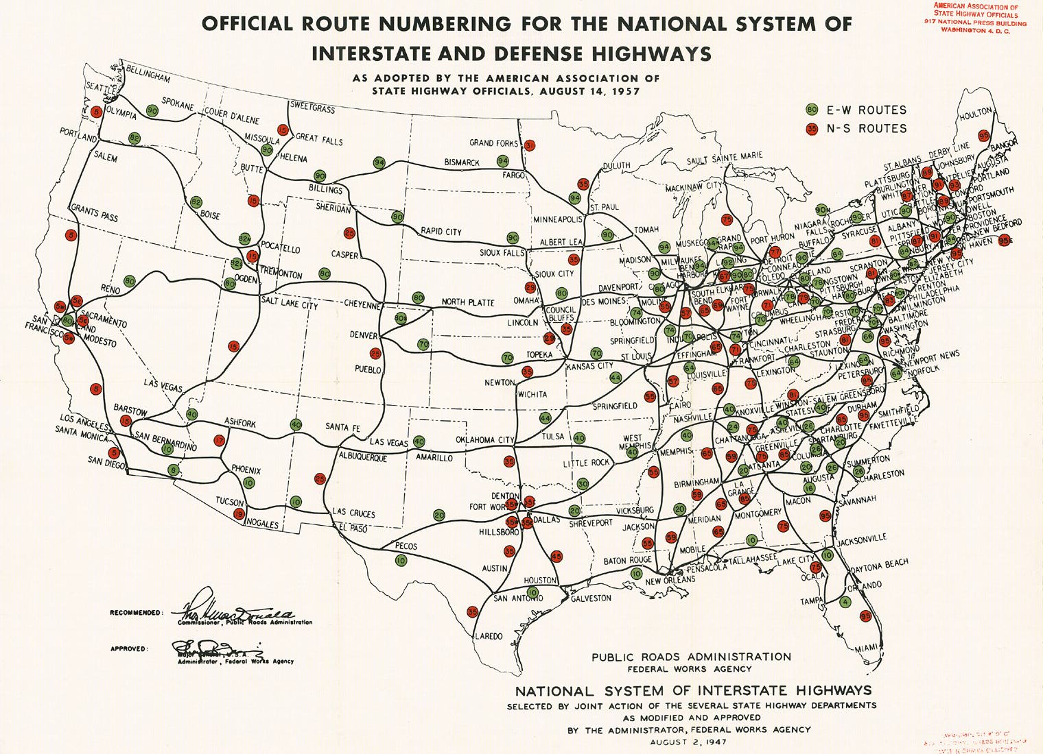
East of Grand Rapids, the highway was a major artery of national importance, and was added to the proposed "Interregional Highway System" as part of a northern route between Chicago and Detroit by the 1940s.[6] A branch from Grand Rapids to Muskegon was added later that decade,[7] and in 1957 the Chicago-Detroit route was labeled as part of Interstate 94, with Interstate 94N on the spur to Muskegon.[8] Michigan, believing that this would "cause considerable confusion to the public", requested a change in April 1958, which would move I-94 to the shorter Kalamazoo route (which was planned as I-92), make the Muskegon-Kalamazoo route I-96, and assign I-67 to the connection from I-94 to I-96 at Grand Rapids,[9] but this was initially rejected by the American Association of State Highway Officials (AASHO).[10] By early 1959, Michigan's plan had been approved, with one change: I-96 would take the south leg from I-94 at Benton Harbor to Grand Rapids, and the north leg to Muskegon would be I-196.[11]
Construction of the Brighton–Farmington Expressway piece of the US 16 upgrade began in 1956,[12] and, when a four-mile (6 km) piece opened on August 1, 1957, it was the first section of funded Interstate to open in Michigan.[13] The entire 23-mile (37 km) expressway from east of Brighton to a bypass of Farmington was completed in December of that year.[14] By early 1959, when signs for I-96 and I-196 were posted, 59 miles (95 km) of the "Detroit–Muskegon Freeway" had been completed and marked as US 16.[15] With the opening of 51 miles (82 km) from west of Lansing to east of Howell, the entire route, except in the Detroit area, was opened for travel on December 12, 1962.[16] US 16 was decommissioned in the state at that time;[17] the portions into Muskegon and Detroit, beyond the ends of the freeway, became Business Spur Interstate 196 (BS I-196) and Business Spur Interstate 96 (BS I-96).[18]
In 1963, the Michigan State Highway Department petitioned AASHO to again make the change it had requested back in 1958, moving I-96 over I-196 to end at Muskegon and renumbering I-96 west of Grand Rapids to I-67. The state cited problems with destination signing and numerous complaints from the public about confusion caused by the numbering.[19] At their October 21, 1963 meeting, AASHO approved the relocation of I-96, but rejected I-67, stating that the number should be kept for a more major route in case the system is expanded, and instead assigned I-196 to the not-yet-complete Benton Harbor – Grand Rapids route.[20] (As of 2007[update], I-67 is the largest odd number not in use.) With the completion of the Lodge Freeway on October 29, 1964, a full freeway route was available from I-96 into downtown Detroit via I-696 and the Lodge,[21] but it would be some time before I-96 was finished into the city.
Construction of the Jeffries Freeway
The Detroit Expressway and Transit System plan, prepared in 1945 for the city of Detroit, included a Grand River Expressway, which was to parallel Grand River Avenue into downtown and relieve congestion on that artery. A rail line would be built in the median of the freeway west of West Chicago Street, where streetcars would exit onto the existing surface tracks on Grand River Avenue into downtown. The plan called for a future conversion to rapid transit with a grade-separated route to downtown.[22] The Department of Street Railways determined in 1947 that the operation would cost $6 million per year, and the planned transit line was dropped from the plans. By 1961, the proposed highway was renamed the Jeffries Freeway, after Edward Jeffries, who served as Detroit mayor from 1940 to 1948.[23][24]
The first piece of the Jeffries Freeway connected the Fisher Freeway (I-75) with the Ford Freeway (I-94) in 1970. It was extended northwest to Livernois Avenue (exit 188A) in 1971, and then to Grand River Avenue at Schaefer Highway (exit 185) in 1973.[citation needed] In 1976, the freeway was extended west to the Southfield Freeway (exit 183), and the entire I-275 concurrent section was opened.[25] The final piece was completed in 1977, connecting the Detroit section to I-275.[26]
Originally, the route of Interstate 96 from the east end of the existing freeway in Farmington through Detroit, named the Jeffries Freeway (commonly referred to as simply "the Jeffries"), was to closely parallel Grand River Avenue (formerly US 16). However, by 1963, several freeway revolts were taking place in urban locations throughout the country, including Detroit. Several of Detroit's planned freeways were modified, scaled back, or outright cancelled, and the Jeffries was no exception. To minimize the impact to existing communities and businesses, it was decided that the freeway would no longer utilize the Grand River Avenue corridor. Instead, the new Interstate 96 freeway corridor would partially use the C&O Railroad right of way through the city of Livonia, and utilize the planned I-275 freeway bypassing Detroit to the west to connect back to the existing freeway.
The Jeffries Freeway (not yet signed as I-96) was opened in stages in the early-1970s. The first two segments, opened in 1970 and 1971, connected I-75 to I-94, and I-94 to Livernois Avenue, respectively.[27] The full freeway-to-freeway connection ramps to the planned Davison Freeway were opened in 1973, in another extension of the Jeffries Freeway to Grand River Avenue.[27] In 1975, the Jeffries was completed westward to the Southfield Freeway (M-39), and, about this time, the Jeffries Freeway was signed as I-96, leaving a gap in the routing between Farmington and the M-39 interchange.[27]
When a portion of the new I-275 freeway opened from the existing I-96 to the Schoolcraft Avenue in 1976, it was still not signed as I-96. In 1977, the final portion of the Jeffries Freeway through Livonia (from I-275 east to the end of the existing Jeffries Freeway) opened to traffic, and with that, the final segment of I-96 in general.[28] The I-96 routing was assigned along the I-275 freeway south to the Jeffries Freeway, and eastward along the new freeway to the M-39 interchange, and the remaining stub of I-96 around Farmington was redesignated as an extension of M-102 (now M-5).
Subsequent history
Since the completion of I-96 in 1977, several expansions of the freeway have taken place, including the addition of a third lane in each direction for most of the eastern half of the route. Beginning in 1984, a southerly extension of the US 27 freeway (later to become I-69) bypassing Lansing opened; US 27 was then cosigned with I-96 along the western side of Lansing. Three years later, the I-69 designation was applied to this new bypass, resulting in a rare triple-concurrency (I-96/I-69/US7 27) that existed until 2002, when US 27 was decommissioned in Michigan.[27]
On January 12, 2005, a massive pile-up consisting of over 200 motor vehicles occurred in both directions of I-96 near Williamston in Ingham County. Two people, Douglas James Baker (age 15) and Jason Eldridge (age 27) were killed in the incident, one of the largest multi-vehicle collisions in U.S. history, which was blamed on heavy fog.[29]
From 2003 to 2005, the Beck Road interchange (exit 160) in Novi was reconstructed as a single point urban interchange (SPUI), the first in the metropolitan Detroit area and the first on I-96, at a cost of $46 million.[30] The reconstruction of the Wixom Road interchange near Novi as a SPUI was completed in late fall of 2008.[31]
Future
While I-96 is, for the most part, a complete route, there are a few minor changes planned or being considered for the future.
Ambassador Bridge connection
At this time, there is no direct freeway access to the Ambassador Bridge at the United States – Canada border; only a short surface street connection exists between the bridge's approaches and the nearby I-75 and I-96. The construction of an Interstate connection between I-75 and the bridge was mandated by the 1998 National Highway System Act; this most likely would take the form of an easterly extension of I-96 directly to the bridge.[32] However, the actual construction of this connection faces several obstacles, including the projected high cost and local impact.[33]
Despite the past obstacles, plans to make I-96 accessible to the Ambassador Bridge are currently underway. Beginning in 2008, the Michigan Department of Transportation began a two year project to realign the interchange between I-75 and I-96 near Downtown Detroit. The project will include a new pedestrian walk, as well as both freeways having a direct link to the Ambassador bridge, eliminating the pedestrian linkage to the bridge. The project is 90% complete as of July 2009.[34]
Additional interchanges
Currently, another interchange at Latson Road in Howell is planned and under study, pending right of way acquisition. This interchange would bring improved access to the eastern Howell area, which is currently only accessible from westbound I-96.[31]
The reconstruction of the Wixom Road interchange near Novi as a SPUI was completed in late fall of 2008.[31]
Grand Rapids area work
The eastbound remodel starts north of Leonard Street. The Leonard Street exit will be realigned and a new loop entrance ramp from Leonard to I-96 eastbound replaces the existing entrance. At the point where the present entrance from Leonard merges with the Interstate, a new single lane exit to I-196 eastbound will be built at ground level. After the I-196 exit, the present freeway will be used as the M-37/M-44 exit ramp and a new 2 lane freeway will be constructed in the median. Through lanes and exit lanes will be built on ground level, passing under a new westbound 3-lane I-196 bridge before new eastbound I-196 travelling lanes merge into the through lanes. I-96 passes under a widened M-37/M-44 bridge with 4 lanes and increases to 5 lanes with the M-37/M-44 entrance ramp. After passing over a railroad with an expanded bridge, I-96 drops two lanes for exits with M-21 (Fulton Street). The present exit to eastbound M-21 will be retained in all aspects and a new exit to westbound M-21 built. An improved Michigan Left turn will be built about 100 feet (30 m) west of the present one for the connection from westbound M-21 to eastbound I-96. A new entrance from eastbound M-21 to eastbound I-96 will be built using almost all of the right of way. This section also adds a third eastbound traveling lane along with a weave merge lane to Cascade Rd. This ends the eastbound remodel.
 Exit and Entry ramps from new (2006) 36th Street I-96 Interchange
The westbound remodel begins where the eastbound ends at Cascade Road. The entrance ramp from Cascade Road adds a westbound weave merge lane. A new westbound exit from the interstate to both east and west M-21 will be built. A minor adjustment of the present intersection maybe required but a new signal will be installed. Some right of way will be acquired to facilitate this new ramp and the retaining wall. When it passes over the railroad on its way to the M-37/M-44 interchange it will have a widened bridge for the new traveling lane. The present weave merge lane will be kept between M-21 and M-37/M-44. A modified exit ramp will be done for M-37/M-44. Just before the freeway goes under the bridge a new 2 lane freeway splits off from itself to move vehicles past Leonard and all the weaving and merging from M-37/M-44, I-196, and Leonard St. This will take the two left lanes of traffic. After the split the current freeway alignment will be used as a weave and merge lanes.
The first merging traffic comes from North M-37/M-44 which place M-37 onto I-96 until Alpine Ave. The next merging traffic comes from South M-44. This will only require an addition of one lane. Midway between the M-37/M-44 and Leonard stretch of freeway the I-196 exit ramp will be built using a new bridge, with the exit around the present location. This bridge will carry three lanes of traffic and will be the official start of that interstate. The I-96 weave merge lane will be reduced at this point to two lanes. The second lane on the right will be used as a splitter with traffic either staying on I-96 or going to I-196. This will give the southbound M-44 entrance ramp about the same amount of distance to merge into the second lane to get onto I-196. After less than a quarter mile (0.4 km) one lane of traffic will be split off and merged with new I-96 through lanes midway between Leonard and the splitting point. After that the new eastbound I-196 to westbound I-96 exit will be merged with the single weave merge lane just before Leonard St bridge. That exit ramp will go over seven sets of freeway traffic using one long bridge. After the bridge the weave merge lanes will use the present Leonard Street exit then become a single lane until the present Leonard Street entrance ramp merges with it. After that merging it will finally merge with I-96 traffic. A final note is that the two lanes of through traffic for I-96 will use the present freeway at the point it gets a merging lane with the weave merge before Leonard. At that point an additional lane of traffic will be added to the present freeway.
The ability to add lanes between the present freeways in the median is possible since the width of the grassy median is over 50 feet (15 m).
Exit list
County Location Mile[1] Exit Destinations Notes Muskegon Norton Shores 0.000 1 US 31 / Airline Road – Grand Haven, Ludington

BUS US 31 north – Downtown Muskegon
 LMCT
LMCTSigned as exits 1A (south) and 1B (north); freeway continues west as BUS US 31 Fruitport Township 0.293 1C Hile Road Eastbound exit and entrance only; westbound access is at exit 1A 3.517 4 Airline Road – Fruitport 5.100 5 Fruitport Road – Fruitport Westbound exit and eastbound entrance Ottawa Crockery Township  M-231 south
Proposed interchange[35] 9.292 9  M-104 – Grand Haven, Spring Lake
Westbound exit and eastbound entrance 10.081 10  B-31 – Nunica
Coopersville 15.991 16  B-35 – Coopersville, Eastmanville
Emergency US 31 runs along 68th Ave. from I-96 in Coopersville to M-45 in Allendale. Access to Allendale and Grand Valley State University 18.584 19 Lamont, Coopersville Wright Township 22.805 23 Marne Tallmadge Township 23.939 24  M-11 – Walker, Grandville
Eastbound exit and westbound entrance 24.215 25 8th Avenue, 4 Mile Road Westbound exit and eastbound entrance; westbound access to M-11 Kent Walker 26.430 26 Fruit Ridge Avenue 28.367 28 Walker Avenue 30.295 30  M-37 north (Alpine Avenue) – Newaygo
Western end of M-37 concurrency; signed as exits 30A (south) and 30B (north) westbound 30.711–
31.44031 US 131 (I-296 south) – Grand Rapids, Kalamazoo, Big Rapids, CadillacSigned as exits 31A (south) and 31B (north) Grand Rapids 33.063 33 
 CONN M-44 north (Plainfield Avenue)
36.533 36 Leonard Street 37.073 37 I-196 (Ford Freeway) – Downtown Grand Rapids, HollandWestbound exit and eastbound entrance 37.801 38  M-37 south / M-44 (East Belt Line Avenue) to M-21
Eastern end of M-37 concurrency Grand Rapids Township 38.687–
38.78839 M-21 – Lowell, FlintEastbound exit and westbound entrance 40.014 40 Cascade Road – Cascade Signed as exits 40A (west) and 40B (east); former US 16 Cascade Township 42.986 43 M-11 west (28th Street) – CascadeSigned as exits 43A (west) and 43B (east) 44.165–
44.17444 36th Street Signed as access to Gerald R. Ford International Airport 45.776–
46.01546  M-6 west to M-37 – Holland
Lowell Township 52.303 52  M-50 east – Charlotte, Lowell
Ionia Boston Township 58.912 59 Saranac, Clarksville Berlin Township 64.429 64 Saranac, Lake Odessa 67.427 67  M-66 – Ionia, Battle Creek
Orange Township 73.291 73 Portland Road, Grand River Avenue – Lyons, Muir Portland 76.071 76 Kent Street 77.493 77 Grand River Avenue – Portland Former BS I-96 Clinton Eagle 83.617 84 Westphalia, Eagle Eagle Township 86.273 86  M-100 south (Wright Road) – Grand Ledge
Watertown Township 89.670 89 I-69 east – FlintEastbound exit and westbound entrance 90.040 90  BL I-96 east (Grand River Avenue)
90.466 91 I-69 east – FlintWestbound exit and eastbound entrance; western end of I-69 concurrency Eaton Delta Township 93.118 93 
 M-43 / BL I-69 east (Saginaw Highway) – Grand Ledge
Signed as exits 93A (west) and 93B (east) 94.579–
94.81595 I-496 east – Downtown LansingWestern terminus of I-496 96.667–
96.68797 I-69 south – Charlotte, Fort WayneEastern end of I-69 concurrency Windsor Township 97.847–
97.85898 Lansing Road Signed as exits 98A (south) and 98B (north); former US 27 Ingham Lansing 101.425 101  M-99 (M L King Boulevard) – Eaton Rapids
104.395–
104.404104 BL I-96 west (Cedar Street) – HoltDelhi Township 106.490–
106.518106 I-496 west / US 127 – Jackson, East Lansing, Downtown LansingSigned as exits 106A (south) and 106B (north); eastern terminus of I-496 Alaiedon Township 109.732 110 Okemos, Mason Wheatfield Township 117.504 117 Dansville, Williamston Signed as exits 117A (Dansville) and 117B (Williamston) eastbound Webberville 121.914 122  M-43 / M-52 – Webberville, Stockbridge
Livingston Fowlerville 128.493 129 Fowlerville Howell Township 133.305 133  M-59 / BL I-96 east (Highland Road) – Howell, Pontiac
Howell 136.799 137  D-19 – Howell, Pinckney
Genoa Township 141.218 141 BL I-96 west – HowellWestbound exit and eastbound entrance Brighton 145.130 145 Grand River Avenue – Brighton Brighton Township 146.768 147 Spencer Road – Brighton 147.578–
147.755148 US 23 – Ann Arbor, FlintSigned as exits 148A (south) and 148B (north) 149.458 150 Pleasant Valley Road Westbound exit and eastbound entrance 151.056 151 Kensington Road Oakland Lyon Township 152.887 153 Kent Lake Road – South Lyon 154.900 155 New Hudson, South Lyon, Milford Signed as exits 155A (New Hudson) and 155B (Milford) westbound Wixom 159.236 159 Wixom Road – Wixom, Walled Lake Novi 160.299–
160.313160 Beck Road – Novi 162.413 162 Walled Lake, Novi, Northville 163.381 163 I-696 east (Reuther Freeway) / M-5 east / I-275 south / Grand River Avenue – Port HuronEastbound exit and westbound entrance; northern end of I-275 concurrency 163.818 164 M-5 north / 12 Mile RoadEastbound exit and westbound entrance Farmington Hills 164.964 165 I-696 east (Reuther Freeway) / M-5 / Grand River Avenue – Port HuronWestbound exit and eastbound entrance Oakland–Wayne Farmington Hills – Livonia 167.383 167 8 Mile Road – Northville Wayne Livonia 168.440 169 7 Mile Road Signed as exits 169A (west) and 169B (east) westbound 169.438 170 6 Mile Road Plymouth Township 170.503–
171.610 I-275 south – Toledo
M-14 west – Ann ArborSouthern end of I-275 concurrency Livonia 172.365 173 Newburgh Road, Levan Road Signed as exits 173A (Newburgh Road) and 173B (Levan Road) westbound 174.366 174 Farmington Road 175.369 175 Merriman Road 176.374 176 Middlebelt Road Redford Township 177.372 177 Inkster Road 178.341 178 Beech Daly Road 179.303–
179.345179 US 24 (Telegraph Road)Detroit 180.328–
180.355180 Outer Drive Western end of express lanes 181.488 182 Evergreen Road 182.527–
182.559183  M-39 (Southfield Freeway)
Additional westbound exit and eastbound entrance on the express lanes 183.505–
183.515184 Greenfield Road 184.575–
184.700185 Schaefer Highway, Grand River Avenue (M-5) 185.579–
185.586186A Wyoming Avenue Eastern end of express lanes 185.935–
186.141186B Davison Avenue (M-8) 186.996 187 Grand River Avenue Eastbound exit and westbound entrance 187.452–
187.880188 Livernois Avenue, West Chicago Avenue, Joy Road Signed as exits 188A (Livernois Avenue, West Chicago Avenue) and 188B (Joy Road) westbound 189.070–
189.107189 Tireman Avenue, West Grand Boulevard 189.791–
189.818190A I-94 (Ford Freeway) – Port Huron, Chicago190.093 190B Warren Avenue 190.857–
191.233191  US 12 (Michigan Avenue) / M L King Jr. Boulevard
190.933  I-75 north (Fisher Freeway) / M-10 (Lodge Freeway) – Flint, Civic Center
Eastbound exit and westbound entrance 191.966 47C Vernor Highway, Ambassador Bridge to Canada Eastbound exit and westbound entrance 192.032 I-75 south (Fisher Freeway) – ToledoEastbound exit and westbound entrance 1.000 mi = 1.609 km; 1.000 km = 0.621 mi
Concurrency terminus • Closed/Former • Incomplete access • UnopenedCanceled routings in Detroit
I-96 was originally intended to shadow Grand River Avenue within Detroit's city limits and was actually completed along this route into Farmington. Local opposition killed this project, so prior to the Jeffries opening through Livonia in the 1977, I-96 was relocated onto it. The Farmington stub was redesignated as an extension to M-102 and now bears the designation of M-5. Furthermore when the interchange with Davison Avenue (present day exit 186) was constructed, it was expected that the Davison Freeway was to be extended to meet up with the Jeffries. Accordingly it was built as a full freeway-to-freeway interchange, but before the Jeffries was completed both the Davison extension was cancelled and I-96 was rerouted. This left both an interchange far larger than traffic dictates and I-96 following an elbow that has it intersecting with the straight Grand River Ave. twice within two miles (3 km).
Discrepancy regarding I-275
MDOT and the FHWA disagree on the designation of the Livonia to Farmington Hills stretch of I-96. MDOT signs this 6-mile (10 km) segment as a concurrency with I-275. However, FHWA maintains that I-275's northern terminus is at the I-96/M-14 intersection near Plymouth and therefore this stretch should only be labeled I-96. Although the mile markers and exit numbers continue with I-96's sequence, local residents tend to refer to this leg of I-96 primarily as I-275; the designation distinctly separates the Jeffries Freeway portion of I-96 from the portion of the highway west of I-696.
Auxiliary routes
I-96 has four auxiliary routes, connecting the highway to downtowns and other cities. I-196 is a relatively long route, beginning at I-96 east of downtown Grand Rapids and heading west through downtown to Holland, and then south to I-94 near Benton Harbor. The unsigned I-296 connects I-96 north of downtown Grand Rapids with I-196 in downtown, and is signed as US 131. I-496 is a loop through downtown Lansing, which I-96 bypasses to the south, and I-696 is a northern bypass of Detroit, connecting I-96 in Novi with I-75 in Royal Oak and |I-94 in St. Clair Shores.
Interstate 96 presently has two business routes: a loop through Lansing and a loop through Howell. Both follow the old route of US 16, with appropriate connections to I-96. A spur into Muskegon once existed, running concurrently with part of BUS US 31 along former US 16,[36] but it has been eliminated. Two routes in the Detroit area—a loop through Farmington and a spur into Detroit—both using Grand River Avenue, and meeting at the temporary end of I-96 near Purdue Avenue, were eliminated when I-96 was moved to the completed Jeffries Freeway in 1977.[37] On 31 October 2007, a spur into Portland was decommissioned and turned back to the City of Portland.[38]
Auxiliary routes of Interstate 96 
References
- ^ a b "MDOT Physical Reference Finder Application". Michigan Department of Transportation. http://www.mcgi.state.mi.us/prfinder/. Retrieved October 2007.
- ^ Michigan Legislature (2001). "Michigan Memorial Highway Act (Excerpt) Act 142 of 2001, 250.1098 Rosa Parks Memorial Highway". State of Michigan. http://www.legislature.mi.gov/mileg.aspx?page=GetMCLDocument&objectname=mcl-250-1098. Retrieved August 18, 2006.
- ^ Barnett PhD, LeRoy (2004). A Drive Down Memory Lane: The Named State and Federal Highways of Michigan. Wayne State University Press. p. 93. ISBN 1-886167-24-9.
- ^ Michigan State Highway Department (1919) (PDF). State of Michigan: Lower Peninsula (Map). Cartography by MSHD. http://maps.lib.msu.edu/miroadmaps/1919-lp.htm. Retrieved March 2, 2008.
- ^ Bureau of Public Roads (1926). United States System of Highways (Map). http://www.okladot.state.ok.us/hqdiv/p-r-div/maps/misc-maps/1926us.pdf. Retrieved May 10, 2008.
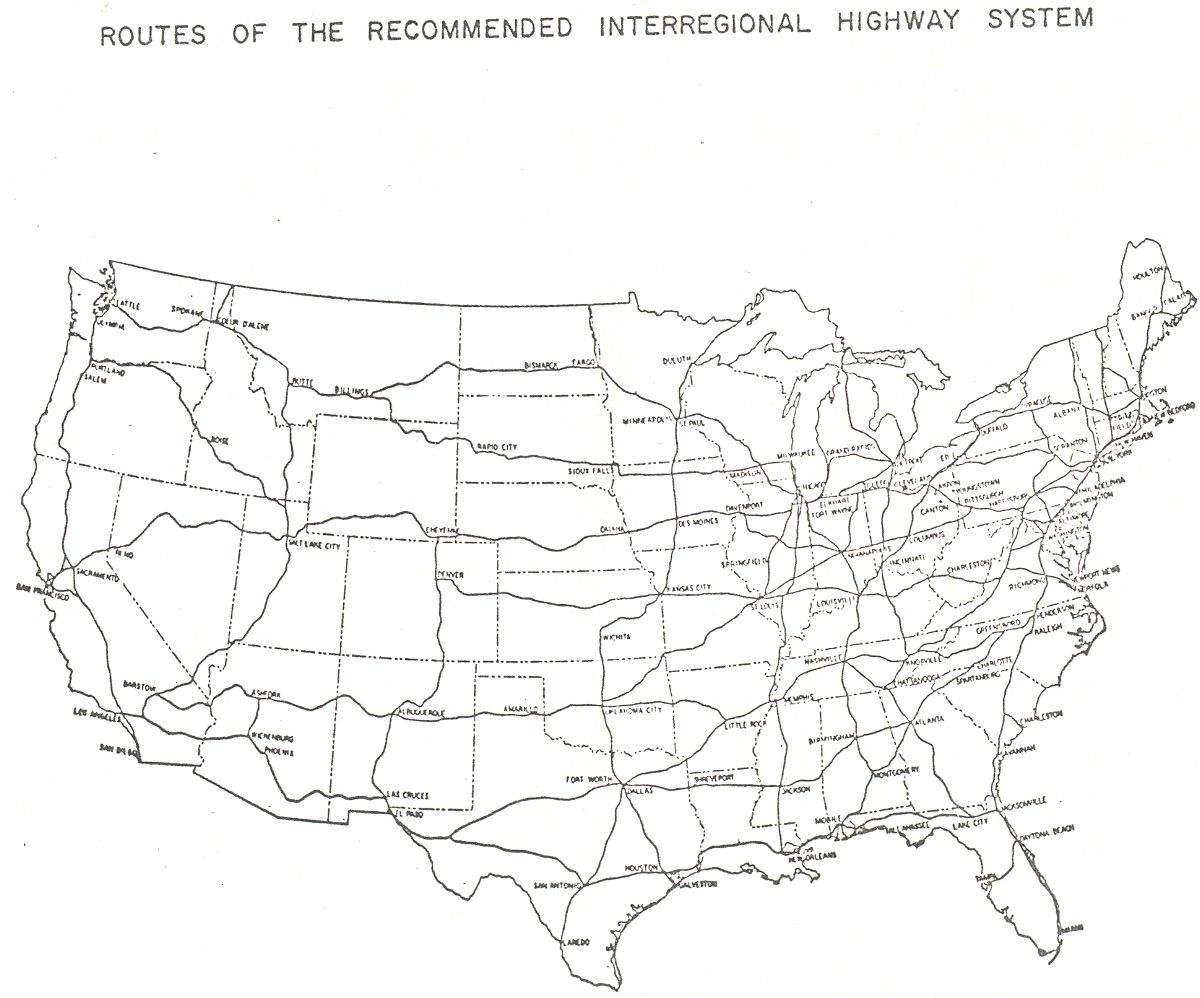
- ^ Public Roads Administration (ca. 1943). Routes of the Recommended Interregional Highway System (Map). http://www.ajfroggie.com/roads/yellowbook/conus-1943.jpg.
- ^ Public Roads Administration (August 2, 1947). National System of Interstate Highways (Map). http://www.fhwa.dot.gov/infrastructure/fairbank17.cfm.
- ^ American Association of State Highway Officials (August 14, 1957). Official Route Numbering for the National System of Interstate and Defense Highways (Map). http://www.roadfan.com/aug57int.jpg.
- ^ "Recommended Numbering: Interstate Highways in Michigan". Michigan State Highway Department. April 25, 1958. Archived from the original on November 21, 2003. http://web.archive.org/web/20031121121341/nwindianahwys.homestead.com/michiplan.html.
- ^ American Association of State Highway Officials (June 27, 1958). Official Route Numbering for the National System of Interstate and Defense Highways (Map). http://www.roadfan.com/jun58int.jpg.
- ^ "Spring to Bring Debut for Interstate Road Numbering". The Herald-Press (St. Joseph, Michigan). January 8, 1959.
- ^ "Road Plans Revised". Holland Evening Sentinel. June 30, 1956.
- ^ "Meeting Minutes". Michigan State Transportation Commission. June 29, 2006. https://michigan.michigan.gov/documents/MDOT-Trans-Comm-Minutes-06-29-06_166647_7.pdf.
- ^ "Expressway to be Opened by Dec. 13". Ironwood Daily Globe. December 6, 1957.
- ^ Holland Evening Sentinel. February 25, 1959.
- ^ "Detroit–Lansing–Muskegon Freeway, Third Freeway Completed". Holland Evening Sentinel. December 8, 1962.
- ^ "Drop US 16 Designation". Holland Evening Sentinel. April 14, 1962.
- ^ Road Atlas: United States, Canada, Mexico. Rand McNally. 1964.
- ^ "Muskegon Freeway Link Number Change Sought". Holland Evening Sentinel. August 24, 1963.
- ^ Holland Evening Sentinel. October 23, 1963.
- ^ "Lodge Road to be Opened". Holland Evening Sentinel. October 28, 1964.
- ^ Andrews, W. Earle. (1945). Detroit Expressway and Transit System. New York. OCLC 7195393.
- ^ "Detroit will stay accessible during I-75 shutdown". Detroit News. January 18, 1999.
- ^ Traffic Quarterly: 238–241. January 1961.
- ^ Milliken, William (1975). Economic Report of the Governor (Report). Office of the Governor. p. 37.
- ^ Milliken, William (1977). Michigan State of the State Message (Speech). Lansing, MI. p. 85.
- ^ a b c d Bessert, Christopher J. (August 1, 2006). "Highways 90 through 99". Michigan Highways. http://michiganhighways.org/listings/MichHwys90-99.html#I-096. Retrieved August 18, 2006.
- ^ Bessert, Christopher J. (August 28, 2006). "Highways 250 through 696". Michigan Highways. http://michiganhighways.org/listings/MichHwys250-696.html. Retrieved September 1, 2006.
- ^ Phillips, Lauren (January 20, 2005). "Police Continue Investigation of Massive I-96 Accident". The State News (Michigan State University, East Lansing, MI). http://www.statenews.com/index.php/article/2005/01/police_continue_investigation_of_massive_i96_accident. Retrieved September 2, 2006.
- ^ "Beck Road & I-96 SPUI". City of Novi, Michigan. http://www.ci.novi.mi.us/Services/Engineering/RoadConstruction/SPUI.asp. Retrieved September 2, 2006.
- ^ a b c "Five Year Transportation Program: Expanding the System" (PDF). Michigan Department of Transportation. p. 7. Archived from 2006-2010 the original on June 26, 2006. http://web.archive.org/web/20060626032334/http://www.michigan.gov/documents/MDOT_5_Year_Plan_Expandingsystem_143171_7.pdf#search=%22interstate%2096%2036th%20street%20site%3Amichigan.gov%22. Retrieved September 3, 2006.
- ^ "High Priority Corridors: Interstate 69 (Corridors 18 and 20)". AARoads. http://www.aaroads.com/high-priority/corr18.html. Retrieved September 3, 2006.
- ^ "Interstate 96". Interstate Guide.. http://www.interstate-guide.com/i-096.html. Retrieved August 18, 2006.
- ^ "Ambassador Bridge Gateway Project in Detroit". Michigan Department of Transportation. http://www.michigan.gov/mdot/0,1607,7-151-9621_11008_45614---,00.html.
- ^ Michigan Department of Transportation (November 25, 2006). "2007–2011 Five-Year Transportation Plan" (PDF). Archived from the original on November 26, 2006. http://web.archive.org/web/20061126015437/http://www.michigan.gov/documents/MDOT_5_year_Plan_Grand_143124_7.pdf. Retrieved February 14, 2009.
- ^ Gulf (1971). Ohio and Michigan Tourgide Map (Map). Cartography by Rand McNally & Company.
- ^ Gulf (1977). Tourgide: United States, Canada and Mexico (Map). Cartography by Rand McNally & Company. (Shows the routes existing just prior to the completion of the new I-96 and the removal of I-96 from the Farmington spur.)
- ^ "ROADWAY SEGMENT transferred from MDOT to the CITY, becoming a City Major Street:
I-96 Business Spur/Grand River Avenue, from the northern terminus of the I-96 Business Spur at the centerline of Kent Street, southeasterly to the southern terminus of the I-96 Business Spur at the eastbound I-96 exit ramp, a distance of approximately 1.29 miles (2.08 km), in control section 34032."
External links
Main Interstate Highways (major interstates highlighted)
4 5 8 10 12 15 16 17 19 20 22 24 25 26 27 29 30 35 37 39 40 43 44 45 49 55 57 59 64 65 66 68 69 70 71 72 73 74 75 76 (W) 76 (E) 77 78 79 80 81 82 83 84 (W) 84 (E) 85 86 (W) 86 (E) 87 88 (W) 88 (E) 89 90 91 93 94 95 96 97 99 H-1 H-2 H-3 Unsigned A-1 A-2 A-3 A-4 PRI-1 PRI-2 PRI-3 Lists Primary Main - Intrastate - Suffixed - Temporary - Future - Gaps Auxiliary Main - Future - Unsigned Other Standards - Business - Bypassed - Tolled Freeways in metropolitan Detroit Fisher (I-75) • Edsel Ford (I-94) • Jeffries (I-96) • I-275 • Chrysler (I-375) • Walter Reuther (I-696) Categories:
- Interstate 96
- Interstate Highway System
- Interstate Highways in Michigan
- Western Michigan
- Central Michigan
- Transportation in Detroit, Michigan
- Transportation in Grand Rapids, Michigan
- Transportation in Lansing, Michigan


Wikimedia Foundation. 2010.