- Alpine County, California
-
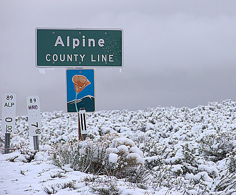
County of Alpine — County — "Alpine County Line" sign on California State Route 89 during a snowstorm, May 26, 2008

SealLocation in the state of California California's location in the United States
Country  United States
State  California
Region Sierra Nevada Incorporated March 16, 1864[1] County seat Markleeville Largest city Markleeville Area – Total 743.19 sq mi (1,924.9 km2) – Land 738.62 sq mi (1,913 km2) – Water 4.57 sq mi (11.8 km2) Population (2010) – Total 1,175 – Density 1.6/sq mi (0.6/km2) Time zone Pacific Standard Time (UTC-8) – Summer (DST) Pacific Daylight Time (UTC-7) Area code(s) 209, 530 Website www.alpinecountyca.gov Alpine County is the smallest county, by population, in the U.S. state of California. As of 2010, it had a population of 1,175, all rural. There are no incorporated cities in the county. The county seat is Markleeville. Alpine County is located in the Sierra Nevada, between Lake Tahoe and Yosemite National Park.
Contents
History
Alpine County was created on March 16, 1864 during a silver boom in the wake of the nearby Comstock Lode discovery. The county was formed from parts of Amador, Calaveras, El Dorado, Mono and Tuolumne Counties.[1] At its formation, the county had a population of about 11,000 with its county seat in Silver Mountain City. By 1868 however, the local silver mines had proven unfruitful, and the population fell to about 1,200. The county seat was moved to Markleeville in 1875.[1]
After the silver rush, Alpine County's economy consisted almost entirely of farming, ranching, and logging. By the 1920s, the population had fallen to just 200 people. With the construction of the Bear Valley and Kirkwood ski resorts in the late 1960s, the population increased to the present level.
Geography
According to the 2000 census, the county has a total area of 743.19 square miles (1,924.9 km2), of which 738.62 square miles (1,913.0 km2) (or 99.39%) is land and 4.57 square miles (11.8 km2) (or 0.61%) is water.[2]
Census-designated Places
- Alpine Village
- Bear Valley
- Kirkwood
- Markleeville
- Mesa Vista
Unincorporated Communities
- Cape Horn
- Fredericksburg
- Lake Alpine
- Loope
- Paynesville
- Peaceful Pines
- Shay Creek Summer Home Area
- Sorensens
Adjacent counties
- Mono County, California - east
- Tuolumne County, California - south
- Calaveras County, California - southwest
- Amador County, California - west
- El Dorado County, California - northwest
- Douglas County, Nevada - north
National protected areas
- Eldorado National Forest (part)
- Stanislaus National Forest (part)
- Toiyabe National Forest (part)
Transportation Infrastructure
Major highways
Public transportation
There is limited, call ahead, public transportation provided by agreement with neighboring Douglas County, Nevada (There are a few trailhead shuttles, designed for hikers).
Airport
Alpine County Airport is a general aviation airport located in the Eastern Sierras about 4 miles (6.4 km) from the town of Markleeville. The airport consists of a simple airstrip with an apron for small light aircraft to park. The airport has no buildings, no lights, and is very rarely used. The airport is popular with astronomers due to the clear, dark skies.
Site Information
- Longitude - 119° 46' 01" West
- Latitude - 38° 44' 09" North
- Altitude - 5,867 feet [1788 meters]
Demographics
Historical populations Census Pop. %± 1870 685 — 1880 539 −21.3% 1890 667 23.7% 1900 509 −23.7% 1910 309 −39.3% 1920 243 −21.4% 1930 241 −0.8% 1940 323 34.0% 1950 241 −25.4% 1960 397 64.7% 1970 484 21.9% 1980 1,097 126.7% 1990 1,113 1.5% 2000 1,208 8.5% 2010 1,175 −2.7% 2010
The 2010 United States Census reported that Alpine County had a population of 1,175. The racial makeup of Alpine County was 881 (75.0%) White, 0 (0.0%) African American, 240 (20.4%) Native American, 7 (0.6%) Asian, 0 (0.0%) Pacific Islander, 19 (1.6%) from other races, and 28 (2.4%) from two or more races. Hispanic or Latino of any race were 84 persons (7.1%).[3]
Population reported at 2010 United States Census The County Total
PopulationWhite African
AmericanNative
AmericanAsian Pacific
Islanderother
racestwo or
more racesHispanic
or Latino
(of any race)Alpine County 1175 881 0 240 7 0 19 28 84 Census-designated
placesTotal
PopulationWhite African
AmericanNative
AmericanAsian Pacific
Islanderother
racestwo or
more racesHispanic
or Latino
(of any race)Alpine Village 114 91 0 19 1 0 2 1 6 Bear Valley 121 119 0 0 1 0 0 1 1 Kirkwood‡ 97 94 0 3 0 0 0 0 0 Markleeville 210 192 0 4 2 0 6 6 11 Mesa Vista 200 178 0 15 2 0 0 5 11 Unincorporated
communitiesTotal
PopulationWhite African
AmericanNative
AmericanAsian Pacific
Islanderother
racestwo or
more racesHispanic
or Latino
(of any race)All others not CDPs (combined) 433 217 0 199 1 0 11 15 51 ‡ - census results for the portion of this CDP in Alpine County 2000
As of the census[4] of 2000, there were 1,208 people, 483 households, and 295 families residing in the county. The population density was 2 people per square mile (1/km²). There were 1,514 housing units at an average density of 2 per square mile (1/km²). The racial makeup of the county was 73.68% White, 0.58% Black or African American, 18.87% Native American, 0.33% Asian, 0.08% Pacific Islander, 1.41% from other races, and 5.05% from two or more races. 7.78% of the population were Hispanic or Latino of any race. 12.1% were of German, 12.1% Irish, 9.3% English, 6.5% American and 5.7% Italian ancestry according to Census 2000. 95.0% spoke English, 3.1% Spanish and 2.0% Washo as their first language.
There were 483 households out of which 25.5% had children under the age of 18 living with them, 43.9% were married couples living together, 11.0% had a female householder with no husband present, and 38.9% were non-families. 27.7% of all households were made up of individuals and 5.4% had someone living alone who was 65 years of age or older. The average household size was 2.50 and the average family size was 2.96.
In the county the population was spread out with 22.8% under the age of 18, 10.40% from 18 to 24, 27.5% from 25 to 44, 29.3% from 45 to 64, and 9.9% who were 65 years of age or older. The median age was 39 years. For every 100 females there were 110.8 males. For every 100 females age 18 and over, there were 117.2 males.
The median income for a household in the county was $41,875, and the median income for a family was $50,250. Males had a median income of $36,544 versus $25,800 for females. The per capita income for the county was $24,431. About 12.0% of families and 19.5% of the population were below the poverty line, including 27.4% of those under age 18 and 10.1% of those age 65 or over.
Almost half of the population in the county is Mormon.[5]
Politics
Alpine County vote
by party in presidential electionsYear GOP DEM Others 2008 36.4% 252 61.0% 422 2.6% 18 2004 44.4% 311 53.2% 373 2.4% 17 2000 48.0% 281 45.2% 265 6.8% 40 1996 43.0% 264 42.0% 258 15.0% 92 1992 35.2% 222 34.1% 215 30.8% 194 1988 55.4% 306 41.7% 230 2.9% 16 1984 56.7% 264 41.6% 194 1.7% 8 1980 55.1% 254 28.9% 133 16.1% 74 1976 50.3% 225 42.3% 189 7.4% 33 1972 63.5% 366 33.9% 195 2.6% 15 1968 59.3% 150 32.8% 83 7.9% 20 1964 57.7% 124 42.3% 91 0.0% 0 1960 76.7% 132 23.3% 40 0.0% 0 1956 79.7% 114 20.3% 29 0.0% 0 1952 88.1% 148 11.9% 20 0.0% 0 1948 76.8% 106 18.1% 25 5.1% 7 1944 68.5% 98 31.5% 45 0.0% 0 1940 66.5% 125 33.0% 62 0.5% 1 1936 46.5% 74 53.5% 85 0.0% 0 1932 47.3% 53 50.0% 56 2.7% 3 1928 94.2% 49 5.8% 3 0.0% 0 1924 88.1% 52 8.5% 5 3.4% 2 1920 91.4% 64 8.6% 6 0.0% 0 Alpine is historically a Republican-leaning county in Presidential and congressional elections. The county narrowly voted for George W. Bush in 2000, but went comfortably for John Kerry in 2004, the first time Alpine voted Democratic in a presidential election since 1936, when Franklin Roosevelt carried every county in California. Barack Obama received an even wider margin of victory over John McCain in 2008.[6]
In November 2008, Alpine was one of just three counties in California's interior in which voters rejected Proposition 8, the ballot initiative to amend the California Constitution to reject the legal extension of the title of marriage to same-sex couples. Alpine voters rejected Proposition 8 by 56.4 percent to 43.6 percent. The other interior counties in which Proposition 8 failed to receive a majority of votes were neighboring Mono County and Yolo County.[7]
According to the California Secretary of State, as of April, 2008, there are 776 registered voters in Alpine County. Of those, 282 (36.3%) are registered Democratic, 272 (35.1%) are registered Republican, 49 (6.3%) are registered with other political parties, and 173 (22.3%) declined to state a political party.
Alpine is part of California's 3rd congressional district, which is held by Republican Dan Lungren. In the State Assembly, Alpine is part of the 4th district, which is held by Republican Beth Gaines, who was elected to the Assembly in May 2011. In the State Senate, Alpine is part of the 1st district, which is held by Republican Ted Gaines, who was elected to the Senate in January 2011.
See also
- List of school districts in Alpine County, California
- National Register of Historic Places listings in Alpine County, California
- Stonewall Nation, a proposal by gay activists to colonize Alpine County in the 1970s
References
- ^ a b c "Alpine County General Plan". Adopted May 18, 1999 (Revised Feb. 2009). p. 7. http://www.alpinecountyca.gov/files/General_Plan-MASTER_Reduced_Size_0.pdf. Retrieved 2011-03-10.
- ^ "Census 2000 U.S. Gazetteer Files: Counties". United States Census. http://www.census.gov/tiger/tms/gazetteer/county2k.txt. Retrieved 2011-02-13.
- ^ "2010 Census P.L. 94-171 Summary File Data". United States Census Bureau. http://www2.census.gov/census_2010/01-Redistricting_File--PL_94-171/California/.
- ^ "American FactFinder". United States Census Bureau. http://factfinder.census.gov. Retrieved 2008-01-31.
- ^ The Association of Religion Data Archives | Maps & Reports
- ^ Map of 2008 Election Results by State and County; The New York Times
- ^ County-by-County Map, California Propositions: The Los Angeles Times
External links

El Dorado County Douglas County, Nevada Amador County 
Mono County  Alpine County, California

Calaveras County Tuolumne County Municipalities and communities of Alpine County, California CDPs Alpine Village | Bear Valley | Kirkwood‡ | Markleeville | Mesa Vista

Unincorporated
communitiesCape Horn | Fredericksburg | Lake Alpine | Loope | Marklee Village | Paynesville | Peaceful Pines | Shay Creek Summer Home Area | Sorensens | Woodfords
Ghost towns Centerville | Fays Camp | Mount Bullion | Silver Creek | Silver Mountain
Footnotes ‡This populated place also has portions in an adjacent county or counties
Categories:- Alpine County, California
- California counties
- 1864 establishments


Wikimedia Foundation. 2010.