- Pagham
-
For the Ham class minesweeper, see HMS Pagham.
Coordinates: 50°46′15″N 0°44′41″W / 50.77083°N 0.74479°W
Pagham 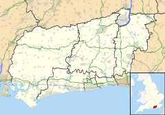
 Pagham
Pagham shown within West SussexArea 10.59 km2 (4.09 sq mi) [1] Population 5,729 [1] 2001 Census - Density 541 /km2 (1,400 /sq mi) OS grid reference SZ886975 - London 57 miles (92 km) NNE Parish Pagham District Arun Shire county West Sussex Region South East Country England Sovereign state United Kingdom Post town BOGNOR REGIS Postcode district PO21 Dialling code 01243 Police Sussex Fire West Sussex Ambulance South East Coast EU Parliament South East England UK Parliament Bognor Regis and Littlehampton Website http://www.paghamcouncil.co.uk/ List of places: UK • England • West Sussex Pagham is a coastal village and civil parish in the Arun district of West Sussex, England, with a population of around 5,500.
Contents
Geography
The village comprises three main areas:
- Pagham Beach, coastal area, developed in the early 20th Century,
- Pagham, the original 13th Century village
- Nyetimber, originally a separate village but has now been subsumed as part of a Local Authority rationalisation and the growth of the area.
Buildings and facilities
Many of the Original Pagham Beach dwellings are bungalows constructed from old railway carriages, although many have now been rebuilt using more modern construction methods.
The Church of St. Thomas a'Becket is considered[by whom?] to be one of the finest of its type[citation needed] in England.
Pagham is home to ale and beer pubs 'The Lamb', 'The Lion' and 'The Bear' as well as the popular 'Inglenook Hotel' which is a favourite stop off point for many during visits to events at Goodwood Circuit and races.
Landmarks
The Site of Special Scientific Interest known as Pagham Harbour falls partly within the parish.[2] The harbour and surrounding land is of national importance for both flora and fauna. The shingle spit is of geological interest.
A Phoenix type Mulberry Harbour is visible in the bay at low tides.
See also
- Crabb v Arun District Council [1975],[3] a leading property and contract case which happened in Pagham, off Hook Lane.
- Nyetimber Mill
- Nyetimber (electoral division)
- Pagham F.C.
References
- ^ a b "2001 Census: West Sussex – Population by Parish". West Sussex County Council. http://www.westsussex.gov.uk/communityandliving/census2001/pop_parish_summary.pdf. Retrieved 3 April 2009.
- ^ (PDF) SSSI Citation — Pagham Harbour. Natural England. http://www.english-nature.org.uk/citation/citation_photo/1000620.pdf. Retrieved 4 April 2009.
- ^ EWCA Civ 7
External links
Towns Villages and Hamlets Aldingbourne · Aldwick · Ancton · Angmering · Atherington · Barnham · Bilsham · Binsted · Burpham · Clapham · Climping · East Preston · Eastergate · Elmer · Felpham · Ferring · Findon · Flansham · Fontwell · Ford · Houghton · Kingston Gorse · Lagness · Lyminster · Madehurst · Middleton-on-Sea · Nepcote · North Bersted · Nyetimber · Offham · Pagham · Patching · Poling · Rose Green · Rustington · Shripney · Slindon · South Bersted · South Stoke · Toddington · Tortington · Walberton · Warningcamp · Wepham · Westergate · Wick · YaptonCivil Parishes Categories:- Arun
- Villages in West Sussex
- Populated coastal places in West Sussex
- West Sussex geography stubs

Wikimedia Foundation. 2010.