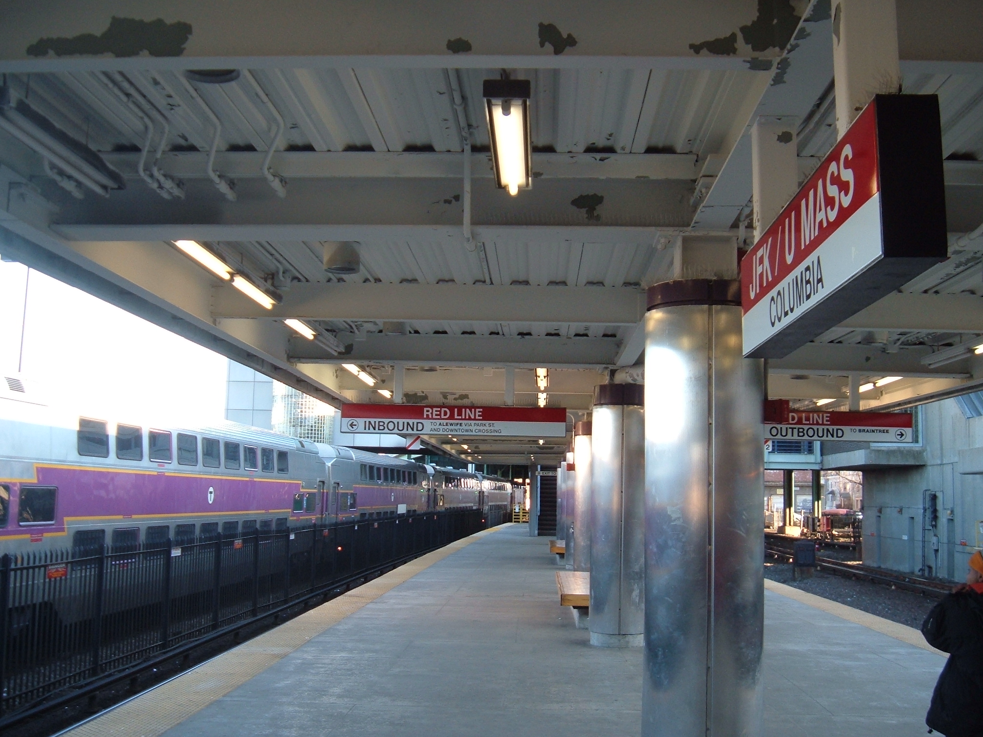
- JFK/UMass (MBTA station)
-
JFK/UMASSJFK/UMASS

Station statistics Address Columbia Road between
Old Colony and MorriseyCoordinates 42°19′14″N 71°03′09″W / 42.32058°N 71.05239°WCoordinates: 42°19′14″N 71°03′09″W / 42.32058°N 71.05239°W Lines Platforms 1 side platform (Commuter Rail)
2 island platforms (Red Line)Tracks 1 (Commuter Rail)
4 (Red Line)Parking No Bicycle facilities 18 spaces Other information Opened November 5, 1927 Rebuilt December 14, 1988 Accessible 
Owned by Massachusetts Bay Transportation Authority Fare zone 1A Formerly Columbia Services Preceding station MBTA Following station toward AlewifeRed Line toward AshmontRed Line toward BraintreeTerminusGreenbush Line toward GreenbushMiddleborough/Lakeville Line toward Middleborough / LakevillePlymouth/Kingston Line JFK/UMass Station is located at the intersection of Columbia Road and Morrissey Boulevard, in the Dorchester neighborhood of Boston, Massachusetts.
Its facilities include:
- a platform on the Boston subway's Red Line for the Ashmont Branch
- a platform on the Boston subway's Red Line for the Braintree Branch
- a platform on the MBTA Commuter Rail served by the Plymouth/Kingston Line, Middleborough/Lakeville Line and the Greenbush Line
- bus connections at street level, including shuttle buses to the University of Massachusetts and the JFK Library.
- passenger drop-off/pickup area adjacent to Interstate 93 access
- a Zipcar location in the employee parking area.
JFK/UMass is the only MBTA station where inbound trains from different branches of a line arrive on separate platforms. Because of this, it is possible for a passenger wishing to travel toward downtown Boston, waiting on the Ashmont platform, to miss a Braintree train that will stop at the same stations (and vice-versa). This is because the Ashmont and Braintree branches of the Red Line merge immediately after the station, rather than immediately prior to it.
Contents
Attractions
- John F. Kennedy Library
- UMass, Boston
- Commonwealth Museum
- Massachusetts State Archives
- Boston College High School
- Bayside Exposition Center (sold to UMass Boston in 2010 for redevelopment)[1][2]
- Moakley Park (formerly Columbus Park)
- Carson Beach on Dorchester Bay
- Headquarters of the Boston Globe
JFK/UMass station also borders Mount Vernon Street, where the Harbor Point Housing Complex (formerly known as Columbia Point) is located.
Accessibility
JFK/UMass Station is wheelchair accessible. See MBTA accessibility.
History
In 1845, the Old Colony Railroad ran through the area and connected Boston and Plymouth, Massachusetts. The station was originally called Crescent Avenue or Crescent Avenue Depot[3] as an Old Colony Railroad station, then called Columbia until December 1, 1982, and then again changed to JFK/UMass.
Before the station's redesign in the 1980s, when it was known as Columbia, it served only the Ashmont line.
Future plans
JFK/UMass Station is a proposed stop on the MBTA's planned Urban Ring Project.[4] The Urban Ring will be a Bus Rapid Transit (BRT) Line designed to connect the current MBTA Lines to reduce strain on the downtown stations.
References
- ^ Forry, Ed, "UMass-Boston seeks to buy Bayside Expo; Motley says no plans for dorms", The Dorchester Reporter, December 16, 2009
- ^ Anderson, Hil, "Boston’s Bayside Expo Site Sold to University", Trade Show Executive News, January 2010.
- ^ Whiting, E., Map of Dorchester Massachusetts in 1850 - Boston Public Library Map Collection. The maps shows the Crescent Avenue Depot of the Old Colony Railroad Line.
- ^ Executive Office of Transportation, Massachusetts, "Urban Ring Phase 2: FACT SHEET", January 2009
External links
Categories:- Red Line (MBTA) stations
- Railway stations in Boston, Massachusetts
- MBTA Commuter Rail stations in Boston, Massachusetts
- Railway stations opened in 1927
- Stations along Old Colony Railroad lines
Wikimedia Foundation. 2010.