Goring Gap

Goring Gap
The Goring Gap seen from Lardon Chase on a snowy January day, with the Chilterns in the background
The River Thames as it passes through the Gap

The Goring Gap is a British geological feature located on the River Thames approximately 8 miles upstream from Reading.

Half a million years ago the River Thames flowed on its existing course through Oxfordshire, but then turned northeast to flow through Hertfordshire before eventually reaching the North Sea in East Anglia near Ipswich. At the end of the last ice age the amounts of melt water entering the Thames caused it to cut a new route through the chalk at the site of the Goring Gap. The newly formed route flowed through Berkshire and present day London before finally reaching the North Sea.[1]

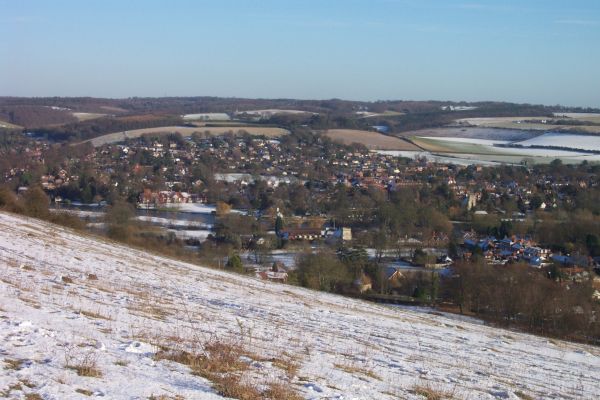
Today, the Goring Gap constricts the River Thames narrowing the otherwise broad river valley. Steep hills rise southwards to Lardon Chase, the nearest section of the Berkshire Downs while the Chiltern Hills rise to the north. The twin villages of Goring and Streatley straddle the River Thames at the Goring Gap.

The Goring Gap represents an important communications and transportation corridor accommodating a major road connecting Reading to Oxford along with the principal railway line west from London (Paddington).

Coordinates: 51°31′19.28″N 1°8′19.33″W / 51.5220222°N 1.1387028°W / 51.5220222; -1.1387028

References

  1. ^ Michael J Crawley. "Geology and Soils" (PDF). Imperial College. http://www3.imperial.ac.uk/portal/pls/portallive/docs/1/587934.PDF. Retrieved March 21, 2007. 

Wikimedia Foundation. 2010.

Игры ⚽ Поможем сделать НИР

Look at other dictionaries:

  • Goring Lock — Goring Lock[1] The view of Goring Lock from Goring and Streatley Bridge …   Wikipedia

  • Goring-on-Thames — Coordinates: 51°31′23″N 1°08′06″W / 51.523°N 1.135°W / 51.523; 1.135 …   Wikipedia

  • Worthing — Infobox Settlement name = Worthing official name = Borough of Worthing other name = native name = nickname = Sunny Worthing settlement type = Town and Borough total type = Borough motto = Ex terra copiam e mari salutem (Latin: From the land… …   Wikipedia

  • Streatley, Berkshire — infobox UK place country = England official name= Streatley latitude= 51.523 longitude= 1.15 population= 974 (2001 census data) civil parish= Streatley unitary england= West Berkshire lieutenancy england=Berkshire region= South East England… …   Wikipedia

  • River Thames — Thames redirects here. For other uses, see Thames (disambiguation). Coordinates: 51°29′56″N 0°36′31″E / 51.4989°N 0.6087°E / 5 …   Wikipedia

  • Whitchurch Lock — Infobox Waterlock lock name = Whitchurch Lock [ [http://www.visitthames.co.uk/uploads/a users guide to the River thames.pdf Statistics from Environment Agency A User s Guide to the River Thames:Part II ] ] caption= Whitchurch Lock with head gates …   Wikipedia

  • United Kingdom — a kingdom in NW Europe, consisting of Great Britain and Northern Ireland: formerly comprising Great Britain and Ireland 1801 1922. 58,610,182; 94,242 sq. mi. (244,100 sq. km). Cap.: London. Abbr.: U.K. Official name, United Kingdom of Great… …   Universalium

  • Maritime history of Worthing — Worthing exploits its seaside location for tourism for which Worthing Pier has always been important but the sea and coast have also been used for farming, fishing and trade. Worthing, a seaside resort on the …   Wikipedia

  • The Ridgeway — Infobox Hiking trail Name=The Ridgeway Photo= Ridgeway mongwell.jpg Caption= The Ridgeway in Grim s Ditch near Mongewell Location=Southern England, United Kingdom Designation=UK National Trail Length=convert|85|mi|km Start/End Points=Overton Hill …   Wikipedia

  • Brighton/Worthing/Littlehampton — The Brighton/Worthing/Littlehampton conurbation has a population of 461,181 (2001 census), making it the 12th largest conurbation in the United Kingdom and England s 10th largest. Named the Brighton/Worthing/Littlehampton conurbation by the… …   Wikipedia

Share the article and excerpts

Direct link
Do a right-click on the link above
and select “Copy Link”