- Marshall County, Alabama
-
Marshall County, Alabama 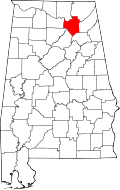
Location in the state of Alabama
Alabama's location in the U.S.Founded January 9, 1836 Named for John Marshall Seat Guntersville Largest city Albertville Area
- Total
- Land
- Water
623.16 sq mi (1,614 km²)
567.06 sq mi (1,469 km²)
56.10 sq mi (145 km²),Population
- (2010)
- Density
93,019
164/sq mi (63/km²)Time zone Central: UTC-6/-5 Website www.marshallco.org Marshall County is a county of the U.S. state of Alabama, and is included in the Huntsville-Decatur Combined Statistical Area. Its name is in honor of John Marshall, famous Chief Justice of the United States. As of 2010 the population was 93,019. Its county seat is Guntersville.
Marshall County is a dry county, with the exception of three cities within the county, Albertville, Arab, and Guntersville.
Contents
History & Geography
Marshall County was established on January 9, 1836.[1]
According to the 2000 census, the county has a total area of 623.16 square miles (1,614.0 km2), of which 567.06 square miles (1,468.7 km2) (or 91.00%) is land and 56.10 square miles (145.3 km2) (or 9.00%) is water.[2] The Tennessee river runs both north and south within the county.
Major highways
 U.S. Highway 431 over the Tennessee River
 U.S. Highway 231
 U.S. Highway 431
 State Route 68
 State Route 69
 State Route 75
 State Route 79
 State Route 168
 State Route 179
 State Route 205
 State Route 227
Rail
River
Adjacent counties
- Jackson County, Alabama - northeast
- DeKalb County, Alabama - east
- Etowah County, Alabama - southeast
- Blount County, Alabama - south
- Cullman County, Alabama - southwest
- Morgan County, Alabama - west
- Madison County, Alabama - northwest
Demographics
Marshall County, Alabama Year Pop. ±% 1840 7,553 — 1850 8,846 +17.1% 1860 11,472 +29.7% 1870 9,871 −14.0% 1880 14,585 +47.8% 1890 18,935 +29.8% 1900 23,289 +23.0% 1910 28,553 +22.6% 1920 32,669 +14.4% 1930 39,802 +21.8% 1940 42,395 +6.5% 1950 45,090 +6.4% 1960 48,018 +6.5% 1970 54,211 +12.9% 1980 65,622 +21.0% 1990 70,832 +7.9% 2000 82,231 +16.1% 2010 93,019 +13.1% Sources: "American FactFinder". United States Census Bureau. http://factfinder2.census.gov/faces/nav/jsf/pages/index.xhtml. through 1960 As of the census[3] of 2000, there were 82,231 people, 32,547 households, and 23,531 families residing in the county. The population density was 145 people per square mile (56/km2). There were 36,331 housing units at an average density of 64 per square mile (25/km2). The racial makeup of the county was 93.38% White, 1.47% Black or African American, 0.53% Native American, 0.24% Asian, 0.04% Pacific Islander, 3.24% from other races, and 1.09% from two or more races. 5.66% of the population were Hispanic or Latino of any race.
There were 32,547 households out of which 32.40% had children under the age of 18 living with them, 57.80% were married couples living together, 10.70% had a female householder with no husband present, and 27.70% were non-families. 24.60% of all households were made up of individuals and 10.90% had someone living alone who was 65 years of age or older. The average household size was 2.50 and the average family size was 2.96.
In the county the population was spread out with 24.90% under the age of 18, 8.50% from 18 to 24, 29.00% from 25 to 44, 23.40% from 45 to 64, and 14.20% who were 65 years of age or older. The median age was 37 years. For every 100 females there were 94.80 males. For every 100 females age 18 and over, there were 91.50 males.
The median income for a household in the county was $32,167, and the median income for a family was $38,788. Males had a median income of $30,500 versus $20,807 for females. The per capita income for the county was $17,089. About 11.70% of families and 14.70% of the population were below the poverty line, including 17.90% of those under age 18 and 19.30% of those age 65 or over.
Cities and towns
- Albertville
- Arab (part of Arab is in Cullman County)
- Boaz (part of Boaz is in Etowah County)
- Douglas
- Grant
- Horton
- Guntersville
- Union Grove
Places of interest
Marshall County is home to numerous outdoor recreation areas including Lake Guntersville State Park, Cathedral Caverns State Park, and Buck's Pocket State Park.
See also
- National Register of Historic Places listings in Marshall County, Alabama
- Properties on the Alabama Register of Landmarks and Heritage in Marshall County, Alabama
References
- ^ Marshall County History
- ^ "Census 2000 U.S. Gazetteer Files: Counties". United States Census. http://www.census.gov/tiger/tms/gazetteer/county2k.txt. Retrieved 2011-02-13.
- ^ "American FactFinder". United States Census Bureau. http://factfinder.census.gov. Retrieved 2008-01-31.
External links

Madison County Jackson County Morgan County 
DeKalb County  Marshall County, Alabama

Cullman County Blount County Etowah County Municipalities and communities of Marshall County, Alabama Cities Albertville | Arab‡ | Boaz‡ | Guntersville

Towns Douglas | Grant | Sardis City‡ | Union Grove
Unincorporated
communitiesAsbury | Horton
Footnotes ‡This populated place also has portions in an adjacent county or counties
Communities of the Huntsville-Decatur Area Population over 100,000 Population over 50,000 Population over 20,000 Population over 10,000 Population over 5,000 Population over 2,000 Population over 1,000 Population over 500 Population over 200 Population under 200 Unincorporated areas Belle Mina · Caddo · Danville · Hulaco · Lacey's Spring · Meridianville · Morgan City · Moulton Heights · New Market · Tanner · ToneyCounties  State of Alabama
Topics - Index
- History
- Geography
- People
- Delegations
- Government
- Governors
- Lieutenant Governors
- Metropolitan Areas
- Visitor Attractions
- National Historic Landmarks
Regions Metros - Greater Birmingham
- Montgomery Metro Area
- Mobile Metro Area
- Huntsville Metro Area
Larger cities Counties - Autauga
- Baldwin
- Barbour
- Bibb
- Blount
- Bullock
- Butler
- Calhoun
- Chambers
- Cherokee
- Chilton
- Choctaw
- Clarke
- Clay
- Cleburne
- Coffee
- Colbert
- Conecuh
- Coosa
- Covington
- Crenshaw
- Cullman
- Dale
- Dallas
- DeKalb
- Elmore
- Escambia
- Etowah
- Fayette
- Franklin
- Geneva
- Greene
- Hale
- Henry
- Houston
- Jackson
- Jefferson
- Lamar
- Lauderdale
- Lawrence
- Lee
- Limestone
- Lowndes
- Macon
- Madison
- Marengo
- Marion
- Marshall
- Mobile
- Monroe
- Montgomery
- Morgan
- Perry
- Pickens
- Pike
- Randolph
- Russell
- Shelby
- St. Clair
- Sumter
- Talladega
- Tallapoosa
- Tuscaloosa
- Walker
- Washington
- Wilcox
- Winston
Coordinates: 34°22′05″N 86°18′14″W / 34.36806°N 86.30389°W
Categories:- Alabama counties
- Huntsville–Decatur Combined Statistical Area
- Marshall County, Alabama
- 1836 establishments in the United States
- Populated places established in 1836


Wikimedia Foundation. 2010.