- Marthall
-
Coordinates: 53°16′41″N 2°18′10″W / 53.278092°N 2.302749°W
Marthall 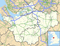
 Marthall
Marthall shown within CheshireOS grid reference SJ779766 Unitary authority Cheshire East Ceremonial county Cheshire Region North West Country England Sovereign state United Kingdom Post town KNUTSFORD Postcode district WA16 Dialling code 01565 Police Cheshire Fire Cheshire Ambulance North West EU Parliament North West England UK Parliament Tatton List of places: UK • England • Cheshire Marthall is a village in the unitary authority of Cheshire East and the ceremonial county of Cheshire, England. It is around 3 miles from Knutsford.
The village is small, it has a village hall, a church as well as a pub (The Egerton Arms). In 1976, Marthall civil parish was formed in its present state by including the neighbouring village, Ollerton. Although they still keep their old identities and village boundaries, they come together in a shared Parish Council and other facilities.
External links
Ceremonial county of Cheshire Cheshire Portal Unitary authorities Major settlements Alsager • Birchwood • Bollington • Chester • Congleton • Crewe • Ellesmere Port • Frodsham • Knutsford • Macclesfield • Middlewich • Nantwich • Neston • Northwich • Poynton • Runcorn • Sandbach • Warrington • Widnes • Wilmslow • Winsford
See also: List of civil parishes in CheshireRivers Topics History • MuseumsCategories:- Villages in Cheshire
- Civil parishes in Cheshire
- Cheshire geography stubs

Wikimedia Foundation. 2010.