- Minuteman Bikeway
-
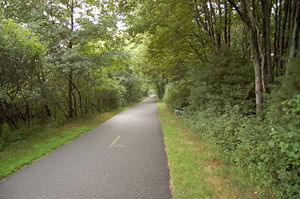 The Minuteman Commuter Bikeway in Bedford, near Wiggins Avenue
The Minuteman Bikeway is a 10-mile (16-kilometre)[1] paved multi-use rail trail located in the Greater Boston area of Massachusetts.
Contents
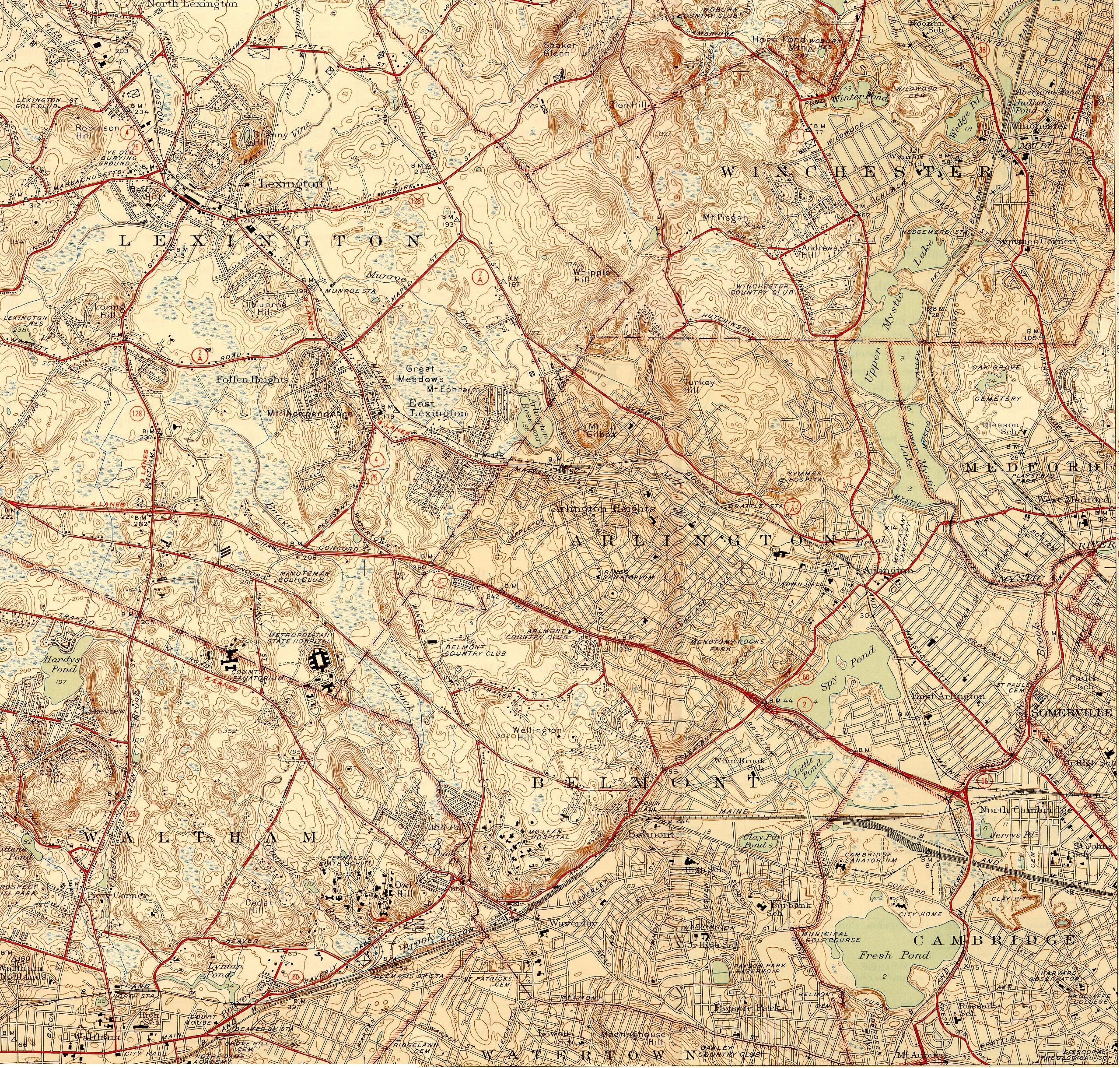
Route
Legend
In Bedford: 
Railbanked line to Concord Reformatory 
South Road 

Bedford Depot Park 


to Billerica 
Elm Brook 
Wiggins Avenue 
in Lexington: Hartwell Avenue 
to Hanscom Air Force Base 
Interstate 95 Bedford Street (Routes 4, 225) Revere Street Hancock Street 
Lexington B&M Station Woburn Street 
Site of B&M's Munroe Station 
Pierce's Bridge (Maple Street) 
Arlington’s Great Meadows Site of B&M's East Lexington Station in Arlington: Site of B&M's Arlington Heights Station Park Avenue Lowell Street Site of B&M's Brattle Station Site of B&M's Arlington Centre Station 
Massachusetts Avenue (U.S. Route 3) 
Spy Pond Site of B&M's Lake Street Station Lake Street Massachusetts Route 2 in Cambridge: 
Alewife Station The Minuteman Bikeway runs from Bedford to the Alewife station at the northern end of the Red Line in Cambridge. It passes through the towns of Lexington and Arlington on the way. Also along the route are several notable regional sites, including Alewife Brook Reservation, Spy Pond and "Arlington’s Great Meadows" (actually located in Lexington).
At its Cambridge terminus, the bikeway connects with two other bike paths: the Fitchburg Cutoff Path and the Cambridge Linear Park which, in turn, leads to the Somerville Community Path. Plans are underway to extend the Somerville Community Path to downtown Boston, which would create a much larger continuous bikeway accessible from the Minuteman.
At the Bedford end, the Minuteman Bikeway connects with the Narrow Gauge Rail Trail[2] and the Reformatory Branch Rail Trail.
History
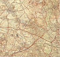 Map from 1946, where Boston & Maine Railway passes along the route of today's Minuteman Bikeway.
The path comprising the current Minuteman Bikeway has a long history. The trail closely approximates the route that Paul Revere took on his famous ride in 1775, which heralded the beginning of the American Revolution.
Along the way to becoming a railroad, the path's right-of-way was laid out east of Lexington in 1846 by the Lexington and West Cambridge Railroad and west of Lexington in 1873 by the Middlesex Central Railroad.
Railbanking of the line was first proposed in 1974, three years before passenger rail service was discontinued, and a full seven years before rail service was discontinued altogether (in 1981). In 1991, the final plan for the conversion was approved, and construction started on the original section of the bikeway. The path was dedicated in 1992 and completed the following year.[3]
In 1998 the bikeway was extended from East Arlington to Alewife station (in Cambridge). In 2002 it was entirely repaved and in 2004 the Bedford Depot Park Enhancement Project was completed at its west terminus.[3]
The property is currently owned by the Massachusetts Bay Transportation Authority and leased to the municipalities through which it passes on an interim basis.[citation needed]
Uses
Area residents use the bikeway for a host of activities, including bicycling, walking, jogging, and inline skating. The main use of the path, however, is for casual biking.[3] In the winter there is often enough snow on the bikeway for cross-country skiing. However, the Bikeway is now plowed from Alewife Station to the Bedford-Lexington border.[4] No motorized vehicles are allowed except for powered wheelchairs and emergency vehicles.
 Artwork posted on the Minuteman Bikeway by local artist Sonik
Future possibilities
New connections under contemplation include one from Lexington to the Battle Road Trail, one to the Charles River bike path via the abandoned Watertown Branch Railroad, and one to the Mystic River bike path following Alewife Brook.[4] The Alewife Brook extension has received $4M from the American Recovery and Reinvestment Act of 2009 as the "Minuteman Bikepath Connector" project.[5]
See also
References
- ^ Some sources list it erroneously as 11 miles. The confusion arises because the mile marker at the beginning of the trail is 1 instead of 0. Wikipedia editors have measured the distance as shown on maps and in Google Earth, and it appears to be 10 miles to within a few hundredths of a mile. For further verification, see: Project for Public Spaces
- ^ Rail-Trails at Bedford Depot Park
- ^ a b c Viser, Matt (2007), "Rage on the bikeway", The Boston Globe, Volume 272, Number 1, 2007-07-01, p.A1.
- ^ a b Gilsdorf, Ethan (June 29, 2008). "Popular bike trail gets even better". boston.com. http://www.boston.com/news/local/massachusetts/articles/2008/06/29/popular_bike_trail_gets_even_better/?page=2. Retrieved 2009-06-11.
- ^ "Patrick-Murray Administration Obligates 100% of ARRA Highway Funding One Month Ahead of Schedule". 2010-02-10. http://www.eot.state.ma.us/default.asp?pgid=content/releases/pr021010_ARRA&sid=release. Retrieved 2010-03-02.
External links
- Friends of the Community Paths
- Depot Park at the Bedford terminus
- Rails-to-Trails Conservancy
- Video of entire trail south to north
- 1870s railroad maps of what is now the Minuteman Bikeway
- Clear the Trail advocacy organization
- Friends of Lexington Bikeways website
- Map with popups of old maps from the 1870s showing each section of the bikeway
- On a Google map
- Friends of Arlington's Great Meadows
Categories:- Bike paths in Massachusetts
- Rail trails in Massachusetts
- Transportation in Boston, Massachusetts
- Cambridge, Massachusetts
- Lexington, Massachusetts
- Bedford, Massachusetts
- Arlington, Massachusetts
- Bay Circuit Trail
- Visitor attractions in Cambridge, Massachusetts


Wikimedia Foundation. 2010.