- Greater Los Angeles Area
-
For the urban area consisting of Los Angeles and Orange Counties, see Los Angeles metropolitan area.
Greater Los Angeles
Los Angeles-Long Beach-Riverside— CSA — Los Angeles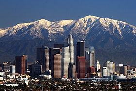 Long Beach
 Riverside
Country  United States
State  California
Principal cities  Los Angeles
- Long Beach
- Glendale
- Santa Clarita
- Lancaster
- Santa Ana
- Anaheim
- Irvine
- Oxnard
- Thousand Oaks
- Ventura
- Riverside
- San Bernardino
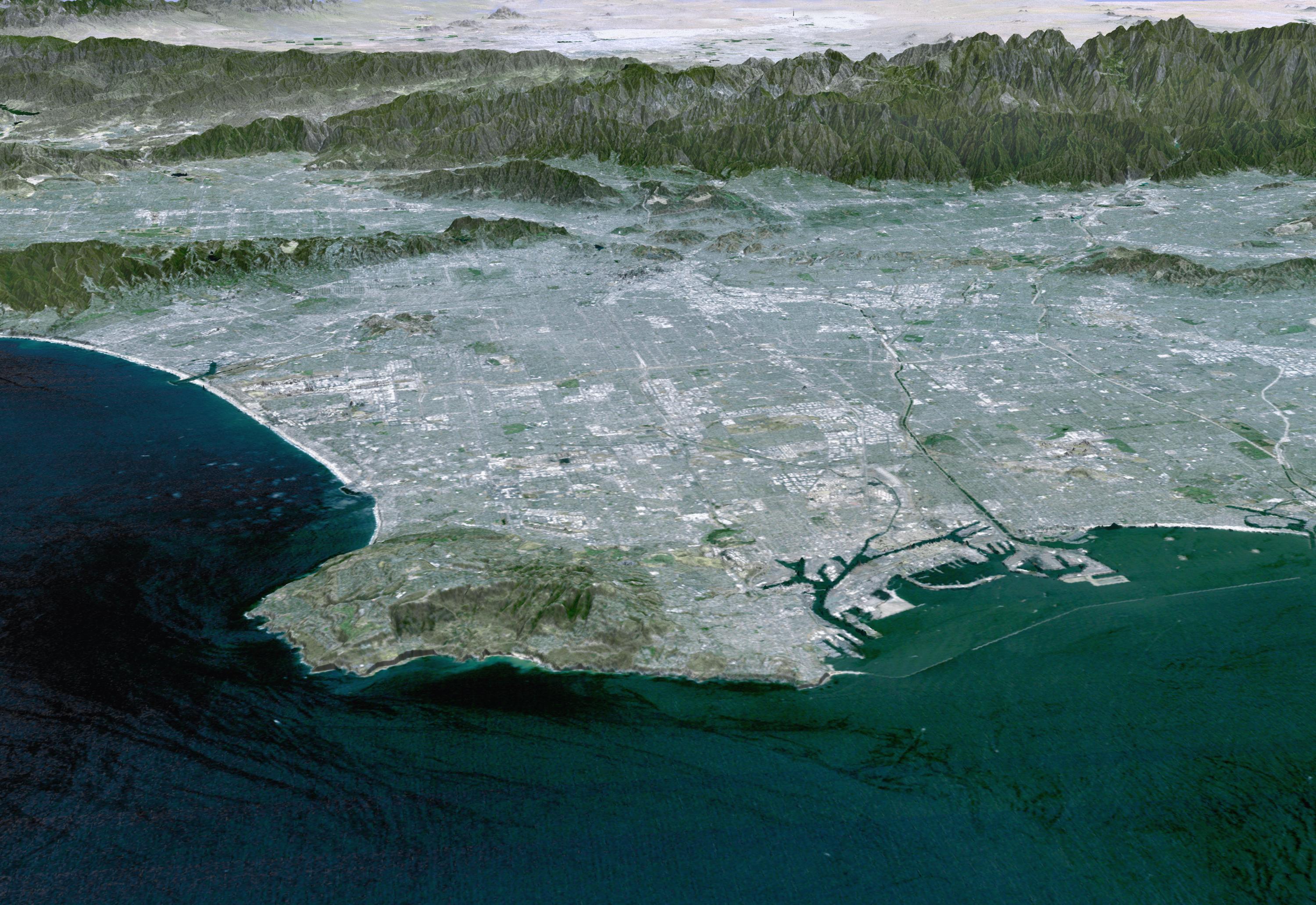
- OntarioArea - Metro 33,954 sq mi (87,490 km2) Elevation 0 - 11,499 ft (0 - 3,505 m) Population (2010 Census)[1] - CSA 17,877,006 (2nd) MSA/CSA = 2010, Urban = 2000 Time zone PST (UTC-8) - Summer (DST) PDT (UTC-7) The Greater Los Angeles Area, or the Southland, is a term used for the Combined Statistical Area (a group of interacting metropolitan areas) sprawled over five counties in the southern part of California, namely Los Angeles County, Orange County, San Bernardino County, Riverside County and Ventura County. It has been one of the fastest growing regions in the United States for decades, first in Los Angeles County, then Orange County, and now in the Inland Empire. As of 2005, the official estimate of the population of the Los Angeles metropolitan area is more than 12.9 million, while in 2009 the larger five-county region had a population of over 17.6 million. Either definition makes it the second-largest core-based statistical area in the country, behind the New York metropolitan area.[2] The term "Southland" has also been used to refer to all of Southern California.[3]
The agglomeration of urbanized Greater Los Angeles area surrounds the urban core of the county of Los Angeles, California. The urban term is defined to refer to the more-or-less continuously urbanized area stretching from Ventura to the southern border of Orange County, and from the Pacific Ocean to the Inland Empire. The Greater Los Angeles area is generally taken to include the Los Angeles metropolitan area, the Inland Empire, and Ventura County - all part of the Census Bureau define combined statistical area. The term "Greater Los Angeles" does not include San Diego and Imperial counties, whose urbanized areas are not geographically continuous with the urbanized area surrounding Los Angeles, rather San Diego is part of the large, but smaller urban area, San Diego–Tijuana.
The United States Census Bureau has designated the five county region as the Los Angeles-Long Beach-Riverside, CA combined statistical area, with a January 1, 2009 population estimate of 17,786,419.[4] According to the U.S. Census Bureau, the Los Angeles metropolitan area has a total area of 4,850 square miles (12,561.442 km2), while the wider combined statistical area covers 33,954 square miles (87,940.456 km2), but more than half of this is the sparsely populated eastern areas of Riverside and San Bernardino counties.
Contents
Geography
 The Los Angeles Basin, viewed south from Mulholland Drive. From left to right can be seen the San Gabriel Mountains (horizon), downtown L.A., West Hollywood, the Hollywood Bowl (foreground), West Los Angeles, Palos Verdes (background), Catalina Island (horizon), Santa Monica, and the Pacific Ocean.
Urban form
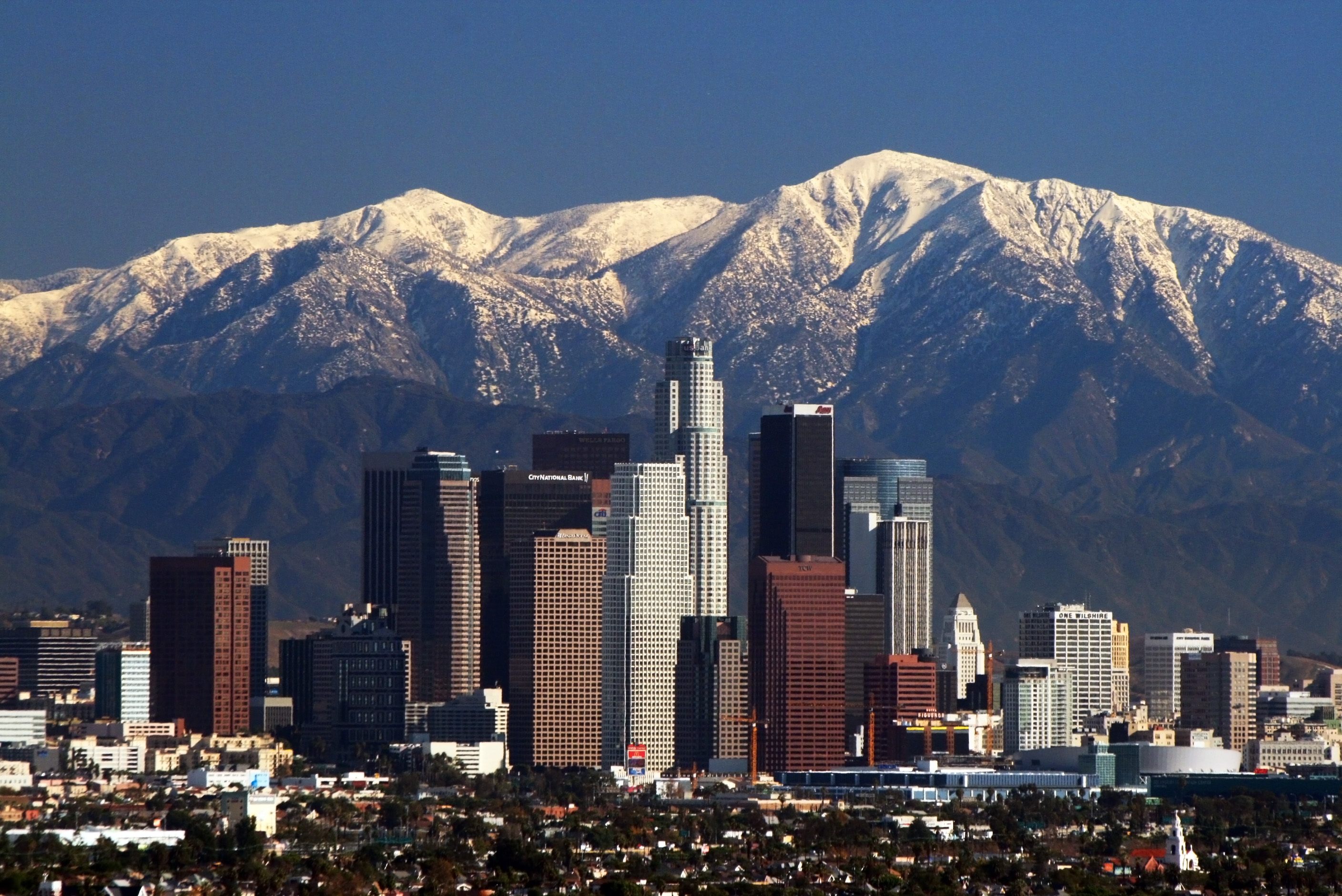
 Skyscrapers in Downtown Los Angeles.
Los Angeles has a long-standing reputation for sprawl. The area is in fact sprawling, but according to the 2000 Census, the "Los Angeles-Long Beach-Santa Ana" Urbanized Area (but not counting the portions of the Inland Empire in the Greater Los Angeles area) had a population density of 7,068 inhabitants per square mile (2,729 /km2), covering 1,668 square miles (4,320 km2) of land area, making it the most densely-populated Urbanized Area (as defined by the United States Census Bureau) in the United States.[5] For comparison, the "New York–Newark" Urbanized Area as a whole had a population density of 5,309 per square mile (2,050 /km2), covering 3,353 square miles (8,684 km2) of land area.
Los Angeles' sprawl may originate in the region's decentralized structure. Its major commercial, financial, and cultural institutionals are geographically dispersed rather than being concentrated in a single downtown or central area. Also, the population density of Los Angeles proper is low (approximately 7,500 per square mile) when compared to some other large American cities such as New York City (27,500), San Francisco (17,000), and Chicago (11,800).[6] However, what gives the entire Los Angeles metro region a high denity is the fact that many of the city's suburbs and satellites cities have high density rates.[7] The population density of the central area was more than 13,500 per square mile (5,212 /km2) in 2000.[8] Within its urbanized areas, Los Angeles is noted for small lot sizes and low-rise buildings. Buildings in the area are low when compared to other large cities, mainly due to zoning regulations regarding earthquakes. Los Angeles became a major city just as the Pacific Electric Railway spread population to smaller cities much as interurbans did in East Coast cities. In the first decades of the twentieth century, the area was marked by a network of fairly dense but separate cities linked by rail. The ascendance of the automobile helped fill in the gaps between these commuter towns with lower-density settlements.[9]
 A flat land area in the greater Los Angeles area completely filled with houses, buildings, roads, and freeways
Suburban areas surround the city of Los Angeles on all sides. Starting in the early twentieth century, there was a large growth in population on the western edges of the city moving to the San Fernando Valley and out into the Conejo Valley in eastern Ventura County. Much of the working class whites migrated to this area during the 1960s and 1970s out of East and Central Los Angeles.[10] As a result, there was a large growth in population into the Conejo Valley and into Ventura County through the US 101 corridor. Making the US 101 a full freeway in the 1960s and expansions that followed helped make commuting to Los Angeles easier and opened the way for development westward. Development in Ventura County and along the US 101 corridor remains controversial, with open-space advocates battling those who feel business development is necessary to economic growth.[11] Although the area still has abundant amount of open space and land, almost all of it was put aside and mandated never to be developed as part of the master plan of each city. Because of this, the area which was once a relatively inexpensive area to buy real estate, saw rising real estate prices well into the 2000s.[12] Median home prices in the Conejo Valley for instance, now range from $700,000 to $2.2 million.[13]
The Los Angeles area continues to grow, principally on the periphery where new, cheaper, undeveloped areas are being sought.[14] As such, in these areas, populations as well as housing prices exploded, although the housing bubble popped late in the decade of the 2000s. Riverside and San Bernardino Counties, which contain large swaths of desert, attracted most of the population increase between 2000 and 2006. Growth continues not only outside the existing urbanized area but also adjacent to existing development in the central areas.[15] As in virtually all US core cities, there is now vigorous residential development in the downtown area with both new buildings and renovation of former office buildings. The Los Angeles Downtown News keeps a list of ongoing development projects, updated every quarter.[16]
Identity
The term "Greater Los Angeles" can be used to denote the metropolitan area or the consolidated area. The term "Southland" is more nebulous and can refer to either. Additionally, the Southland is used more so in local media than by residents. As is the case in many major metropolitan areas, employment now consistently occurs outside the downtown core and many people commute and conduct all of their daily activities in suburban areas, such as the large counties and the municipalities that are outside the city of Los Angeles.[17]
Regional identity remains a contentious issue, with many residents refusing to acknowledge any association with the whole. For example, while Los Angeles County and Orange County share a geographical border, the two also share a host of sharp demographic, political, and financial distinctions. Orange County is often identified apart from Los Angeles in popular media and by residents. While only 1.63% of Angelinos commute to Orange County, over 6% of Orange County commuters head to Los Angeles to work.[18] Western Riverside County and San Bernardino County have become commuter regions characteristic of other suburban counties throughout the nation. Most residents in these counties commute to Los Angeles County and Orange County for employment.[19] In contrast to each other, Riverside County and San Bernardino County maintain distinct identities because of their geographical boundaries and vast distances that separate the eastern portions of those counties from the rest of the Los Angeles area.
Boundaries
 Los Angeles Basin at dawn
Some areas are bounded by natural features such as mountains or the ocean; others are marked by city boundaries, freeways, or other constructed landmarks. For example, Downtown Los Angeles is the area of Los Angeles roughly enclosed by three freeways and one river: the Harbor Freeway (SR 110) to the west, the Santa Ana Freeway (US 101) to the north, the Los Angeles River to the east, and the Santa Monica Freeway (I-10) to the south. Or, the San Fernando Valley: lying north-northwest of downtown ("The Valley") is a 15 miles (24 km) wide basin ringed by mountains.
Some other areas of Los Angeles include the Westside; South L.A. (formerly known as South Central L.A.); and the San Pedro/Harbor City area. Adjoining areas that are outside the actual city boundaries of the incorporated city of Los Angeles include the South Bay, the Gateway Cities, the San Gabriel Valley and the Foothills. The San Pedro/Harbor City area was annexed by the city of Los Angeles so the city could have access to and control over the Port of Los Angeles. It is connected to the rest of L.A. only by a narrow corridor that generally follows the Harbor Freeway. Many Angelenos consider the Eastside to be the area east of the Los Angeles River, south of Glendale and Pasadena, and north of the Gateway Cities, including the area of unincorporated Los Angeles County that includes East Los Angeles.
City boundaries within Greater Los Angeles are quite complicated. For example, Beverly Hills and West Hollywood are completely surrounded by the City of Los Angeles with the exception of a small border shared between the two cities. Another example is Culver City completely surrounded by L.A. except for where it shares boundaries with the unincorporated communities of Ladera Heights and Baldwin Hills. Both Santa Monica and Marina del Rey are surrounded by L.A. as well, with regard to their ocean side. San Fernando in the northern corner of the San Fernando Valley is also an incorporated city entirely surrounded by L.A. territory.
Despite the large footprint of the City of L.A., a majority of the land area within Los Angeles County is unincorporated and under the primary jurisdiction of Los Angeles County. Much of this land however is that of which cannot be easily developed; geographic features such as the Santa Monica Mountains, San Gabriel Mountains ranges, and the Mojave Desert. Developed land in these regions is observed on the fringes of incorporated cities, some of which are fully developed.
Census statistics
Combined Statistical Area
The Los Angeles Combined Statistical Area includes cities in Los Angeles County; and Orange County; as well as cities in the western edge of the Inland Empire, such as Ontario, and Riverside, and streching to Redlands; in addition to cities in Ventura County.
Metropolitan Statistical Area
The Los Angeles metropolitan area comprises Los Angeles County (9,862,049), and Orange County (3,010,759). The metropolitan division to which Los Angeles County belongs to is known as the Los Angeles-Long Beach-Glendale, CA Metropolitan Division, while Orange County belongs to the Santa Ana-Anaheim-Irvine, CA Metropolitan Division. The total population for the Los Angeles metropolitan area is 12,872,808.[20]
In addition to the Los Angeles-Long Beach-Santa Ana, CA Metropolitan Statistical Area, the following Metropolitan Statistical Areas are also included in the Los Angeles-Long Beach-Riverside, CA Combined Statistical Area (total pop. 17,786,419):[20] Oxnard-Thousand Oaks-Ventura, CA Metropolitan Statistical Area (797,740), comprised solely of Ventura County and the Riverside-San Bernardino-Ontario, CA Metropolitan Statistical Area (4,115,871) made up of Riverside County, California (2,100,516)and San Bernardino County, California (2,015,355).
Urban areas
The combined statistical area is a multicore metropolitan region containing several urban areas.
Population
RankUrbanized Area 2000
Population2 Los Angeles–Long Beach–Santa Ana 11,789,487 25 Riverside–San Bernardino 1,506,816 68 Mission Viejo 533,015 91 Oxnard 337,591 123 Palmdale–Lancaster 263,532 125 Indio–Cathedral City–Palm Springs 254,856 131 Temecula–Murrieta 229,810 143 Thousand Oaks 210,990 150 Victorville–Hesperia–Apple Valley 200,436 176 Santa Clarita 170,481 227 Hemet 117,200 238 Simi Valley 112,345 368 Camarillo 62,798 Economic areas
The Bureau of Economic Analysis defines an even larger region known as an "economic area", which delineates the relevant regional market surrounding a metropolitan area. Economic areas consist of one or more economic nodes, which are MSAs or CSAs. Economic areas are defined as a collection of nodes and other outlying counties on the basis of commuting data and newspaper circulation data. The Los Angeles economic area consists of the Los Angeles-Long Beach-Riverside CSA, then San Luis Obispo-Paso Robles MSA, Bakersfield MSA and Santa Barbara-Santa Maria-Goleta MSA to the north and extending in the southwest to the El Centro MSA and the Yuma MSA.
In addition to the above, the economic area includes La Paz County in Arizona, and Inyo and Mono counties in California.[21]
Principal cities
Further information: List of Districts and Neighborhoods in Los AngelesThe following is a list of principal cities in the Greater Los Angeles Area with 2009 California Department of Finance estimates of their population:[22]
Los Angeles–Long Beach–Santa Ana MSA
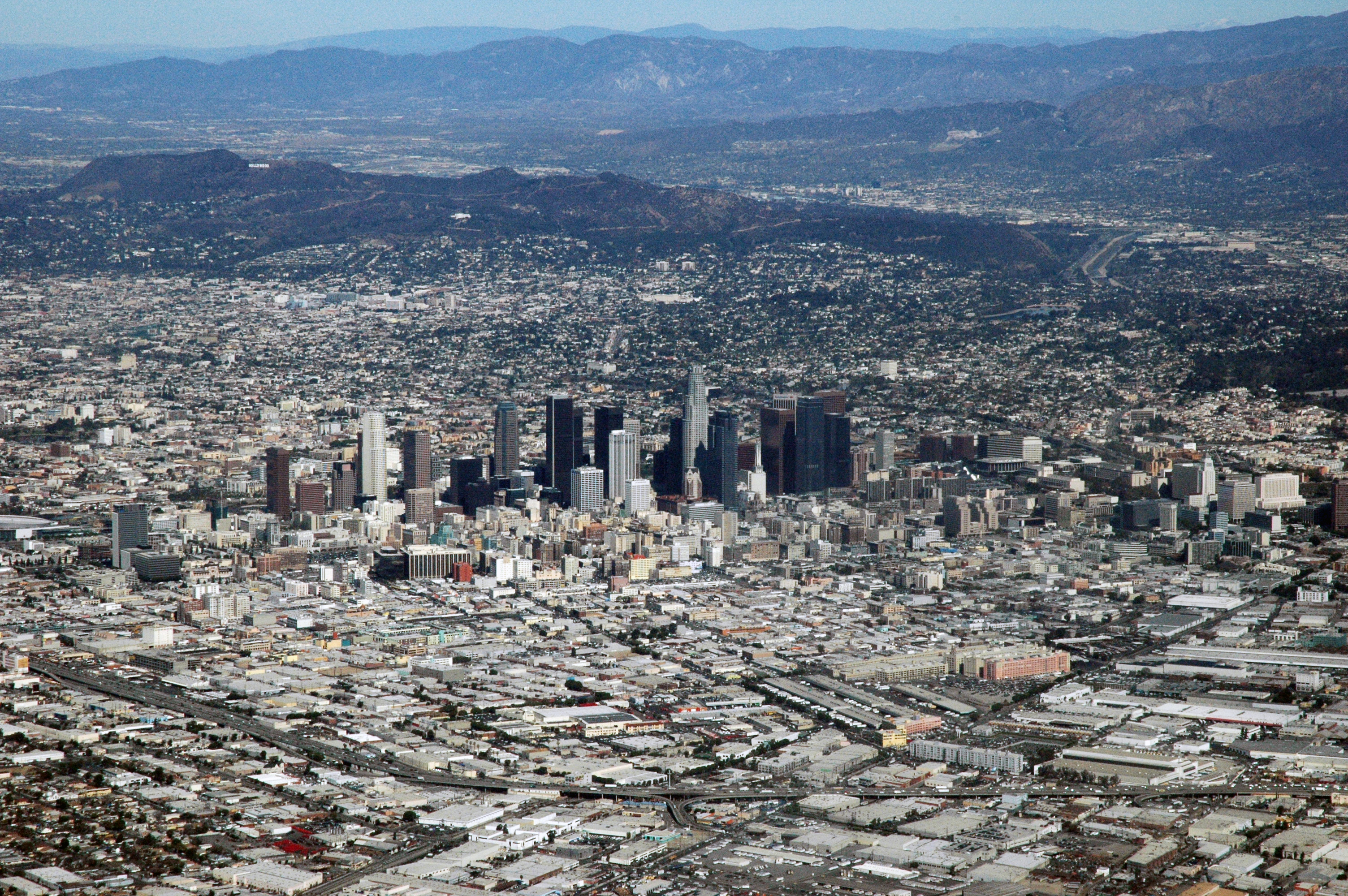
 View of the Los Angeles MSA CBD
- Los Angeles (4,065,585)
- Long Beach (492,682)
- Santa Ana (355,662)
- Anaheim (348,467)
- Irvine (212,793)
- Glendale (207,303)
- Huntington Beach (202,480)
- Santa Clarita (177,150)
- Garden Grove (174,715)
- Pomona (162,255)
- Palmdale (151,346)
- Pasadena (150,185)
- Torrance (149,111)
- Lancaster (145,074)
- Orange (141,634)
- Fullerton (137,624)
- El Monte (126,308)
- Inglewood (118,868)
- Costa Mesa (116,479)
- Downey (113,469)
- West Covina (112,648)
- Norwalk (109,567)
- Burbank (108,082)
- South Gate (102,770)
- Mission Viejo (100,242)
- Compton (99,431)
- Carson (98,159)
- Westminster (93,284)
- Santa Monica (92,494)
- Hawthorne (89,979)
- Alhambra (89,171)
- Whittier (86,788)
- Newport Beach (86,252)
- Baldwin Park (84,812)
- Lakewood (83,508)
- Buena Park (83,385)
- Lake Forest (78,344)
- Tustin (74,825)
- Yorba Linda (68,399)
- Redondo Beach (67,646)
- Montebello (65,667)
- Gardena (61,810)
- Diamond Bar (60,360)
- Paramount (57,874)
- Arcadia (56,565)
- Cerritos (54,855)
Riverside–San Bernardino–Ontario MSA
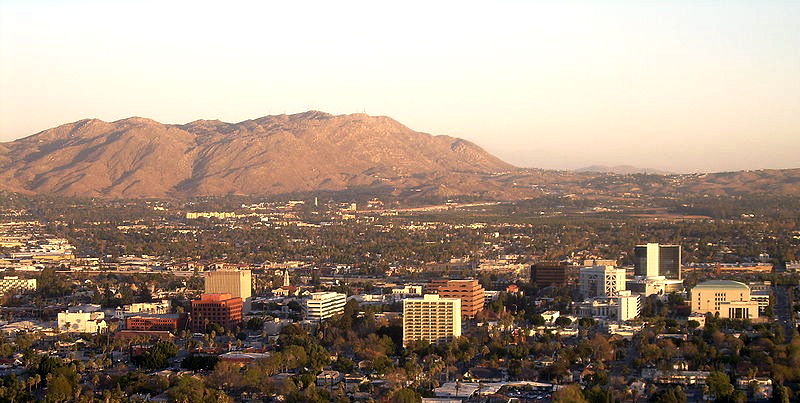
 View of the San Bernardino Valley
- Riverside (300,430)
- San Bernardino (204,483)
- Fontana (188,498)
- Moreno Valley (186,301)
- Rancho Cucamonga (177,736)
- Ontario (173,188)
- Corona (148,597)
- Victorville (109,441)
- Temecula (102,604)
- Murrieta (100,714)
- Rialto (100,022)
- Hesperia (88,184)
- Chino (84,173)
- Indio (82,230)
- Chino Hills (78,725)
- Upland (75,035)
- Hemet (74,361)
- Redlands (71,646)
- Apple Valley (69,861)
Oxnard–Thousand Oaks–Ventura MSA
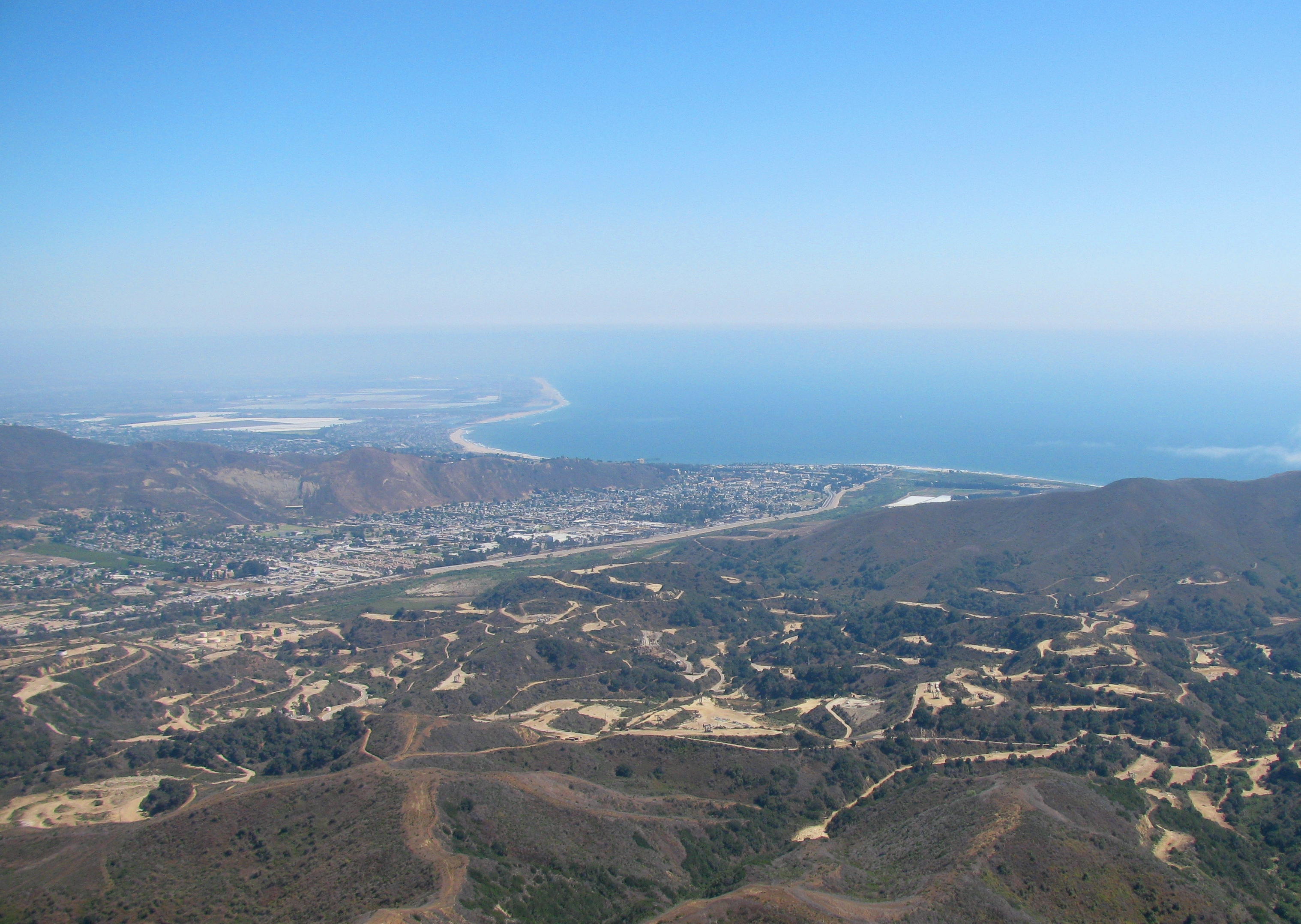
 View of the Ventura MSA coast
- Oxnard (197,067)
- Thousand Oaks (128,564)
- Simi Valley (125,814)
- Ventura (108,787)
- Camarillo (66,149)
Regions of the Southland
While there is not official designation for the regions that comprise Greater Los Angeles, one authority, the Los Angeles Times, divides the area into the following regions:[23]
- Angeles Forest
- Antelope Valley
- Central L.A. (Downtown Los Angeles, Hollywood , etc.)
- Eastside
- Harbor (see Gateway Cities)
- Northeast L.A. (Highland Park, Eagle Rock, etc.)
- Northwest County (including the Santa Clarita Valley)
- Pomona Valley
- San Fernando Valley
- San Gabriel Valley
- Santa Monica Mountains (Malibu, Topanga, etc.)
- South Bay
- South Los Angeles
- Southeast L.A. County (incl. Whittier and Norwalk, see Gateway Cities)
- The Verdugos (including Glendale, Pasadena and the Crescenta Valley)
- Westside
regions in adjacent counties include:
Demographics
Historical populations Census Pop. %± 1900 250,187 — 1910 648,316 159.1% 1920 1,150,252 77.4% 1930 2,597,066 125.8% 1940 3,252,720 25.2% 1950 4,934,246 51.7% 1960 7,751,616 57.1% 1970 9,972,037 28.6% 1980 11,497,486 15.3% 1990 14,531,529 26.4% 2000 16,373,645 12.7% 2010 17,877,006 9.2% historical data source:[24] According to the 2000 census, there were 16,373,645 people residing in the Greater Los Angeles Area. The racial makeup of the area was 55.1% White (39.0% White Non-Hispanic), 10.4% Asian, 0.3% Pacific Islander, 7.6% African American, 0.9% Native American, 21.0% from other races, and 4.7% from two or more races. 40.3% of the population were Hispanic of any race. 31.0% of the population (5.068 million) was foreign born; of this, 62.1% came from Latin America, 28.9% from Asia, 6.0% from Europe, and 3.0% from other parts of the world. 20.2% of the population (3.31 million) was born in different states.
The explosive growth of the region in the 20th century can be attributed to its favorable Mediterranean climate, the availability of land and many booming industries such as oil, automobile and rubber, motion pictures and aerospace which in turn attracted millions of people from all over the United States and world.[citation needed] Citrus production was important to the region's development in the earlier part of the 20th century.[25]
While the New York metropolitan area is presently the most populous metropolitan area in the United States, it has been predicted in the past that Greater Los Angeles will eventually surpass Greater New York in population.[citation needed] Whether this will happen is yet to be seen, but past predictions on this event have been off the mark. A 1966 article in Time predicted Greater Los Angeles would surpass New York by 1975, and that by 1990, would reach close to the 19 million mark.[26] But the article's flawed definition of Greater Los Angeles included San Diego, which is actually its own metropolitan area. A 1989 article in The New York Times predicted Greater Los Angeles would surpass Greater New York by 2010,[27] but the article predicted the population would be 18.3 million in that year, a number Greater New York has already surpassed as of 2007 by half a million people. As of 2009, the New York metropolitan area had a population of 22.2 million compared to the Greater Los Angeles Area's 18.7 million, about a 3.56 million persons difference.[28]
Politics
Presidential Election Results Year GOP DEM Others 2008 37.3% 2,099,609 60.8% 3,425,319 1.9% 107,147 2004 45.3% 2,490,150 53.4% 2,932,429 1.3% 69,649 2000 41.3% 2,003,114 54.6% 2,652,907 4.1% 198,750 1996 38.3% 1,661,209 51.3% 2,220,837 10.4% 449,706 1992 33.8% 1,657,151 45.0% 2,202,345 21.2% 1,038,448 1988 53.8% 2,408,696 45.0% 2,014,670 1.2% 54,441 1984 60.6% 2,614,904 38.3% 1,650,231 1.1% 48,225 1980 55.5% 2,187,859 35.0% 1,381,285 9.5% 374,993 1976 50.8% 1,877,267 46.7% 1,728,532 2.5% 93,554 1972 57.7% 2,346,127 38.7% 1,573,708 3.6% 146,653 1968 50.3% 1,836,478 43.0% 1,570,478 7.3% 247,280 1964 44.0% 1,578,837 55.9% 2,006,184 0.1% 2,488 1960 50.8% 1,677,962 48.9% 1,612,924 0.3% 10,524 Greater Los Angeles is a politically divided metropolitan area. During the 1970s and 1980s the region leaned toward the Republican Party. Los Angeles County, the most populous of the region, is a Democratic stronghold, although it voted twice for both Richard Nixon (1968, 1972) and Ronald Reagan (1980, 1984). Ventura County, Riverside County, and San Bernardino County lean towards the Republican Party. Orange County is a Republican stronghold and has been carried by every Republican presidential candidate since 1940.[29]
Economy
The Greater Los Angeles Area is the third largest metropolitan economy in the world, behind Greater Tokyo Area and New York Metropolitan Area.[citation needed] A 2005 PricewaterhouseCoopers study showed that Los Angeles urban area had a $639 billion economy.[30] Greater Los Angeles (including Inland Empire and Ventura county) had a $770.6 billion economy.[31]
Greater Los Angeles Area is the home of the US National headquarters of almost all Asian car manufacturers except Nissan and Subaru (Nissan moved to Tennessee); Toyota, Honda, Mazda, Mitsubishi, Suzuki, Hyundai and Kia have set up their National headquarters here.[citation needed]
Promoted as the "Entertainment Capital of the World" Greater Los Angeles has a large tourist industry. Major attractions include:
Theme parks
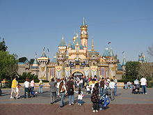 Sleeping Beauty Castle at Disneyland Park
- Disneyland
- Disney's California Adventure
- Knott's Berry Farm
- Pacific Park
- Six Flags Magic Mountain
- Universal Studios Hollywood
Beaches
 Laguna Beach coastline is popular for sunbathers
- Malibu
- Venice Beach
- Huntington Beach
- Laguna Beach
- Dana Point
- Sunset Beach
- Bolsa Chica State Beach
- Newport Beach
- Manhattan Beach
- Hermosa Beach
- Redondo Beach
- San Clemente
- Santa Monica
- Zuma Beach
Shopping
 Rodeo Drive in Beverly Hills
- Americana at Brand
- Bella Terra
- Beverly Center
- The Block at Orange
- Cerritos Auto Square
- Cerritos Towne Center
- Del Amo Mall
- Downtown Disney
- Fashion Island
- Glendale Galleria
- The Grove at Farmer's Market
- Hollywood and Highland
- Irvine Spectrum Center
- Los Cerritos Center
- Old Pasadena
- Ontario Mills
- Paseo Colorado
- Rodeo Drive
- South Bay Galleria
- South Coast Plaza
- Stonewood Center
- Third Street Promenade
- Universal CityWalk
- Valencia Town Center
- Victoria Gardens
- Westfield Century City
- Westfield MainPlace
- Westfield Santa Anita
- Westfield Topanga
- Westside Pavilion
Motion picture studios
 Warner Brothers Studios in the San Fernando Valley
- CBS Television City
- CBS Studio Center
- CBS Columbia Square
- Charlie Chaplin Studios
- Ren-Mar Studios
- Paramount Studios
- NBC Studios
- Walt Disney Studios
- Golden Oak Ranch
- Hollywood Center Studios
- Universal Studios
- The Prospect Studios
- Metromedia Square
- Santa Clarita Studios
- Nestor Studios
- 20th Century Fox
- Sony Pictures Entertainment
- Fox Television Center
- Nickelodeon Animation Studios
- Sunset Gower Studios
- Downey Studios
- Warner Brothers Studios
Waterparks
- Raging Waters
- Knott's Soak City USA
- Six Flags Hurricane Harbor
- Wild Rivers
Zoos and aquariums
 Los Angeles Zoo
Nightlife
- Downtown Fullerton
- Hollywood
- West Hollywood
- Sunset Strip
- Santa Monica
- Huntington Beach
- Downtown Los Angeles
- Downtown Long Beach
Museums
See also: Los Angeles City Museums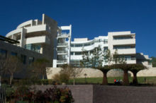 The Getty Center sits on a hill overlooking Los Angeles
- Bowers Museum
- Heritage Square Museum
- California Science Center
- Discovery Science Center
- Getty Center
- Getty Villa
- Griffith Observatory
- Huntington Library
- La Brea Tar Pits
- Los Angeles County Museum of Art
- Natural History Museum of Los Angeles County
- Norton Simon Museum
- Kidspace Children's Museum
- Museum of Contemporary Art, Los Angeles
- Museum of Latin American Art
- Museum of Tolerance
- Petersen Automotive Museum
- Richard Nixon Presidential Library and Museum
- Ronald Reagan Presidential Library
- Toyota USA Automobile Museum
Other
Major business districts
Greater Los Angeles supports large business districts throughout its urban area. The central business district is located at Downtown Los Angeles. Within the Los Angeles city limits are multiple districts, and other than Bunker Hill, these are Century City and businesses lining Wilshire Boulevard. Other major districts nearby Los Angeles include Downtown Long Beach, downtown Glendale, and downtown Burbank. In the southern reaches of Greater Los Angeles, major business districts include Newport Center, South Coast Metro, and the developing business district in Irvine. To the east major business districts include the respective centers of Downtown Riverside and Downtown San Bernardino.
Transportation
Greater Los Angeles is known for its extensive transportation network. Most notable is its extensive highway system. The area is a junction for numerous interstates coming from the north, east, and south. The area is also home to several ports. These include the twin ports of Long Beach and Los Angeles, as well as Port Hueneme. Major international airports to the region are the Los Angeles International Airport (LAX) and LA/Ontario International Airport. Other airports include John Wayne Airport (SNA), Bob Hope Airport, and the Long Beach Municipal Airport.
Sports
Further information: History of National Football League in Los AngelesThe Greater Los Angeles area also has three well-known horse racing facilities: Santa Anita Park, Los Alamitos Race Course and Hollywood Park Racetrack and four major motorsport venues: Auto Club Speedway, Long Beach street circuit, Irwindale Speedway and Auto Club Raceway at Pomona. In addition, the city of Los Angeles hosted the Summer Olympics in 1932 and 1984.
The Los Angeles area media market currently lacks a National Football League team. After the 1994 season, the Los Angeles Rams moved to St. Louis, Missouri and the Los Angeles Raiders returned to their original home of Oakland, California (both teams played each other in Anaheim during the 1994 season, with the Raiders winning). There are two competing plans to build a stadium which will become home to an NFL team in the future, one in the City of Industry and one in Downtown Los Angeles.[34] In 2009 the city council of the City of Industry approved[35] the construction of a stadium and Governor Arnold Schwarzenegger signed a bill with an evironmental exemption to support a stadium in that city.[36] In 2011 the Los Angeles City Council approved plans to build Farmers Field in Downtown Los Angeles.[37]
As a whole, the Los Angeles area has more national championships, all sports combined (college and professional), than any other city in the United States, with over four times as many championships as the entire state of Texas, and just over twice that of New York City.[38]
See also
- United States metropolitan area
- Table of United States Metropolitan Statistical Areas
- Largest metropolitan areas in the Americas
- California megapolitan areas
References
- ^ "Population and Housing Occupancy Status: 2010 - United States -- Combined Statistical Area; and for Puerto Rico". United States Census Bureau. 2010. http://factfinder2.census.gov/faces/tableservices/jsf/pages/productview.xhtml?pid=DEC_10_NSRD_GCTPL2.US41PR&prodType=table. Retrieved 2011-04-23.
- ^ "Metropolitan and Micropolitan Statistical Areas". United States Census Bureau. http://www.census.gov/population/www/estimates/metroarea.html. Retrieved 2008-03-30.
- ^ southlandwx.com
- ^ "Annual Estimates of the Population of Combined Statistical Areas: April 1, 2000 to July 1, 2009" (CSV). 2009 Population Estimates. United States Census Bureau, Population Division. March 23, 2010. http://www.census.gov/popest/metro/files/2009/CSA-EST2009-alldata.csv. Retrieved March 29, 2010.
- ^ American Factfinder, United States Census Bureau, Table: "GCT-PH1-R. Population, Housing Units, Area, and Density (geographies ranked by total population): 2000" from Data Set: "Census 2000 Summary File 1 (SF 1) 100-Percent Data", accessed 10 October 2007 at: [1] See also: List of United States urban areas
- ^ Haughton, Graham, and Colin Hunter, Sustainable Cities, London: Routledge, 2003: 81.
- ^ Bruegmann, Robert. Sprawl: A Compact History. University of Chicago Press, Chicago 2005: 65.
- ^ "City of Los Angeles Population by Area from 1950". Demographia.com. Wendell Cox Consultancy. http://www.demographia.com/db-la-area.htm.
- ^ Abu-Lughod, Janet L. (1999). New York, Chicago, Los Angeles: America's Global Cities. Minneapolis: University of Minnesota Press. ISBN 9780816633364.
- ^ Gutierrez, David. The Columbia History of Latinos in the United States. New York: Columbia University Press, 2003: 94.
- ^ Curtiss, Aaron. "Bitter Land-Use Fights Seen For 101 Corridor Development." Los Angeles Times 20 November 1993: B1.
- ^ Olsen, Andy. "Local Home Prices Soar in May." Los Angeles Times 23 June 2003: B3.
- ^ Griggs, Gregory. "Local Homes Get Even Pricier." Los Angeles Times 21 August 2003: B1.
- ^ Hale, David (2003). New York and Los Angeles: Politics, Society, and Culture: A Comparative View. Chicago: University of Chicago Press. pp. 181–183, 185. ISBN 9780226313696.
- ^ Soja, Edward W. (1999). "Taking Los Angeles Apart". Postmodern Geographies:The Reassertion of Space in Critical Social Theory (5th ed.). London: Verso. pp. 224–233. ISBN 9780860919360.
- ^ http://www.downtownnews.com/development downtownnews.com
- ^ Wolch, Jennifer R.; Manuel Pastor, Peter Dreier (2004). Up Against the Sprawl: Public Policy and the Making of Southern California. Minneapolis: University of Minnesota Press. ISBN 9780816642984.
- ^ "Orange County to County Commuting". Labor Market Information Division. http://www.calmis.ca.gov/file/commute-maps/orancommute.pdf.
- ^ "Riverside County is 'extreme commute' king". North County Times. http://www.nctimes.com/articles/2005/03/31/news/californian/0_39_333_31_05.txt.
- ^ a b U.S. Census Bureau - Combined statistical area population and estimated components of change: April 1, 2000 to July 1, 2008
- ^ BEA Economic Area - Component Counties
- ^ "City/County population estimates with annual percentage change". California Department of Finance. 2009-01-01. http://www.dof.ca.gov/research/demographic/reports/estimates/cities_ranked/2009/documents/Rankcities_2009.xls. Retrieved 2009-05-01.
- ^ http://projects.latimes.com/mapping-la/neighborhoods/
- ^ "Older Suburbs in the Los Angeles Metropolitan Area" (pdf). Local Government Commission. http://www.lgc.org/freepub/PDF/Land_Use/reports/older_suburbs_in_LA.pdf.
- ^ Garcia, Matt (2001). A World of its Own: Race, Labor, and Citrus in the Making of Greater Los Angeles, 1900–1970 (2nd ed.). Chapel Hill: University of North Carolina Press. ISBN 9780807826584.
- ^ "Magnet in the West". Time Magazine. 1966-09-02. http://www.time.com/time/magazine/article/0,9171,842728-4,00.html. Retrieved 2008-04-24 "Greater Los Angeles is already the second-most-populous metropolis in the U.S., is almost sure to surpass New York by 1975. Last week alone, some 5,000 people moved into the area. By 1990, such growth will make the city the hub of an uninterrupted urbanized stretch of almost 19 million inhabitants occupying the 175-mile-long, coastal area that runs from Santa Barbara in the north to San Diego in the south."
- ^ Reinhold, Robert (1989-08-28). "No Headline". The New York Times. http://query.nytimes.com/gst/fullpage.html?res=950DE0DC1330F93BA1575BC0A96F948260&sec=&spon=&pagewanted=2. Retrieved 2008-04-24. "and the region's population will surpass New York's, reaching 18.3 million in 2010"
- ^ Excerpted from California Department of Finance
- ^ Orange County Registrar of Voters - District Registration by Party
- ^ The 150 richest cities in the world by GDP in 2005
- ^ U.S. Metro Economies: GMP - The Engines of America's Growth
- ^ Royal Lady – The Queen Mary Reigns in Long Beach
- ^ City of Riverside Historic Districts and Buildings
- ^ "L.A. council approves framework to build NFL stadium". CBSSports.com. August 9, 2011. http://www.cbssports.com/nfl/story/15417842/la-council-approves-framework-to-build-nfl-stadium/rss. Retrieved August 11, 2011.
- ^ "Industry Council Approves Pro Football Stadium". nbcla.com. KNBC. July 17, 2009. http://www.nbclosangeles.com/news/sports/Industry-Council-Approves-Pro-Football-Stadium.html. Retrieved August 11, 2011.
- ^ Adams, John (October 22, 2009). "Los Angeles, Are You Ready For Some NFL Football?". nbcla.com. KNBC. http://www.nbclosangeles.com/news/local/Los-Angeles-Are-You-Ready-For-Some-Football-64701932.html. Retrieved August 11, 2011.
- ^ http://latimesblogs.latimes.com/lanow/2011/08/next-challenge-for-farmers-field-finding-nfl-team-for-la.html
- ^ "Los Angeles Sports Travel". Los Angeles Sports Travel. http://losangelessportstravel.com/.
External links
Greater Los Angeles Area Central city Counties Satellite cities Cities
>200kCities and towns
100k–200kBurbank • Compton • Corona • Costa Mesa • Downey • East Los Angeles • El Monte • Fontana • Fullerton • Garden Grove • Inglewood • Lancaster • Mission Viejo • Moreno Valley • Murrieta • Norwalk • Ontario • Orange • Palmdale • Pasadena • Pomona • Rancho Cucamonga • Santa Clarita • Simi Valley • South Gate • Temecula • Thousand Oaks • Torrance • Ventura • Victorville • West CovinaArea regions Antelope Valley • Conejo Valley • Downtown Los Angeles • East Los Angeles • Gateway Cities • Greater Hollywood • Harbor Area • Inland Empire • Palos Verdes Hills • Pomona Valley • San Bernardino Valley • San Fernando Valley • San Gabriel Valley • Santa Ana Valley • Santa Clarita Valley • South Bay • South Los Angeles • Westside Los AngelesLandforms Los Angeles Basin • Baldwin Hills (range) • Calico Mountains • Catalina Island • Channel Islands • Coachella Valley • High Desert—Mojave Desert • Low Desert—Colorado Desert • San Fernando Valley • San Bernardino Mountains • San Gabriel Mountains • Santa Ana Mountains • Santa Monica Mountains • Santa Susana Mountains • Verdugo MountainsBodies of water Los Angeles River • Aliso Creek • Arroyo Seco • Ballona Creek • Bell Creek • Big Bear Lake • Coyote Creek • Lake Arrowhead • Lake Perris • Lake Piru • Malibu Creek • Pacific Ocean • Pyramid Lake • Rio Hondo • San Gabriel River • San Juan Creek • San Pedro Bay • Santa Ana River • Santa Clara River • Santa Margarita River • Santa Monica BayLos Angeles metropolitan area Population - 12,874,797 Counties 
Major city
3.8 millionCities over 250K Cities and towns
100k-250kBurbank • Costa Mesa • Downey • East Los Angeles • El Monte • Fullerton • Garden Grove • Glendale • Huntington Beach • Inglewood • Irvine • Norwalk • Orange • Pasadena • Pomona • Santa Clarita • Simi Valley • South Gate • Thousand Oaks • Torrance • West CovinaBodies of water Regions Sports teams based in Greater Los Angeles Baseball 


Basketball NBA: Los Angeles Clippers • Los Angeles Lakers - WNBA: Los Angeles Sparks - D-League: Los Angeles D-Fenders - ABA: Los Angeles Slam • Riverside Rainmakers - IBL: Los Angeles Lightning - WCPBL: Beijing Aoshen Olympians • Hollywood Jammers • Newport Beach Surf • Orange County Gladiators • Pasadena Slam • Santa Barbara Breakers • Ventura County JetsFootball WFA: Los Angeles Amazons • Pacific Warriors - IWFL: California Quake • Desert Fire Cats • Southern California Breakers - WSFL: Ventura Black Widows - LFL: Los Angeles TemptationIce hockey Soccer MLS: Chivas USA • Los Angeles Galaxy - USL Pro: Los Angeles Blues - PDL: Los Angeles Blues 23 • Los Angeles Legends • Orange County Blue Star • Southern California Seahorses • Ventura County Fusion - NPSL: FC Hasental • Hollywood United Hitmen • Lancaster Rattlers • Santa Ana Winds - WL: Los Angeles Legends • Pali Blues • Ventura County FusionRoller derby WFTDA: Angel City Derby Girls - WORD: Los Angeles Derby DollsRugby College athletics
(NCAA Div. I)Cal State Fullerton • Cal State Northridge • Long Beach State • Loyola Marymount • Pepperdine • UC Irvine • UC Riverside • UCLA • USCVenues Anaheim Convention Center • Angel Stadium • Citizens Business Bank Arena • Dodger Stadium • The Forum • Galen Center • Home Depot Center • Honda Center • Long Beach Arena • Los Angeles Memorial Coliseum • Los Angeles Memorial Sports Arena • Pauley Pavilion • Rose Bowl • Staples Center • Walter PyramidWorld's twenty most populous metropolitan areas 6
 Jakarta
7 São Paulo
8 Delhi
Delhi
9 Keihanshin
10 Shanghai
16
 Cairo
Cairo
17 Buenos Aires
18 London
19 Beijing
20 KarachiCategories:
- Greater Los Angeles Area
- Metropolitan areas of California
- Southern California


Wikimedia Foundation. 2010.