- Market Street Metrolink station
-
 Market Street
Manchester Metrolink 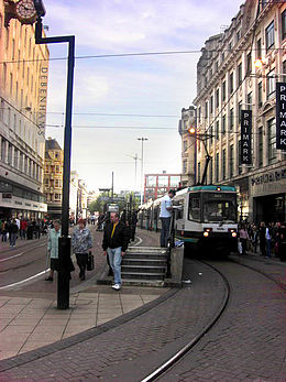
Location Place Manchester City Centre Local authority Manchester Fare zone information Metrolink Zone D (City) History Opened 1992-04-27
Northbound trams only
1998-08-10
Both directions City Centre
to Bury 

to Rochdale 


Victoria 


Second City Crossing 
Shudehill 
High Street Exchange Square 
Market Street 

Mosley Street 
Piccadilly Gardens 


Piccadilly St Peter's Square 
to Ashton-under-Lyne D'gate-Castlefield ( Deansgate)
Cornbrook to MediaCityUK and Eccles 

Trafford Bar 


to East Didsbury and to Altrincham 
Manchester Airport  UK Trams portal
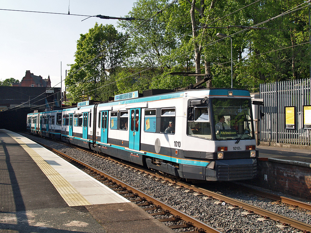
Market Street Metrolink Station is a Manchester Metrolink station on Market Street, Manchester. Market Street is one of eight City-Zone Metrolink Stations.Originally the stop in Market Street handled trams to Bury only, and the one around the corner in High Street handled trams from Bury only. When Market Street was closed to road traffic these stops were replaced by a new platform stop in the centre of Market Street, which handles trams in both directions. This stop opened on 10 August 1998.
Services
Market Street is served by trams on the Bury and Altrincham lines with a tram running every 6 minutes during the day, Mondays to Saturdays, to Bury and every 12 minutes during the day, Mondays to Saturdays, to Piccadilly or Altrincham. Monday to Saturday evening and Sunday daytime journeys run every 12 minutes to Bury and to Altrincham via Piccadilly, while Sunday evening journeys run every 15 minutes.
Market Street is also located on the South Manchester Line with trams towards Victoria and St Werburgh's Road running every 12 minutes Monday-Saturdays and Sunday daytime and every 15 minutes Sunday early mornings and evenings.[1]. Service will increase from 12 minutes to 6 minutes once the line to Central Park, Oldham Mumps and Rochdale opens. Services will extend from St Werburgh's Road to East Didsbury in 2013 and additional services will run between the city centre and Manchester Airport in 2016.
References
- ^ "Metrolink - Tram Times". Transport for Greater Manchester. http://www.metrolink.co.uk/tramtimes/. Retrieved 6 July 2011.
External links
- Tram times and station information for Market Street Metrolink station from Manchester Metrolink
Coordinates: 53°28′55″N 2°14′20″W / 53.4819°N 2.2388°W
Manchester Lines - City Centre and North, (Past, Present and Future) LegendTo Bury 
To Rochdale Moston 
To Oldham Bowker Vale 


Newton Heath 


Newton Heath and Moston 

Crumpsall 


Central Park 

To Tameside Abraham Moss;Monsall Clayton Bridge Woodlands Road Park Queens Road 


To Tameside Miles Platting 
Edge Lane 


Clayton Oldham Road 
Sportcity-Velodrome Manchester Victoria 


Holt Town/Sportcity-Stadium Exchange 

To Salford 
New Islington 


Ardwick Exchange Square/Shudehill 

Ashburys High Street; Manchester Piccadilly 

Mayfield;To South Manchester Market Street; Piccadilly Gardens 


To Belle Vue;Gorton Moseley Street;Oxford Road 


To Hyde Road St Peter's Square To Tameside Manchester Central/Deansgate-Castlefield 

Deansgate Liverpool Road 


To Salford;Cornbrook Cornbrook 


Pomona To Eccles 
Trafford Bar To Trafford 


Firswood To Trafford;To Altrincham To Chorlton Preceding station  Manchester Metrolink
Following station towards AltrinchamAltrincham - Bury Line towards Burytowards PiccadillyBury - Piccadilly Line towards St Werburgh's RoadSt Werburgh's Road - Victoria Line towards VictoriaUnder Construction towards East DidsburySouth Manchester Line towards Victoriatowards RochdaleRochdale-Manchester Line towards Manchester Airport
or East Didsbury MetrolinkStations City zoneDeansgate-Castlefield · Market Street · Mosley Street · Piccadilly · Piccadilly Gardens · Shudehill · St Peter's Square · Victoria
Altrincham LineAltrincham · Brooklands · Cornbrook · Dane Road · Navigation Road · Old Trafford · Sale · Stretford · Timperley · Trafford Bar
Bury LineAbraham Moss · Besses o'th' Barn · Bowker Vale · Bury · Crumpsall · Heaton Park · Prestwich · Radcliffe · Whitefield · Woodlands Road
Eccles LineAnchorage · Broadway · Eccles · Exchange Quay · Harbour City · Ladywell · Langworthy · MediaCityUK · Pomona · Salford Quays · Weaste
South Manchester LineChorlton · Firswood · St Werburgh's Road
Operations OperatorsStagecoach Group · Transport for Greater ManchesterVehiclesFlexity Swift M5000 · T-68History Former operatorsTransferred linesClosed stationsAbandoned plansUnder Construction Bury LineQueens Road
East Manchester LineAshton Moss · Ashton Under Lyne · Ashton West · Audenshaw · Cemetery Road · Clayton Hall · Droylsden · Eastlands City Stadium · Edge Lane · Holt Town · New Islington · Velopark
Oldham & Rochdale LineCentral Park · Derker · Failsworth · Freehold · Hollinwood · Kingsway · Monsall · Milnrow · Newbold · Newton Heath and Moston · Newhey · Oldham Central · Oldham King Street · Oldham Mumps · Rochdale railway station · Rochdale Town Centre · Shaw & Crompton · South Chadderton · Westwood
South Manchester LinesBaguley · Barlow Moor Rd. · Benchill · Burton Road · Crossacres · Didsbury · East Didsbury · Hardy Farm · Haveley · Hough End · Manchester Airport · Martinscroft · Moor Road · Northern Moor · Peel Hall · Robinswood Road · Roundthorn · Sale Water Park · Shadowmoss · West Didsbury · Withington · Woodhouse Park · Wythenshawe Town Centre · Wythenshawe Park
Proposed Bury LineBuckley Wells
Trafford Centre LineImperial War Museum · Lostock Parkway · Manchester United · Parkway Circle · Port Salford · Salford Reds · Trafford Centre · Trafford Quays · Village
Stockport LineGorsey Bank · Heaton Mersey · Kings Reach · Stockport Interchange
Second City CrossingExchange Square
Transport for Greater Manchester · UK light rail systems
This UK Tram-related article is a stub. You can help Wikipedia by expanding it.