- Virginia, County Cavan
Infobox Irish Place
name = Virginia
gaeilge = Achadh an Iúir
crest
motto =
map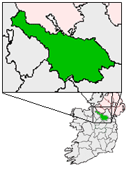
pin coords = left: 109px; top: 69px
north coord = 53.833333
west coord = 7.0833337
irish grid = N604876
area =
elevation = 113 m (379 ft)
province =Ulster
county =County Cavan
town pop = 3,188
rural pop = 4,796
census yr = 2006
web = www.virginia.ie
|Virginia (Irish place name|Achadh an Iúir|Field at the Fork of the river) is a town of population 3,188 persons located in
County Cavan , Ireland. It was founded in the early 17th century and named after Queen Elizabeth I of England.Situated pleasantly close to
Lough Ramor , Virginia is on the N3 route approximately 80 km fromDublin city , where once it was a strategic staging and rest point for the coaches plying betweenEnniskillen and Dublin. In more recent times, Virginia is connected to the capital by an hourly bus service from Cavan townBus Éireann . Regarded these days as a commuter town with its proximity to larger trading towns east and west, the local industry comprises mainly of farming and milk processing at the localGlanbia factory, (formerly Virginia Milk Products) which produces skim milk powder and cream for the world renowned brandBaileys Irish Cream liqueur. Other local manufacturers include the Fleetwood brand of paint products.Lough Ramor is one of the largest lakes in County Cavan stretching approx. 7km in length by 1km at the narrowest point and feeds into the Blackwater and Boyne river systems. It is a popular lake with anglers and a wide variety of fish species are to be found including pike, bream, roach, hybrids, trout and eel. Some record catches have been recorded in recent times, and most noted with visiting anglers from Britain.History
Virginia began as an
Ulster Plantation project, where an English adventurer named John Ridgeway was granted the crown patent in August of 1612 to build a new town upon the great road between the already existing towns of Kells and Cavan. The conditions of which were to introduce English settlers to the area and build the town to incorporated borough status. Ridgeway's difficulty in attracting sufficient English trades people and settler families into what was then regarded as a hostile territory outside of the protection of the Leinster Pale, managed to build a few wooden cabins and a corn mill close to the then existing O'Reilly castle, located close to the shores of Lough Ramor. Ridgeway passed the patent on to another Englishman captain Hugh Culme who already possessed lands about Lough Oughter in County Cavan and had access to building timber. Culme persuaded the Plantation Commission to move the location of Virginia to its present location close to the Blackwater tributary river, whereupon he built a number of cabins for the settlers but still failed to meet the Commissions time frame for developing the town further before giving up on the task, probably for the same reasons as his predecessor. During November of 1622, the Virginia estate came into the possession of Lucas PlunkettEarl of Fingall who also held extensive lands around County Meath. Plunkett was a Catholic Anglo-Irish lord probably from twelfth century Norman descent undertook to complete the patented project.Complaints from the Virginia inhabitants about the lack of development progress reached the Commission by 1638 where upon the second Earl of Fingall, Christopher Plunkett was ordered to submit a substantial bond with the Commission court and to build the church in Virginia or face forfeiture of his county Cavan lands. The Anglican Bishop of Kilmore then
William Bedell undertook to lay out the town in accordance with the Commission requirement. However events which led to the1641 Rebellion andIrish Confederate Wars enveloped Virginia causing widespread destruction and de-population. The summer of 1642 saw the outright destruction by government forces of the castle along with the burning of stocks of hay, corn and turf in a bid to punish the outlawed Earl of Fingall for supporting an insurgent siege on the garrison located at Drogheda. Subsequent hearth tax records from the 1660s, followed during the following century by estate surveys undertaken for the absentee landlord (who was living in exile since the Williamite wars of 1688-91), tell of a wayside Inn that existed in Virginia since the earliest times (exact location unknown), operated then in 1727 by a Cornelius Donnellan and was frequented around that time byJonathan Swift during his several excursions to Co. Cavan. The Virginia estate was eventually sold around the year 1750 by the absentee Plunkett's to pay off mounting debts, setting the way for a new landlord Thomas Taylor, Lord Headfort to continue in building the town where others had failed. It is recorded that Taylor's grandfather, also a Thomas Taylor, was a cartographer who assistedSir William Petty with theDown Survey during the previous century.The Taylors (later Taylour) had built a substantial mansion (now the Headfort school) beside Kells in County Meath and turned their attention to making the unproductive lands around Virginia into profitable farms through land drainage and afforestation of low lying areas. The results of which brought employment and quickly led to the setting up of local markets and fairs in Virginia where produce was traded on the streets. Virginia's population grew to double from 467 inhabitants between the census years of 1821 to 1841, as did the rapid construction of the town with the Main street as we know it today. Successive Lords Headfort, later became Earl of Bective and
Marquess of Headfort , created their own private demesne and a hunting lodge (now Park Hotel) overlooking Lough Ramor.The famine of 1845-49 (see ref. below) caused by successive failures in the potato crop brought with it extreme hardship for the poorer classes, death was widespread caused by diseases like
typhus andcholera , pandemic throughout Europe at that time and the result of poor sanitation and deplorable living conditions. Starvation which ravished many parts of the country was averted in Virginia due to the efforts of the local Famine Relief Committee, who made extra rations of Indian meal available in return for hard labour, this included women and children breaking stones for making roads and the building of the local Catholic church which took place during 1845 on lands donated by the landlord.In subsequent years Virginia prospered with the introduction of a Butter market in 1856, followed by the opening of a railway line between Kells and Oldcastle in March 1863. Cattle and livestock could then be moved for export, however this also meant that produce such as coal and beer could be transported from the larger towns into rural areas which led to the closure of the local malt brewery and several bakeries in the town.Until relatively recently emigration was a feature of rural Irish life down through the centuries and Virginia was no exception to this. Perhaps the most famous Virginia emigrant was
Philip H. Sheridan , whose parents came from nearby Killinkere, left Ireland around 1830 and settled in America. Sheridan achieved success through a military career, particularly during the American Civil War. President Lincoln stated, "this Sheridan is a little Irishman, but a big fighter", eventually became commanding General of the US Army and had many honours bestowed upon him. Other famous people who have associations to Virginia are DeanJonathan Swift who penned his well known novelGullivers Travels while staying nearby at Quilca, the home of his cleric friend Thomas Sheridan who also kept a classics school and later became headmaster of Cavan's Royal School. PlaywrightRichard Brinsley Sheridan was also descended from this family, while anothor reputable Virginian from the nineteenth century wasThomas Fitzpatrick a noted London physician. Admiral SirJosias Rowley had links here through his brother Rev. John Rowley who was an Anglican clergyman and incumbent at Virginia during the period that the First Fruits church was built. Admiral Rowley also helped to finance the rebuilding of the church after a major fire destroyed the roof on Christmas night 1830.Nowadays, Virginia continues to modernise as a growing urban community with a foothold clinging on to its rural origins. The closure of the railway line in 1958 came about as population levels fell to their lowest levels, however road transport links continue to improve. A continuing rise in prosperity and population in the town is evident with many new houses and commercial business being built. The last census, taken in 2006, put the population of Virginia electoral area at 3,188 inhabitants, having risen by 34.5% from the previous 2002 census.
ee also
* List of towns and villages in Ireland
*Market Houses in Ireland
*National Library of Ireland NLI manuscript archives ref. Fingall and Headfort papers.
*Clayton and Bell Stained glass church windows
*Irish Architectural Archive External links
* [http://www.virginia.ie] Community website for Virginia and its surrounding communities
* [http://www.proni.gov.uk/] Public Records Office for Northern Ireland.
* [http://multitext.ucc.ie/d/Central_Relief_Committee] Great Irish Famine and the work of the Central Relief Committee.
* [http://www.bluegraymagazine.com] Blue & Gray Magazine references to General Philip Sheridan's campaign's in American Civil War (Shenandoah - Winchester & Ceder Creek)
* [http://www.pumpkinfestival.ie] Virginia's Pumpkin Festival October Bank Holiday Weekend
* [http://www.virginia.kilmore.anglican.org] Virginia Group of Parishes website
* [http://www.irish-roots.ie] Irish Genealogy and Family History website
Wikimedia Foundation. 2010.