- Mono County, California
-
Coordinates: 37°55′N 118°52′W / 37.917°N 118.867°W
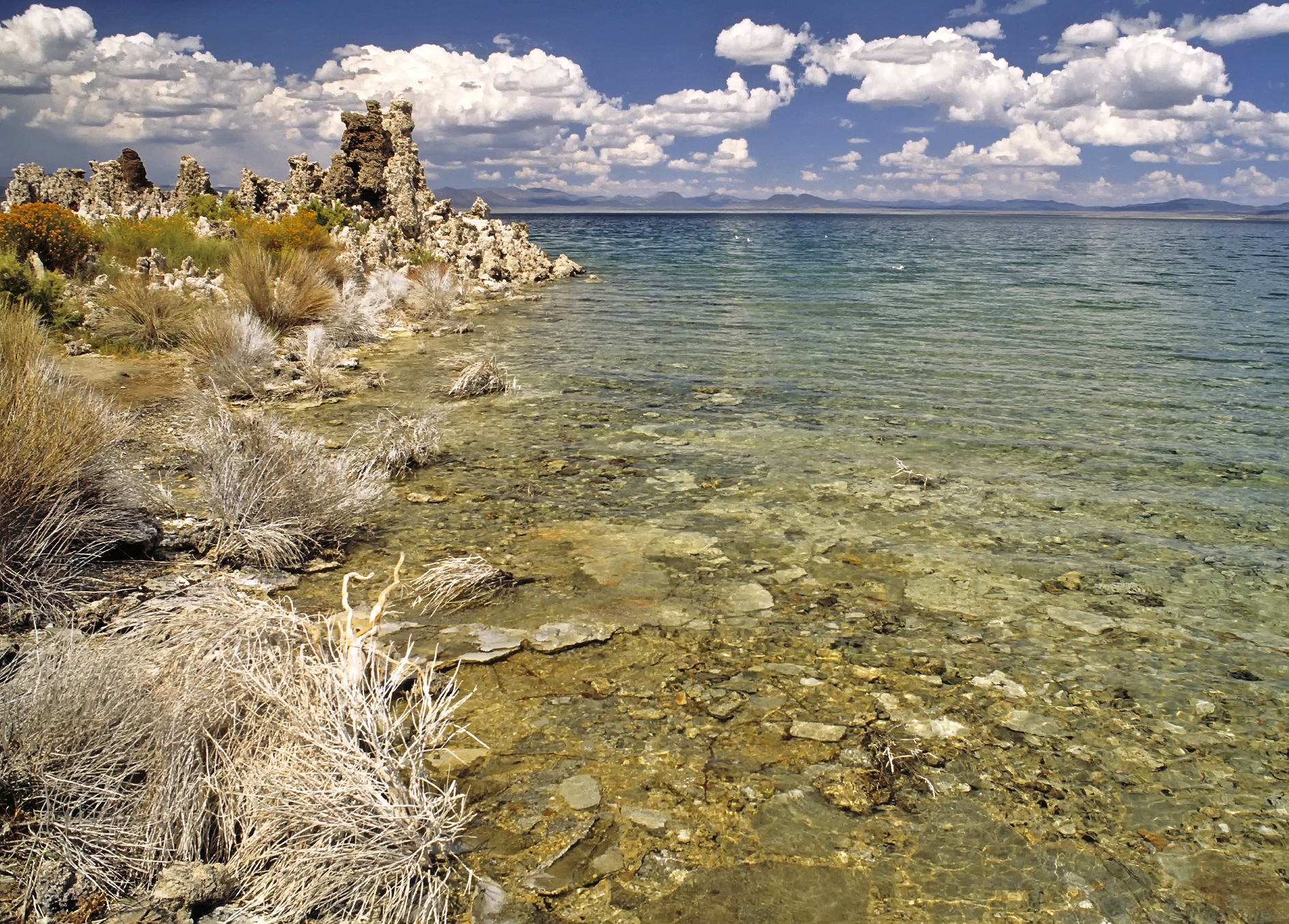
Mono County, California 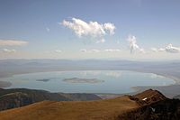 Mono Lake, the dominant geographical feature in Mono County
Seal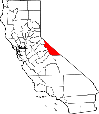
Location in the state of California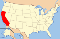
California's location in the U.S.Founded 1861 Named for Mono Lake Seat Bridgeport Largest city Mammoth Lakes Area
- Total
- Land
- Water
3,131.80 sq mi (8,111 km²)
3,044.40 sq mi (7,885 km²)
87.40 sq mi (226 km²),Population
- (2010)
- Density
14,202
4/sq mi (2/km²)Congressional district 25th Time zone Pacific: UTC-8/-7 Website www.monocounty.ca.gov Mono County (
 /ˈmoʊnoʊ/) is a county located in the east central portion of the U.S. state of California, to the east of the Sierra Nevada between Yosemite National Park and Nevada. As of the 2010 census, the population was 14,202, up from 12,853 at the 2000 census. The county seat is Bridgeport.[1]
The only incorporated town in the county is Mammoth Lakes,[2] which is located at the foot of Mammoth Mountain.[3] Other locations, such as June Lake, are also famous as skiing and fishing resorts. Located in the middle of the county is Mono Lake, a vital habitat for millions of migratory and nesting birds. The lake is located in a wild natural setting, with pinnacles of tufa arising out of the salty and alkaline lake.
Also located in Mono County is Bodie, the official state gold rush ghost town, which is now a California State Historic Park.
Contents
History
Mono County was formed in 1861 from parts of Calaveras County, Fresno County and Mariposa County. Parts of the county's territory were given to Inyo County in 1866.
The county is named after Mono Lake which, in 1852, was named for a Native American Paiute tribe, the Mono people, that inhabited the Sierra Nevada from north of Mono Lake to Owens Lake. The tribe's western neighbors, the Yokuts, called them monachie meaning "fly people" because fly larvae was their chief food staple and trading article.[4] Archeologists know almost nothing about the first inhabitants of the county, but the Kuzedika had been there many generations by the time the first anglophones arrived. The Kuzedikas were hunter-gatherers and their language is a part of the Shoshone language.[4]
Geography
According to the 2000 census, the county has a total area of 3,131.80 square miles (8,111.3 km2), of which 3,044.40 square miles (7,885.0 km2) (or 97.21%) is land and 87.40 square miles (226.4 km2) (or 2.79%) is water.[5]
Cities and towns
- Benton
- Bridgeport
- Chalfant
- Coleville
- Lee Vining
- Mammoth Lakes (the only incorporated place in the county)
- Swall Meadows
Adjacent Counties
Mono County is one of the few US counties to border as many as nine counties.
- Inyo County, California - south
- Fresno County, California - southwest
- Madera County, California - southwest
- Tuolumne County, California- west
- Alpine County, California - northwest
- Douglas County, Nevada - north
- Lyon County, Nevada - northeast
- Mineral County, Nevada - east
- Esmeralda County, Nevada - southeast
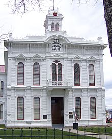 The Mono County Court House in Bridgeport.
National protected areas
- Inyo National Forest (part)
- Toiyabe National Forest (part)
Transportation infrastructure
Major highways
 U.S. Route 6
 U.S. Route 395
 State Route 108
 State Route 120
 State Route 167
 State Route 182
 State Route 270
Public transportation
Eastern Sierra Transit Authority operates intercity bus service along U.S. 395, as well as local services in Mammoth Lakes. Service extends south to Lancaster, California (Los Angeles County) and north to Reno, Nevada.
Yosemite Area Regional Transit System (YARTS) also runs along U.S. 395 from Mammoth Lakes to Lee Vining before entering Yosemite National Park.
Airports
General aviation airports in Mono County include Bryant Field near Bridgeport, Mammoth Yosemite Airport and Lee Vining Airport. In December 2008, Mammoth Yosemite Airport began commercial air service to Los Angeles International Airport on a seasonal (December to April) basis; the service is provided by Horizon Air, and is subsidized by Mammoth Mountain Ski Resort.
Demographics
2010
The 2010 United States Census reported that Mono County had a population of 14,202. The racial makeup of Mono County was 11,697 (82.4%) White, 47 (0.3%) African American, 302 (2.1%) Native American, 192 (1.4%) Asian, 11 (0.1%) Pacific Islander, 1,539 (10.8%) from other races, and 414 (2.9%) from two or more races. Hispanic or Latino of any race were 3,762 persons (26.5%).[6]
Population reported at 2010 United States Census The County Total
PopulationWhite African
AmericanNative
AmericanAsian Pacific
Islanderother
racestwo or
more racesHispanic
or Latino
(of any race)Mono County 14,202 11,697 47 302 192 11 1,539 414 3,762 Incorporated
townTotal
PopulationWhite African
AmericanNative
AmericanAsian Pacific
Islanderother
racestwo or
more racesHispanic
or Latino
(of any race)Mammoth Lakes 8,234 6,643 29 49 128 5 1,151 229 2,772 Census-designated
placeTotal
PopulationWhite African
AmericanNative
AmericanAsian Pacific
Islanderother
racestwo or
more racesHispanic
or Latino
(of any race)Aspen Springs 65 62 0 0 2 0 0 1 1 Benton 280 199 1 59 1 0 15 5 38 Bridgeport 575 484 1 43 1 0 25 21 148 Chalfant 651 594 0 13 5 0 16 23 67 Coleville 495 386 6 10 8 0 62 23 110 Crowley Lake 875 769 4 6 11 0 60 25 128 June Lake 629 534 0 7 2 0 78 8 137 Lee Vining 222 126 0 25 0 0 64 7 96 McGee Creek 41 39 0 0 0 0 0 2 2 Mono City 172 156 0 1 2 0 2 11 37 Paradise 153 130 0 2 6 0 5 10 14 Sunny Slopes 182 159 0 2 7 4 0 10 3 Swall Meadows 220 201 0 3 5 0 2 9 6 Topaz 50 44 0 1 0 0 5 0 24 Walker 721 629 3 57 3 1 13 15 70 Unincorporated
communitiesTotal
PopulationWhite African
AmericanNative
AmericanAsian Pacific
Islanderother
racestwo or
more racesHispanic
or Latino
(of any race)All others not CDPs (combined) 637 542 3 24 11 1 41 15 109 2000
As of the census[7] of 2000, there were 12,853 people, 5,137 households, and 3,143 families residing in the county. The population density was 4 /sq mi (1.5 /km2). There were 11,757 housing units at an average density of 4 /sq mi (1.5 /km2). The racial makeup of the county was 84.17% White, 0.47% Black or African American, 2.40% Native American, 1.11% Asian, 0.09% Pacific Islander, 9.51% from other races, and 2.25% from two or more races. 17.69% of the population were Hispanic or Latino of any race. 13.4% were of German, 12.6% Irish and 11.4% English ancestry according to Census 2000. 84.0% spoke English and 15.1% Spanish as their first language.
There were 5,137 households out of which 28.7% had children under the age of 18 living with them, 50.6% were married couples living together, 6.5% had a female householder with no husband present, and 38.8% were non-families. 26.6% of all households were made up of individuals and 4.3% had someone living alone who was 65 years of age or older. The average household size was 2.43 and the average family size was 2.98.
In the county the population was spread out with 23.0% under the age of 18, 10.3% from 18 to 24, 33.4% from 25 to 44, 25.6% from 45 to 64, and 7.6% who were 65 years of age or older. The median age was 36 years. For every 100 females there were 121.8 males. For every 100 females age 18 and over, there were 126.8 males.
The median income for a household in the county was $44,992, and the median income for a family was $50,487. Males had a median income of $32,600 versus $26,227 for females. The per capita income for the county was $23,422. About 6.30% of families and 11.50% of the population were below the poverty line, including 12.20% of those under age 18 and 1.90% of those age 65 or over.
Politics
Mono County vote
by party in presidential electionsYear GOP DEM Others 2008 42.3% 2,354 55.6% 3,093 2.2% 124 2004 49.1% 2,621 49.2% 2,628 1.7% 89 2000 52.5% 2,296 40.9% 1,788 6.6% 287 1996 46.0% 1,882 38.6% 1,580 15.4% 629 1992 36.1% 1,570 34.2% 1,489 29.8% 1,296 1988 61.4% 2,177 36.2% 1,284 2.4% 86 1984 72.3% 2,659 26.2% 962 1.5% 56 1980 62.3% 2,132 25.3% 865 12.4% 424 1976 58.8% 1,600 37.7% 1,025 3.5% 96 1972 66.9% 1,872 29.6% 828 3.5% 99 1968 64.3% 1,130 26.5% 465 9.3% 163 1964 56.1% 850 43.9% 666 0.0% 0 1960 66.3% 912 33.2% 457 0.4% 6 1956 73.8% 673 26.0% 237 0.2% 2 1952 76.6% 891 22.7% 264 0.7% 8 1948 64.8% 541 30.5% 255 4.7% 39 1944 60.9% 378 39.0% 242 0.2% 1 1940 46.1% 459 52.6% 523 1.3% 13 1936 34.1% 241 64.8% 458 1.1% 8 1932 34.3% 199 64.4% 374 1.4% 8 1928 61.8% 220 35.7% 127 2.5% 9 1924 53.6% 166 14.5% 45 31.9% 99 1920 67.7% 170 22.3% 56 10.0% 25 Mono used to be a Republican-leaning county in Presidential and congressional elections but has become more of a swing county in recent elections, going for John Kerry by an extremely slim margin of seven votes in 2004. In 2008, Barack Obama did substantially better, receiving 668 more votes than Republican candidate John McCain.[8] Prior to 2004, the last Democrat to win a majority in the county was Franklin Roosevelt in 1940.
In November 2008, Mono County was one of just three counties in California's interior in which voters rejected Proposition 8 to ban gay marriage. The county's voters rejected Proposition 8 by 55.5 percent to 44.5 percent. The other interior counties in which Proposition 8 failed to receive a majority of votes were neighboring Alpine County and Yolo County.[9]
Mono is part of California's 25th congressional district, which is held by Republican Buck McKeon. In the state legislature Mono is in the 25th Assembly district, which is held by Republican Kristin Olsen, and the 1st Senate district, which is held by Republican Ted Gaines.
See also
- List of school districts in Mono County, California
- National Register of Historic Places listings in Mono County, California
References
- ^ "Mono County General Information". http://www.monocounty.ca.gov/information.html. Retrieved 2007-11-05.
- ^ "Town of Mammoth Lakes, California". http://www.ci.mammoth-lakes.ca.us/. Retrieved 2007-11-05.
- ^ "Mammoth Mountain". http://www.mammothmountain.com/. Retrieved 2007-11-05.
- ^ a b Sprague, Marguerite (2003). "Welcome to Bodie". Bodie's Gold. Reno, Nevada: University of Nevada Press. pp. 3, 205. ISBN 0-87417-628-X.
- ^ "Census 2000 U.S. Gazetteer Files: Counties". United States Census. http://www.census.gov/tiger/tms/gazetteer/county2k.txt. Retrieved 2011-02-13.
- ^ "2010 Census P.L. 94-171 Summary File Data". United States Census Bureau. http://www2.census.gov/census_2010/01-Redistricting_File--PL_94-171/California/.
- ^ "American FactFinder". United States Census Bureau. http://factfinder.census.gov. Retrieved 2008-01-31.
- ^ Map of 2008 Election Results By State and County; The New York Times
- ^ County-by-County Map, California Propositions: The Los Angeles Times
Further reading
- Rockwell, G. L.; Honeywell, P. D. (2004). Water-quality data for selected stream sites in Bridgeport Valley, Mono County, California, April 2000 to June 2003. U.S. Geological Survey Data Series. 89. Reston, VA: U.S. Department of the Interior, U.S. Geological Survey.
External links

Alpine County Douglas County, Nevada Lyon County, Nevada Tuolumne County 
Mineral County, Nevada  Mono County, California

Fresno County and Madera County Inyo County Esmeralda County, Nevada Municipalities and communities of Mono County, California Town 
CDPs Aspen Springs | Benton | Bridgeport | Chalfant | Coleville | Crowley Lake | June Lake | Lee Vining | McGee Creek | Mono City | Paradise | Sunny Slopes | Swall Meadows | Topaz | Walker
Unincorporated
communitiesBelfort | Benton Crossing | Benton Hot Springs | Chinatown | Crestview | Fales Hot Springs | Hammil | June Lake Junction | Lake Mary | Lower Town | Mesa Camp | Montgomery City | North Landing | Oasis | Pizona | Sonora Junction | South Landing | Toms Place | Upper Town | Wheeler Crest | Whitmore Hot Springs | Willow Springs
Indian
reservationsBenton Paiute Reservation | Bridgeport Paiute Indian Colony
Former
settlementsBennettville | Bodie | Dog Town | Dunderberg Mill | Lundy | Masonic | Mill City | Mono Mills | Mono Village | Monoville | State Line
Categories:- California counties
- Mono County, California
- Sierra Nevada (U.S.)


Wikimedia Foundation. 2010.