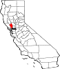
- Napa County, California
-
"Napa Valley" redirects here. For the wine country, see Napa Valley AVA.
County of Napa
Napa Valley— County — Napa Valley sign

SealLocation in the state of California California's location in the United States
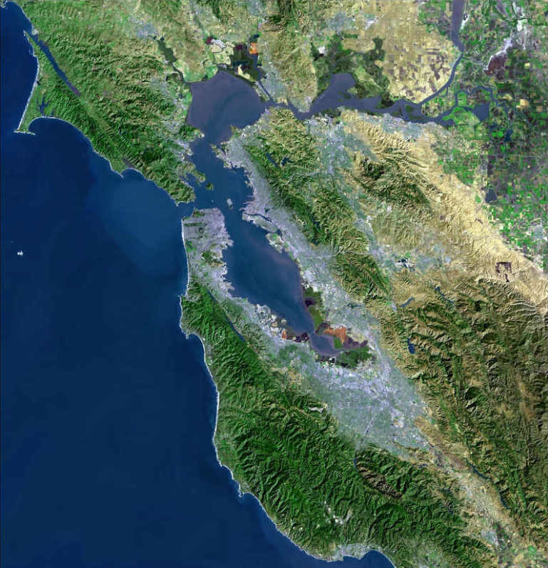
Country United States State California Region/Metro area San Francisco Bay Area Incorporated 1850 County seat Napa Area – Total 788.27 sq mi (2,041.6 km2) – Land 753.73 sq mi (1,952.2 km2) – Water 34.53 sq mi (89.4 km2) Population (2010) – Total 136,484 – Density 173.1/sq mi (66.9/km2) Time zone Pacific Standard Time (UTC-8) – Summer (DST) Pacific Daylight Time (UTC-7) Website www.countyofnapa.org Napa County is a county located north of the San Francisco Bay Area in the U.S. state of California. It is coterminous with the Napa, California, Metropolitan Statistical Area. As of 2010 the population is 136,484. The county seat is Napa. Napa County was one of the original counties of California, created in 1850 at the time of statehood. Parts of the county's territory were given to Lake County in 1861. The word napa is of Native American derivation and has been variously translated as "grizzly bear", "house", "motherland", and "fish"[citation needed]. Of the many explanations of the name's origin, the most plausible seems to be that it is derived from the Patwin word napo meaning house[citation needed], although local residents will often cite an urban legend that gives the translation as "you will always return".
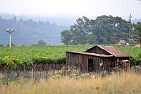
Napa County, once the producer of many different crops, is known today for its wine industry, rising in the 1960s to the first rank of wine regions with France, Italy, and Spain.[citation needed]
Contents
Demographics
2010
The 2010 United States Census reported that Napa County had a population of 136,484. The racial makeup of Napa County was 97,525 (71.5%) White, 2,668 (2.0%) African American, 1,058 (0.8%) Native American, 9,223 (6.8%) Asian, 372 (0.3%) Pacific Islander, 20,058 (14.7%) from other races, and 5,580 (4.1%) from two or more races. Hispanic or Latino of any race were 44,010 persons (32.2%).[1]
Population reported at 2010 United States Census The County Total
PopulationWhite African
AmericanNative
AmericanAsian Pacific
Islanderother
racestwo or
more racesHispanic
or Latino
(of any race)Napa County 136,484 97,525 2,668 1,058 9,223 372 20,058 5,580 44,010 Incorporated
cityTotal
PopulationWhite African
AmericanNative
AmericanAsian Pacific
Islanderother
racestwo or
more racesHispanic
or Latino
(of any race)American Canyon 19,454 7,564 1,535 142 6,396 176 2,357 1,284 5,009 Calistoga 5,155 3,735 27 21 47 10 968 347 2,545 Napa 76,915 57,754 486 637 1,755 144 13,256 2,883 28,923 St. Helena 5,814 4,525 25 35 98 9 978 144 1,914 Yountville 2,933 2,623 38 30 49 0 92 101 289 Census-designated
placeTotal
PopulationWhite African
AmericanNative
AmericanAsian Pacific
Islanderother
racestwo or
more racesHispanic
or Latino
(of any race)Angwin 3,051 2,124 139 22 339 5 234 188 625 Deer Park 1,267 1,108 13 9 51 0 61 25 147 Moskowite Corner 211 183 1 14 1 0 8 4 25 Oakville 71 26 0 1 1 1 38 4 45 Rutherford 164 123 0 0 0 0 30 11 70 Silverado Resort 1,095 1,010 1 1 36 4 28 15 59 Unincorporated
communitiesTotal
PopulationWhite African
AmericanNative
AmericanAsian Pacific
Islanderother
racestwo or
more racesHispanic
or Latino
(of any race)All others not CDPs (combined) 20,354 16,750 403 146 450 23 2,008 574 4,359 2000
As of the census[2] of 2000, there were 124,279 people, 45,402 households, and 30,691 families residing in the county. The population density was 165 people per square mile (64/km²). There were 48,554 housing units at an average density of 64 per square mile (25/km²). The racial makeup of the county in 2010 was 56.4% non-Hispanic White, 1.8% non-Hispanic Black or African American, 0.4% Native American, 6.6% Asian, 0.2% Pacific Islander, 0.2% from other races, and 2.2% from two or more races. 32.2% of the population were Hispanic or Latino of any race. 11.9% were of German, 9.7% English, 8.6% Irish, 6.7% Italian and 5.3% American ancestry according to Census 2000. 75.3% spoke English, 19.5% Spanish and 1.1% Tagalog as their first language.
 The Napa Valley
There were 45,402 households out of which 31.4% had children under the age of 18 living with them, 53.2% were married couples living together, 9.9% had a female householder with no husband present, and 32.4% were non-families. 25.8% of all households were made up of individuals and 11.6% had someone living alone who was 65 years of age or older. The average household size was 2.62 and the average family size was 3.16.
In the county the population was spread out with 24.1% under the age of 18, 8.5% from 18 to 24, 27.7% from 25 to 44, 24.3% from 45 to 64, and 15.4% who were 65 years of age or older. The median age was 38 years. For every 100 females there were 99.6 males. For every 100 females age 18 and over, there were 97.4 males. The median income for a household in the county was $51,738, and the median income for a family was $61,410. Males had a median income of $42,137 versus $31,781 for females. The per capita income for the county was $26,395. About 5.6% of families and 8.3% of the population were below the poverty line, including 10.6% of those under age 18 and 5.6% of those age 65 or over.
Geography and environment
 Napa Valley
 Napa Valley in Fall
According to the 2000 census, the county has a total area of 788.27 square miles (2,041.6 km2), of which 753.73 square miles (1,952.2 km2) (or 95.62%) is land and 34.53 square miles (89.4 km2) (or 4.38%) is water.[3]
Napa is warmer in the summer than Sonoma County to the west or Santa Barbara County, a wine-producing county in southern California. Thus, the Napa wineries favor varietals such as Cabernet Sauvignon, while Pinot Noir and Chardonnay are more the specialty of Sonoma wineries and Santa Barbara wineries. At the north end of Napa County, in the Mayacamas Mountains, lies Mount Saint Helena, the Bay Area's second tallest peak at 4,344 feet (1,323 m) and home to Robert Louis Stevenson State Park; Snell Valley is also situated in northern Napa County; the Missimer Wildflower Preserve is within Snell Valley. At the west side of the Napa Valley is Hood Mountain, elevation 2,750 feet (838 m).
Napa County is home to a variety of flora and fauna including numerous rare and endangered species such as Tiburon Indian paintbrush and Contra Costa goldfields.
History
Historical populations Census Pop. %± 1850 405 — 1860 5,521 1,263.2% 1870 7,163 29.7% 1880 13,235 84.8% 1890 16,411 24.0% 1900 16,451 0.2% 1910 19,800 20.4% 1920 20,678 4.4% 1930 22,897 10.7% 1940 28,503 24.5% 1950 46,603 63.5% 1960 65,890 41.4% 1970 79,140 20.1% 1980 99,199 25.3% 1990 110,765 11.7% 2000 124,279 12.2% 2010 136,484 9.8% In prehistoric times, the valley was inhabited by the Patwin Native Americans, with possible habitation by Wappo tribes in the northwestern foothills. Most villages are thought to have been constructed near the floodplains of watercourses that drain the valley. Their food consisted of wild roots, acorns, small animals, earthworms, grasshoppers, and bread made from crushed California buckeye kernels. In winter they would construct huts made of tree branches. In summer they camped near rivers and streams. In winter months, they were half clad in wild animal skins and at other times they wore no clothing. The maximum prehistoric population is thought not to have exceeded 5000 persons.[4]
In 1776, a fort was erected by the Spanish Governor, Felipe de Neve a short distance northwest of Napa, on an elevated plateau.[5] Russians from Sonoma County's Fort Ross grazed cattle and sheep in the Napa Valley in the early 19th century and in 1841 a survey party from the fort placed a plaque on the summit of Mount Saint Helena.
Francis Castro and Father Jose Altimura were the first Europeans to explore the Napa Valley in 1823. [6] When the first white settlers arrived in the early 1830s, there were six tribes in the valley speaking different dialects and they were often at war with each other. The Mayacomos tribe lived in the area where Calistoga was founded. The Callajomans were in the area near where the town of St. Helena now stands. Further south, the Kymus dwelt in the middle part of the valley. The Napa and Ulcus tribes occupied part of the area where the City of Napa now exists while the Soscol tribe occupied the portion that now makes up the southern end of the valley. Many of the native peoples died during a smallpox epidemic in 1838. Settlers also killed several over claims of cattle theft.
During the era between 1836 and 1846, when California was a province of independent Mexico, the following 13 ranchos were granted in Napa County:[7]
- Carne Humana
- Catacula
- Caymus
- Chimiles
- Entre Napa
- La Jota
- Las Putas
- Locoallomi
- Napa
- Tulucay
- Yajome
- Huichica
- Mallacomes
George Calvert Yount was an early settler in Napa County and is believed to be the first Anglo-Saxon resident in the county. In 1836 Yount obtained the Mexican grant Rancho Caymus where he built what is said to be the first log house in California. Soon afterward, he built a sawmill and grain mill, and was the first person to plant a vineyard in the county. Following Yount's death in 1865 at age 71, the town of Yountville was named in his honor.
Following his marriage to General Vallejo’s niece Maria Guadalupe Soberanes, Edward Turner Bale became a citizen of Mexico and was granted Rancho Carne Humana in the northern end of the valley. Bale completed building the Bale Grist Mill a few miles north of St. Helena in 1846. Colonel Joseph B. Chiles a guide for one of the earliest immigrant trains to California, was granted Rancho Catacula in 1844.
The Town of Napa was founded on Rancho Entre Napa by Nathan Coombs in 1847.
Following the event of the Mexican–American War, Bear Flag Revolt in 1846 and the Mexican Cession in 1848, settlers were granted deeds from the original ranchos during the 1850s through 1870s. To this day, a number of streets and landmarks around the valley reflect the names of these ranchos and original grantees.
John Patchett opened the first commercial winery in the county in 1859. The vineyard and wine cellar were located in an area that is now in the city limits of Napa. After working as a winemaker for Patchett, Charles Krug founded his own winery in St. Helena 1861. [8]
Descendents of George Yount and Captain Edward Bale played key roles in the early development of Napa County. Yount's granddaughter Elizabeth Yount married Thomas Rutherford in 1864. The couple received as a wedding gift from George Yount, land in the area of the valley now known as Rutherford. Rutherford established himself as a serious grower and producer of fine wines in the following years. Bale's oldest daughter Lolita married the seaman Louis Bruck. According to Napa Valley historian Riccardo Gaudino, Bruck is the most unrecognized of early pioneers having a major role in Napa County. When Bale died in 1848, Bruck became the executor of the will for the family. He was elected the first mayor of Napa City when incorporated in 1872. Charles Krug, a fellow Prussian compatriot and pioneer viticulturalist at Sonoma, married Lolita's younger sister Caroline with a dowry that included land near the Bale mill. Krug then moved north of St. Helena to establish the valley's first commercial winery.
 Napa Valley scenery
Napa County was formed and became one of the original California counties when the state became part of the United States in 1849.
The county's population began to swell in mid century as pioneers, prospectors and entrepreneurs moved in and set up residence. During this period, settlers primarily raised cattle, farmed grain and fruit crops. Mineral mining also played a role in the economics of the county. While gold was being prospected in other areas of the state in the 1850s, Napa County became a center for silver and quicksilver mining.
In 1866 John Lawley established a toll road from Calistoga over Mount Saint Helena to Lake County.
Robert Louis Stevenson's book The Silverado Squatters provides a snapshot of life and insight into some of the characters that lived around the valley during the later part of the 19th century. Stevenson, accompanied by his new bride Fanny Vandegrift and her 12 year old son from a previous marriage, Lloyd Osbourne, spent the late spring and early summer of 1880 honeymooning in an abandoned bunk house at a played out mine near the summit of Mount Saint Helena. In the book, Stevenson's descriptive writing style documented his ventures in the area and profiled several of the early pioneers who played a role in shaping the region's commerce and society.
In the mid 1880's, entrepreneur Samuel Brannan purchased land in the northern end of the valley at the foot of Mount Saint Helena and founded Calistoga. He began developing it as a resort town taking advantage of or the area’s numerous mineral hot springs. He also founded the Napa Valley Railroad Company in 1864 to bring tourists to Calistoga from San Francisco ferry boats that docked in Vallejo. Brannan’s railroad venture failed and was sold at a foreclosure sale in 1869. The railroad eventually came under ownership of Southern Pacific Railroad late in the 19th century.
The Veterans Home of California Yountville was established in Yountville in 1884 by the San Francisco chapter of the Grand Army of the Republic. The State of California assumed administration of the Home in 1897. [9]
Stevenson's book also brought attention to the various spas and hot springs in the county. From Calistoga to Æetna Springs in Pope Valley to Soda Springs Resort a few miles east of Napa, tourists of the late 19th and early 20th centuries made the county their destination much the same as modern day tourists. The resorts became very popular with San Franciscans anxious to escape the cold and foggy weather that often plagues the city to enjoy the warmer climate that Napa County offered.
In 1858 the great silver rush began in Napa Valley, and miners flocked to the eastern hills. In the 1860s, mining carried on, on a large scale, with quicksilver mines operating in many areas of Napa County. At this time, the first wave of rural, foreign laborers from coastal villages of China's Canton province arrived in California, and at Napa County mines. Global investment bankers and national trading companies, especially British, imported this first wave of cheap workers to do the manual labor needed to build a country. In contrast, the 49ers were often literate Anglo-Americans from the East concerned about the rights of labor. Gold rush wages were high with California enjoying a demand for workers. This condition set in motion a clash that resulted in the White Workingman's Party movement. Napa Valley vintner Charles Krug was treasurer. The socialist Kearny led the Party to control the State government in the 1870s. These predominately Irish- or German-born newcomers eventually passed the "anti-stick" legislation that led to the Chinese Exclusion Act. The racial prejudices against the Chinese, the end of slavery in Brazil, and the Civil War in the United States, saw the need to recruit a new group for doing the dirty work to expand global trade and commerce. For investors (especially in Northern Europe), this reality changed the source of labor to Southern Europeans, mostly Catholic. The next wave of cheap laborers also came from coastal provinces; but close to the Port of Genova in Italy. In the 1880s, these illiterate young men from the hillside villages of Valbrevenna signed contracts as bracianti with shipping companies for passage to work in Napa County silver mines at Knoxville, Oat Hill, the Sierra foothills and on ranches in Uruguay-Argentina. America was an opportunity for young people to own good land. The wives and family came later. In the history of Napa, the names of Arata, Banchero, Bartolucci, Borreo, Brovelli, Forni, Rossi, Navone, Massa, Nichelini, Vasconi, are surnames of many families who re-planted their roots from Switzerland's Ticino region, Italy's Piedmont areas of Lago Maggiore and Cuneo Valley, Genova's inland hills of Valbrevenna, and along the Riviera Coast from Lucca into France.[10]
Andrea Sbarbaro, the San Francisco visionary from Savona, had attracted land hungry youth to emigrate from the coastal towns to the inland hillside vineyards of Asti. He established the experimental Italian-Swiss Colony agricultural cooperative near Cloverdale in 1881. This population arrived as a new wave of contracted field laborers, ready to work in a similar geography with horticulture and viticulture skills. They became the "dirt farmers" that expanded fruit growing, with marriages, across Sonoma, Napa and Mendocino counties.
By the end of the 20th century's first decade, farmers had planted over 500,000 fruit and nut trees in the county, especially prunes and pears. This helped to soften the blows to the agricultural economy caused by the phylloxera infestation in the county's vineyards and upcoming prohibition that crippled the wine industry, but resulted in a boom for shipping grapes to immigrant, home winemakers across the country.
During World War II, the Basalt Rock Company located south of the City of Napa on the Napa River, built 3 dozen salvage rescue tugs for the United States Navy.[11] Following the war, several small and medium size businesses began operating in the County. A large majority of these businesses were related to the wine industry and tourism. Agriculture in the county remained very diverse until late in the 20th century when wine grapes again became the primary focus. While vineyards were planted on well over 90% of the agricultural land in the county by the end of the 20th century, modern day farmers have recently began exploring the possibility of raising other food crops in order to again diversify and take advantage of growing conditions.[12]
Wine in Napa Valley
Main article: Napa Valley AVANapa Valley is widely considered one of the top American Viticultural Areas in California, and all of the United States, with a history dating back to the early nineteenth century. By the end of the nineteenth century there were more than one hundred and forty wineries in the area. Of those original wineries several still exist in the valley today including Charles Krug Winery, Shramsburg, Chateau Montelena and Beringer. Viticulture in Napa suffered a setback when prohibition was enacted across the country in 1920.[13] Furthering the damage was an infestation of the phylloxera root louse which killed many of the vines through the valley. These two events caused many wineries to shut down and stalled the growth of the wine industry in Napa County for years. But for many Italian and Swiss families as farm labor in the vineyards, Prohibition offered the unique opportunity for the growing and shipping of grapes to immigrant homewinemakers across the country. Charles Forni, who received a gold coin as his first U.S. dollar upon arriving, rose to be a large shipper. The Mondavi family came West from the Minnesota ore-country to Lodi to ship grapes to the "Italian Club" miners. When Prohibition stopped in 1933, the price of grapes crashed to below $24 per ton. Then A.P. Giannini, founder of Bank of America at San Francisco, started to promote to rebuild the commerce of wine and viticulture. Following the Second World War, the wine industry in Napa again began to grow. But cattle and prunes were king.
 Robert Mondavi Winery, Napa
In 1965, Napa Valley icon Robert Mondavi broke away from his family's Charles Krug estate to found his own. This was the first new large scale winery to be established in the valley since before prohibition. Following the establishment of the Mondavi estate, the number of wineries in the valley continued to grow, as did the region's reputation. Consumer trends followed the 60s free lifestyle for experimentation. The old "paesano" customers of "dego red" gallon jug wines changed to young women who considered white wine, not beer, as their new drink of choice for romance. Robert Mondavi Winery attracted new wine aficionados by introducing the larger, 1.5 wine bottle for an image of affordable quality.
 Chateau Montelena
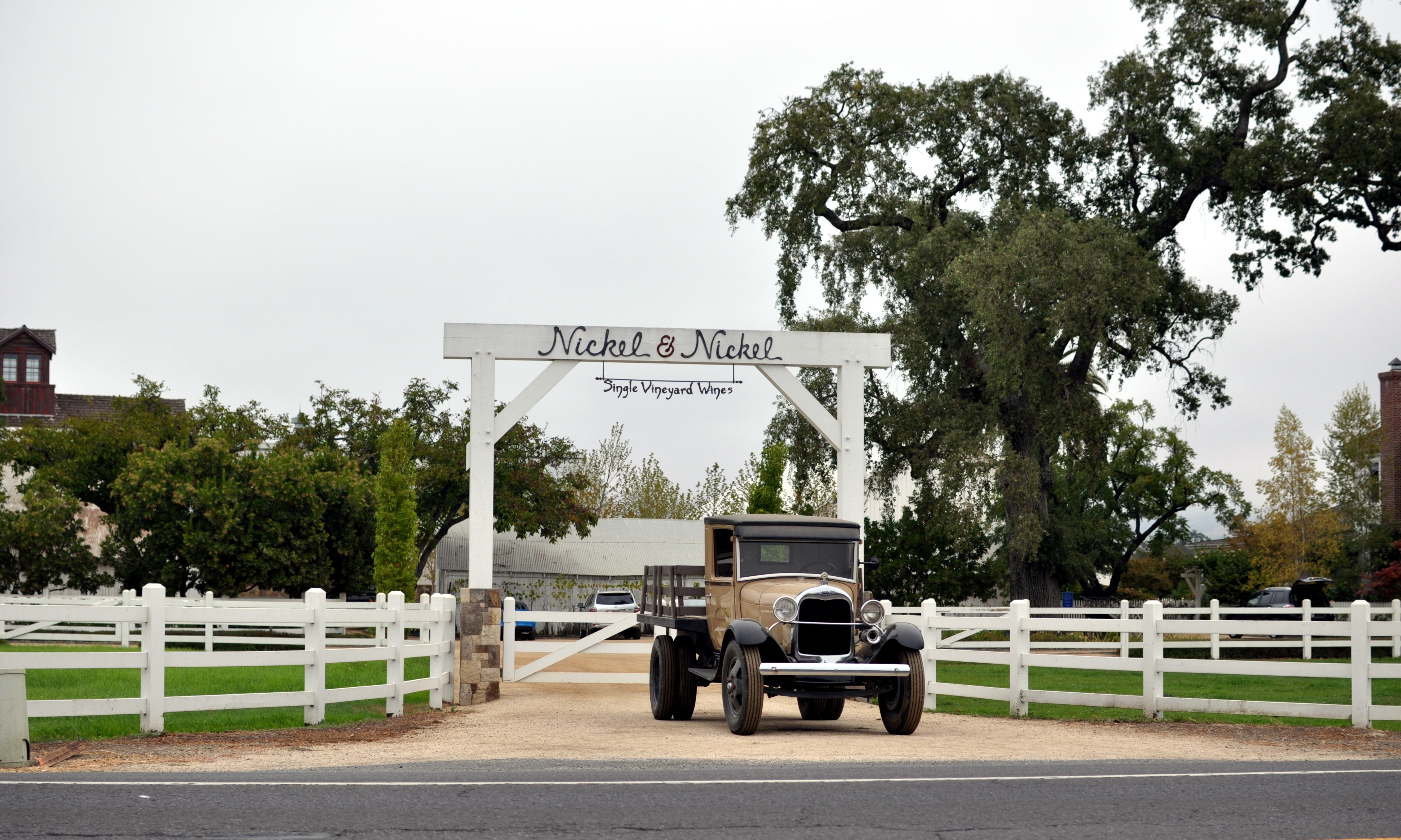
In addition to large scale wineries, Napa Valley's boutique wineries produce some of the world's best wines. The producers of these wines include but are not limited to: Araujo, Bryant Family, Chimney Rock Winery, Colgin Cellars, Dalla Valle Maya, Diamond Creek, Dominus Estate, Duckhorn Vineyards, Dunn Howell Mountain, Grace Family, Harlan Estate, Husic, Kistler, Jericho Canyon Vineyards, Marcassin, Rutherford Hill Winery, Screaming Eagle, Sequoia Grove, Shafer Hillside Select, Spencer-Roloson Winery, Steltzner Vineyards and Bouchaine Vineyards.
Today Napa Valley features more than three hundred wineries and grows many different grape varieties including Cabernet Sauvignon, Chardonnay, Merlot, Zinfandel, and other popular varietals. Napa Valley is visited by as many as five million people each year.
Growth, rural and agricultural preservation
 Mustard growing in a Napa Valley vineyard.
Napa County has maintained a rural agricultural environment in a large portion of the valley floor while neighboring Sonoma, Solano and Yolo counties have allowed large tracts of former farmland to be rezoned for commercial and residential development. In 1968 vintners and civic leaders in the county seized an opportunity to preserve farmland by taking advantage of the Williamson Act[14] enacted by the California Legislature to give landowners property tax relief for designating their land for agricultural purposes. This agricultural preserve[15] on the floor of the valley in unincorporated areas between Napa and Calistoga was the first of its kind in the state. Initially, the preserve encompassed 23,000 acres (93.1 km2), since founding it has grown to more than 30,000 acres (121.4 km2). In 2010, legislation was passed by the California State Senate and State Assembly and sent to the Governor for signing in the form of Senate Bill 1142. This bill was created to provide relief stream of funding to augment the Williamson Act.[16]
The county has resisted encroachment on the preserve since it was created with voters reaffirming their desire keep it intact on several occasions. In 1990 voters passed Measure J [17] adopting an initiative freezing all county zoning changes until the year 2020 unless there is a ⅔ majority vote to adopt such changes. Measure J was reaffirmed by a 5-2 vote of the California Supreme Court in 1995 in the case of Devita v. County of Napa.[18]
The Land Trust of Napa County[19] was founded in 1976 by a group of local citizens with a mission to protect the natural diversity, scenic open space and agricultural vitality of the county. The trust acquires conservation easements, facilitates land transfers to local, state and federal agencies along with accepting outright donations of land within and outside the boundary of the agricultural preserve. The trust now covers over 50,000 acres (202.3 km2).[20]
While establishment of the agricultural preserve and the land trust has slowed residential development in much of the county, residential growth within the incorporated cities has continued at a moderate pace. Several substantial homes have been built on the hills surrounding the valley in areas not covered by the preserve or the land trust. A large portion of the land south of the City of Napa remained undeveloped for many decades until the 1980s. Several wine bottling facilities and wine storage warehouses now stand on what was once vacant land. A number of light industries have also sprung up in this region as new business parks have been built. The growth of American Canyon,[21] Napa County’s southernmost and newest city; incorporated in 1992 has prompted the establishment of several new retail outlets in the southern end of the county in recent years. American Canyon has also established a green belt preserve of over 1,000 acres (4.0 km2) on the western and eastern sides of the city.
Government and politics
Napa County vote
by party in presidential electionsYear GOP DEM Others 2008 32.8% 19,484 65.3% 38,849 1.9% 1,214 2004 39.0% 22,059 59.5% 33,666 1.5% 874 2000 39.9% 20,633 54.3% 28,097 5.8% 2,994 1996 36.1% 17,439 50.9% 24,588 13.0% 6,292 1992 29.3% 15,662 45.3% 24,215 25.4% 13,578 1988 50.2% 23,235 48.1% 22,283 1.7% 772 1984 57.8% 26,322 40.8% 18,599 1.4% 640 1980 53.7% 23,632 33.8% 14,898 12.5% 5,505 1976 51.8% 20,839 44.9% 18,048 5.0% 11,507 1972 59.6% 23,403 37.0% 14,529 3.4% 1,329 1968 43.8% 14,270 45.2% 14,762 11.0% 3,580 1964 37.1% 11,567 62.7% 19,580 0.2% 63 1960 52.6% 15,125 46.9% 13,499 0.5% 154 1956 55.9% 13,610 43.7% 10,623 0.4% 100 1952 61.5% 14,065 37.8% 8,655 0.7% 163 1948 52.8% 8,724 43.6% 7,207 3.5% 585 1944 47.5% 7,092 51.9% 7,748 0.6% 96 1940 46.1% 5,924 52.7% 6,771 1.2% 158 1936 38.2% 3,973 60.4% 6,270 1.4% 147 1932 37.0% 3,521 60.3% 5,745 2.7% 258 1928 57.5% 4,699 41.9% 3,422 0.7% 54 1924 54.8% 3,605 10.2% 670 35.0% 2,301 1920 71.0% 4,448 23.1% 1,444 6.0% 374  The County Administration Building at the county seat, the City of Napa
Napa County is governed by a five-member Board of Supervisors. The current supervisors are: Board Chairman Mark Luce (term expires November 2012), Brad Wagenknecht (term expires November 2010), Bill Dodd (term expires November 2012), Diane Dillon (term expires November 2010) and Keith Caldwell (term expires November 2012).
Napa has become a strongly Democratic county in Presidential and congressional elections. The last Republican to win a majority in the county was George H. W. Bush in 1988.
Napa is part of California's 1st congressional district, which is held by Democrat Mike Thompson. In the state legislature Napa is in the 7th Assembly district, which is held by Democrat Michael Allen, and the 2nd Senate district, which is held by Democrat Noreen Evans.
On Nov. 4, 2008 Napa County voted 55.9 % against Proposition 8 which amended the California Constitution to ban same-sex marriages.
The county is among one of three counties in California to establish a separate department to deal with corrections pursuant to California Government Code §23013, the Napa County Department of Corrections, along with Santa Clara County and Madera County.
Library
The Napa City-County Library, is the public library of Napa California. The main branch is located in downtown Napa at 580 Coombs Street. There are three branch libraries: American Canyon, Calistoga and Yountville.
Napa Library is part of the SNAP (Solano, Napa, and Partners) consortium, a group of 14 libraries serving residents in Napa and Solano counties.
Geography
Cities and towns
Unincorporated Communities A-L Unincorporated Communities M-Z - Aetna Springs
- Angwin
- Berryessa Highlands
- Capell Valley
- Chiles Valley
- Circle Oaks
- Deer Park
- Dry Creek
- Gordon Valley
- Lokoya
- Los Carneros
- Moskowite Corner
- Mt. Veeder
- Oakville
- Pope Valley
- Rutherford
- Soda Canyon
- Spanish Flat
- Vichy Springs
Adjacent counties
- Solano County, California - south, southeast
- Sonoma County, California - west
- Lake County, California - north
- Yolo County, California - east
National protected area
Rivers and creeks
Lakes, marshes and reservoirs
- East Napa Reservoir
- East Side Reservoir
- Fiege Reservoir
- Lake Berryessa
- Lake Hennessey
- Lake Marie
- Lake Orville
- Lake Whitehead
- Milliken Reservoir
- Napa Sonoma Marsh
- Rector Reservoir
- West Napa Reservoir
Transportation infrastructure
Major highways
Public transportation
Napa Valley VINE operates local bus service in Napa, along with an intercity route along State Route 29 between Vallejo (Solano County) and Calistoga. Limited service runs from Calistoga to Santa Rosa (Sonoma County).
Airports
- Napa County Airport is a general aviation airport located just south of the City of Napa.
- Angwin-Parrett Field is a public use airport located east of Angwin and is owned by Pacific Union College.
Rail
Napa Valley Railroad is owned by the Napa Valley Wine Train, a dining/excursion service.
Education
In addition to its many public and private schools, two colleges also operate in the County. Pacific Union College, classified as a National Liberal Arts College by the Carnegie Foundation, is the county's only four year college and serves roughly 1500 students. Napa Valley College, a community college, offers two year degrees in the county.
Media
- Napa Valley Register
- Napa SentinelGTF
- KVON AM
- KVYN FM
- St. Helena Star
Cultural events
Napa County hosts numerous cultural events throughout the year. The county fair takes place annually in early July at the Napa County Fairgrounds in Calistoga. The Napa Town and Country Fair takes place in early August at the Napa Valley Expo in Napa. In order to boost tourism during the normally slow winter months, area hotels, restaurants tourist based businesses developed the Napa Valley Mustard Festival in the 1993.[22] In June, the Napa Valley Wine Auction takes place. Wineries from throughout the valley donate wines and other prizes to be auctioned off to the highest bidder. This annual event raises several million benefiting several charities located in Napa County.[23] In 2006 Napa Valley became home to the Festival del Sole, an annual food, wine, art, and music festival held at various venues throughout the valley.
See also
- Pacific Union College
- Eriophyllum latilobum
- Lasthenia conjugens
- Hiking trails in Napa County
- List of school districts in Napa County, California
- Napa County Airport
- National Register of Historic Places listings in Napa County, California
References
- ^ "2010 Census P.L. 94-171 Summary File Data". United States Census Bureau. http://www2.census.gov/census_2010/01-Redistricting_File--PL_94-171/California/.
- ^ "American FactFinder". United States Census Bureau. http://factfinder.census.gov. Retrieved 2008-01-31.
- ^ "Census 2000 U.S. Gazetteer Files: Counties". United States Census. http://www.census.gov/tiger/tms/gazetteer/county2k.txt. Retrieved 2011-02-13.
- ^ Environmental Assessment for the Napa Valley Wine Train, Napa County and the California Public Utilities Commission, Earth Metrics Inc. report 10072, January, 1990
- ^ http://www.calarchives4u.com/history/history-napa.htm California Genealogy and History Archives
- ^ Heeger, Jack (December 7, 2004). "A peek at Napa Valley's hidden past". Napa Valley Register (Napa, CA: Lee Enterprises, Inc.). http://napavalleyregister.com/eagle/lifestyles/a-peek-at-napa-valley-s-hidden-past/article_9f5d6a22-a85f-5499-83a7-91d3fdaa6dc8.html. Retrieved September 30, 2011.
- ^ Napa County Mexican Land Grants
- ^ Brennen, Nancy (November 21, 2010). "John Patchett: Introducing one of Napa’s pioneers". Napa Valley Register (Napa, CA: Lee Enterprises, Inc.). http://napavalleyregister.com/lifestyles/real-napa/article_b2750390-f509-11df-9ea4-001cc4c03286.htmll. Retrieved September 30, 2011.
- ^ O’DEA GAUGHAN, Timothy (March 22, 2009). "Veterans Home marks 125 years". Napa Valley Register (Napa, CA: Lee Enterprises, Inc.). http://napavalleyregister.com/lifestyles/real-napa/article_22948b48-8e8b-5373-b590-1479d2f39387.html. Retrieved September 28, 2011.
- ^ Gaudino, Riccardo (October 11, 1993). "Italians of Napa Valley". LATE HARVEST 1983 (Napa, CA: Napa County Historical Research Project).
- ^ Courtney, Kevin (February 11, 2008). "One man's journey to save Napa-made warship". Napa Valley Register (Napa, CA). http://napavalleyregister.com/news/local/article_fcce346d-1e1f-5373-8e4e-7c20e7e6234b.html. Retrieved October 16, 2010.
- ^ Franson, Paul (August 24, 2010). "Vintners and growers investigating planting food other than grapes". Napa Valley Register (Napa, CA). http://napavalleyregister.com/news/local/article_eb53dbd0-af38-11df-9d3a-001cc4c03286.html. Retrieved August 25, 2010.
- ^ Burnham, Kelsey (2010-04-18). "Prohibition in Wine Country". Napa Valley Register. http://www.napavalleyregister.com/lifestyles/real-napa/article_ed8bdf22-4a81-11df-bb7d-001cc4c002e0.html. Retrieved 2010-04-18.
- ^ explanation of Williamson Act
- ^ Napa Chamber of Commerce info on Napa County Agricultural Preserve
- ^ Jones, Julian (August 26, 2009). "Wiggins bill could help replenish farm funds". Napa Valley Register (Napa, CA: Lee Enterprises, Inc.). http://napavalleyregister.com/news/local/article_bf326ffa-b1a2-11df-a4cc-001cc4c03286.html. Retrieved August 27, 2010.
- ^ article about Measure J
- ^ Devita v County of Napa
- ^ Land Trust of Napa County
- ^ Land Trust of Napa County website
- ^ City of American Canyon website
- ^ http://www.mustardfestival.org Napa Valley Mustard Festival website
- ^ http://www.napavintners.com/anv Napa Valley Vinters website
External links

Lake County Sonoma County 
Yolo County  Napa County, California

Solano County Solano County Municipalities and communities of Napa County, California Cities and towns American Canyon | Calistoga | Napa | St. Helena | Yountville
CDPs Angwin | Deer Park | Moskowite Corner | Oakville | Rutherford | Silverado Resort
Unincorporated
communitiesAetna Springs | Atlas | Bale | Barro | Brazos | Buchli | Circle Oaks | Collins | Creston | Cuttings Wharf | Enchanted Hills | Howell Mountain | Imola | Knoxville | Krug | Larkmead | Lokoya | Lombard | Lowell | Merazo | Middleton | Napa Junction | Napa Soda Springs | Oak Knoll | Pope Valley | Ratto Landing | Rocktram | Salvador | Sanitarium | Spanish Flat | Spanish Flat Resort | Squab | Stanley | Steel Canyon Resort | Suscol | Thoman | Thompson | Union | Veteran Heights | Vichy Springs | Walter Springs | Woodleaf | Zinfandel
Ghost towns Carneros | Caymus | Guthrie | Kelly | Monticello | Napa Wye | Redbud Park | Shipyard Acres | Spruce Hill | Tuluka
 State of California
Topics - Climate
- Delegations
- Deserts
- Districts
- Ecology
- Elections
- Environment
- Geography
- Government
- History
- Protected areas
- Sports
- Symbols
- Transportation
- Visitor attractions
- Index of California-related articles
Society Regions - Antelope Valley
- Big Sur
- Cascade Range
- Central California
- Central Coast
- Central Valley
- Channel Islands
- Coachella Valley
- Conejo Valley
- Cucamonga Valley
- Death Valley
- East Bay (SF)
- East County (SD)
- Eastern California
- Emerald Triangle
- Gold Country
- Great Basin
- Greater Los Angeles
- Greater Sacramento
- Inland Empire
- Lake Tahoe
- Los Angeles Basin
- Lost Coast
- Metropolitan Fresno
- Mojave
- Mountain Empire
- North Bay (SF)
- North Coast
- North County (SD)
- Northern California
- Owens Valley
- Oxnard Plain
- San Francisco Peninsula
- Pomona Valley
- Sacramento Valley
- San Bernardino Valley
- San Diego–Tijuana
- San Fernando Valley
- San Francisco Bay Area
- San Gabriel Valley
- San Joaquin Valley
- Santa Clara Valley
- Santa Clara River Valley
- Santa Clarita Valley
- Shasta Cascade
- Sierra Nevada
- Silicon Valley
- South Bay (LA)
- South Bay (SF)
- South Bay (SD)
- South Coast
- Southern California
- Southern Border Region
- Tri-Valley
- Upstate California
- Victor Valley
- Wine Country
- Yosemite
Metro areas - Bakersfield
- Chico
- El Centro
- Fresno
- Hanford–Corcoran
- Los Angeles–Long Beach–Glendale
- Madera
- Modesto
- Merced
- Napa
- Oakland–Fremont–Hayward
- Oxnard–Thousand Oaks–Ventura
- Redding
- Riverside–San Bernardino–Ontario
- Sacramento–Arden Arcade–Roseville
- Salinas
- San Diego–Carlsbad–San Marcos
- San Francisco–San Mateo–Redwood City
- San Jose–Sunnyvale–Santa Clara
- San Luis Obispo–Paso Robles
- Santa Ana–Anaheim–Irvine
- Santa Barbara–Santa Maria–Goleta
- Santa Cruz–Watsonville
- Santa Rosa–Petaluma
- Stockton
- Vallejo–Fairfield
- Visalia–Porterville
- Yuba City
Micro areas Counties - Alameda
- Alpine
- Amador
- Butte
- Calaveras
- Colusa
- Contra Costa
- Del Norte
- El Dorado
- Fresno
- Glenn
- Humboldt
- Imperial
- Inyo
- Kern
- Kings
- Lake
- Lassen
- Los Angeles
- Madera
- Marin
- Mariposa
- Mendocino
- Merced
- Modoc
- Mono
- Monterey
- Napa
- Nevada
- Orange
- Placer
- Plumas
- Riverside
- Sacramento
- San Benito
- San Bernardino
- San Diego
- San Francisco
- San Joaquin
- San Luis Obispo
- San Mateo
- Santa Barbara
- Santa Clara
- Santa Cruz
- Shasta
- Sierra
- Siskiyou
- Solano
- Sonoma
- Stanislaus
- Sutter
- Tehama
- Trinity
- Tulare
- Tuolumne
- Ventura
- Yolo
- Yuba
Categories:- Napa County, California
- Counties in the San Francisco Bay Area
- California counties
- Metropolitan areas of California
- Geography of Napa County, California
- Valleys of California


Wikimedia Foundation. 2010.