- San Mateo County, California
-
County of San Mateo — County — 
SealLocation in the state of California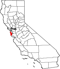 California's location in the United States
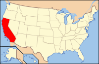
Country  United States
State  California
Region/Metro area San Francisco Bay Area Incorporated 1856 County seat Redwood City Largest city Daly City Area – Total 1,919.2 km2 (741.01 sq mi) – Land 1,163.1 km2 (449.07 sq mi) – Water 756.1 km2 (291.95 sq mi) Population (2010) – Total 718,451 – Density 617.6/km2 (1,599.6/sq mi) Time zone Pacific Standard Time (UTC-8) – Summer (DST) Pacific Daylight Time (UTC-7) Website www.co.sanmateo.ca.us San Mateo County (
 /ˌsæn məˈteɪ.oʊ/ san mə-tay-oh; Spanish for "Saint Matthew") is a county located in the San Francisco Bay Area of the U.S. state of California. It covers most of the San Francisco Peninsula just south of San Francisco, and north of Santa Clara County. San Francisco International Airport is located at the northern end of the county, and Silicon Valley begins at the southern end. As of 2010 the population was 718,451. The county seat is Redwood City. It is strongly Democratic and ethnically diverse. The county's built-up areas are mostly suburban with some areas being very urban, and are home to several corporate campuses.
Contents
History
San Mateo County was formed from parts of San Francisco County and Santa Cruz County in 1856.
The county bears the Spanish name for Saint Matthew. As a place name, San Mateo appears as early as 1776 and several local geographic features were also designated San Mateo on early maps including variously: a settlement, an arroyo, a headland jutting into the Pacific (Point Montara), and a large land holding (Rancho San Mateo). Until about 1850, the name appeared as San Matheo.
Geography
According to the 2000 census, the county has a total area of 741.01 square miles (1,919.2 km2), of which 449.07 square miles (1,163.1 km2) (or 60.60%) is land and 291.95 square miles (756.1 km2) (or 39.40%) is water.[1] A number of bayside watercourses drain the eastern part of the county including San Bruno Creek and Colma Creek. Streams draining the western county include Frenchmans Creek, Pilarcitos Creek, Naples Creek, Arroyo de en Medio, and Denniston Creek.
Incorporated cities
Unincorporated communities
- Broadmoor
- Burlingame Hills
- El Granada
- Devonshire
- Emerald Lake Hills
- Highlands-Baywood Park
- Kings Mountain
- La Honda
- Loma Mar
- Menlo Oaks
- Montara
- Moss Beach
- North Fair Oaks
- Pescadero
- Princeton-by-the-Sea
- San Gregorio
- Sky Londa
- West Menlo Park
Adjacent counties
- San Francisco County, California north
- Alameda County, California east, border is entirely in San Francisco Bay
- Santa Clara County, California southeast
- Santa Cruz County, California south
National protected areas
- Don Edwards San Francisco Bay National Wildlife Refuge (part)
- Golden Gate National Recreation Area (part)
Transportation infrastructure
Major highways
 Interstate 280 (Junipero Serra Freeway)
 Interstate 380 (Kopp Freeway)
 U.S. Route 101 (Bayshore Freeway)
 State Route 1 (Cabrillo Highway)
 State Route 35 (Skyline Boulevard)
 State Route 82 (El Camino Real)
 State Route 84 (Woodside Road, Dumbarton Bridge)
 State Route 92 (J. Arthur Younger Freeway, San Mateo Bridge)
Public transportation
SamTrans (San Mateo County Transit District) provides local bus service within San Mateo County. Local and commuter bus routes also operate into San Francisco.
Caltrain, the commuter rail system, traverses the county from north to south, running alongside the Highway 101 corridor for most of the way. Bay Area Rapid Transit (BART) trains serve San Francisco International Airport and the northern portion of the county, terminating at Millbrae.
Caltrain, BART, and SamTrans converge at the Millbrae Intermodal station.
Airports
San Francisco International Airport is geographically located in San Mateo County, but it is owned by the City and County of San Francisco.
San Mateo County does own two general aviation airports: Half Moon Bay Airport and San Carlos Airport. [2]
Marine transport
The only deepwater port in South San Francisco Bay is the Port of Redwood City, situated along Redwood Creek, originally created as a lumber embarcadero in 1850.
Demographics
Historical populations Census Pop. %± 1860 3,214 — 1870 6,635 106.4% 1880 8,669 30.7% 1890 10,087 16.4% 1900 12,094 19.9% 1910 26,585 119.8% 1920 36,781 38.4% 1930 77,405 110.4% 1940 111,782 44.4% 1950 235,659 110.8% 1960 444,387 88.6% 1970 556,234 25.2% 1980 587,329 5.6% 1990 649,623 10.6% 2000 707,161 8.9% 2010 718,451 1.6% 2010
The 2010 United States Census reported that San Mateo County had a population of 718,451. The racial makeup of San Mateo County was 383,535 (53.4%) White, 20,436 (2.8%) African American, 3,306 (0.5%) Native American, 178,118 (24.8%) Asian (9.8% Filipino, 9.0% Chinese, 1.9% Indian, 1.2% Japanese, 0.8% Korean, 0.5% Vietnamese, 0.3% Burmese, 0.1% Pakistani), 10,317 (1.4%) Pacific Islander, 84,529 (11.8%) from other races, and 38,210 (5.3%) from two or more races. Hispanic or Latino of any race were 182,502 persons (25.4%); 15.7% of San Mateo County is Mexican, 2.7% Salvadoran, 1.2% Guatemalan, 1.2% Nicaraguan, 0.7% Peruvian, 0.6% Puerto Rican, 0.2% Colombian, and 0.2% Cuban.[3]
Population reported at 2010 United States Census The County Total
PopulationWhite African
AmericanNative
AmericanAsian Pacific
Islanderother
racestwo or
more racesHispanic
or Latino
(of any race)San Mateo County 718,451 383,535 20,436 3,306 178,118 10,317 84,529 38,210 182,502 Incorporated
cities and townsTotal
PopulationWhite African
AmericanNative
AmericanAsian Pacific
Islanderother
racestwo or
more racesHispanic
or Latino
(of any race)Atherton 6,914 5,565 75 7 911 45 95 216 268 Belmont 25,835 17,455 423 72 5,151 198 964 1,572 2,977 Brisbane 4,282 2,578 80 21 1,084 41 182 296 712 Burlingame 28,806 19,510 360 74 5,841 139 1,451 1,431 3,966 Colma 1,792 620 59 7 619 9 366 112 708 Daly City 101,123 23,842 3,600 404 56,267 805 11,236 4,969 23,929 East Palo Alto 28,155 8,104 4,704 120 1,057 2,118 10,694 1,358 18,147 Foster City 30,567 13,912 576 29 13,746 189 575 1,540 1,995 Half Moon Bay 11,324 8,580 82 71 490 9 1,710 382 3,563 Hillsborough 10,825 7,178 42 7 3,044 23 109 422 373 Menlo Park 32,026 22,494 1,551 156 3,157 454 2,776 1,438 5,902 Millbrae 21,532 10,177 179 33 9,205 214 776 948 2,555 Pacifica 37,234 24,166 976 206 7,230 315 1,703 2,638 6,243 Portola Valley 4,353 3,960 12 5 242 1 29 104 175 Redwood City 76,815 46,255 1,881 511 8,216 795 14,967 4,190 29,810 San Bruno 41,114 20,350 942 246 10,423 1,377 5,075 2,701 12,016 San Carlos 28,406 22,497 233 65 3,267 70 827 1,447 2,855 San Mateo 97,207 56,214 2,296 505 18,384 1,998 12,264 5,546 25,815 South San Francisco 63,632 23,760 1,625 395 23,293 1,111 9,598 3,850 21,645 Woodside 5,287 4,717 23 4 332 4 63 144 243 Census-designated
placesTotal
PopulationWhite African
AmericanNative
AmericanAsian Pacific
Islanderother
racestwo or
more racesHispanic
or Latino
(of any race)Broadmoor 4,176 1,705 100 30 1,676 44 359 262 981 El Granada 5,467 4,608 45 38 190 5 336 245 813 Emerald Lake Hills 4,278 3,655 39 5 322 15 56 186 288 Highlands-Baywood Park 4,027 2,657 53 9 1,017 17 47 227 306 Ladera 928 811 13 0 16 2 18 68 69 La Honda 1,426 1,269 3 1 98 0 5 50 33 Loma Mar 113 101 2 0 3 0 0 7 12 Montara 2,909 2,491 16 21 142 1 97 141 324 Moss Beach 3,103 2,280 25 43 118 9 494 134 903 North Fair Oaks 14,687 7,060 235 143 548 219 5,728 754 10,731 Pescadero 643 314 2 2 5 1 294 25 402 West Menlo Park 3,659 2,983 28 2 416 4 52 174 201 Unincorporated
communitiesTotal
PopulationWhite African
AmericanNative
AmericanAsian Pacific
Islanderother
racestwo or
more racesHispanic
or Latino
(of any race)All others not CDPs (combined) 15,806 11,667 156 74 1,608 85 1,583 633 3,542 2000
 Age distribution (2000 census)
As of the census of 2009,[4] there were 714,936 people, 258,648 households, and 174,582 families residing in the county. The population density was 2,753/sq mi (825/km²). There were 284,471 housing units at an average density of 789/sq mi (432/km²). 7.4% were of Italian, 7.1% Irish, 7.0% German and 5.3% English ancestry according to Census 2000. 46.9% spoke English, 28.4% Spanish, 6.2% Tagalog, 4.0% Chinese or Mandarin and 1.1% Cantonese, and other language 4.2%, as their first language from estimate census 2009.
There were 258,648 households out of which 30% had children under the age of 18, 48.6% were married couples living together, 14.7% had a female householder with no husband present, and 41.7% were non-families. 31.5% of all households were made up of individuals and 6.2% had someone living alone who was 65 years of age or older. The average household size was 3.79 and the average family size was 4.44.
In the county, the population was spread out with 28.6% under the age of 18, 15.9% from 18 to 24, 25.8% from 25 to 44, 21% from 45 to 64, and 9.7% who were 65 years of age or older. The median age was 31 years. For every 100 females there were 97.8 males. For every 100 females age 18 and over, there were 95.1 males.
The median income for a household in the county was $69,306, and the median income for a family was $77,737. Males had a median income of $48,342 versus $45,383 for females. The per capita income for the county was $36,045. About 6.42% of families and 9.51% of the population were below the poverty line, including 10.01% of those under age 18 and 8.52% of those age 65 or over.
Politics
 San Mateo County Government Center in Redwood City, facing northwest
San Mateo County vote
by party in presidential electionsYear GOP DEM Others 2008 24.8% 75,006 73.6% 222,767 1.6% 4,963 2004 29.3% 83,315 69.5% 197,922 1.3% 3,620 2000 31.0% 80,296 64.3% 166,757 4.8% 12,346 1996 29.2% 73,508 60.6% 152,304 10.2% 25,720 1992 27.2% 75,080 54.0% 149,232 18.9% 52,196 1988 42.9% 109,261 55.7% 141,859 1.3% 3,360 1984 51.9% 135,185 46.9% 122,268 1.2% 3,178 1980 48.8% 116,491 36.6% 87,335 14.6% 34,811 1976 50.6% 117,338 44.4% 102,896 5.0% 11,507 1972 52.8% 135,377 42.8% 109,745 4.4% 11,175 1968 43.7% 98,654 47.2% 106,519 9.1% 20,495 1964 35.6% 77,916 64.3% 140,978 0.1% 297 1960 51.7% 104,570 48.0% 97,154 0.3% 528 1956 61.0% 100,049 38.8% 63,637 0.1% 217 1952 63.6% 92,279 36.0% 52,149 0.5% 651 1948 56.7% 48,909 39.7% 34,215 3.7% 3,148 1944 49.2% 33,590 50.6% 34,594 0.2% 158 1940 46.6% 26,539 52.4% 29,831 1.0% 581 1936 33.1% 13,650 65.7% 27,087 1.2% 511 1932 39.7% 13,442 56.4% 19,094 4.0% 1,343 1928 58.9% 14,360 40.0% 9,755 1.1% 277 1924 55.3% 8,126 5.2% 771 39.5% 5,805 1920 70.5% 7,205 19.2% 1,958 10.3% 1,054 San Mateo County has a five-member Board of Supervisors, representing five geographic districts, but elected at-large. The California Secretary of State, as of April 2008, reports that San Mateo County has 357,514 registered voters. Of those voters registered, 179,994 (50.4%) are registered Democratic, 82,189 (23.0%) are registered Republican, 13,648 (3.8%) are registered with other political parties, and 81,683 (22.8%) declined to state a political party preference. With the exceptions of Atherton, Hillsborough, and Woodside, every city, town, and the unincorporated areas of San Mateo County has more registered Democrats than Republicans.
San Mateo is a strongly Democratic county in presidential and congressional elections. The last Republican to win a majority in the county was Ronald Reagan in 1984.
San Mateo is part of California's 12th and 14th congressional districts, held by Democrats Jackie Speier and Anna Eshoo, respectively. In the State Assembly, San Mateo is in the 12th, 19th, and 21st districts, which are held by Democrats Fiona Ma, Jerry Hill, and Rich Gordon, respectively. In the State Senate, San Mateo is in the 8th and 11th districts, which are held by Democrats Leland Yee and Joe Simitian, respectively.
On Nov. 4, 2008 San Mateo County voted 61.8 % against Proposition 8, which amended the California Constitution to ban same-sex marriages.[5]
Environmental features
San Mateo County straddles the San Francisco Peninsula, with the Santa Cruz Mountains running its entire length. The county encompasses a variety of habitats including estuarine, marine, oak woodland, redwood forest, coastal scrub and oak savannah. There are numerous species of wildlife present, especially along the San Francisco Bay estuarine shoreline, San Bruno Mountain, Fitzgerald Marine Reserve and the forests on the Montara Mountain block. Several creeks discharge to the San Francisco Bay including San Mateo Creek and Laurel Creek and several coastal streams discharge to the Pacific Ocean such as Frenchmans Creek and San Vicente Creek.
The county is home to several endangered species including the San Francisco garter snake and the San Bruno elfin butterfly, both of which are endemic to San Mateo County. The endangered California clapper rail is also found on the shores of San Francisco Bay, in the cities of Belmont and San Mateo. The endangered wildflower Hickman's potentilla is found near the Pacific Ocean on the lower slopes of Montara Mountain. The endangered wildflowers White-rayed pentachaeta, Pentachaeta bellidiflora, San Mateo Woolly Sunflower, Eriophyllum latilobum, Marin Dwarf Flax, Hesperolinon congestum and the San Mateo Thornmint, Acanthomintha duttonii, are found in the vicinity of the Crystal Springs Reservoir.
Año Nuevo State Marine Conservation Area and Greyhound Rock State Marine Conservation Area are two adjoining marine protected areas off the coast of San Mateo County. Like underwater parks, these marine protected areas help conserve ocean wildlife and marine ecosystems.
Education
The people of San Mateo county may use the services of the Peninsula Library System and its dozens of branches, bookmobile and Library-a-Go-Go machine at the Millbrae BART/Caltrain station.
The county is broken up into several public school districts in addition to the local Catholic diocese and many other private parochial and secular schools.
Some students in San Mateo County's public schools attend outdoor education in La Honda. San Mateo Outdoor Education is a residential school that teaches major concepts of ecology via exploration of forest, pond, garden, tidepool, wetland, and sandy shore habitats.[6] The center's mascot is the banana slug, a large yellow gastropod. The school uses songs from the famous Banana Slug String Band.
Economy
Prior to its dissolution, Pacific Air Lines had its corporate headquarters on the grounds of San Francisco International Airport in an unincorporated area in San Mateo County.[7] Prior to its dissolution, Hughes Airwest had its headquarters on the grounds of San Francisco International.[8]
Notable structures
There are a number of well known structures within San Mateo County:
- Carolands Mansion, Hillsborough
- Cow Palace, Daly City
- Crocker Mansion, Hillsborough
- Crystal Springs Reservoir, unincorporated central part of county
- CuriOdyssey, San Mateo
- Dakin Building, Brisbane
- Filoli Mansion, Woodside
- Notre Dame de Namur University, Belmont, which incorporates Ralston Hall
- Pigeon Point Lighthouse, Pescadero
- Point Montara Lighthouse, Montara
- Pulgas Water Temple, Woodside
- Sanchez Adobe, Pacifica
- San Francisco International Airport
- Stanford Linear Accelerator Center, Menlo Park
- Kohl Mansion, Burlingame
County trails
See this county page for trail descriptions.
- Alpine Trail
- Bog Trail
- Cañada Trail
- Crystal Springs Trail
- Edgewood Trail
- Ralston Trail
- San Andreas Trail
- Sand Hill Trail
- Sawyer Camp Trail
- Skyline Trail
- Sheep Camp Trail
- Sweeney Ridge Trail
- Hiking trails in San Mateo County
County parks
- Coyote Point Recreation Area
- Coyote Point Marina
- Crystal Springs
- Edgewood Park and Natural Reserve
- Fitzgerald Marine Reserve
- Flood Park (County)
- Heritage Grove
- Huddart Park
- Junipero Serra County Park
- San Mateo County Memorial Park
- Pescadero Creek Park
- Russian Ridge Open Space Preserve
- Sam MacDonald Park
- San Bruno Mountain (County Park)
- San Mateo Fishing Pier
- San Mateo County Memorial Park
- San Pedro Valley County Park
- Sanchez Adobe
- Woodside Store
- Wunderlich Park – New
Source: http://www.sanmateocountyparks.org/
County Parks: http://www.co.sanmateo.ca.us/portal/site/parksState parks
- Año Nuevo State Park
- Butano State Park
- Castle Rock State Park
- Heritage Grove
- Portola Redwoods State Park
- Quarry Park
- Burleigh H. Murray Ranch
- Pigeon Point Light Station Historic State Park
- Point Montara Light Station State Park
- Portola Redwoods State Park
- San Bruno Mountain State Park
State beaches
- Año Nuevo State Reserve
- Bean Hollow State Beach
- Big Basin State Beach
- Gray Whale Cove State Beach
- Half Moon Bay State Beach
- Montara State Beach
- Pacifica State Beach
- Pebble Beach
- Pescadero State Beach
- Pomponio State Beach
- San Gregorio State Beach
- Thornton State Beach
Source: http://www.parks.ca.gov/parkindex/default.asp?tab=3 State Parks, Choose San Mateo
See also
- List of school districts in San Mateo County, California
- List of California Historical Landmarks in San Mateo County, California
- List of California public officials charged with crimes, San Mateo County
- National Register of Historic Places listings in San Mateo County, California
- Peninsula Humane Society
- Seaport Centre
- Telephone Area code 650
- Leo J. Ryan Memorial Park
- Leo J. Ryan Federal Building
- Silicon Valley
References
- ^ "Census 2000 U.S. Gazetteer Files: Counties". United States Census. http://www.census.gov/tiger/tms/gazetteer/county2k.txt. Retrieved 2011-02-13.
- ^ San Mateo County Public Works. "San Mateo County – Public Works – General Aviation Airports". http://www.co.sanmateo.ca.us/portal/site/publicworks/menuitem.a4bfacf14e50a00d82439054d17332a0/?vgnextoid=7f5c4b3a4b71f110VgnVCM1000001d37230aRCRD&vgnextchannel=5f5c4b3a4b71f110VgnVCM1000001d37230a____&vgnextfmt=DivisionsLanding. Retrieved 14 June 2010.
- ^ "2010 Census P.L. 94-171 Summary File Data". United States Census Bureau. http://www2.census.gov/census_2010/01-Redistricting_File--PL_94-171/California/.
- ^ "American FactFinder". United States Census Bureau. http://factfinder.census.gov. Retrieved 2008-01-31.
- ^ California Secretary of State. "State Ballot Measures (Proposition Numbers 1A-12) by County". http://www.sos.ca.gov/elections/sov/2008_general/57_65_ballot_measures.pdf. Retrieved 14 June 2009.
- ^ San Mateo County Office of Education. "Information for Parents About Outdoor Education". http://www.smcoe.k12.ca.us/outdoored/SMOLibrary/SMOLib004/SMOLib004Parents.html. Retrieved 14 June 2010.
- ^ Flight International. April 2, 1964. 523.
- ^ "World Airline Directory." Flight International. April 28, 1979. 1379.
External links
- County of San Mateo Official Website
- Visitors Guide from the Visitors Bureau
- San Mateo County Library – 12 branches throughout the County and a bookmobile
- Peninsula Library System – serving all of San Mateo County
- Superior Court Records
- SamCERA (San Mateo County Employees' Retirement Association
- Brisbane Baylands Project
- Diseño del Rancho Cañada de Guadalupe, la Visitacion y Rodeo Viejo : San Mateo Co., Ca at the Bancroft Library

San Francisco County Pacific Ocean 
Alameda County  San Mateo County, California

Santa Cruz County Santa Clara County Municipalities and communities of San Mateo County, California Cities and towns Atherton | Belmont | Brisbane | Burlingame | Colma | Daly City | East Palo Alto | Foster City | Half Moon Bay | Hillsborough | Menlo Park | Millbrae | Pacifica | Portola Valley | Redwood City | San Bruno | San Carlos | San Mateo | South San Francisco | Woodside

CDPs Unincorporated
communitiesGhost towns  State of California
Topics - Climate
- Delegations
- Deserts
- Districts
- Ecology
- Elections
- Environment
- Geography
- Government
- History
- Protected areas
- Sports
- Symbols
- Transportation
- Visitor attractions
- Index of California-related articles
Society Regions - Antelope Valley
- Big Sur
- Cascade Range
- Central California
- Central Coast
- Central Valley
- Channel Islands
- Coachella Valley
- Conejo Valley
- Cucamonga Valley
- Death Valley
- East Bay (SF)
- East County (SD)
- Eastern California
- Emerald Triangle
- Gold Country
- Great Basin
- Greater Los Angeles
- Greater Sacramento
- Inland Empire
- Lake Tahoe
- Los Angeles Basin
- Lost Coast
- Metropolitan Fresno
- Mojave
- Mountain Empire
- North Bay (SF)
- North Coast
- North County (SD)
- Northern California
- Owens Valley
- Oxnard Plain
- San Francisco Peninsula
- Pomona Valley
- Sacramento Valley
- San Bernardino Valley
- San Diego–Tijuana
- San Fernando Valley
- San Francisco Bay Area
- San Gabriel Valley
- San Joaquin Valley
- Santa Clara Valley
- Santa Clara River Valley
- Santa Clarita Valley
- Shasta Cascade
- Sierra Nevada
- Silicon Valley
- South Bay (LA)
- South Bay (SF)
- South Bay (SD)
- South Coast
- Southern California
- Southern Border Region
- Tri-Valley
- Upstate California
- Victor Valley
- Wine Country
- Yosemite
Metro areas - Bakersfield
- Chico
- El Centro
- Fresno
- Hanford–Corcoran
- Los Angeles–Long Beach–Glendale
- Madera
- Modesto
- Merced
- Napa
- Oakland–Fremont–Hayward
- Oxnard–Thousand Oaks–Ventura
- Redding
- Riverside–San Bernardino–Ontario
- Sacramento–Arden Arcade–Roseville
- Salinas
- San Diego–Carlsbad–San Marcos
- San Francisco–San Mateo–Redwood City
- San Jose–Sunnyvale–Santa Clara
- San Luis Obispo–Paso Robles
- Santa Ana–Anaheim–Irvine
- Santa Barbara–Santa Maria–Goleta
- Santa Cruz–Watsonville
- Santa Rosa–Petaluma
- Stockton
- Vallejo–Fairfield
- Visalia–Porterville
- Yuba City
Micro areas Counties - Alameda
- Alpine
- Amador
- Butte
- Calaveras
- Colusa
- Contra Costa
- Del Norte
- El Dorado
- Fresno
- Glenn
- Humboldt
- Imperial
- Inyo
- Kern
- Kings
- Lake
- Lassen
- Los Angeles
- Madera
- Marin
- Mariposa
- Mendocino
- Merced
- Modoc
- Mono
- Monterey
- Napa
- Nevada
- Orange
- Placer
- Plumas
- Riverside
- Sacramento
- San Benito
- San Bernardino
- San Diego
- San Francisco
- San Joaquin
- San Luis Obispo
- San Mateo
- Santa Barbara
- Santa Clara
- Santa Cruz
- Shasta
- Sierra
- Siskiyou
- Solano
- Sonoma
- Stanislaus
- Sutter
- Tehama
- Trinity
- Tulare
- Tuolumne
- Ventura
- Yolo
- Yuba
Categories:- San Mateo County, California
- Counties in the San Francisco Bay Area
- California counties


Wikimedia Foundation. 2010.