- Pennsylvania Turnpike
-
This article is about the east-west mainline and Northeast Extension of the Pennsylvania Turnpike system, commonly referred to simply as the Pennsylvania Turnpike. For the agency overseeing the Pennsylvania Turnpike system, see Pennsylvania Turnpike Commission.
Pennsylvania Turnpike

The East–West Mainline of the Pennsylvania Turnpike system.Route information Maintained by Pennsylvania Turnpike Commission Length: 359.6 mi[1] (578.7 km) Existed: October 1940 – present Major junctions West end: 
 I-76 / Ohio Tpk. at Ohio state line
 I-376 near Beaver Falls

 I-79 / US 19 near Pittsburgh
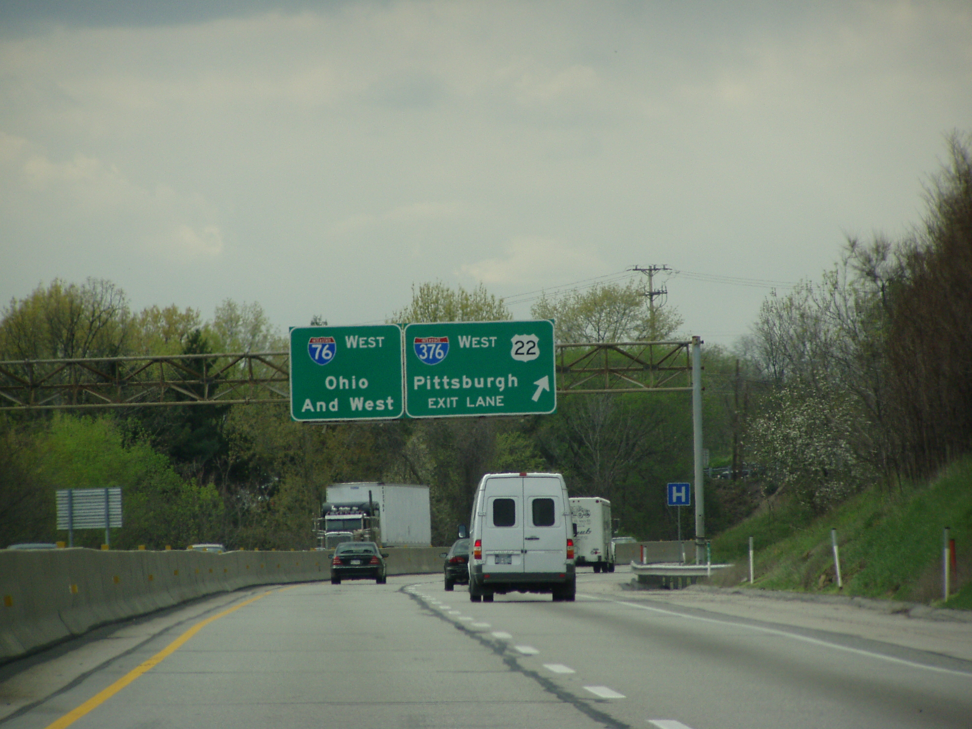
 I-376 / US 22 near Pittsburgh


 I-70 / Toll PA 66 / US 119 near New Stanton

 I-99 / US 220 near Bedford
 I-70 / US 30 near Breezewood

 I-81 / US 11 near Middlesex
 I-83 near Harrisburg
I-76 near Valley Forge I-476 near Plymouth Meeting
East end:  I-95 on Delaware River - Turnpike Toll Bridge at New Jersey state line in Bristol Township
Highway system Roads in Pennsylvania
Interstate • US • State • Legislative←  PA 274
PA 276  →
→←  I-279
I-279
PA 280  →
→The Pennsylvania Turnpike is a toll highway system operated by the Pennsylvania Turnpike Commission in the Commonwealth of Pennsylvania, United States. The three sections of the turnpike system total 532 miles (856 km). The main section extends from Ohio (west) to New Jersey (east) and is 359 miles (578 km) long. The 110-mile (180 km) Northeast Extension extends from Plymouth Meeting in the southeast to Wilkes-Barre and Scranton in the northeast. The various access segments in Western Pennsylvania total 62 miles (100 km).
The highway serves most of Pennsylvania's major urban areas. The main east/west section serves the Pittsburgh, Harrisburg, and Philadelphia areas, while its Northeast Extension serves the Allentown/Bethlehem and Scranton/Wilkes-Barre areas.
This system has an optional payment method called E-ZPass, where tolls are paid electronically through a transponder attached to the car either behind its rear-view mirror or to the front bumper.
Contents
Route numbers
 Pennsylvania Turnpike westbound in Whitemarsh Township.
The Pennsylvania Turnpike is part of the U.S. Interstate Highway System, and is signed with the following route numbers:
- Interstate 76. Interstate 76 comprises the majority of the system, starting at the turnpike's western terminus at the Ohio state line, and continuing to the Valley Forge exit, where Interstate 76 leaves the turnpike.
- Interstate 70 joins the turnpike at New Stanton, Exit 75, and runs concurrently with Interstate 76 until leaving the turnpike at Breezewood, Exit 161 (the only other tolled section of I-70 is on the Kansas Turnpike). This section is internally known as State Route 7076.[2]
- Interstate 276. Interstate 76 leaves the turnpike mainline at Valley Forge/Philadelphia, Exit 326, where it begins to follow the Schuylkill Expressway. At that point, the turnpike becomes Interstate 276 for 32.65 mi (52.55 km)[3] until it meets with a spur of the New Jersey Turnpike at the Delaware River, at the turnpike's eastern end. Some maps have the I-276 shield on the New Jersey Turnpike extension. This section is internally known as State Route 7276.[2]
- Interstate 376. Interstate 376 is a recent addition to the Pennsylvania Turnpike system, known as the James E. Ross Highway, formerly signed as Pennsylvania Route 60.
- Interstate 476. The Northeast Extension, which meets the turnpike mainline at milepost 333.5 (the interchange is designated as Exit-20, the milepost marker for I-476), is signed as part of Interstate 476. This section was originally signed as Pennsylvania Route 9 before redesignation in the 1990s. This section is internally known as State Route 7476.[2]
- Interstate 95. The turnpike mainline currently crosses Interstate 95; however, there is no direct connection between the two routes. Once the Pennsylvania Turnpike/Interstate 95 Interchange Project northeast of Philadelphia is completed, which will add a direct connection, the section of the turnpike east of that interchange (now Interstate 276) will be redesignated Interstate 95.
Toll system
 Pennsylvania Turnpike Toll Ticket at Warrendale (Exit 30). Shows toll prices for eastbound Class 1 vehicles (two-axle cars without trailers) from April 2006.
Most of the turnpike operates as a ticket system toll road. A driver receives a paper ticket on entry and pays on exit; the fare is calculated on the entrance and exit points.
If a motorist loses the ticket, the Turnpike charges the highest fare to the exit where the motorist leaves and issues a receipt. If the ticket is later found, the motorist may send the ticket and receipt to the Turnpike Commission for a refund of the excess fare.
Most of the system's access points are simple trumpet interchanges, with a toll barrier located between the interchange and the local connector road. Between 1957 and 1997, the road had three "mainline" barrier plazas, one at Gateway (at the Pennsylvania/Ohio state line), connecting to the Ohio Turnpike, one at the Delaware River Bridge near Bristol Township, where the turnpike crosses the Delaware River and connects with the New Jersey Turnpike, and one on the Northeastern Extension at Clarks Summit, where it connects with Interstate 81 near Scranton.
In 1992, the new Mid-County interchange opened, connecting Interstate 476 with the main trunk of the Turnpike. It doubles as a mainline and interchange barrier. In 2002, the Gateway barrier was converted to an all-cash plaza. And, since January 2, 2006, only eastbound motorists are charged—westbound motorists no longer have to pay a toll (similar to the one-way tolls on the Garden State Parkway). In addition, a new mainline barrier, at Warrendale, was added. With the opening of the new Warrendale barrier, the Turnpike between Gateway and Warrendale is toll-free and gives motorists direct access to the James E. Ross Highway, Interstate 79, and two local roads. A similar approach was used between the Wyoming Valley interchange and Clarks Summit on the Northeastern Extension, allowing for the construction of the Keyser Avenue interchange, along with a new coin-drop booth north of the exit. This will also be implemented when the Turnpike/Interstate 95 exit is completed in Bristol Township allowing I-95 to access the Turnpike with a high-speed interchange.
 Willow Grove toll plaza entrance to the Pennsylvania Turnpike, Exit 343
Fares range from as low as $1.00 from one exit to the next, to over $30 for long distance travel. In March 2010, the fare for a two-axle automobile traveling the entire Turnpike eastbound from Gateway to the end of the Turnpike at the Delaware River Bridge into New Jersey, a distance of 357.6 miles (575.5 km), costs $32.30 ($30.17 with E-ZPass), or by traveling from Gateway to the Clarks Summit barrier near the end of the Northeast Extension, a distance of 444.2 miles (714.9 km), costs $38.15 ($35.49 with E-ZPass).[1] A three percent toll increase went into effect on January 3, 2010 at 12:01 a.m.[4] Another toll hike occurred on January 2, 2011, where cash tolls increased 10 percent and E-ZPass tolls increased 3 percent.[5] As part of this toll hike, the Pennsylvania Turnpike Commission initially planned not to print the toll amount on new tickets in order to save money.[6][7] As a result of this plan, Pennsylvania Auditor Jack Wagner questioned if the Pennsylvania Turnpike Commission was trying to hide the toll hike.[7] The Turnpike Commission later decided to include the fares on the new tickets.[8]
E-ZPass is accepted in designated lanes at all toll plazas. The Virginia Drive exit near Fort Washington and the Philadelphia Park interchange near Bensalem are accessible only to E-ZPass customers. In addition, the proposed Great Valley interchange near Malvern is expected to be E-ZPass-only.
The Pennsylvania Turnpike is considering eliminating manned toll booths in favor of all-electronic tolls. In 2011, the Fort Littleton, Willow Hill, and Blue Mountain interchanges are expected to become unmanned, in which either E-ZPass or credit cards will be accepted.[9] Drivers unable to pay by either of these methods will be billed in the mail using license plate technology, with an additional surcharge applied.[10] In addition to E-ZPass, the Turnpike Commission other automated options to pay for tolls such as using a prepaid account that utilizes license plate technology. McCormick Taylor and Wilbur Smith Associates have been hired to conduct a feasibility study on converting the road to all-electronic tolls.[8] If this experiment proves successful, the turnpike extensions, including Pennsylvania Route 43 and Pennsylvania Route 576, may become cashless as well.[9]
Emergency assistance
The turnpike has a callbox at each mile for its entire length. Motorists may also dial *11 on their mobile phones. First responder services are available to all turnpike customers via the State Farm Safety Patrol program.[11]
History
 Pennsylvania Turnpike as it appeared in July 1942
Governor Earle signed the Turnpike into law on May 21, 1937, and construction began shortly after, with the first section from the Pittsburgh suburb of Irwin, Pennsylvania to Carlisle, Pennsylvania opening in 1940, and from Ohio line to the New Jersey line in 1956. When the first section opened in 1940, it was built to higher design standards and extended over a longer distance than any other limited-access divided highway in the United States, and was the first inter-city expressway comparable to the German Autobahn. Before World War II it was popularly known as the "tunnel highway" because of the seven mountain tunnels along its route.
First section
The turnpike was partly constructed on an unused railroad grade intended for the aborted South Pennsylvania Railroad project, and six of its seven original tunnels (all except the Allegheny Mountain tunnel) were first bored for that railroad. The construction began in the 1880s but was never completed. A combined total of 4.5 miles (7.2 km) of tunnel had been dug through seven mountains.[12][13]
 Rays Hill Tunnel during construction of the railroad tunnel in the 1880s. Andrew Carnegie is present in the middle of the image
Proposals to use the grade and tunnels for a toll road were first made in late 1934. The road would bypass the steep grades on Pennsylvania's existing major east–west highways—US 22 (William Penn Highway) and US 30 (Lincoln Highway)—and offer a high-speed four lane route free of cross traffic. The Pennsylvania Turnpike Commission was created by law on May 21, 1937, and construction began October 27, 1938, with the removal of water from the unfinished tunnels. The 160-mile (260 km) roadway took 770,000 tons of sand, 1,200,000 tons of stone, 50,000 tons of steel, and more than 300,000 tons of cement to complete.[12] It was built at a cost of $370,000 per mile ($230,910 per km).[14]
On October 1, 1940, the first section of Turnpike opened, running from US 11 near Carlisle (southwest of Harrisburg) west to US 30 at Irwin (east of Pittsburgh). As built, most of the road was four lanes, but it narrowed to one lane in each direction for the seven tunnels (the South Pennsylvania had begun work on nine, but two—the Quemahoning Tunnel and Negro Mountain Tunnel—were bypassed by the Turnpike). Despite the railroad right-of-way, much of the new Turnpike was built on a new, straighter alignment, as engineering had progressed much since the days of the railroad.
Unlike earlier parkways, mostly in the New York City area, which were restricted to cars, the Turnpike allowed all traffic. Like the German Autobahn on which it was loosely based, there was no enforced speed limit on most of the road; some cars could travel at 100 miles per hour (160 km/h) and traverse the entire 160-mile (260 km) original segment in less than two hours. The phenomenon of highway hypnosis began to afflict motorists on some of the long, straight segments, especially on the 21-mile (34 km) section of Turnpike between the Blue Mountain Tunnel and the eastern terminus at Carlisle.
A speed limit of 70 miles per hour (110 km/h) for passenger cars was enacted on April 15, 1941, with a speed limit of 50–65 mph (80–105 km/h) for trucks based on weight, and speed limits of 35 miles per hour (56 km/h) in tunnels and 45 miles per hour (72 km/h) on bridges. During World War II, the Turnpike adopted the national speed limit of 35 miles per hour (56 km/h).[15] In the 1950s, the speed limit was reduced to 65 miles per hour (105 km/h) for all vehicles, and again reduced to 55 miles per hour (89 km/h) in 1974 when the federal government enacted a national speed limit. The speed limit was once again raised to 65 miles per hour (105 km/h) in 1995, but it did not cover the Delaware River extension or the Northeast Extension. Those two segments were restored to a 65 mph speed limit several years later.
Expansion
With the success of the original 160-mile (260 km) segment, the Turnpike Commission planned to expand the original turnpike to a high-speed cross-state route, connecting Philadelphia and Pittsburgh. This was shelved with the onset of World War II, but with the war's end, the Turnpike Commission resumed construction.
Philadelphia Extension
The Philadelphia Extension extended the turnpike east to King of Prussia near Philadelphia and Valley Forge, Pennsylvania. The first phase of that expansion made the highway slightly longer, stretching it to US 15 near Harrisburg. That section opened on February 1, and the rest of the expansion, east to King of Prussia, opened on November 20, 1950. At that time the old mainline toll booth and interchange at Carlisle was closed, and the Middlesex interchange, at the old east end at US 11, was reconfigured and renamed as the Carlisle interchange. The original eastern end of the Philadelphia Extension was at what is now the present-day interchange with Interstate 76 and US 202.
Western Extension

The first piece of the Western Extension, from Irwin to US 22 at Monroeville, east of Pittsburgh, opened August 7, 1951. The remainder opened to traffic on December 26, 1951, taking the highway west almost to the Ohio state line. Traffic was diverted onto the two-lane Burkey Road just west of the western barrier toll for almost three years until a connection with the Ohio Turnpike connection opened. The interchange with Pennsylvania Route 18 at Homewood was not completed until March 1, 1952. The turnpike connected with Youngstown, Ohio, after the first section of the Ohio Turnpike opened on December 1, 1954.
Delaware River Extension
The Delaware River Extension to Pennsylvania Route 611 at Willow Grove opened on August 23, 1954 and the intermediate Fort Washington interchange with PA 309 opened September 20. Extensions to US 1 near Trevose opened October 27 and to US 13 near Bristol Township on November 17, 1954. The final piece opened on May 23, 1956 with the completion of the Delaware River – Turnpike Toll Bridge, which connected to a short spur of the New Jersey Turnpike. The highway, originally designated as Interstate 280 when the Pennsylvania Turnpike between the Ohio state line and Valley Forge was I-80S, received its present number of I-276 in 1964 when I-80S became I-76.
Northeast Extension
Main article: Interstate 476The Northeast Extension, from the Mid-County Interchange northwest of Philadelphia north to Interstate 81 near Scranton, opened in stages from November 23, 1955 to November 7, 1957. This was the last segment of the Turnpike system to be built until the late 1980s. Formerly signed as Pennsylvania Route 9, in 1996 after the expansion of the Lehigh Tunnel to four lanes, the entire extension became part of Interstate 476 (continuing from the Chester-to-Plymouth Meeting freeway).
Other highways
Main article: Pennsylvania Turnpike CommissionWestern expansions
Western extensions which mostly serve the Pittsburgh area were constructed from the 1990s and work on them continues to this day. The James E. Ross Highway and the Amos K. Hutchinson Bypass were completed by 1994, and the James J. Manderino Highway, a West Virginia-to-Pittsburgh route, (Mon/Fayette Expressway) is about half completed with the last major link to Pittsburgh under design. The first section of the Pittsburgh Southern Beltway (from the Mon/Fayette Expressway to the Pittsburgh International Airport) has been completed and is open to traffic. Environmental Impact Statements (EIS) for the two remaining sections are in preparation.
Competing highways
The Pennsylvania Turnpike Commission originally proposed a statewide system of additional toll highways, but these plans were rendered unnecessary with the inception of the U.S. Interstate Highway system in 1956. A toll-free east–west competitor—Interstate 80—opened on August 29, 1970 across northern Pennsylvania, forming a route that was more direct for New York–Chicago traffic. In 2007, however, the Commonwealth of Pennsylvania leased Interstate 80 to the Turnpike Commission. Under this lease agreement, this would have allowed the Turnpike Commission to convert Interstate 80 to a toll highway.[16][17] However, on September 11, 2008, the Federal Highway Administration rejected Pennsylvania's application to toll Interstate 80.[18]
2004 Teamsters strike
On November 24, 2004, the day before Thanksgiving, two-thousand Teamsters Union employees of the Pennsylvania Turnpike went on strike, after contract negotiations failed. As this is usually one of the busiest traffic days in the United States, to keep the turnpike open, tolls were waived for the rest of the day.[19] Starting on November 25, turnpike management personnel collected flat-rate passenger tolls of $2 and commercial tolls of $15 from cash customers on the ticketed system, while E-ZPass customers were charged the lesser of the actual toll or the same flat rates.[20] This was a substantial discount for many travelers, who would normally have paid $19.75 to travel the full length of the main east–west route in a passenger car, and between $29 and $794, depending on vehicle weight class, to cross the state in a commercial vehicle.[21] The strike lasted only seven days, with an agreement reached on November 30. Normal toll collection resumed December 1.[22]
The "Tunnel Highway"
 The west portal of the Blue Mountain Tunnel's eastbound tube.
In spite of the Turnpike Commission dubbing the new road "The World's Greatest Highway",[23] the Turnpike was popularly known as the "Tunnel Highway".[citation needed] Postcards and other souvenirs promoted the original stretch's seven tunnels through Pennsylvania's Appalachian Mountains.[24] These tunnels, from east to west, bored through Blue Mountain, Kittattiny Mountain, Tuscarora Mountain, Sideling Hill, Ray's Hill, Allegheny Mountain, and Laurel Hill.
Modernization
While the Turnpike was built as a four-lane, limited-access freeway with a median varying between 4 and 10 feet (1.2 and 3.0 m) (the norm), the seven tunnels each had only two undivided travel lanes. By the 1960s, this constriction was creating long delays at each tunnel. To alleviate the overcrowding, the Turnpike Commission studied ways either to expand or to bypass each tunnel.
The result was four tunnels being "twinned" through the construction of parallel two-lane tunnels, the three others either bypassed or closed. The Blue, Kittattiny, Tuscarora, and Allegheny Mountain twins were of slightly larger diameter and featured white ceramic tile cladding and improved lighting inside yet maintained identical exterior appearance. Upon completion, the original tunnels were temporarily closed to be brought up to the new interior standards.[25]
The Sideling Hill, Rays Hill, and Laurel Hill tunnels were closed and bypassed. A large scale cut and fill was employed to divert the highway past the nearly adjacent Sideling Hill and Rays Hill tunnels, while a long rock cut through Laurel Hill was made above the original tunnel.
The three bypassed tunnels are still in existence. The 13-mile (21 km) stretch that contained the Sideling Hill and Rays Hill Tunnels are now part of a popular tourist attraction known as the Abandoned Pennsylvania Turnpike, most of which was sold to Southern Alleghenies Conservancy in 2001. The Laurel Hill stretch, which is much shorter at about 2 miles (3.2 km), is still owned by the PTC and trespassing is prohibited.
Lehigh Tunnel
The Northeast Extension of the Pennsylvania Turnpike contains the Lehigh Tunnel, a 4,461-foot (1,360 m) tunnel through Blue Mountain. The tunnel was named Lehigh Tunnel to avoid confusion with the existing Blue Mountain tunnel on the mainline. (It was to be named for Turnpike Commission chairman Thomas J. Evans, but this was changed when he was convicted for conspiracy to defraud the Turnpike Commission of $19 million on July 25, 1967.) [26]
The Lehigh Tunnel was originally a two-lane tunnel, like the highway's original seven tunnels but it was twinned in the early 1990s. The new Lehigh Tunnel is the only tunnel built by the Turnpike Commission using the New Austrian Tunnelling method. With this method, tunnels are built using a special machine resembling a large electric razor blade, guided by lasers. The tunneled area is reinforced with shotcrete, a slurry mixture, as it is bored, eliminating the need for wooden supports. Because of the new construction, the new tube, which is round, contrasts sharply with the original rectangular tube, which was carved by the older dynamite blasting method.
Allegheny Tunnel modernization
 West portal, Allegheny Mountain Tunnel
The Allegheny Mountain Tunnel, currently the longest active tunnel complex on the entire Turnpike system (only the bypassed Sideling Hill Tunnel was longer), and the only one of the original seven mainline tunnels not to have been originally bored for the aborted South Pennsylvania Railroad project, is currently the turnpike's most problematic tunnel. In 1996, the turnpike commission began a study on how to address this tunnel, which was deteriorating and had a low traffic capacity. The study recommended that a bypass (known as the "Brown Cut") be blasted through the adjacent mountain, but a high price tag and opposition from landowners and environmental groups shelved this project. The commission is currently realigning the approach roads to the tunnel while examining more acceptable ways to address the capacity and age-related issues of the tunnels.
Aborted extensions and expansions
Soon after the mainline was built, the Pennsylvania Turnpike Commission proposed a number of extensions as part of a 1,000 mile (1,600 km) Turnpike network. These plans were dropped in the mid-1950s in favor of the Interstate Highway System. The proposed network included the following:
- Chester Extension—now Interstate 476 between Chester and the Northeast Extension
- Northwest Extension—now Interstate 79, this would connect with I-90 (the road that becomes the New York State Thruway) near Erie.
- Southwest Extension—now Interstate 79, this would be a continuation of the Northwest Extension to West Virginia.
- Gettysburg Extension—now the U.S. Route 15 Gettysburg Bypass
- Northeastern Extension (Clarks Summit to New York State Line)—now Interstate 81. This would also connect with the New York State Thruway in Syracuse.
- Philadelphia Loop Connection—now Interstate 95 between Interstate 76 at the Walt Whitman Bridge and Interstate 276
- Sharon Lateral Connection—now Interstate 80
Although the extensions were dropped, the commission also looked into a major expansion project in the early 1970s in which the east–west mainline would be expanded into a "dual-dual" eight-lane highway similar to that of the New Jersey Turnpike between Monroe Township (near Jamesburg) and Newark. With the dual-dual configuration, the inner two lanes would be car-only lanes while the outer lanes would be for trucks, buses, and trailers.
The dual-dual would have required major realignments, similar to that of the Sideling Hill relocation, but most of the original infrastructure would have remained intact in most places. This plan was dropped by 1976, but since 1980, most of the original plan was implemented on a smaller scale. Truck climbing lanes were built on the Allegheny Ridge and Sideling Hill, and the roadway was expanded to six lanes between the Valley Forge and Bensalem exits. The six-lane configuration was planned or in the process of being constructed between the proposed Great Valley Slip Ramp and Valley Forge, between Bensalem and the New Jersey Turnpike, and on the Northeast Extension between Mid-County and Lansdale.
Current events
Today, the Turnpike is controlled by the Pennsylvania Turnpike Commission, handles over 172 million vehicles a year, and employs nearly 2,200 people.
The Pennsylvania Turnpike Commission is currently reconfiguring and expanding the Turnpike to meet modern traffic needs. Parts of the original Irwin-Carlisle section are being rebuilt with new roadbeds (using the original concrete and later macadam paving), and long-duration "Superpave" macadam asphalt (similar to a process used on I-95 in Delaware between U.S. Route 202 and the Pennsylvania State Line in 2000), new interchanges, and overpasses, the latter two being done well in advance of any major upgrade projects.
A project to expand the highway from four to six lanes between Norristown and Valley Forge is now complete, making all the turnpike between the Valley Forge and Bensalem (formerly Philadelphia) interchanges six lanes.[27] Completing the entire I-95/Turnpike exit (and building the second Turnpike Connector Bridge) will make all the Delaware River Extension six lanes.
A similar six-lane expansion began in 2008 for the Northeast Extension, between its junction in Plymouth Meeting to the Lansdale interchange in Kulpsville; another expansion is planned on the mainline turnpike between Valley Forge and the Downingtown interchange, the westernmost of the turnpike's Philadelphia suburban interchanges. Some of the bridges between Valley Forge and Downingtown have already been widened.
 The Virginia Drive "slip ramp" off the westbound Pennsylvania Turnpike in Fort Washington, which is for E-ZPass tagholders only.
Other projects include building unmanned "slip ramps" between existing interchanges. One has been built (for E-Z Pass tagholders only[28]) near Fort Washington (Virginia Drive). On November 22, 2010, a second slip ramp opened at Pennsylvania Route 132 in Bensalem Township. This slip ramp, which cost $7.4 million, has access to and from the eastbound direction of the Pennsylvania Turnpike and was built to provide improved access to the Parx Casino.[29][30]
On Memorial Day weekend 2005, the Pennsylvania Turnpike system became the first highway system in Pennsylvania to have a 65 mph (105 km/h) speed limit on the entire length (except for the tunnels themselves, and the winding 5.5-mile (9 km) eastern approach to the Allegheny Mountain Tunnel) of both the mainline turnpike and the Northeast Extension. This is the first time since the mandated 55 mph (88 km/h) speed limit was implemented in 1974 that a motorist can cross the entire Commonwealth of Pennsylvania at 65 mph (105 km/h) without having to travel at lower speeds for extended periods.
The PA Turnpike Commission is currently seeking approval to add Interstate 80 to the turnpike system and thus apply a toll to the highway.[31]
Future slip ramp locations
The Pennsylvania Turnpike Commission is considering several E-ZPass only slip ramps along the Pennsylvania Turnpike. These locations include PA Route 29 near milemarker 319 in East Whiteland Township, Chester County to serve the Great Valley Corporate Center near Malvern,[32] and Lafayette Street & U.S. 202 near milemarker 331 near Bridgeport and Norristown in Montgomery County.[33] In August 2010, it was announced that the Pennsylvania Turnpike Commission would approve constructing the slip ramp at PA 29. Construction on the ramp, which is estimated to cost $60 million, began in March 2011 and is expected to be finished in the later part of 2012.[34][35][36] The Norristown slip ramp is intended to help revitalize the downtown area of Norristown, is expected to cost $160 million, and will call for an extension of Lafayette Street to the new interchange. Montgomery County officials have proposed a surcharge for the new exit in order to help pay for the project.[37] The turnpike commission is also considering slip ramps near the New Stanton area as a part of the ongoing total reconstruction process going on between MP67 (IRWIN) and MP75 (New Stanton)[38] and in Carbon County on the Northeast Extension to provide access to PA Route 903 for Poconos traffic between the Mahoning Valley (74) and Pocono (95) interchanges. Construction on the PA 903 slip ramp began in 2008 with completion expected in the later part of 2013.[39]
Interchange with Interstate 95 project
Main article: Pennsylvania Turnpike/Interstate 95 Interchange ProjectInterstate 95 and the Pennsylvania Turnpike now cross each other without an interchange. This is related to (but not because of) a gap in Interstate 95 in New Jersey, where local opposition groups managed to stop construction of the Somerset Freeway through the area. Earlier laws, since lifted, only allowed federal funds to be used to build connections to toll roads "to a point where such project will have some use irrespective of its use for such toll road, bridge, or tunnel",[40] hence the lack of direct connections between the PA Turnpike and major north–south Interstates until the 1990s. Heading northbound from Pennsylvania into Ewing Township (by Trenton, New Jersey), Interstate 95 abruptly ends at its intersection with U.S. 1. From there, the highway is then signed as Interstate 295, and turns south. To continue on Interstate 95 northbound, one must travel south on Interstate 295 then east on Interstate 195 (or use a non-freeway section of U.S. 1) in order to reach the northern section of the New Jersey Turnpike, which is signed as Interstate 95.
A project[41] is currently planned to install a high speed interchange between the two highways. In addition to the new interchange, the PTC will expand the existing four-lane road to six lanes east of the Bensalem interchange (U.S. 1), build a new facility at milepost 353 to collect toll tickets, and convert the present Delaware River Bridge toll barrier, which currently collects tickets, to a westbound-only exact-change and high-speed E-ZPass facility. In addition, both the PTC and the New Jersey Turnpike Authority will build a twin parallel bridge over the Delaware River, with the NJTPA itself expanding the mainline Turnpike itself from its current six lanes to a dual-dual configuration like that found north of Monroe. This project will complete I-95 from Miami, Florida to Houlton, Maine. Construction on the project is expected to start in later 2010, with the replacement of two bridges over the Pennsylvania Turnpike, and will cost approximately $500 million.[42][43] Construction on the interchange itself will begin in 2013 with completion in 2017.[43]
Privatization
In November 2006, Pennsylvania Governor Ed Rendell and former Pennsylvania House Speaker John Perzel separately raised the idea of a long-term lease of the turnpike to a private group as a means of raising money to improve other infrastructure within the state, following examples of similar toll road lease arrangements in Illinois, Indiana, Texas, and Virginia. Although no plans are immediately in place, Rendell and Perzel have speculated that a lease of the system could bring anywhere from $2.5 to $30 billion to the state.[44]
This idea faced criticism from the legislature, and instead a plan was created to lease Interstate 80 to the Pennsylvania Turnpike Commission and place tolls on it to fund transportation. However, this plan faced opposition from many people in Northern Pennsylvania who feared tolls on I-80 would hurt the economy of the region, which led Rendell to revive the plan of leasing the Pennsylvania Turnpike. In October 2007, 34 companies submitted 14 proposals to leasing the turnpike.[45] On May 19, 2008, the Spanish firm Abertis Infraestructuras, SA and Citi Infrastructure Investors of New York City submitted a record $12.8 billion proposal to lease the turnpike. It still faces approval by the state legislature.[46]
Service plaza updates
 Sideling Hill service area
The PTC awarded HMSHost a 30-year contract for all of the service plazas in 2006.[47] As part of the deal, the plazas will be torn down and rebuilt from the ground up, starting with the Oakmont Service Plaza near Pittsburgh, which would reopen in time for the 2007 U.S. Open Golf Championship at Oakmont Country Club. Most of the plazas had been standing since the Turnpike opened in 1940 and had not been remodeled since Howard Johnson's left the Turnpike in the 1980s. As of 2011, the Oakmont Plum, North Somerset, Sideling Hill, New Stanton, Bowmansville, Lawn, and King of Prussia plazas along the mainline and the Allentown and Hickory Run plazas along the Northeast Extension have been rebuilt.[48]
The Oakmont Plum Service Plaza was rebuilt between September 2006 and May 2007. Between September 2007 and May 2008, the Allentown, Sideling Hill, and North Somerset plazas were rebuilt. The New Stanton Service Plaza was rebuilt from September 2008 to May 2009. The King of Prussia and Hickory Run plazas closed for reconstruction in January 2009, with King of Prussia opening in May 2010 and the Hickory Run opening in November 2010. The Lawn and Bowmansville Service Plazas were rebuilt between September 2010 and May 2011. The Plainfield, Blue Mountain, and South Somerset plazas closed in September 2011, and are expected to reopen in May 2012. The North Midway, South Midway, and Peter J. Camiel plazas are expected to be rebuilt between September 2012 and May 2013, and the Highspire and Valley Forge plazas between September 2013 and May 2014.[48]
Before the agreement, HMSHost had the bulk of the plazas, while McDonald's had five and Arby's had the plaza at Oakmont. Philadelphia-based Sunoco remains the fuel supplier along the Turnpike.
The deal led to the closing of four of the 21 plazas. The south Neshaminy Service Plaza near Philadelphia was closed and razed as part of the Philadelphia Park Raceway casino slip ramp project, while the Hempfield service plaza was closed due to its close proximity to the New Stanton exit and the PTC's needing to widen the roadway for the exit. The Zelienople Service Plaza closed on November 15, 2008 due to lack of business, since it was located on what is now the "free" stretch of the Turnpike from the Ohio state line to Cranberry Township, thus allowing motorists to easily leave and re-enter this section of the Turnpike without having to travel through a toll plaza. Most recently, the North Neshaminy Service Plaza, which sat right across from the South Neshaminy Service Plaza, was closed on May 12, 2010, and demolished due to the I-95 project.
Radio broadcasts
The Pennsylvania Turnpike Commission broadcasts current roadway, traffic, and weather conditions via "Highway Advisory Radio" transmitters at each exit. The broadcasts are available on AM 1640 and can be heard approximately two miles away from each exit.[49]
Exit list
Previous to the 1950s, the sequential numbering along the original section was redone. Until October 25, 2000, exit numbers were numbered in sequence along the entire turnpike. On that day, mile-based exit numbers were added, and the old numbers were moved onto smaller "old exit" tabs. This was done at the same time the Pennsylvania Department of Transportation (PennDOT) did a similar upgrade on all of the state's Interstate Highways.
For exits on the Northeast Extension, see Interstate 476.
County Location Mile[50] Old exit[51] New exit[51] Name Destinations Notes Lawrence North Beaver Township 1.4 1 2 Gateway Toll Plaza
Toll eastbound onlyBeaver Big Beaver 9.4 1A 10 New Castle I-376 – New Castle, PittsburghIndirect access to Pennsylvania Route 351 as well Homewood 12.8 2 13 Beaver Valley  PA 18 – Ellwood City, Beaver Falls
Butler Cranberry Township 28.4 3 28 Cranberry I-79 / US 19 – Erie, Pittsburgh, Cranberry, WarrendaleAllegheny Warrendale 30.0 30 Warrendale Toll Plaza
West end of ticket systemHampton Township 39.1 4 39 Butler Valley  PA 8 – Butler, Pittsburgh
Cheswick 47.7 5 48 Allegheny Valley  PA 28 – Pittsburgh, New Kensington
Monroeville 56.6 6 57 Pittsburgh I-376 / US 22 – Pittsburgh, MonroevilleWestmoreland Irwin 67.4 1, 7 67 Irwin US 30 – Greensburg, Irwin, McKeesportNew Stanton 75.5 2, 8 75 New Stanton I-70 west / US 119 / Toll PA 66 – Greensburg, WheelingWest end of I-70 overlap Donegal 90.7 3, 9 91 Donegal 
 PA 31 / PA 711 – Ligonier, Uniontown, Donegal
Somerset Somerset 109.9 4, 10 110 Somerset  US 219 – Johnstown, Somerset
Stonycreek Township Allegheny Mountain Tunnel Bedford Bedford 145.5 5, 11 146 Bedford I-99 / US 220 – Bedford, Altoona, JohnstownEast Providence Township 161.4 6, 12 161 Breezewood US 30 to I-70 east – Baltimore, Washington, Everett, HancockEast end of I-70 overlap Fulton Dublin Township 179.5 7, 13 180 Fort Littleton  US 522 – McConnellsburg, Mount Union
Huntingdon No major junctions Huntingdon–
FranklinTuscarora Mountain Tunnel Franklin Metal Township 188.6 8, 14 189 Willow Hill  PA 75 – Willow Hill, Fort Loudon
Kittatinny Mountain Tunnel Lurgan Township Blue Mountain Tunnel 201.3 9, 15 201 Blue Mountain  PA 997 – Shippensburg, Chambersburg
Cumberland Carlisle 226.3 11, 16 226 Carlisle I-81 / US 11 – Carlisle, Harrisburg, ChambersburgUpper Allen Township 236.1 17 236 Gettysburg Pike  US 15 – Gettysburg, Harrisburg
York Fairview Township 242.0 18 242 Harrisburg West I-83 – York, Baltimore, HarrisburgDauphin Harrisburg 247.4 19 247 Harrisburg East 
 I-283 / PA 283 – Harrisburg, Hershey
Lebanon No major junctions Lancaster Rapho Township 266.4 20 266 Lebanon–Lancaster  PA 72 – Lebanon, Lancaster, Hershey
East Cocalico Township 285.5 21 286 Reading  US 222 – Reading, Lancaster, Ephrata
Berks Morgantown 296.3 22 298 Morgantown 
 I-176 (Morgantown Expressway) / PA 10 – Morgantown, Reading
Chester Uwchlan Township 312.0 23 312 Downingtown  PA 100 – Pottstown, West Chester
East Whiteland Township 320  PA 29 – Malvern, Phoenixville
E-ZPass only slip ramp under construction. Montgomery Upper Merion Township 326.3 24 326 Valley Forge  I-76 east (Schuylkill Expressway) to US 202 / I-476 – Philadelphia, Valley Forge
East end of I-76 overlap; west end of I-276 Plymouth Township 333.1 25 333 Norristown Norristown I-476 north (Northeast Extension) – Allentown, Scranton25A 20 Mid-County I-476 south (Blue Route) – Philadelphia, ChesterWestbound exit and eastbound entrance Upper Dublin Township 338.5 26 339 Fort Washington  PA 309 (Fort Washington Expressway) – Philadelphia, Ambler
340 26A[52] 340 Virginia Drive Westbound exit and entrance only; E-ZPass only slip ramp. Exit toll calculated from Fort Washington; entrance toll calculated from Willow Grove.[53] Upper Moreland Township 342.9 27 343 Willow Grove  PA 611 – Doylestown, Jenkintown
Bucks Bensalem Township 351.3 28 351 Bensalem  US 1 – Philadelphia, Trenton
Formerly called the Philadelphia Interchange 352 352 Street Road  PA 132 (Street Road)
Eastbound exit and entrance only; E-ZPass only slip ramp. Bristol Township I-95 south – Philadelphia


 I-195 east to I-295 / NJ Turnpike – Trenton
Pennsylvania Turnpike/Interstate 95 Interchange Project; Under construction 357.7 29 358 Delaware Valley  US 13 – Levittown, Bristol
359.0 30 359 Delaware River Bridge Toll Plaza
East end of ticket systemDelaware River Delaware River – Turnpike Toll Bridge 1.000 mi = 1.609 km; 1.000 km = 0.621 mi See also
- Abandoned Pennsylvania Turnpike
- Joseph G. Brimmeier
- List of Pennsylvania state agencies
- List of toll roads
- Rumble strip
References
- ^ a b "Toll/Mileage Calculator". Pennsylvania Turnpike Commission. http://www.paturnpike.com/toll/tollmileage.aspx. Retrieved 2007-03-16.
- ^ a b c "Penndot - Pennsylvania Stateroads 200901". Pennsylvania Department of Transportation. http://www.pasda.psu.edu/uci/MetadataDisplay.aspx?entry=PASDA&file=PaStateRoads2009_01.xml&dataset=54. Retrieved 2010-01-19.
- ^ Route Log - Auxiliary Routes of the Eisenhower National System Of Interstate and Defense Highways - Table 2
- ^ WYTV Website Accessed 2 Jan 2010
- ^ "Pa. Turnpike Approves Toll Increases For 2011". KYW-TV. July 15, 2010.
- ^ "Pa. turnpike won't print tolls on tickets in 2011". WHP-TV. December 7, 2010. http://www.whptv.com/news/local/story/Pa-turnpike-wont-print-tolls-on-tickets-in-2011/qnY8pwV4bUu5DF7GllEvqA.cspx?rss=50. Retrieved December 8, 2010.
- ^ a b Andren, Kari (December 7, 2010). "Pennsylvania Auditor General Jack Wagner questions whether the Turnpike Commission is trying to hide fare increases". The Patriot-News. http://www.pennlive.com/midstate/index.ssf/2010/12/pennsylvania_auditor_general_j_2.html. Retrieved December 8, 2010.
- ^ a b Mattar, George (December 29, 2010). "Turnpike considers getting rid of cash tolls". The Intelligencer (Doylestown, PA).
- ^ a b Schmitz, Jon (October 6, 2010). "Turnpike considers all-electronic tolls". Pittsburgh Post-Gazette. http://www.post-gazette.com/pg/10279/1092861-147.stm. Retrieved October 7, 2010.
- ^ "No E-ZPass? Expect to pay extra to drive Interstate 76". Reading Eagle. October 11, 2010. http://readingeagle.com/article.aspx?id=255316. Retrieved October 12, 2010.
- ^ "TRIP - Turnpike Roadway Information Program". Paturnpike.com. http://www.paturnpike.com/tools/statefarm/info.html. Retrieved 2009-04-14.
- ^ a b "The Abandoned Pennsylvania Turnpike - Back in Time - Highway History - FHWA". Fhwa.dot.gov. http://www.fhwa.dot.gov/infrastructure/back1007.cfm. Retrieved 2009-04-14.
- ^ "New Super Highway Tunnels The Alleghenies", September 1940, Popular Science illustration of the seven tunnels route
- ^ Schmitt, F.E. (January 5, 1939). "South Penn Experiment" (Google books). Engineering News-Record (New York: McGraw-Hill Publishing Company, Inc.) 122 (1). http://books.google.com/books?id=48ojAAAAMAAJ. Retrieved 2008-12-28. "Tolls have been set high enough for the expected traffic to amortize its high cost—$370,000 per mile"
- ^ PA Highways.com Turnpike page
- ^ Commonwealth of Pennsylvania. "Act 44 of 2007 (history)". http://www.legis.state.pa.us/WU01/LI/BI/BH/2007/0/HB1590.HTM. Retrieved 2007-08-18.
- ^ Commonwealth of Pennsylvania. "Act 44 of 2007". p6. 264, lines 28-29. http://www.legis.state.pa.us/CFDOCS/Legis/PN/Public/btCheck.cfm?txtType=PDF&sessYr=2007&sessInd=0&billBody=H&billTyp=B&billNbr=1590&pn=2342
- ^ "Federal Highway Administration press release, September 11, 2008". Fhwa.dot.gov. 2008-07-22. http://www.fhwa.dot.gov/pressroom/fhwa0820.htm. Retrieved 2009-04-14.[dead link]
- ^ Pennsylvania Turnpike Commission (2004-11-24). "Turnpike Union Workers Implement Statewide Walkout". http://www.paturnpike.com/news/2004/November/nr112404.htm. Retrieved 2006-08-19.
- ^ Pennsylvania Turnpike Commission (2004-11-26). "Turnpike Officials Report Smooth Operations Despite Strike". http://www.paturnpike.com/news/2004/November/nr112604b.htm. Retrieved 2006-08-19.
- ^ Pennsylvania Turnpike Commission. "Pennsylvania Turnpike Financial". http://www.paturnpike.com. http://www.paturnpike.com/geninfo/fastfacts/financial.aspx. Retrieved 2006-08-19.
- ^ Pennsylvania Turnpike Commission (2004-12-01). "Turnpike, Union Reach Accord Ending Seven-Day Strike". http://www.paturnpike.com/news/2004/December/nr120104.htm. Retrieved 2006-08-19.
- ^ The Pennsylvania Turnpike, Mitchell E. Dakelman & Neal A. Schorr, p. 69
- ^ Henry, Lowman S. (Summer 1998). "America's Tunnel Highway". Turnpike Traveler (Pennsylvania Turnpike Commission): p. 4. http://www.paturnpike.com/newsletters/summer98/page-4.htm. Retrieved 2007-08-19.
- ^ The Pennsylvania Turnpike, Dakelman & Schorr
- ^ Kitsko, Jeffrey J.. "Pennsylvania Highways: Pennsylvania Turnpike". PAHighways.com. http://www.pahighways.com/toll/PATurnpike.html. Retrieved 2007-08-20.
- ^ "PA Turnpike News Release". Pennsylvania Turnpike Commission. http://www.paturnpike.com/news/2008/november/nr112508.htm. Retrieved 2008-11-30.
- ^ "Pennsylvania Turnpike Commission Abandons Plans To Build Two Slip Ramps on Northeast Extension". Commission News Release. Pennsylvania Turnpike Commission. http://www.paturnpike.com/news/2002/Sep/nr092502.aspx. Retrieved 2007-05-26.
- ^ Mattar, George (November 23, 2010). "Turnpike E-ZPass exit opens at Street Road". The Intelligencer (Doylestown, PA).
- ^ Edwards and Kelcey (2005-09-14). "Design Advisory Committee Meeting #2" (PDF). http://www.paturnpikei95.com/pdf/DACMeeting050914.pdf. Retrieved 2007-08-20
- ^ "Pa. Turnpike Resubmits Tolling Application". http://www.paturnpike.com/I80/. Retrieved 2008-07-22.
- ^ Pennsylvania Turnpike Commission. "Route 29 Slip Ramp Project". http://www.paturnpike.com/ConstructionProjects/Route29_SlipRamp/home.html. Retrieved 2007-08-20.
- ^ Montgomery County Pennsylvania Planning Commission. "Lafayette Street Corridor Project". http://planning.montcopa.org/planning/cwp/view,a,1458,q,54860.asp. Retrieved 2007-08-20.
- ^ Madden, David (August 4, 2010). "Additional Pa. Turnpike Ramps Coming for Great Valley". KYW-AM. http://kyw.cbslocal.com/2010/08/04/additional-pa-turnpike-ramps-coming-for-great-valley/. Retrieved August 4, 2010.
- ^ "Turnpike to build electronic interchange". The Intelligencer (Doylestown, PA). August 5, 2010.
- ^ Metz, Gretchen (March 24, 2011). "Route 29 slip ramp hailed as boon for Chester County". The Mercury (Pottstown, PA). http://www.pottsmerc.com/articles/2011/03/24/news/doc4d8c0d325f32f778462698.txt. Retrieved May 28, 2011.
- ^ Mastrull, Diane. "Montco devises a novel pay plan" The Philadelphia Inquirer, May 9, 2008
- ^ "Turnpike Access Improvements Proposed In New Stanton - Traffic News Story - WPXI Pittsburgh". Wpxi.com. 2007-04-04. http://www.wpxi.com/traffic/11520469/detail.html. Retrieved 2009-04-14.
- ^ Hartzell, Dan (October 10, 2010). "Route 903 interchange being built, expected to open in 2013.". The Morning Call. http://www.mcall.com/news/local/mc-road-warrior-turnpike-20101010,0,423189.column. Retrieved October 11, 2010.
- ^ "Why Does The Interstate System Include Toll Facilities?". Ask the Rambler. 2008-04-10. http://www.fhwa.dot.gov/infrastructure/tollroad.htm. Retrieved 2008-06-24.
- ^ PA Turnpike / I-95 Interchange Project
- ^ "Construction". PA Turnpike / I-95 Interchange Project. http://www.paturnpikei95.com/construction.htm. Retrieved 2010-01-31.
- ^ a b Frassinelli, Mike (September 7, 2010). "N.J., Pennsylvania officials plan to close longtime gap on Route 95". The Star-Ledger. http://www.nj.com/news/index.ssf/2010/09/nj_pa_officials_plan_to_close.html. Retrieved 2010-09-20.
- ^ [1][dead link]
- ^ Nussbaum, Paul. "Interest to lease turnpike is broad" The Philadelphia Inquirer, October 2, 2007
- ^ Nussbaum, Paul (May 20, 2008). "Top bid to lease turnpike is record". The Philadelphia Inquirer. Archived from the original on May 21, 2008. http://web.archive.org/web/20080521052318/http://www.philly.com/inquirer/front_page/20080520_Spanish_firm_submits_highest_turnpike_bid.html. Retrieved 2008-05-21.
- ^ "PA Turnpike News Release". Paturnpike.com. http://www.paturnpike.com/news/2006/Sept/nr092506.htm. Retrieved 2009-04-14.
- ^ a b "Service Plazas - Tentative Reconstruction Schedule". Pennsylvania Turnpike Commission. http://www.paturnpike.com/geninfo/srvcplaza/reconstruction.aspx. Retrieved January 25, 2011.
- ^ "HAR Transmissions Now Broadcast at Every PA Turnpike Interchange". Paturnpike.com. 2002-07-03. http://www.paturnpike.com/news/2002/Jul/nr070302a.aspx. Retrieved 2009-04-14.
- ^ "Pennsylvania Turnpike Map (simplified)". Pennsylvania Turnpike Commission. http://www.paturnpike.com/travelmap/simpmap.aspx. Retrieved 2009-01-10.
- ^ a b "Pennsylvania Exit Numbering". Pennsylvania Department of Transportation. ftp://ftp.dot.state.pa.us/public/pdf/Interstate%20exit%20numbering1.pdf. Retrieved 2007-10-02.
- ^ Hampton, Christina M. (December 2000). "First Turnpike Slip Ramps Open at Fort Washington". Turnpike Traveler (Pennsylvania Turnpike Commission): p. 8. http://www.paturnpike.com/newsletters/december00/page08.htm. Retrieved 2008-01-12.
- ^ "Toll Calculator". Pennsylvania Turnpike Commission. http://www.paturnpike.com/toll/tollmileage.aspx. Retrieved 2010-11-20.
Further reading
- Cupper, Dan, The Pennsylvania Turnpike: A History, Lebanon, PA: Applied Arts Publishers, 1990, 48pp, ISBN 0911410901
External links
Categories:- Interstate 70
- Interstate 76 (east)
- Interstate 95
- Lincoln Highway
- Toll roads in Pennsylvania
- Tolled sections of Interstate Highways
- U.S. Route 30
- Historic Civil Engineering Landmarks


Wikimedia Foundation. 2010.