- Crookhaven
-
Crookhaven
An Cruachán— Town — Location in Ireland
 Crookhaven
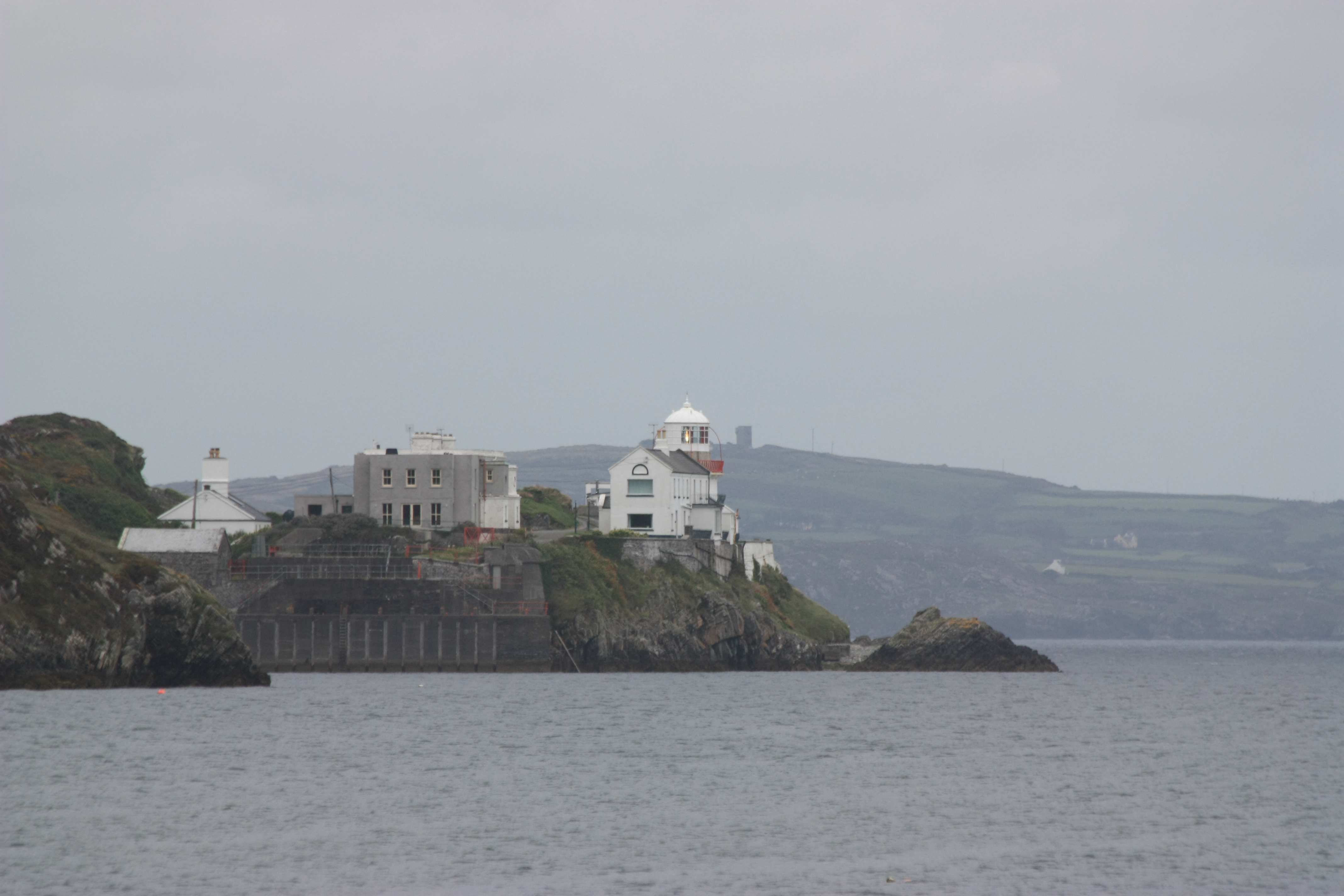
Coordinates: 51°27′47″N 9°43′13″W / 51.463°N 9.7202°WCoordinates: 51°27′47″N 9°43′13″W / 51.463°N 9.7202°W Country Ireland Province Munster County County Cork Area - Town 2.57 km2 (1 sq mi) Elevation 11 m (36 ft) Population (2006) - Urban 240 Time zone WET (UTC+0) - Summer (DST) IST (WEST) (UTC-1) Irish Grid Reference V805255 Website crookhaven.ie  Crookhaven lighthouse
Crookhaven (Irish: An Cruachán) is a village in County Cork, Ireland, on the most southwestern tip of Ireland. A winter population of about forty swells in the summer to about four hundred with the occupants of the many holiday homes arriving.
Contents
History
The village was an important port of call for shipping between Europe and the United States, and many inhabitants were in the business of supplying the ships as they sheltered in Crookhaven after or before a long voyage. In 1959 Crookhaven was the subject of a film by English film maker James Clarke in his film Irish Village. At that time the film records the population of the town and local farms as being 69.
Crookhaven was one location where Guglielmo Marconi did a lot of experiments with his interest in wireless communication and his experiments in ship-to-shore communication. In fact, most of his work was done between the Fastnet lighthouse, Crookhaven, and Cape Clear Island, since they were so closely connected. This was a great location for him because there was a telegraph line connecting Crookhaven and Cape Clear Island, which was located eighty miles away. Marconi did work here from 1901 until 1914, when he sold the rights. The station was ultimately destroyed in 1922. [1].
Amenities
The village has three pubs. O'Sullivans faces the harbour and its walls are adorned with historical pictures of the village and notes about the area.
Nottages (or The Welcome Inn) is only open during the summer. The pub was once owned by a Mr Nottage - an English gentleman who came to the village to work at the Marconi signal station.
The last pub is The Crookhaven Inn. The pub building today was once the bottle store for the larger pub and hotel located across the road. When the original building was converted to flats, the bottle store was converted.
The village also has a shop and post office located next to O'Sullivans.
Places of interest
The road to the village comes from Goleen and curves around the harbour. As one drives from Goleen, one passes a road to the left leading onto Rock Island. Originally this was the site of a coast guard station - which replaced an earlier station to its south. The "new" station was occupied from 1907 until 1921. During the height of the War of Independence, British Marines were stationed there to protect the station and Brow Head War Signal Station. During their occupation, the I.R.A. destroyed Brow Head. Also on Rock Island was a fishery plant. From here most of the shellfish of Ireland was exported to Europe. The ponds were open until the late 1970s, then it became a food processing plant packaging garlic butter and mussels but is now derelict.
Transport & communications
The village is located in south-western Ireland, 132 kilometres (82 mi) from Cork and 383 kilometres (238 mi) from Dublin. The nearest airport to Crookhaven is Cork Airport, and closest regional road is the R591.
See also
References
- ^ Sexton, Michael. Marconi The Irish Connection. Portland: Four Courts Press, 2005. Print.
External links
- Mizen Head Signal Station
- Irish Village Film details
- 360' Panorama of the harbour area
- Crookhaven Harbour Sailing Club
Irish lighthouses Lighthouses are shown in anti-clockwise sequence beginning from the north and proceeding west, south, east, and back to north. County Donegal Inishowen · Inishtrahull · Fanad · Dunree · Buncrana · Tory Island · Arranmore · Ballagh Rocks · Rathlin O'Birne · Rotten Island · St. John's

County Sligo Blackrock · Lower Rosses Point · Metal Man · Oyster Island
County Mayo Broadhaven · Eagle Island · Blackrock · Blacksod Bay · Achillbeg · Inishgort
County Galway Slyne Head Cashla Bay · Eeragh · Straw Island · Inisheer
County Clare Blackhead · Loop Head · Kilcredaun Head · Corlis Point Front · Corlis Point Rear · Scattery Island
County Kerry Little Samphire Island · Inishtearaght · Cromwell Point · Valentia Rear · Valentia Front · Skelligs
County Cork Bull Rock · Ardnakinna · Castletown Directional Light · Roancarrig · Sheep's Head · Mizen Head · Crookhaven · Copper Point · Fastnet Rock · Baltimore Beacon · Galley Head · Old Head of Kinsale · Charlesfort · Roches Point · Ballycotton · Youghal
County Waterford Mine Head · Ballinacourty Point · Dunmore East
County Wexford County Wicklow County Dublin Muglins · Poolbeg · Kish Bank · Baily · Howth Head · Rockabill
County Louth County Down Green Island · Vidal Bank · Haulbowline · St. John's Point · ` Angus Rock · Donaghadee · Mew Island
County Antrim Blackhead · Chaine Tower · The Maidens · Rathlin East · Rue Point · Rathlin West
List of lighthouses in Ireland · Lightvessels in Ireland · Commissioners of Irish Lights · Category:Lighthouses in Ireland · List of islands of Ireland · Coastal landforms of Ireland Categories:- Untranslated Irish place names
- Towns and villages in County Cork
- Visitor attractions in County Cork

Wikimedia Foundation. 2010.