- Dadaab
-
Dadaab Street scene in downtown Dadaab. Location in Kenya
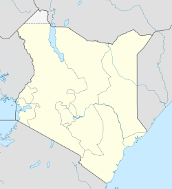
 Dadaab
Coordinates: 0°03′04″N 40°18′50″E / 0.051°N 40.314°ECoordinates: 0°03′04″N 40°18′50″E / 0.051°N 40.314°E Country Kenya Province North Eastern Province Time zone EAT (UTC+3) Dadaab is a semi-arid town in the North Eastern Province in Kenya. As of 2011, it hosts what is often described as the largest refugee camp in the world.[1][2]
Contents
Overview
General
Dadaab is located approximately 100 kilometers from the Kenya-Somalia border. Until recently, the local population traditionally consisted of nomadic Somali camel and goat herders. The nearest major town is Garissa, which is the headquarters of the North Eastern Province.
UNHCR base
Dadaab features a UNHCR base that serves refugee camps around the town: Hagadera, Ifo and Dagahaley. The international humanitarian organization CARE is UNHCR's lead implementing partner responsible for managing the camp. Much of the town's economy is based on services for refugees.
 Humanitarian and relief supplies delivered by a Combined Joint Task Force - Horn of Africa airplane at the UNHCR base in Dadaab.
Dadaab hosts people that have fled various conflicts in the larger Eastern Africa region. Most have come as a consequence of the civil war in southern Somalia, including both Somalis and members of Somalia's various ethnic minority groups such as the Bantu.[3] Most of the latter have migrated from the southern Juba River valley and the Gedo region, while the remainder have arrived from Kismayo, Mogadishu and Bardera. In 1999, the United States classified the Bantu refugees from Somalia as a priority and the United States Department of State first began what has been described as the most ambitious resettlement plan ever from Africa, with thousands of Bantus in Dadaab scheduled for resettlement in America.[4]
The camps cover a total area of 50 square km and are within an 18 km radius of Dadaab town. In December 2006, the Kenyan government closed its border to refugees, a move that sharply reduced the number of new arrivals to the UNHCR base. However, the region suffered a severe drought in 2011, causing a dramatic surge in the camps' population.[5] In July 2011 it was reported that more than 1000 people per day were arriving in dire need of assistance.[2] The influx has placed great strain on the camps' resources: The capacity of the camps is about 90,000, but they were host to over 465,000 refugees as of July 2011,[6][7][8][1] a number that is expected to increase to 500,000 by the end of 2011 according to estimates from Médecins Sans Frontières. These population figures rank Dadaab as the largest refugee camp in the world.[1]
 An outdoor school at the UNHCR base in Dadaab.
Full recovery from the drought's effects is not expected until 2012, with long-term strategies by national governments in conjunction with development agencies believed to offer the most sustainable results.[9]
Dadaab is also a division in the Garissa District, which suffered a severe drought for almost four years. The drought killed approximately 50 percent of the local livestock, creating a major economic strain on the region. Given its arid, desert location, the long term settlement of refugees has severely impacted the landscape, as fuel and building materials are in constant demand.[10]
In 2006, flooding severely affected the region. More than 2,000 homes in the Ifo refugee camp were destroyed, forcing the relocation of more than 10,000 refugees. The sole access road to the camp and to the town was also cut off by the floods, effectively cutting off the town and refugee camps from essential supplies. Humantiarian agencies present in the area are currently working together to bring these vital goods to the area. As of 2007, the Norwegian Refugee Council has been working to improve the housing and planning of Dadaab, with the construction of a new camp using Sphere Humanitarian Standards.[11][12] However various obstacles, such as Kenyan policy and the continued influx of refugees from Somalia, restricts viable shelter and urban planning opportunities for long term planning and development.[13]
See also
Liboi - a town in the North Eastern Province located 75 kilometres east of Dadaab.
Notes
- ^ a b c Dadaab: The World's Biggest Refugee Camp Al-Jazeera, 11 July 2011.
- ^ a b Inside world's biggest refugee camp Al-Jazeera, 8 July 2011.
- ^ Refugee Reports November 2002 Volume 23, Number 8
- ^ Out of Africa: Somali Bantu and the Paradigm Shift in Refugee Resettlement
- ^ Plea for 'massive aid' for Africa refugees Al-Jazeera, 10 July 2011.
- ^ http://www.unhcr.se/fi/media/artikel/68f4298e87bfe9fa64408b4c8d05ad18/un-high-commissioner-for-refugees-ap-1.html
- ^ "U.N. flies aid to terrorist-controlled Somalia". CBS News. http://www.cbsnews.com/stories/2011/07/16/501364/main20080122.shtml.
- ^ World's biggest refugee camp extended as Somalis flood in, Reuters, 28 July 2011.
- ^ "The worst drought in 60 years in Horn Africa". Africa and Europe in Partnership. http://www.africa-eu-partnership.org/node/2158. Retrieved 2 August 2011.
- ^ Sipus 2008
- ^ Norwegian Refugee Council
- ^ Sphere Humanitarian Standards
- ^ Sipus 2010
External links
Categories:- Populated places in the North Eastern Province of Kenya
- Refugee camps in Kenya


Wikimedia Foundation. 2010.