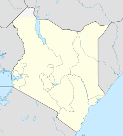
Namanga — 1 Original name in latin Namanga Name in other language Namanga State code KE Continent/City Africa/Nairobi longitude 2.54327 latitude 36.79053 altitude 1307 Population 13193 Date 2012 01 17 2 Original name in latin Namanga Name in other language … Cities with a population over 1000 database
Namanga (Tanzanian ward) — Namanga is an administrative ward in the Monduli district of the Arusha Region of Tanzania. According to the 2002 census, the ward has a total population of 10,904.[1] References ^ 2002 Population and Housing Census General Report (in en).… … Wikipedia
Ol Doinyo Orok / Namanga Hills — Infobox Mountain Name = Namanga Hills (official name) Photo = oldoinyoorokint.jpg Elevation = convert|2548|m|ft|0|lk=on Location = KenyaThe Ol Doinyo Orok mountain (in kimaasai), also called Namanga Hills, is situated in southern Kenya next to… … Wikipedia
Ol Doinyo Orok — Namanga Hills (official name) Elevation 2,548 m (8,360 ft) … Wikipedia
Namangan — Namangạn, Gebietshauptstadt in Usbekistan, im Ferganabecken am Nördlichen Ferganakanal, 319 200 Einwohner; Universität, Hochschule für Industriewesen und Technologie; Baumwollentkernung, Naturseidenweberei, Bekleidungs , Chemiefaser ,… … Universal-Lexikon
Nairobi — City Nairobi s skyline at dusk … Wikipedia
Kajiado District — Basisdaten Einwohner Bevölkerungsdichte 640.593 Einw. 29 Einw./km² Fläche 21.903 km² Koordinaten … Deutsch Wikipedia
Transport in Tanzania — is mainly road transport, supplemented by rail. Tanzania s road network, however, is of limited quality and especially the tarmac roads are few. Dirt roads often turn unpassable in rainy seasons and can halt traffic for days on end or even weeks … Wikipedia
Mombasa — Mvita redirects here. For the electoral constituency, see Mvita Constituency. Island of War redirects here. For the television series, see Island at War. For the asteroid, see 1428 Mombasa. Mombasa City … Wikipedia
List of cities in Kenya — This is a list of cities and towns in Kenya:*Baragoi *Bungoma *Busia *Dadaab *Diani Beach *Eldoret *Embu *Garissa *Gede *Hola *Homa Bay *Isiolo *Kajiado *Kakamega *Kakuma *Kapenguria *Kericho *Kiambu *Kilifi *Kisii *Kisumu *Kitale *Langata… … Wikipedia


