- Connewarre, Victoria
-
Connewarre
Victoria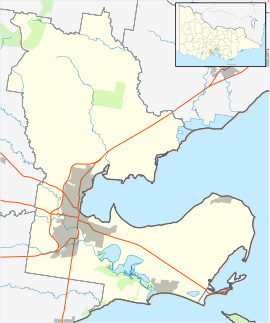
 Connewarre
Population: 78 (2006)[1] Postcode: 3227 Location: LGA: State District: South Barwon Federal Division: Corangamite Connewarre, Victoria, Australia, is located in southern Australia in an area that is sparsely populated. At the 2006 census, Connewarre and the surrounding area had a population of 78.
Part of the locality, mainly lying to the west of Barwon Heads Road, is within the large Armstrong Creek Growth Area with urban development beginning in 2010.
Places near Connewarre include Ant Spit, Breamlea and Lake Connewarre; towns nearest Connewarre are Torquay to the west and Barwon Heads to the east.
History
The Post Office opened on 9 September 1860 and closed in 1967. An earlier Connewarre office was renamed Mount Duneed. [2]
References
- ^ Australian Bureau of Statistics (25 October 2007). "Connewarre (State Suburb)". 2006 Census QuickStats. http://www.censusdata.abs.gov.au/ABSNavigation/prenav/LocationSearch?collection=Census&period=2006&areacode=SSC25389&producttype=QuickStats&breadcrumb=PL&action=401. Retrieved 2007-10-01.
- ^ Premier Postal History, Post Office List, https://www.premierpostal.com/cgi-bin/wsProd.sh/Viewpocdwrapper.p?SortBy=VIC&country=, retrieved 2008-04-11
Towns in Surf Coast Shire Aireys Inlet • Anglesea • Bellbrae • Bells Beach • Connewarre • Deans Marsh • Gherang • Jan Juc • Lorne • Moriac • Torquay • Wensleydale • Winchelsea
 Suburbs and localities of GeelongArmstrong Creek Growth Area • Bell Park • Bell Post Hill • Belmont • Breakwater • Corio • Drumcondra • East Geelong • Fyansford • Geelong City • Geelong West • Grovedale • Hamlyn Heights • Herne Hill • Highton • Lara • Leopold • Lovely Banks • Manifold Heights • Marshall • Moolap • Mount Duneed • Newcomb • Newtown • Norlane • North Geelong • North Shore • Rippleside • Rosewall • St Albans Park • South Geelong • Thomson • Wandana Heights • Waurn Ponds • WhittingtonAnakie • Avalon • Balliang • Barwon Heads • Batesford • Breamlea • Ceres • Clifton Springs • Connewarre • Curlewis • Drysdale • Indented Head • Little River • Mannerim • Marcus Hill • Moorabool • Ocean Grove • Point Wilson • Portarlington • Staughton Vale • St Leonards • Swan Bay • WallingtonCategories:
- Towns in Victoria (Australia)
- Victoria (Australia) geography stubs

Wikimedia Foundation. 2010.