- Columbia, Pennsylvania
-
Borough of Columbia Borough 
Country United States State Pennsylvania County Lancaster Elevation 361 ft (110 m) Coordinates 40°01′59″N 76°29′48″W / 40.03306°N 76.49667°W Area 2.7 sq mi (7 km2) - land 2.4 sq mi (6 km2) - water 0.3 sq mi (1 km2), 11.11% Population 10,400 (2010) Density 4,227.8 / sq mi (1,632.4 / km2) Timezone EST (UTC-5) - summer (DST) EDT (UTC-4) ZIP code 17512 Area code 717 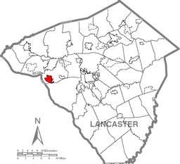 Location of Columbia in Lancaster County
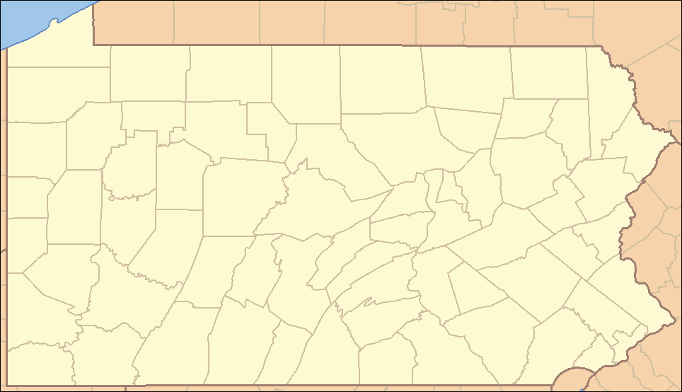
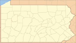
 Location of Columbia in Pennsylvania
 Location of Pennsylvania in the United States
Website: http://www.columbiapa.net Columbia, once colonial Wright's Ferry, is a borough in Lancaster County, Pennsylvania, 28 miles (45 km) southeast of Harrisburg on the left (east) bank Susquehanna River across from Wrightsville and York County. Originally, the area may have been called Conejohela Flats, for the many islands and islets in the nearby river. The settlement was founded in 1726 by Colonial English Quakers from Chester County led by John Wright who had been visiting the region evangelizing among the natives since 1724, many of whom gradually adopted Christianity. The settlement, which began with three families, grew slowly until Wright established the first ferry across the Susquehanna, "Wright's Ferry" in 1730—enabling a vast increase in traffic to the west (right) bank—and giving a name to the community which then began to rapidly grow into a town, with its employment specialized around water craft exploitation and standard fundamental colonial cottage industries.
Population counts were these: in 1890, 10,199; in 1900, 12,316; in 1910, 11,454; in 1920, 10,836; in 1940, 11,547; in 2000, 10,311; and 10,400 in the 2010 census.[1]Contents
General information
- ZIP code: 17512
- Area code: 717
- Schools: Taylor Elementary School, Park Elementary School, Our Lady of The Angels and Columbia Jr./Sr. High School
Geography
Columbia is located at 40°1′59″N 76°29′48″W / 40.03306°N 76.49667°W (40.033197, -76.496802)[2].
Columbia is located immediately east of the Susquehanna River. It is just south of U.S. Route 30.
According to the United States Census Bureau, the borough has a total area of 2.7 square miles (7.0 km2), of which, 2.4 square miles (6.2 km2) of it is land and 0.2 square miles (0.52 km2) of it (8.61%) is water.
Demographics
As of the census[3] of 2000, there were 10,311 people, 4,287 households, and 2,589 families residing in the borough. The population density was 4,227.8 people per square mile (1,631.6/km²). There were 4,595 housing units at an average density of 1,884.1 per square mile (727.1/km²). The racial makeup of the borough was 91.34% White, 4.42% Black or African American, 0.18% Native American, 0.41% Asian, 0.05% Pacific Islander, 1.70% from other races, and 1.90% from two or more races. 4.49% of the population were Hispanic or Latino of any race.
There were 4,287 households out of which 28.3% had children under the age of 18 living with them, 41.5% were married couples living together, 19.2% had a female householder with no husband present, and 39.6% were non-families. 33.7% of all households were made up of individuals and 16.6% had someone living alone who was 65 years of age or older. The average household size was 2.35 and the average family size was 3.01.
In the borough the population was spread out with 24.3% under the age of 18, 8.7% from 18 to 24, 29.2% from 25 to 44, 20.5% from 45 to 64, and 17.2% who were 65 years of age or older. The median age was 37 years. For every 100 females there were 89.3 males. For every 100 females age 18 and over, there were 85.5 males.
The median income for a household in the borough was $32,385, and the median income for a family was $26,309. Males had a median income of $27,528 versus $22,748 for females. The per capita income for the borough was $14,626. About 11.5% of families and 11.9% of the population were below the poverty line, including 18.3% of those under age 18 and 10.6% of those age 65 or over.
Schools
Schools in columbia are part of the Columbia borough school district.
Elementary
Middle/High
History
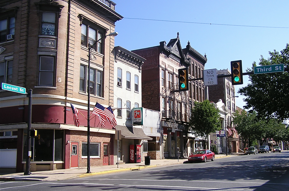
 Downtown Columbia.
18th century
Early history
The area in and around Columbia was originally populated by Native American tribes, most notably, the Susquehannocks. The Susquehannocks had migrated to the area around 1575 to 1600, after separating from the Iroquois, a federation including the Mohawk, Oneida, Cayuga, Seneca, and Onondaga tribes. The word Susquehannock derives from “Sasquesahanough,” and was used to describe the tribe by Captain John Smith. Smith’s Algonquin interpreter first used the term, which means “People at the Falls” or “People of the Muddy River.” The Susquehannocks established villages just south of Columbia in what is now known as Washington Boro, as well as points as far south as modern day Maryland. Smith estimated their numbers to be about 2,000 at the time.
Wright's Ferry
In 1724, John Wright, an English Quaker, traveled to the area (then a part of Chester County) to explore the land and proselytize to a Native American tribe, the Shawnee, who had established a settlement along a creek known as Shawnee Creek, which is still called that today. Wright built a log cabin near there on part of a tract of land first granted to George Beale by William Penn in 1699, and stayed for more than a year. The area was known as Shawanatown.
When Wright returned in 1726 with Robert Barber and Samuel Blunston, he and the others began developing the area, with Wright building a house about a hundred yards from the edge of the Susquehanna River, in the area of South Second and Union Streets. This structure eventually became home to the Wright family, including sons John Jr. and James. Daughter Susanna, born in England in 1697, arrived in the area in 1718, and later moved to the family residence to help take care of her brothers and sisters after her mother died.
Robert Barber constructed a saw mill in 1727 and years later built a home near the river, on the Washington Boro Pike, along what is now Route 441. The home still stands across from the Columbia Wastewater Treatment Plant and is the second oldest in the borough, after the Wright’s Ferry Mansion.
Samuel Blunston constructed a mansion, which he named Bellmont, atop the hill next to North Second Street, near Chestnut Street, at the location of the present-day Rotary Park Playground. Upon his death, Blunston willed the mansion to Susanna Wright, who had become a close friend. She lived there, occasionally visiting brother James, ministering to the Native Americans, and raising silk worms for the local silk industry, until her death in 1784 at the age of 87. The residence was demolished in the late 1920s to allow for construction of the Veterans’ Memorial Bridge.
In 1730, John Wright was granted a patent to operate a ferry across the Susquehanna River and subsequently established the ferry, known as Wright's Ferry, with Barber and Blunston. He also built a ferry house and a tavern on the eastern shore, north of Locust Street, on Front Street. The two-story log tavern, operated by John Wright, Jr. until 1834, consisted of a large room on either end connected by a passageway. When John Jr. married, he moved to York County’s western shore, in what became Wrightsville, and built a ferry house and tavern. The ferry itself consisted of two dugout canoes fastened together with carriage and wagon wheels. When numerous cattle were moved, the canoeist guided a lead animal with a rope so that the others would follow. If the lead animal became confused and started swimming in circles, however, the other animals followed until they tired and eventually drowned.
Traffic heading west from Lancaster, Philadelphia, and other nearby towns regularly traveled through Columbia, using the ferry to cross the Susquehanna. As traffic flow increased, the ferry grew, to the point of including canoes, rafts, flatboats, and steamboats, and was capable of handling Conestoga Wagons and other large vehicles. Due to the volume of traffic, however, wagons, freight, supplies and people often became backed up, creating a waiting period of several days to cross the river. With 150 to 200 vehicles lined up on the Columbia side, ferrymen used chalk to number the wagons. Typical fares were as follows: Coach with four passengers and drawn by five horses-9 shillings; 4-horse wagon - 3 shillings and 9 pence; Man and horse - 6 pence. Fares were reduced in 1787 due to competition from Anderson's Ferry, located further upstream, near Marietta. Wright’s Ferry was located immediately south of the Veterans Memorial Bridge along Route 462. In later years, Wright rented the ferry to others and eventually sold it.
In 1729, after Wright had petitioned William Penn’s son to create a new county, the provincial government took land from Chester County to establish Lancaster County, the fourth county in Pennsylvania. County residents - Indians and colonists alike - regularly traveled to Wright’s home to file papers and claims, seek government assistance and redress of issues, and register land deeds. During this time, the town was called “Wright’s Ferry.”
In 1738, James Wright built the Wright’s Ferry Mansion, the oldest existing house in Columbia, for his family. The structure can still be seen at Second and Cherry Streets.
Columbia
Samuel Wright, son of James and Rhoda Wright, was born on May 12, 1754. He eventually became the town proprietor and created a public grounds company to administer the land. Through his trusteeship, the town’s first water distribution system (later The Columbia Water Company) was established and created, as well as “The Washington Institute,” the town’s first school of higher learning, and the Locust Street Park, located next to what is now Locust Street and Route 462.
In the spring of 1788 Samuel Wright had the area surveyed, and formally laid out the town into 160 building lots, which were chanced off by lottery at 15 shillings per ticket. "Adventurers" as purchasers were known, included speculators from many areas of the country. Wright and town citizens renamed the town “Columbia” in honor of Christopher Columbus in the hope of influencing the U.S. Congress to select it as the nation’s capital, a plan George Washington favored.[4] A formal proposal to do so was made in 1789. Unfortunately for the town, when Congress voted in 1790, the final tally was one vote short. Later, Columbia narrowly missed becoming the capital of Pennsylvania. Harrisburg was chosen instead, since it is closer to the state’s geographical center. The third strikeout was despite its competitive location in regards to transportation, coal, and steel, resources, Columbia narrowly lost out to Detroit during the selection process for a center for the new automotive industry.
19th century
English Anglicans, Scots-Irish Presbyterians, freed African slaves, German Lutherans, and descendants of French Huguenots came to outnumber the first Quaker settlers within a generation.
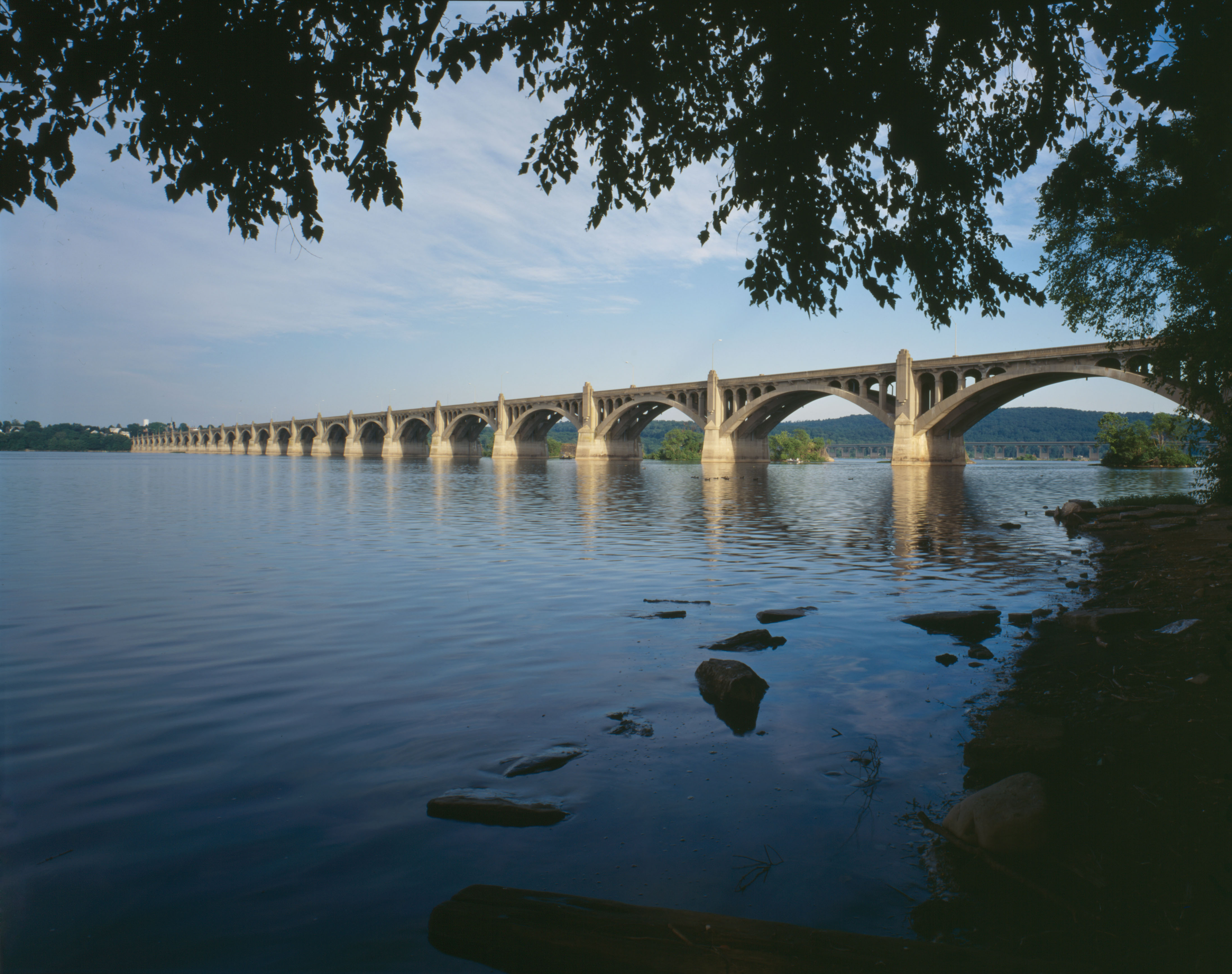
Columbia became an incorporated borough In 1814, formed out of Hempfield Township. The same year, the world's longest covered bridge was built and crossed the Susquehanna to Wrightsville, facilitating traffic flow across the river and reducing the need for the ferry. The bridge was 5,690 feet (1,730 m) long and 30 feet (9.1 m) wide, and had 54 stone piers. After handling traffic across the Susquehanna for 18 years, it was destroyed by high water, ice, and severe weather in the winter of 1832. A replacement covered bridge was built within two years.
In February 1826, the Pennsylvania state legislature approved $300,000 for constructing a canal along the Susquehanna’s eastern shore to bypass rapids and shallows and make the river navigable anywhere along its route. Begun in 1832, the Pennsylvania Canal went into operation in 1833. It started at Columbia, stretching 40 miles (64 km) north to the junction of the Juniata River. Travelers at Columbia could use the canal system to go west to Pittsburgh, Lake Erie, Ohio and West Virginia, north into New York State and east to Philadelphia. Canal boats could often be seen at the Bruner coal wharf, which was operated by H.F. Bruner & Sons at North Front and Bridge Streets. The original plan of the canal had been to extend it south from Columbia on the east side of the river, but local property owners objected. Instead, a two-tiered towpath was constructed along the south side of the bridge for transporting boats across the river using teams of horses and mules walking on the towpath. The boats would then link with the Susquehanna and Tidewater Canal, along the western shore at Wrightsville. This part of the canal system, which afforded passage to Baltimore or to the Chesapeake and Delaware Canal, opened in 1840. Several years later, a small dam was constructed across the river to form a pool that allowed steam boats to tow the canal boats.
Canals could not be used in winter due to ice and floods, and in spring were often found to have been damaged. Such weather conditions as well as an increase in railroad traffic led to the decline of the canals, causing the Columbia Canal to close in 1901.
During this time, Columbia also became a stopping-off site on the Underground Railroad. Slaves seeking freedom were transported across the Susquehanna and often fed and given supplies on their way north to other states and Canada. To slave hunters from the South, the slaves simply disappeared, leading one hunter to declare that there “must be an underground railroad here.”[5]
1834 saw the completion of another bridge spanning the river. Built by James Moore and John Evans at a cost of $157,300, this bridge, too, enjoyed the distinction of being the world’s longest covered bridge. This year also saw construction of the first railway line linking Columbia and Philadelphia, which subsequently became part of the Pennsylvania Railroad. Named the Philadelphia and Columbia Railroad it was officially opened in October, 1834.
By 1852 regular rail transportation from Columbia to Baltimore, Philadelphia, Pittsburgh, and Harrisburg made the town the commercial center for the area halfway between the county seats of Lancaster and York.
Columbia's role in the Civil War
In early 1863, a number of local black citizens enlisted in the 54th Massachusetts Infantry, a regiment composed of black soldiers serving under white officers. The unit achieved fame in an assault on Fort Wagner in South Carolina. Stephen Swails, one of its members, may have been the first African-American officer commissioned during the Civil War. Other local citizens fought in various regiments of the United States Colored Troops. Some of these veterans are buried in a cemetery located near Fifth Street.
On June 28, 1863, during the Gettysburg Campaign, the replacement covered bridge was burned by Columbia residents and the Pennsylvania state militia to prevent Confederate soldiers of the Army of Northern Virginia from entering Lancaster County. Lee had hoped to invade Harrisburg from the rear and move eastward to Lancaster and Philadelphia, and in the process destroy railroad yards and other facilities. Under General Jubal A. Early’s command and following Lee’s orders, General John B. Gordon was to place Lancaster and the surrounding farming area “under contribution” for the Confederate Army’s war supplies and to attack Harrisburg from the east side of the river while another portion of Lee’s army advanced from the west side. General Early was given orders to burn the bridge but hoped instead to capture it, while Union forces under the command of Colonel Jacob G. Frick and Major Granville O. Haller, hoping to save the bridge, were forced to burn it.
With the Union Army of the Potomac hastening northward into Maryland and Pennsylvania, Robert E. Lee ordered his widely scattered forces to withdraw to Heidlersburg and Cashtown (not far from Gettysburg) to rendezvous with other contingents of the Confederate Army. The burning of the Columbia-Wrightsville Bridge thwarted one of Lee's goals for the invasion of Pennsylvania, and General Gordon later claimed the skirmish at Wrightsville reinforced the Confederate belief that the only defensive forces on hand were inefficient local militia, an attitude that carried over to the first day of the Battle of Gettysburg.
Owners of the bridge petitioned congress repeatedly for reimbursement well into the 1960s, but were denied payment.
After the war
After the bridge burning, a tugboat, Columbia, was used to tow the canal boat across the river. In 1868, yet another replacement covered bridge was built, but was destroyed by a hurricane in 1896.
The next bridge, the Pennsylvania Railroad Bridge, was an open-air bridge constructed of steel, and carried the tracks of the Pennsylvania Railroad and a two-lane roadway for cars. It was dismantled for scrap by November 1964. Its stone piers, which supported the Civil War era bridge, can still be seen today, running parallel to the Veterans’ Memorial Bridge on Route 462. The piers have become the site of present-day “Flames Across the Susquehanna” bridge-burning reenactments sponsored by Rivertownes PA USA.
By the mid-19th century Columbia had become a busy transportation hub with its ferry, bridge, canal, railroad and wharves. It was a major transshipment point for lumber, coal, grain, pig iron, and people. Important industries of the time included warehousing, tobacco processing, iron production, clock making and boat building. some of the local industries were the Ashley & Baily Silk Mill, The Columbia Lace Mill, and H.F. Bruner & Sons.
Trolley service for the borough and the surrounding area was established in 1893, allowing Columbians to take advantage of economic opportunities in Lancaster and other surrounding towns. Between 1830 and 1900, the Borough’s population increased from 2,046 to 12,316.
From about 1854 to 1900 an industrial complex existed in and around Columbia, Marietta and Wrightsville that included 11 anthracite iron furnaces and related structures, as well as canal and railroad facilities servicing them. By 1887, that number had grown to 13 blast furnaces operating within a three-mile (5 km) radius of Columbia. The furnaces, which produced pig iron, exemplified the technology of the day through their use of anthracite coal and hot blast for smelting iron ores, a process that dominated the iron industry briefly before the widespread use of coke as a fuel. Since northeastern Pennsylvania could supply a rich source of anthracite coal to areas which had none, anthracite-fired furnaces, using locally available iron ores, were built throughout eastern Pennsylvania, helping make the state a leader in iron production in the latter half of the 19th century. Lancaster County also became a leader in pig iron production during this time, with the complex of furnaces in the river towns contributing significantly to its output.
In 1875, a new three-story grand town hall was opened, featuring a second-floor auditorium that seated over 900 and was used as an opera house. The second floor's ceiling was higher than those of the first and third floors, and each level contained 60 windows. The building also included office shops, council chambers, storerooms and market stalls. A 140-foot (43 m)-high bell tower, holding the town clock, crowned the building. The clock was visible from all over the borough, and its bell was audible throughout the surrounding countryside. The building was destroyed by fire in December 1947, but was rebuilt as a one-story municipal building that exists today.
20th century
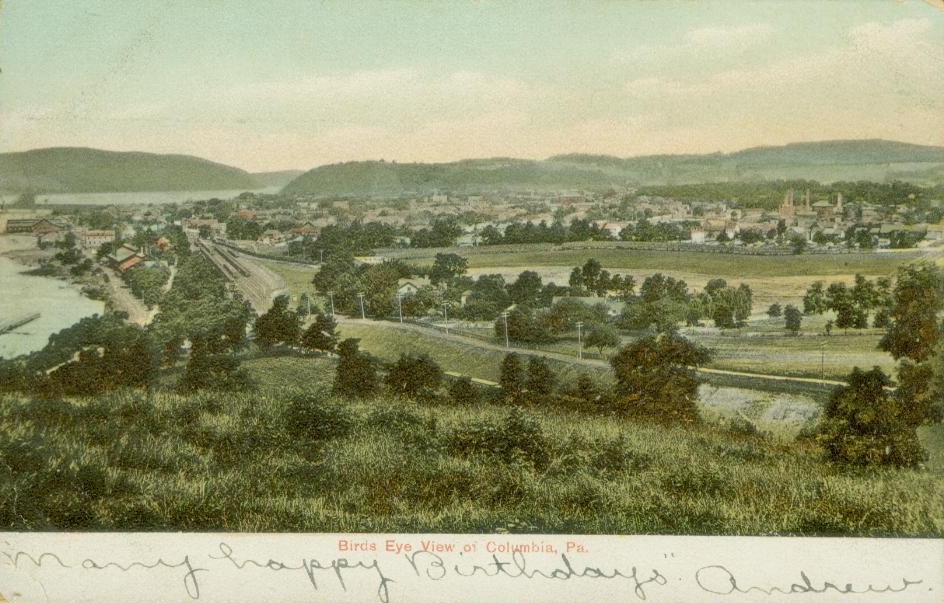
 Columbia, about 1905
By 1900, the town’s population had grown to over 12,000, with a 50% increase from 1880 to 1900. Some of the items produced by its industries were silk goods, lace, pipe, laundry machinery, stoves, iron toys, flour, lumber, and wagons. By this time Wright’s Ferry had ceased its operations, having been supplanted by rail and bridge traffic.
For over half a century, Columbia has been home to the headquarters of the National Association of Watch and Clock Collectors (NAWCC), whose campus on Poplar Street includes a clocktower, museum, library, and "School of Horology," for training professional clock and watch repairers.
In 1930, another bridge, the Veterans Memorial Bridge, was opened to facilitate traffic flow across the Susquehanna. It first opened as a toll bridge, and to avoid the toll, in coldest winter months some daring motorists would cross on the firmly frozen river.
Also in the 1930s, many of Columbia's brick walkways were replaced with concrete sidewalks by D.K. Lockard, and H.T. Peters of Mountville, whose bronze plaques can still be seen today embedded in the sidewalks.
Some of the original schools in Columbia were the Washington Institute, Manor Street School, Cherry Street School, Poplar Street School, and Taylor School. Today's schools are Park Elementary, Taylor Elementary, Holy Trinity Elementary, Our Lady of the Angels Elementary, and the Columbia High School.
The start of the 20th century brought economic challenge to Columbia as local industries declined. The lumber industry eventually disappeared as surrounding woodlands became depleted. With the depletion of Chestnut Hill iron ores, the iron furnaces shut down. Eventually steel rolling mills also ceased operation. In 1906, the Pennsylvania Railroad opened a new facility in Enola across the river from Harrisburg which decreased the work force of Columbia’s railroad. By 1920, the population had dropped over 10% to 10,836.
The Great Depression accelerated Columbia’s economic decline. The Pennsylvania Railroad’s service to the north and the south was eliminated. WW II brought increased employment, but did not bring long-term prosperity to the borough.
The 1960 population had returned to the 1900 levels, and in 1965 a detailed study of Columbia’s basic strengths and weaknesses was prepared. Although some of the reports findings were implemented, most were not. The Wright's Ferry Bridge was opened in 1972, but only served to divert traffic around Columbia. The growth and prosperity experienced in many surrounding Lancaster County towns bypassed Columbia for the remainder of the 20th Century.
Notable people
- Stephen Atkins Swails, soldier and politician
Museums and historic sites
- The National Watch and Clock Museum
- The National Watch and Clock Library and Research Center
- Wright's Ferry Mansion
- First National Bank Museum
- The Columbia Historic Preservation Society
- Columbia Market House
See also
- Battle of Gettysburg
- Continental Congress
- Covered bridge
- Lancaster County, Pennsylvania
- Main Line of Public Works
- National Watch and Clock Museum
- Pennsylvania
- Pennsylvania Canal
- Pennsylvania Railroad
- Petroglyph
- Susquehanna River
- Three Mile Island Nuclear Generating Station
- Underground Railroad
- York County, Pennsylvania
References
- Columbia, the Gem, Bill Kloidt, Sr. 1994, Miffilin Press, Inc.
- East of Gettysburg, A Gray Shadow Crosses York County, PA, James McClure. 2003, York Daily Record/York County Heritage Trust. ISBN 0-9710416-4-4.
- Fire on the River, The Defense of the World’s Longest Covered Bridge and How It Changed the Battle of Gettysburg, George Sheldon. 2006, Quaker Hills Press, Inc. ISBN 0-9779315-0-1, ISBN 978-0-9779315-0-7.
- The Susquehanna, Carl Carmer. 1955, Rinehart & Company, Inc. Library of Congress catalog Card No.: 53-8227.
- Town Historical Markers and Plaques provided by Columbia Borough and Rivertownes PA USA.
Notes
- ^ http://2010.census.gov/2010census/popmap/. Accessed 2011-10-04
- ^ "US Gazetteer files: 2010, 2000, and 1990". United States Census Bureau. 2011-02-12. http://www.census.gov/geo/www/gazetteer/gazette.html. Retrieved 2011-04-23.
- ^ "American FactFinder". United States Census Bureau. http://factfinder.census.gov. Retrieved 2008-01-31.
- ^ Sheldon, 2006, p. 38.
- ^ Sheldon, 2006, p.53.
External links
- Borough of Columbia
- http://www.columbiapaonline.com/
- Columbia Historic Preservation Society
- http://www.rivertownes.org/townes.htm
- http://www.civilwaralbum.com/misc6/columbia_wrightsville_bridge1.htm
- PHMC on underground railway
- http://columbiapa17512.blogspot.com/
- http://columbianewsandviews.com/
- http://barry-ford.blogspot.com/
 Commonwealth of Pennsylvania
Topics - Cities
- Politics
- Government
- Delegations
- History
- Geography
- Geology
- Pennsylvanians
- State parks
- Symbols
- Visitor attractions
Metro areas Cities Largest
municipalities- Baldwin
- Berwick
- Bethel Park
- Brentwood
- Carlisle
- Chambersburg
- Columbia
- Darby
- Dunmore
- Elizabethtown
- Emmaus
- Ephrata
- Franklin Park
- Hanover
- Indiana
- Kingston
- Lansdale
- Lansdowne
- Monroeville
- Munhall
- Murrysville
- Norristown
- Penn Hills
- Phoenixville
- Plum
- Pottstown
- State College
- West Chester
- West Mifflin
- Whitehall
- Wilkinsburg
- Wyomissing
- Yeadon
Regions - Allegheny Mountains
- Allegheny National Forest
- Allegheny Plateau
- Atlantic Coastal Plain
- Blue Ridge
- Coal Region
- Cumberland Valley
- Delaware Valley
- Dutch Country
- Endless Mountains
- Happy Valley
- Laurel Highlands
- Lehigh Valley
- Main Line
- Northeast
- Northern Tier
- Northwestern
- Oil Region
- Pennsylvania Highlands
- Piedmont
- The Poconos
- Ridge and Valley
- South Central
- Susquehanna Valley
- Western
- Wyoming Valley
Counties - Adams
- Allegheny
- Armstrong
- Beaver
- Bedford
- Berks
- Blair
- Bradford
- Bucks
- Butler
- Cambria
- Cameron
- Carbon
- Centre
- Chester
- Clarion
- Clearfield
- Clinton
- Columbia
- Crawford
- Cumberland
- Dauphin
- Delaware
- Elk
- Erie
- Fayette
- Forest
- Franklin
- Fulton
- Greene
- Huntingdon
- Indiana
- Jefferson
- Juniata
- Lackawanna
- Lancaster
- Lawrence
- Lebanon
- Lehigh
- Luzerne
- Lycoming
- McKean
- Mercer
- Mifflin
- Monroe
- Montgomery
- Montour
- Northampton
- Northumberland
- Perry
- Philadelphia
- Pike
- Potter
- Schuylkill
- Snyder
- Somerset
- Sullivan
- Susquehanna
- Tioga
- Union
- Venango
- Warren
- Washington
- Wayne
- Westmoreland
- Wyoming
- York
Categories:- Underground Railroad locations
- Populated places on the Susquehanna River
- Populated places established in 1788
- Boroughs in Lancaster County, Pennsylvania


Wikimedia Foundation. 2010.