- Clubmoor
-
Coordinates: 53°26′06″N 2°55′44″W / 53.435°N 2.929°W
Clubmoor 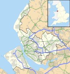
 Clubmoor
Clubmoor shown within MerseysidePopulation 13,387 (2001 Census)[1] OS grid reference SJ383954 Metropolitan borough Liverpool Metropolitan county Merseyside Region North West Country England Sovereign state United Kingdom Post town LIVERPOOL Postcode district L11, L13 Dialling code 0151 Police Merseyside Fire Merseyside Ambulance North West EU Parliament North West England UK Parliament Liverpool Walton List of places: UK • England • Merseyside Clubmoor is a district of Liverpool, Merseyside, England and a Liverpool City Council ward.
At the 2001 Census the population was recorded as 13,387.[1] The Clubmoor ward is heavily residential but with a few areas of employment such as the nearby district centre known locally as "Broadway" situated on Broadway/Broad Lane.
As a Liverpool City Council ward, it is represented by three Labour Party councillors - Roz Gladden, James Noakes and Irene Rainey. The local Member of Parliament is Labour MP Steve Rotherham.
Contents
Description
The Clubmoor area is situated in north Liverpool and is bordered by the nearby districts of Norris Green, Anfield and Tuebrook. The main Liverpool inner ring-road Queens Drive (A5058) passes through Clubmoor.
Transport wise, Clubmoor is well served by buses on the routes to Liverpool city centre and also on Queens Drive. Until 1960 it was served by Clubmoor railway station on the old loop line.
History
Ammunition train incident
During world war 2, a notable incident of the area was the ammunition train explosion of 1940[2][3][4][5]. The train was leaving the docks in order to avoid the luftwaffe bombing, but was hit near Townsend Lane with the explosion sent the debris flying in all directions at such speed that a train wheel smashed through the doorway of the Clubmoor pub killing the manager. The driver of the train, George Roberts (later awarded a medal) acted extremely selflessly and managed to detach the back end of the train and shunt it away to stop it from catching fire. One of the men was off duty railwayman John Guinan from Witton Road who ran to help as soon as he heard the blast. To this day, many of the surrounding houses have been affected by the blast.
Post 1945-Present day
During the 1950s, US Troops from RAF Burtonwood and RAF Sealand used the open spaces in Clubmoor[clarification needed] for playing baseball[citation needed]. This land as well as the nearby Breckside park depot was also used for storing Tanks, Ack Ack guns, Landing crafts etc there to prepare them for shipping to Europe and Africa. Houses were also built next to the railway depot with the streets with American States as names.
References
- ^ a b 2001 Census: Clubmoor, Office for National Statistics, http://neighbourhood.statistics.gov.uk/dissemination/LeadKeyFigures.do?a=3&b=6096653&c=clubmoor&d=14&e=15&g=358683&i=1001x1003x1004&m=0&r=1&s=1231543408450&enc=1, retrieved 9 January 2009
- ^ http://www.bbc.co.uk/ww2peopleswar/stories/94/a1985394.shtml
- ^ http://www.liverpoolecho.co.uk/views/echo-letters/2011/05/16/liverpool-echo-letters-may-16-2011-100252-28699066/
- ^ http://www.bbcattic.org/ww2peopleswar/stories/31/a2496431.shtml
- ^ http://www.yoliverpool.com/forum/attachment.php?attachmentid=3150&d=1180281106
External links
- Liverpool City Council, Ward profile: Clubmoor
- Liverpool Street Gallery - Liverpool 11
- Liverpool Street Gallery - Liverpool 13
Districts and Wards of the City of Liverpool Districts Aigburth · Allerton · Anfield · Belle Vale · Broadgreen · Canning · Childwall · Chinatown · City Centre · Clubmoor · Croxteth · Dingle · Dovecot · Edge Hill · Everton · Fairfield · Fazakerley · Garston · Gateacre · Gillmoss · Grassendale · Hunts Cross · Kensington · Kirkdale · Knotty Ash · Mossley Hill · Netherley · Norris Green · Old Swan · Orrell Park · St Michael's Hamlet · Speke · Stoneycroft · Toxteth · Tuebrook · Vauxhall · Walton · Wavertree · West Derby · WooltonWards Allerton and Hunts Cross · Anfield · Belle Vale · Central · Childwall · Church · Clubmoor · County · Cressington · Croxteth · Everton · Fazakerley · Greenbank · Kensington and Fairfield · Kirkdale · Knotty Ash · Mossley Hill · Norris Green · Old Swan · Picton · Princes Park · Riverside · Speke-Garston · St Michael's · Tuebrook and Stoneycroft · Warbreck · Wavertree · West Derby · Woolton · Yew TreeCategories:- Districts of Liverpool
- Merseyside geography stubs

Wikimedia Foundation. 2010.