- Netham Lock
-
 Netham Lock & lock keepers cottage
 Netham Weir
Netham Lock Legend

River Avon 


Moorings 
1 Hanham Lock 

Hanham weir 
A4174 Road bridge 

Feeder Road bridge 

Netham Road bridges (2) 
Netham Lock and weir 
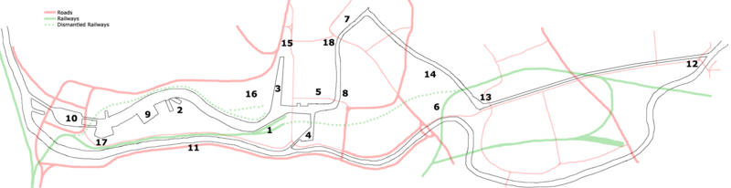
Floating Harbour feeder New Cut to Avon Gorge Netham lock (grid reference ST616727) is the point at Netham in Bristol at which boats from the River Avon, acting as part of the Kennet and Avon Canal, gain access to Bristol's Floating Harbour.
Construction started in 1804 to build the tidal New Cut and divert the River Avon along the Feeder Canal to the harbour; a system designed and built by William Jessop and later improved by Isambard Kingdom Brunel.[1]
A weir carries the river into the New Cut and boats use the adjacent lock. High tides often pass over the weir, and the river is effectively tidal to the next lock upstream at Hanham. Some spring tides can also pass over the weir at Hanham, making the river tidal as far as Keynsham lock.[2]
Access to the harbour is only possible during the day when the lock keeper will open the gates unless the water level in the river between Netham and Hanham is above or below the level of the harbour.[3]
The maximum dimensions of a vessel which can pass through Netham Lock are:
- Length: 24.4 metres (80 ft)
- Beam: 5.4 metres (18 ft)
- Draught: 1.9 metres (6.2 ft)
- Headroom: 3.1 metres (10 ft)[3]
The lock-keeper's cottage, built in the early nineteenth century, is a grade II listed building and has a plaque listing it as Bristol Docks building number 1.[1] The floral displays around the cottage and on the banking have attracted praise.[4]
Netham Lock and the weir form part of Bristol's flood defence mechanisms and it was announced in December 2008 that they would be upgraded as part of the £11 million City Docks Capital Project.[5]
References
- ^ a b Clensy, David (14 June 2008). "Lock, stock and a barrel of fun" (fee required). Western Daily Press, archived at Nexis (Bristol United Press): pp. 4. http://www.lexisnexis.com/uk/nexis/results/docview/docview.do?docLinkInd=true&risb=21_T7131415098&format=GNBFI&sort=BOOLEAN&startDocNo=1&resultsUrlKey=29_T7131418307&cisb=22_T7131418306&treeMax=true&treeWidth=0&csi=169745&docNo=5. Retrieved 12 August 2009.
- ^ "Boaters' Guides". Waterscape.com. British Waterways. July 2009. pp. 2. http://www.waterscape.com/things-to-do/boating/guides/download/d091be5609fa41c736ad91c319b034a4. Retrieved 12 August 2009.
- ^ a b "Navigation of Floating Harbour and Feeder Canal". Marine and waterway services. Bristol City Council. http://www.bristol.gov.uk/ccm/content/Transport-Streets/Marine-waterway-services/floating-harbour-and-feeder-canal.en?page=2. Retrieved 12 August 2009.
- ^ Latimer's Diary (22 July 2002). "Scene says it all with flowers" (fee required). Bristol Evening Post, archived at Nexis (Bristol United Press): pp. 11. http://www.lexisnexis.com/uk/nexis/results/docview/docview.do?docLinkInd=true&risb=21_T7131415098&format=GNBFI&sort=BOOLEAN&startDocNo=1&resultsUrlKey=29_T7131418307&cisb=22_T7131418306&treeMax=true&treeWidth=0&csi=169745&docNo=17. Retrieved 12 August 2009.
- ^ Staff writer (12 December 2008). "Work starts to secure bristol's floating harbour" (fee required). Bristol Evening Post, archived at Nexis (Bristol United Press): pp. 15. http://www.lexisnexis.com/uk/nexis/results/docview/docview.do?docLinkInd=true&risb=21_T7131415098&format=GNBFI&sort=BOOLEAN&startDocNo=1&resultsUrlKey=29_T7131418307&cisb=22_T7131418306&treeMax=true&treeWidth=0&csi=166254&docNo=4. Retrieved 12 August 2009.
See also
- Prince's Wharf, including the Bristol Industrial Museum, Pyronaut
- Dry docks: SS Great Britain, the Matthew
- St Augustine's Reach, Pero's Bridge
- Bathurst Basin
- Queen Square
- Bristol Temple Meads railway station
- Castle Park
- Redcliffe Quay and Redcliffe Caves
- Baltic Wharf marina
- Cumberland Basin & Brunel Locks
- The New Cut
- Netham Lock, entrance to the Feeder Canal
- Totterdown Basin
- Temple Quay
- The Centre
- Canons Marsh, including Millennium Square and At-Bristol
- Underfall Yard
- Bristol Bridge
Next lock upstream River Avon, Bristol / Kennet and Avon Canal Next lock downstream Hanham Lock Netham Lock
Grid reference: ST614727Bristol Harbour entrance lock Coordinates: 51°27′07″N 2°33′15″W / 51.4520°N 2.5542°W
Transport in Bristol Road Motorways European Routes A roads Bus Buses in Bristol · Bristol Bus Station · Bristol Portway park and ride · Bristol A4 Bath Road park and ride · Bugler Coaches · First Bristol · First Somerset & Avon · Wessex Red · List of bus routes in BristolCycling Rail Railway lines Stations Avonmouth · Bedminster · Bristol Parkway · Bristol Temple Meads · Clifton Down · Lawrence Hill · Montpelier · Parson Street · Portway · Redland · Sea Mills · Severn Beach · Shirehampton · St Andrews Road · Stapleton RoadOther Greater Bristol MetroAir Waterways River Avon · Bristol Harbour · Cumberland Basin · Netham Lock · Bristol Ferry Boat Company · Bristol Marina · Underfall Yard · Kennet and Avon CanalSea Public Transport Bridges Categories:- Buildings and structures in Bristol
- Transport in Bristol
- Locks on the Kennet and Avon Canal
- Bristol Harbourside


Wikimedia Foundation. 2010.