- British Empire Range
Geobox|Range
name=British Empire Range
image_size=275
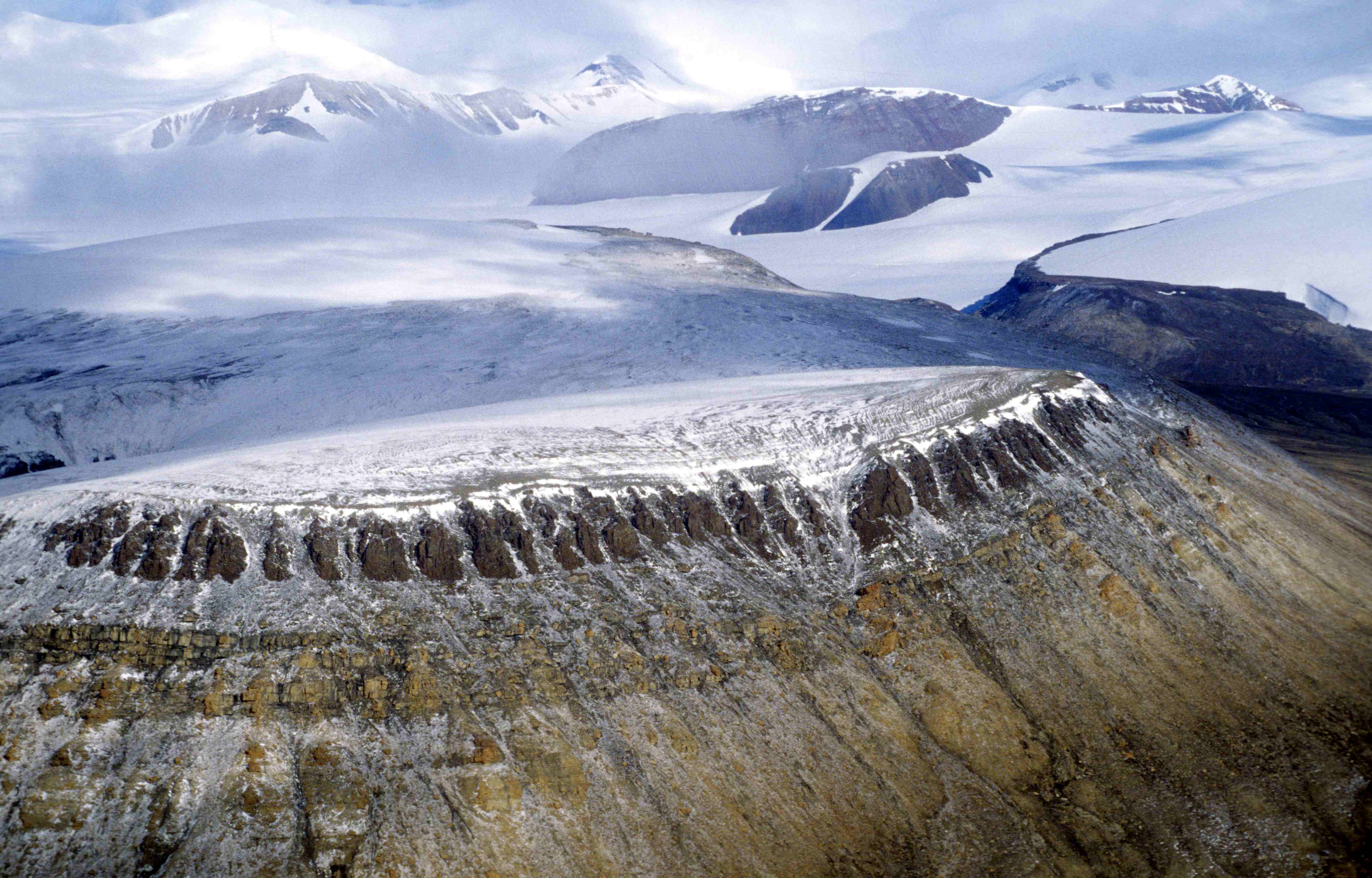
image_caption=British Empire Range, in the north of Tanquary Fiord
country=Canada
region=Nunavut|region_type=Territory
unit=
highest=Barbeau Peak
highest_elevation=2616
highest_lat_d=81|highest_lat_m=54|highest_lat_s=30|highest_lat_NS=N
highest_long_d=75|highest_long_m=01|highest_long_s=30|highest_long_EW=W
geology= | period= | orogeny=
map_size=275
map_caption=The British Empire Range is a
mountain range onEllesmere Island inNunavut ,Canada . The range is one of the most northern ranges in the world [ [http://atlas.nrcan.gc.ca/site/english/maps/topo/map?mapsize=428%20380&lat=82.3500000007&long=-77.4999999985&mapxy=268573.707593+3702696.05337&scale=5000000&feature_na=British+Empire+Range&location1=62&unique_key=0c754d28849c20c35b4ad5ba544daf38&searchstring=British%20Empire%20Range&entity=MTN&layers=fapfeature+fapfeature%20north_arrow%20other_features%20million_grid%20t50k_grid%20grid_50k_3%20roads%20hydrography%20boundary%20builtup%20vegetation%20populated_places%20railway%20power_network%20manmade_features%20designated_areas%20water_features%20water_saturated_soils%20relief%20contours%20toponymy%20contour%20nodata_ntdb_50k&urlappend=%26map_textzoom03_feature%3Dnew%26map_textzoom03_feature_points%3D268593.589101+3702693.18667%26map_textzoom03_class_text%3DBritish%2BEmpire%2BRange%26map_textzoom46_feature%3Dnew%26map_textzoom46_feature_points%3D268593.589101+3702693.18667%26map_textzoom46_class_text%3DBritish%2BEmpire%2BRange%26map_arrowzoom03_feature%3Dnew%26map_arrowzoom03_feature_points%3D268593.589101+3702693.18667 British Empire Range] at theAtlas of Canada ] and theArctic Cordillera , surpassed only by theChallenger Mountains [ [http://atlas.nrcan.gc.ca/site/english/maps/topo/map?mapsize=428%20380&lat=82.6832999996&long=-76.1999999985&mapxy=276605.284964+3745683.90322&scale=5000000&feature_na=Challenger+Mountains&location1=62&unique_key=0c74ea53849c20c359694e5b24ec0678&searchstring=Challenger%20Mountains&entity=MTN&layers=fapfeature+fapfeature%20north_arrow%20other_features%20million_grid%20t50k_grid%20grid_50k_3%20roads%20hydrography%20boundary%20builtup%20vegetation%20populated_places%20railway%20power_network%20manmade_features%20designated_areas%20water_features%20water_saturated_soils%20relief%20contours%20toponymy%20contour%20nodata_ntdb_50k&urlappend=%26map_textzoom03_feature%3Dnew%26map_textzoom03_feature_points%3D276625.395611+3745681.12644%26map_textzoom03_class_text%3DChallenger%2BMountains%26map_textzoom46_feature%3Dnew%26map_textzoom46_feature_points%3D276625.395611+3745681.12644%26map_textzoom46_class_text%3DChallenger%2BMountains%26map_arrowzoom03_feature%3Dnew%26map_arrowzoom03_feature_points%3D276625.395611+3745681.12644 The Challenger Mountains] at the Atlas of Canada] which lies immediately to the northwest and theUnited States Range [ [http://atlas.nrcan.gc.ca/site/english/maps/topo/map?mapsize=428%20380&lat=82.416700001&long=-67.999999999&mapxy=403957.197374+3760352.04993&scale=5000000&feature_na=United+States+Range&location1=62&unique_key=86a15593d05411d892e2080020a0f4c9&searchstring=United%20States%20Range&entity=MTN&layers=fapfeature+fapfeature%20north_arrow%20other_features%20million_grid%20t50k_grid%20grid_50k_3%20roads%20hydrography%20boundary%20builtup%20vegetation%20populated_places%20railway%20power_network%20manmade_features%20designated_areas%20water_features%20water_saturated_soils%20relief%20contours%20toponymy%20contour%20nodata_ntdb_50k&urlappend=%26map_textzoom03_feature%3Dnew%26map_textzoom03_feature_points%3D403977.32549+3760352.11754%26map_textzoom03_class_text%3DUnited%2BStates%2BRange%26map_textzoom46_feature%3Dnew%26map_textzoom46_feature_points%3D403977.32549+3760352.11754%26map_textzoom46_class_text%3DUnited%2BStates%2BRange%26map_arrowzoom03_feature%3Dnew%26map_arrowzoom03_feature_points%3D403977.32549+3760352.11754 The United States Range] at the Atlas of Canada] slightly further east. The highest mountain in the range,Barbeau Peak , is the highest peak in North America east of theNorth America nRocky Mountains .The range was named by
Gordon Noel Humphreys during the "Oxford University Ellesmere Land Expedition". Edward Shackleton, also a member of the party, claimed, in 1937, that Humphreys had done so because he was "a great imperialist".Peaks of the range include:
References
*"Geographical Names of the Ellesmere Island National Park Reserve and Vicinity" by Geoffrey Hattersley-Smith (1998) ISBN 0-919034-96-9
Wikimedia Foundation. 2010.