- Cergy
-
Cergy

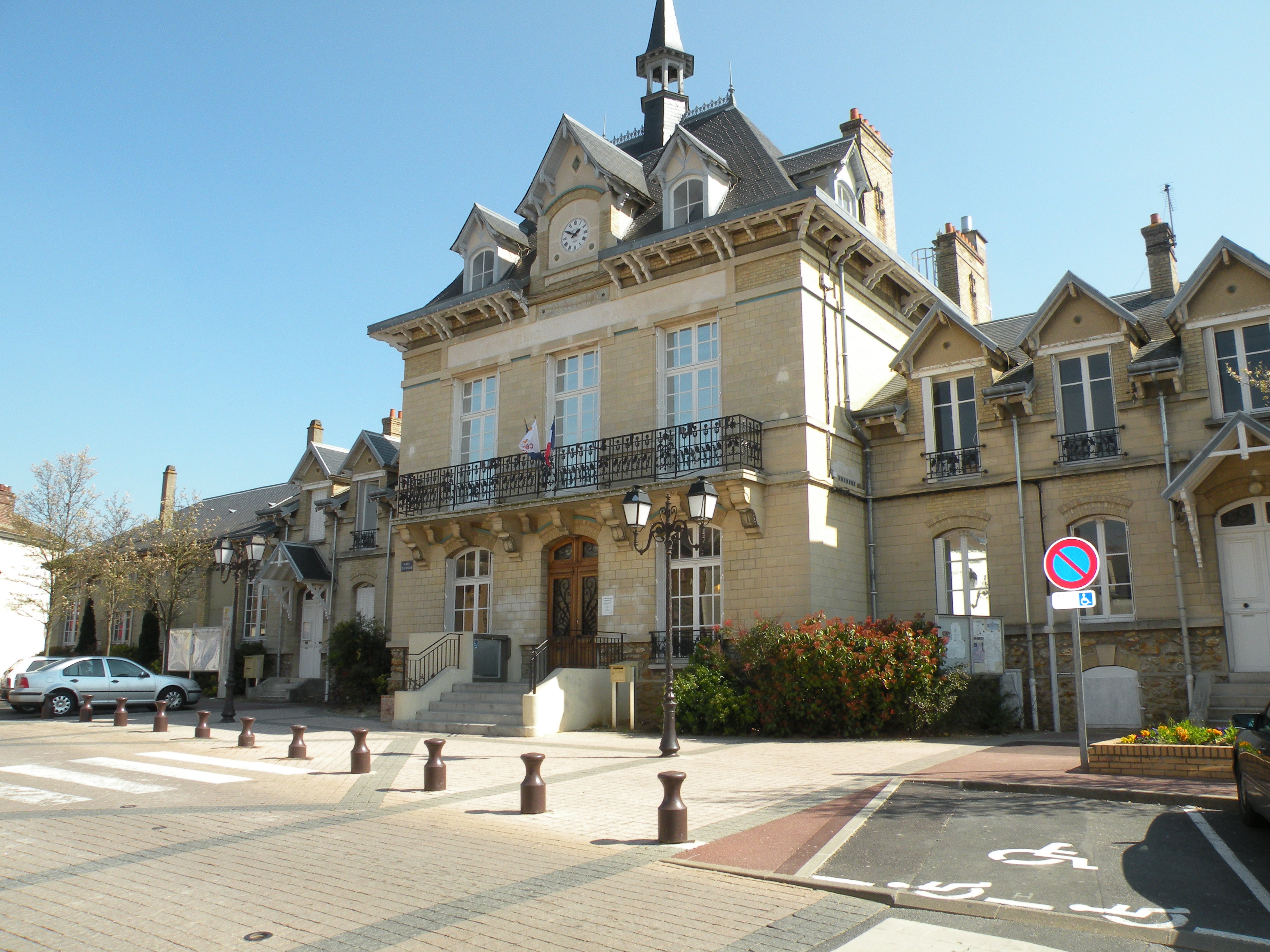
Town hall 

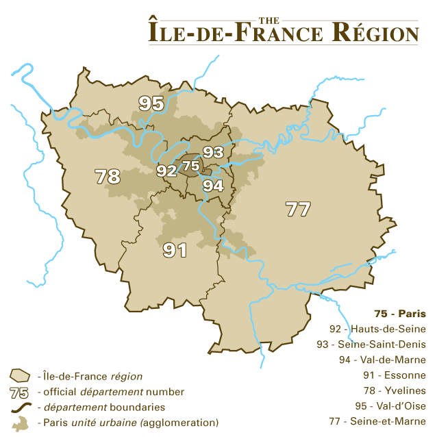
Location (in red) within Paris inner and outer suburbs Location within Île-de-France region
 Cergy
CergyAdministration Country France Region Île-de-France Department Val-d'Oise Arrondissement Pontoise Intercommunality Cergy-Pontoise Mayor Dominique Lefebvre
(2001–2008)Statistics Elevation 21–121 m (69–397 ft)
(avg. 25 m/82 ft)Land area1 11.68 km2 (4.51 sq mi) Population2 58,265 (2006) - Density 4,988 /km2 (12,920 /sq mi) INSEE/Postal code 95127/ 95000 1 French Land Register data, which excludes lakes, ponds, glaciers > 1 km² (0.386 sq mi or 247 acres) and river estuaries. 2 Population without double counting: residents of multiple communes (e.g., students and military personnel) only counted once. Coordinates: 49°02′10″N 2°03′47″E / 49.0361111111°N 2.06305555556°E
Cergy (French pronunciation: [sɛʁ.ʒi]) is a commune in the northwestern suburbs of Paris, France. It is located 27.8 km (17.3 mi) from the center of Paris, in the "new town" of Cergy-Pontoise, created in the 1960s, of which it is the central and most populated commune.
Although neighboring Pontoise is the official préfecture (capital) of the Val-d'Oise département, the préfecture building and administration, as well as the department council (conseil général), are located inside the commune of Cergy, which is regarded as the de facto capital of Val-d'Oise. The sous-préfecture building and administration, on the other hand, are located inside the commune of Pontoise.
Contents
Name
The name Cergy comes from Medieval Latin Sergiacum, meaning "estate of Sergius", a Gallo-Roman landowner.
Administration
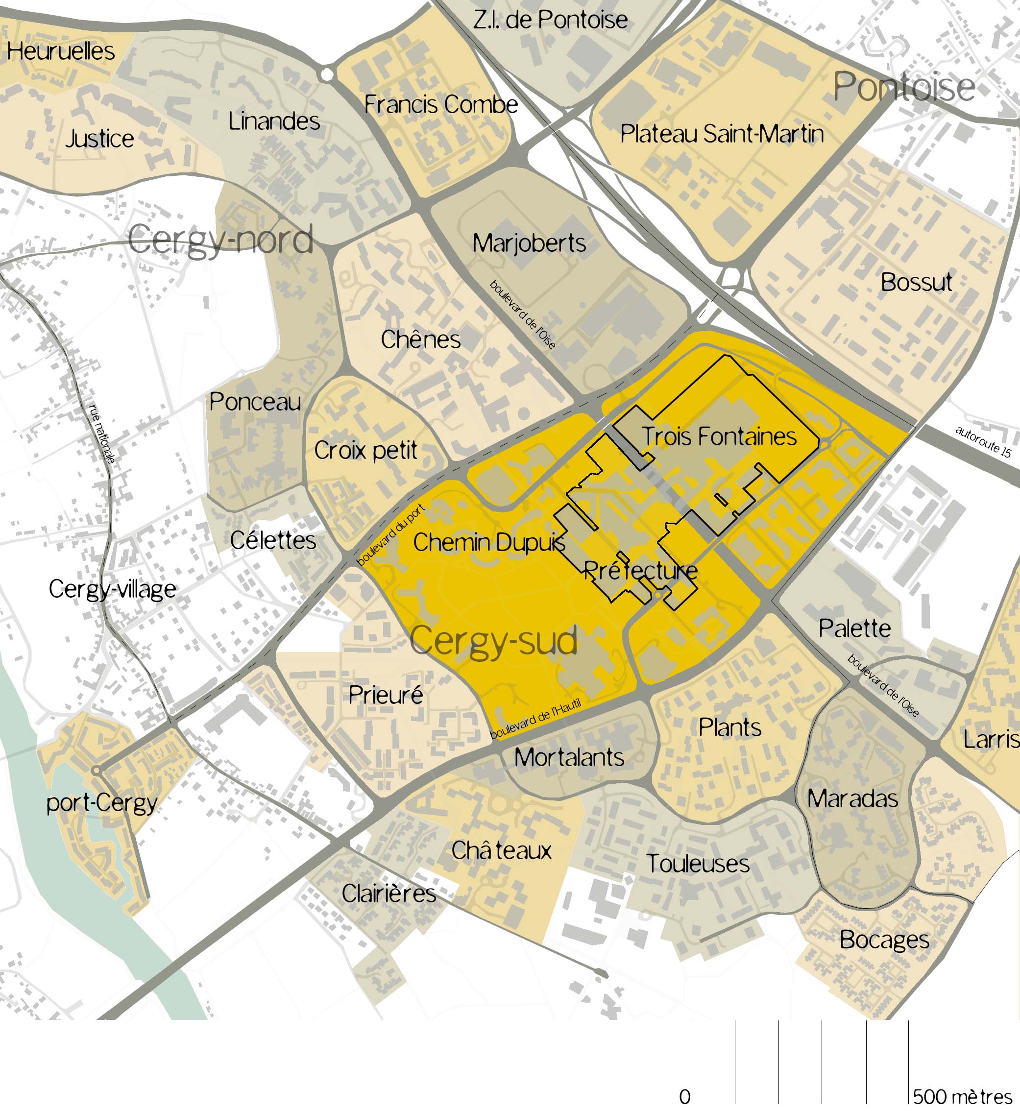
 Map of the quarters of Cergy.
Cergy is the chief town of two cantons:
- The canton of Cergy-Nord is made of part of Cergy and communes of Boissy-l'Aillerie, Osny, Puiseux-Pontoise (53,779 inhabitants)
- The canton of Cergy-Sud is made of part of Cergy and the commune of Éragny (32,969 inhabitants).
Twin towns and sister cities
 Columbia, Maryland, United States.
 Erkrath, Germany.
 Liaoyang, People's Republic of China.
 Porto Novo, Benin.
 Tres Cantos, Spain
 West Lancashire, United Kingdom.
Demographics
When Cergy was selected to become the center of a "new town", it was only a village. The commune had only 2,895 inhabitants in 1968. It then started to develop very quickly, exceeding 10,000 inhabitants in the mid-1970s and then 20,000 in the early-1980s. It is in this decade that its growth was most spectacular, since the city exceeded 48,000 inhabitants in 1990. The increase continued since, but at a notably slower pace, to reach 54,500 as of 2004 estimates. However, on 1 January 2000, the commune lost a portion of its territory (net 0.03 km2 (0.012 sq mi) with a 1999 population of 62 persons) to the adjacent commune of Courdimanche.[1] The official census figures have thus been revised downward from the 1999 official 54,781 to 54,719, and the land area from 11.68 km2 (4.51 sq mi) to 11.65 km².
Immigration
Place of birth of residents of Cergy in 1999 Born in Metropolitan France Born outside Metropolitan France 78.2% 21.8% Born in
Overseas FranceBorn in foreign countries with French citizenship at birth¹ EU-15 immigrants² Non-EU-15 immigrants 2.8% 3.4% 1.9% 13.7% ¹This group is made up largely of pieds-noirs from Northwest Africa, followed by former colonial citizens who had French citizenship at birth (such as was often the case for the native elite in French colonies), and to a lesser extent foreign-born children of French expatriates. Note that a foreign country is understood as a country not part of France as of 1999, so a person born for example in 1950 in Algeria, when Algeria was an integral part of France, is nonetheless listed as a person born in a foreign country in French statistics.
²An immigrant is a person born in a foreign country not having French citizenship at birth. Note that an immigrant may have acquired French citizenship since moving to France, but is still considered an immigrant in French statistics. On the other hand, persons born in France with foreign citizenship (the children of immigrants) are not listed as immigrants.Port Cergy
 Port Cergy.
Port Cergy is a marina on the River Oise at pk 9. The site comprises both housing and recreational yachts as well as a boating school. The marina can hold 103 ships ranging 5 to 22m long and. The northern part of the site is reserved for restaurants and shops and have been built around a small bassin.
Ham
Ham is a small village to the south of Cergy. The village used to be part of the Sergentery and then commune of Neuville-sur-Oise but has since been amalgamated in the commune of Cergy. On its territory is the outdoor leisure centre 'Base de Loisirs de Cergy-Neuville'.
Transport
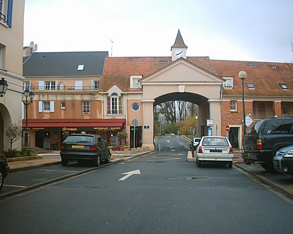
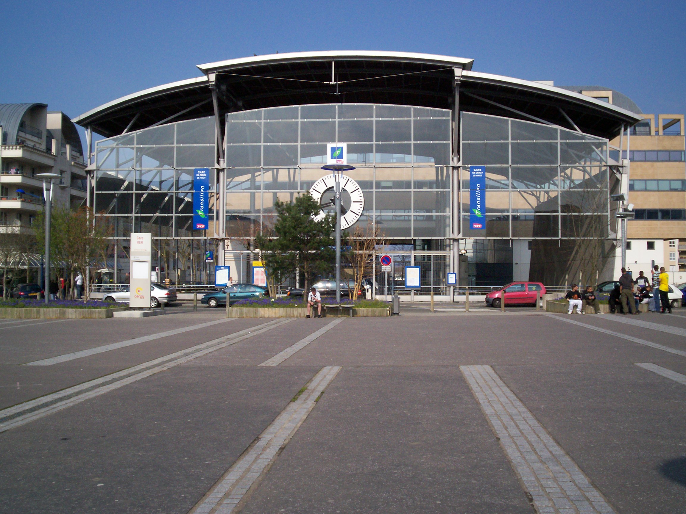
 Train station of Cergy le Haut.
Cergy is served by three stations on Paris RER line A and on the Transilien Paris – Saint-Lazare suburban rail line: Cergy – Préfecture, Cergy – Saint-Christophe, and Cergy – Le Haut. Cergy is served by direct buses from Charles de Gaulle International Airport.[2]
The bus company STIVO provides 17 lines of buses to travel within the agglomeration of Cergy.
Education
- Cergy-Pontoise University
- ESSEC Business School (grande école)
- ENSEA École Nationale Supérieure de l'Électronique et de ses Applications
- ITIN, IT-Institute (École supérieure d'informatique, réseaux et systèmes d'information)
- EISTI, École internationale des sciences du traitement de l'information
- Web site of Professional Bachelor’s degree in International Trade and International Tourism (Cergy-Pontoise University)
Crime
Cergy-Pontoise has 137.62 criminal incidents per 1000 inhabitants, far higher than national average (83 per 1000) and even higher than the crime rate of the Val-d'Oise department (88.15 per 1000). Cergy-pontoise is one of the most dangerous city of the Val-d'Oise département after Argenteuil.
In popular culture
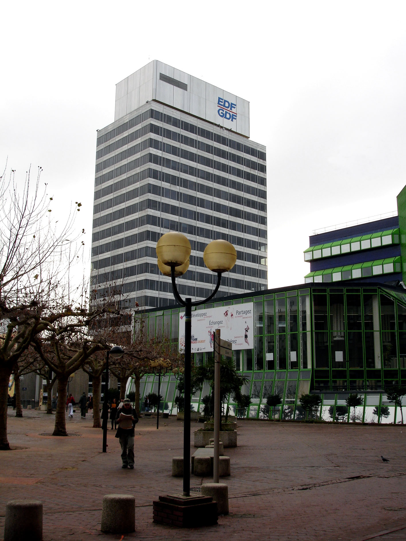
 EDF-GDF tower, Cergy-Pontoise (France)
The town was used as a filming location for Henri Verneuil's film I... comme Icare released in 1979, starring Yves Montand. The EDF-GDF tower designed by architect Renzo Moro is the building from which the shots were fired to assassinate president Marc Jarry. The country that the movie depicts is not named, although the United States is perhaps suggested. The filmmakers chose the modern and innovative architecture of the new city to avoid depicting any particular country.[3]
See also
References
- ^ Code officiel géographique, from INSEE
- ^ Bus transport to Cergy
- ^ Eric Bureau (27.08.2003). "Le président d'« I... comme Icare » a été assassiné à Cergy" (in French). http://www.leparisien.fr/val-d-oise/le-president-d-i-comme-icare-a-ete-assassine-a-cergy-27-08-2003-2004339459.php. Retrieved 2011-11-20.
External links
- Cergy official website (French)
- Internet site of the Université de Cergy-Pontoise (French)
- portcergy.com (French)
- Mérimée database – Cultural heritage (French)
- Land use (IAURIF) (English)
- Accommodation and Travel in Cergy-Pontoise (English)
 Communes in the Metropolitan Area of Paris
Population over 2 million Population over 100,000 Population over 75,000 Asnières-sur-Seine · Aulnay-sous-Bois · Champigny-sur-Marne · Colombes · Courbevoie · Créteil · Nanterre · Rueil-Malmaison · Saint-Maur-des-Fossés · Versailles · Vitry-sur-SeinePopulation over 50,000 Antony · Aubervilliers · Le Blanc-Mesnil · Bondy · Cergy · Chelles · Clamart · Clichy · Drancy · Épinay-sur-Seine · Évry · Fontenay-sous-Bois · Issy-les-Moulineaux · Ivry-sur-Seine · Levallois-Perret · Maisons-Alfort · Neuilly-sur-Seine · Noisy-le-Grand · Pantin · Sarcelles · Sartrouville · Sevran · VillejuifPopulation over 25,000 Alfortville · Athis-Mons · Bagneux · Bagnolet · Bezons · Bobigny · Bois-Colombes · Brunoy · Cachan · Charenton-le-Pont · Châtenay-Malabry · Châtillon · Chatou · Le Chesnay · Choisy-le-Roi · Clichy-sous-Bois · Conflans-Sainte-Honorine · Corbeil-Essonnes · La Courneuve · Draveil · Élancourt · Ermont · Franconville · Fresnes · Gagny · La Garenne-Colombes · Garges-lès-Gonesse · Gennevilliers · Gonesse · Goussainville · Grigny · Guyancourt · L'Haÿ-les-Roses · Herblay · Houilles · Le Kremlin-Bicêtre · Livry-Gargan · Malakoff · Mantes-la-Jolie · Massy · Meaux · Melun · Meudon · Montigny-le-Bretonneux · Montrouge · Les Mureaux · Neuilly-sur-Marne · Nogent-sur-Marne · Noisy-le-Sec · Palaiseau · Le Perreux-sur-Marne · Pierrefitte-sur-Seine · Plaisir · Poissy · Pontault-Combault · Pontoise · Puteaux · Rambouillet · Ris-Orangis · Romainville · Rosny-sous-Bois · Saint-Cloud · Saint-Germain-en-Laye · Saint-Ouen · Sainte-Geneviève-des-Bois · Sannois · Savigny-sur-Orge · Savigny-le-Temple · Stains · Sucy-en-Brie · Suresnes · Taverny · Thiais · Trappes · Tremblay-en-France · Vanves · Vigneux-sur-Seine · Villemomble · Villeneuve-Saint-Georges · Villepinte · Villiers-le-Bel · Villiers-sur-Marne · Vincennes · Viry-Châtillon · YerresPopulation under 25,000 1,460 other communesCommunes of the Val-d'Oise department  Ableiges · Aincourt · Ambleville · Amenucourt · Andilly · Argenteuil · Arnouville · Arronville · Arthies · Asnières-sur-Oise · Attainville · Auvers-sur-Oise · Avernes · Baillet-en-France · Banthelu · Beauchamp · Beaumont-sur-Oise · Le Bellay-en-Vexin · Bellefontaine · Belloy-en-France · Bernes-sur-Oise · Berville · Bessancourt · Béthemont-la-Forêt · Bezons · Boisemont · Boissy-l'Aillerie · Bonneuil-en-France · Bouffémont · Bouqueval · Bray-et-Lû · Bréançon · Brignancourt · Bruyères-sur-Oise · Buhy · Butry-sur-Oise · Cergy · Champagne-sur-Oise · La Chapelle-en-Vexin · Charmont · Chars · Châtenay-en-France · Chaumontel · Chaussy · Chauvry · Chennevières-lès-Louvres · Chérence · Cléry-en-Vexin · Commeny · Condécourt · Cormeilles-en-Parisis · Cormeilles-en-Vexin · Courcelles-sur-Viosne · Courdimanche · Deuil-la-Barre · Domont · Eaubonne · Écouen · Enghien-les-Bains · Ennery · Épiais-lès-Louvres · Épiais-Rhus · Épinay-Champlâtreux · Éragny · Ermont · Ézanville · Fontenay-en-Parisis · Fosses · Franconville · Frémainville · Frémécourt · Frépillon · La Frette-sur-Seine · Frouville · Gadancourt · Garges-lès-Gonesse · Genainville · Génicourt · Gonesse · Goussainville · Gouzangrez · Grisy-les-Plâtres · Groslay · Guiry-en-Vexin · Haravilliers · Haute-Isle · Le Heaulme · Hédouville · Herblay · Hérouville · Hodent · L'Isle-Adam · Jagny-sous-Bois · Jouy-le-Moutier · Labbeville · Lassy · Livilliers · Longuesse · Louvres · Luzarches · Maffliers · Magny-en-Vexin · Mareil-en-France · Margency · Marines · Marly-la-Ville · Maudétour-en-Vexin · Menouville · Menucourt · Mériel · Méry-sur-Oise · Le Mesnil-Aubry · Moisselles · Montgeroult · Montigny-lès-Cormeilles · Montlignon · Montmagny · Montmorency · Montreuil-sur-Epte · Montsoult · Mours · Moussy · Nerville-la-Forêt · Nesles-la-Vallée · Neuilly-en-Vexin · Neuville-sur-Oise · Nointel · Noisy-sur-Oise · Nucourt · Omerville · Osny · Parmain · Le Perchay · Persan · Pierrelaye · Piscop · Le Plessis-Bouchard · Le Plessis-Gassot · Le Plessis-Luzarches · Pontoise · Presles · Puiseux-en-France · Puiseux-Pontoise · La Roche-Guyon · Roissy-en-France · Ronquerolles · Sagy · Saint-Brice-sous-Forêt · Saint-Clair-sur-Epte · Saint-Cyr-en-Arthies · Saint-Gervais · Saint-Gratien · Saint-Leu-la-Forêt · Saint-Martin-du-Tertre · Saint-Ouen-l'Aumône · Saint-Prix · Saint-Witz · Sannois · Santeuil · Sarcelles · Seraincourt · Seugy · Soisy-sous-Montmorency · Survilliers · Taverny · Théméricourt · Theuville · Le Thillay · Us · Vallangoujard · Valmondois · Vaudherland · Vauréal · Vémars · Vétheuil · Viarmes · Vienne-en-Arthies · Vigny · Villaines-sous-Bois · Villeron · Villers-en-Arthies · Villiers-Adam · Villiers-le-Bel · Villiers-le-Sec · Wy-dit-Joli-VillageCategories:
- Communes of Val-d'Oise


Wikimedia Foundation. 2010.