- Killiney
-
Killiney
Cill Iníon Léinín— Suburb of Dublin — Killiney Bay Location in Ireland
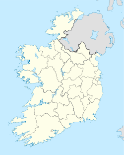
 Killiney
Coordinates: 53°15′54″N 6°06′49″W / 53.2651°N 6.1137°WCoordinates: 53°15′54″N 6°06′49″W / 53.2651°N 6.1137°W Country Ireland Province Leinster County Dun Laoghaire-
RathdownElevation 30 m (98 ft) Population (2002) – Urban 10,600 Irish Grid Reference O240261 Killiney (Irish: Cill Iníon Léinín, meaning "Church of the Daughters of Léinín") is a suburb of Dublin in south County Dublin, Ireland. It is within the administrative area of Dún Laoghaire-Rathdown County. The area is by the coast, south of neighbouring Dalkey, and north to Shankill area in the most southern outskirt of Dublin.
Killiney is part of the Dáil Éireann constituency of Dún Laoghaire.
 Killiney Bay from Vico Baths
Contents
Amenities
Killiney Hill Park was opened in 1887 as Victoria Hill in honour of Queen Victoria's 50 years on the throne. The park boasts magnificent views of Dublin Bay, Killiney Bay, Bray Head and the mountain of Great Sugar Loaf (506 m), stretching from the Wicklow Mountains right across to Howth Head. The Park's topography is quite dramatic and its highest point, at the obelisk, is 170 metres above sea level.
Other attractions include Killiney Beach, Killiney Golf Club, a local Martello Tower, and the ruins of Cill Iníon Léinín, the church around which the original village was based.
The coastal areas of Killiney are often favourably compared to the Bay of Naples in Italy. This comparison is reflected in the names of surrounding roads, like Vico, Sorrento, Monte Alverno, San Elmo, and Capri. On clear days, the Mourne Mountains of County Down can be seen, although this is less and less frequent due to air pollution.[citation needed] The park was once part of the estate of Killiney Castle, now a hotel. Since early 2010 a pod of bottlenose dolphins has been seen regularly in Killiney Bay.
Transport
An Aircoach service starting at Fitzpatrick's Castle Hotel links Killiney with Dublin Airport on the hour off-peak and half hourly at peak times.
Famous residents
North-eastern Killiney is one of Dublin's most exclusive residential areas. Famous residents include U2 members Bono and The Edge, Enya and occasionally former racing driver Eddie Jordan. Killiney is also home to a number of foreign ambassadors to Ireland.
History
For many centuries the major part of the district was the property of the Talbot de Malahide family, some of the original followers of the 1170 Norman invasion. The obelisk on top of Killiney Hill records the famine of 1741 and the relief works made for the poor which include the obelisk and the many walls which cover the top of the hill. By the 19th century, the areas to the north and east of the village were owned by Robert Warren, who developed many of the Victorian residential roads. The Warrens also sold the land required to extend the Dublin and Kingstown Railway to Killiney and ultimately Bray. Killiney beach was a popular seaside destination for Dubliners, and John Rocque's 1757 map shows bath houses near White Rock, on Killiney Beach. The coastline became even more popular once the railway opened, and the opening of Victoria Park in 1887 to commemorate the Queen's visit and the opening of Vico Road in 1889 appear to have increased this popularity further. Victoria Castle was also built in honour of Queen Victoria, specifically her accession to the throne. This is currently owned by Donegal singer Enya who has renamed it Manderley Castle.
From 1900 until the late 1940s Killiney remained a near-rural area, despite its proximity to Dublin city. This lack of further development can be traced to the 35% fall in the non-Catholic population of Dublin from 1901 to 1926, followed by the recession caused by the Economic War and the restrictions on nonessential construction during The Emergency from 1939 to 1945.
20th century development
In the first half of the twentieth century, the Electoral Division of North Killiney still consisted of a small village at its centre and a number of suburban roads lined with large houses. A few modest cottages were occupied by working class locals and bohemian residents such as George Bernard Shaw, whose house, Torca Cottage, is close to the boundary with Dalkey.
South Killiney consisted of farmland (owned by the Hackett[disambiguation needed
 ] family) uncultivated hillside and woodland, a few large country houses (Ballinclea House in particular, owned by the Talbot de Malahide family and destroyed by fire in the early 1970s, and Rochestown House, near to the contemporary Killiney Shopping Centre), the convent of the Sisters of St. Joseph of Cluny and Killiney Golf Club, a nine-hole course founded in 1903.
Killiney's population grew substantially in the decades following The Emergency as the urbanization of Ireland and the suburbanization of Dublin progressed. The main sub-districts most locals will identify are Victoria (or Killiney Hill) Park, Roche's Hill (locally called Mullins Hill), Killiney Village itself, North Killiney (Cluny Grove, Killiney Road, Ballinclea), Killiney Hill Road, and the Vico Road. The last six of these areas are developed, most frequently with two-story housing, at average densities of 10 to 30 houses per hectare. North Killiney mainly consists of 2 bedroom, 2 storey housing at 10 to 30 houses per hectare.
The population, as recorded by the Census of Ireland, peaked in 1996 at approximately 10,800 and has fallen by about 12% since then, as falling average family sizes have outpaced residential construction.
See also
Sources
- The History of Killiney Hill Park Dunlaoghaire-Rathdown County Council
- Carrickmines Castle, the Vale of Shanganagh, Dalkey, Killiney and Ballybrack Hills (Waybackmachine archive link)
- Pearson, Peter (1998). Between the Mountains and the Sea: Dun Laoghaire-Rathdown County, Dublin: The O'Brien Press. ISBN 0-86278-582-0.
External links
- Dun Laoghaire Rathdown County Council
- Killiney railway station
- 2002 Census of Ireland Population Classified by Religion
- 2006 Census of Ireland Preliminary Report
Places in Dún Laoghaire–Rathdown Towns 
Villages - Category:Mountains and hills of County Dublin
- Category:Rivers of County Dublin
- Category:Geography of County Dublin
Categories:- Locations in Dublin (city)
- Beaches of the Republic of Ireland


Wikimedia Foundation. 2010.