- Clara Vale
-
Coordinates: 54°58′41″N 1°47′31″W / 54.978°N 1.792°W
Clara Vale 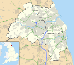
 Clara Vale
Clara Vale shown within Tyne and WearOS grid reference NZ133649 Metropolitan borough Gateshead Metropolitan county Tyne and Wear Region North East Country England Sovereign state United Kingdom Post town RYTON Postcode district NE40 Dialling code 0191 Police Northumbria Fire Tyne and Wear Ambulance North East EU Parliament North East England UK Parliament Blaydon List of places: UK • England • Tyne and Wear Clara Vale is a hamlet situated on the south bank of the River Tyne in Tyne and Wear, England. Once an independent village in County Durham it became incorporated into the new metropolitan county of Tyne and Wear in 1974 and later became part of the Metropolitan Borough of Gateshead.
Contents
Location
Clara Vale stands on the south bank of the River Tyne in a low-lying and quite secluded spot. Crawcrook borders the hamlet to the south. To the north, across the river, is the village of Wylam in Northumberland. It is notable for being the first settlement in Tyne and Wear that the river Tyne reaches and passes after leaving Northumberland.
Politics
In local government, Clara Vale is located in the 'Crawcrook, Greenside and Clara Vale ward' of Gateshead Council. The ward is at the far west of Gateshead and borders part of Northumberland. The ward is served by three councillors, all Liberal Democrats. Gateshead Council is Labour controlled.
Clara Vale is located within the parliamentary constituency of Blaydon. Its current MP is Labour's Dave Anderson.
History
Clara Vale came into existence as a purpose built colliery community in the late nineteenth century. Built by the Stella Coal Company, it thrived next to the nearby pit of Clara. However, by the 1960s, the mine closed down. So too had many other nearby pits such as Emma, Greenside and Stargate.
Modern-day Clara Vale
After the collapse of the coal industry in the 1960s Clara Vale has managed to survive and is still a vibrant community. In the present day it has rather affluent residents and employment tends to be in managerial and professional roles who are attracted to the area for its quiet and rural character. Farming is also an important sector in the area.
Clara Vale remains a remarkable community and is still only a very small village, barely larger than a hamlet. This is largely due to a great lack of recent development in the area. There is very little in the way of modern housing, only the one terraced street, built in the traditional style of the village. Of the other non-pit housing and buildings, there is only the chapel and former school (now a community centre). There are no local shops.
By avoiding the suburbanisation experienced by nearby towns and villages such as Crawcrook, Greenside and Ryton. Clara Vale has retained its rural character completely. Farms and countryside surrounds the village. This includes a local nature reserve which stands at the site of the old colliery.
Due to its small size, Clara Vale has limited amenities and local services. However, nearby Crawcrook and Ryton offer a range of shops and services and both of these are within walking distance of the village so whilst Clara Vale remains secluded, it is by no means isolated. Clara Vale does, however, have three nearby golf courses. Ryton golf course, in Clara Vale itself; Tyneside golf club in Ryton and, over the river to the north, Close House golf club in Wylam.
The village also has a recreation ground, originally provided by the pit owners for the miners' welfare. The recreation ground has a football pitch and a cricket pitch with pavilion. Clara Vale Cricket Club play matches at the recreation ground on Saturdays during the Summer, with Ovingham Bridge End Cricket Club playing on some Sundays and Merz and McLellan Cricket Club on some Wednesday evenings. Clara Vale FC junior teams also play on the pitch at the Recreation Ground.
External links
- An aerial view of the village, provided by Google Maps.
- A website giving information on the former pit villages of County Durham, this section concerns Clara Vale.
- The website for Clara Vale Cricket Club
- Clara Vale cricketer in club v country dilemma
- The website for Clara Vale Football Club
- Clara Vale online via Facebook.
Categories:- Hamlets in England

Wikimedia Foundation. 2010.