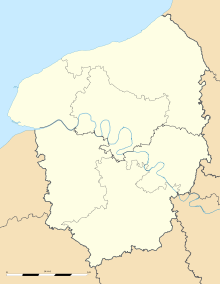
- Mélamare
-
Mélamare
Administration Country France Region Upper Normandy Department Seine-Maritime Arrondissement Le Havre Canton Lillebonne Intercommunality Caux-Vallée de Seine Statistics Elevation 60–136 m (200–446 ft)
(avg. 115 m/377 ft)Land area1 6.35 km2 (2.45 sq mi) Population2 773 (2006) - Density 122 /km2 (320 /sq mi) INSEE/Postal code 76421/ 76170 1 French Land Register data, which excludes lakes, ponds, glaciers > 1 km² (0.386 sq mi or 247 acres) and river estuaries. 2 Population without double counting: residents of multiple communes (e.g., students and military personnel) only counted once. Coordinates: 49°32′18″N 0°27′05″E / 49.5383333333°N 0.451388888889°E
Mélamare is a commune in the Seine-Maritime department in the Haute-Normandie region in northern France.
Contents
Geography
A farming town in the Pays de Caux, situated some 14 miles (23 km) east of Le Havre, near the junction of the D34 and D312 roads.
History
Tradition holds that Saint Honorina (Sainte-Honorine) was martyred here in 303AD. There is a chapel dedicated to her in the town. The town name was recorded as Mellomara in the thirteenth century. After the revocation of the Edict of Nantes, Protestantism survived here clandestinely.
Population
Population history 1962 1968 1975 1982 1990 1999 2006 388 432 408 711 762 751 773 Starting in 1962: Population without duplicates Places of interest
- The thirteenth century chapel of St.Honorine.
- The church of St.Jacques-et-Sainte-Anne, dating from the twelfth century.
- An old windmill.
See also
References
External links
- Mélamare on the Quid website (French)
Categories:- Communes of Seine-Maritime
- Le Havre geography stubs
Wikimedia Foundation. 2010.


