- Batterstown
Infobox Irish Place
name = Batterstown
gaeilge = Baile an Bhóthair
crest
motto =
map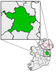
pin coords = left: 85px; top: 88px
north coord = 53.4697
west coord = 6.5364
irish grid =
area =
elevation =
province =Leinster
county =County Meath
town pop = rural pop =
census yr =
web =
|Batterstown (Irish place name|Baile an Bhóthair|town of the Bhóthair road [cite web|url=http://www.booksulster.com/library/plnm/placenamesB.php|title=Irish Local Names|accessdate=2008-07-07|author=P W Joyce] ) is a small village about km to mi | 40 | abbr=yes | precision=0 from
Dublin in the county of Meath, Ireland [http://www.fallingrain.com/world/EI/21/Batterstown.html] . It is located on the R154regional road . [http://www.irishtourist.com/meath/towns/batterstown/] . It hosts a cycling race [http://www.cyclingnews.com/road/?id=IRE/2003/mar03/mar09batterstown] .Transport
Batterstown railway station opened on
1 July 1863 , was closed for passenger traffic on27 January 1947 , closed for goods traffic on12 June 1961 , and finally closed altogether on1 April 1963 . [cite web | title=Batterstown station | work=Railscot - Irish Railways | url=http://www.railscot.co.uk/Ireland/Irish_railways.pdf | accessdate=2007-09-12]Bus Eireann currently runs a service from Monday to Saturday that includes Batterstown. [ [http://www.buseireann.ie/pdf/1212760885-Table-111.pdf A4 Portrait101-200.qxd ] ]References
Wikimedia Foundation. 2010.