- Savant Lake, Ontario
Infobox Settlement
official_name = Savant Lake
other_name =
native_name =
nickname =
motto =
imagesize =
image_caption =
flag_size =
image_
seal_size =
image_shield =
shield_size =
mapsize =
map_caption =
image_dot_
imagesize =
image_caption =
flag_size =
image_
seal_size =
image_shield =
shield_size =
mapsize =
map_caption =
image_dot_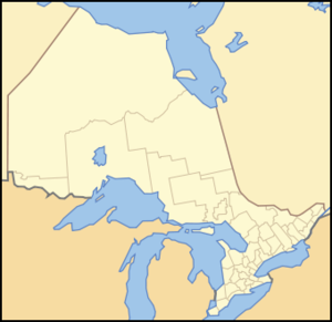
dot_mapsize = 250px
dot_map_caption = Location of PAGENAME
dot_x = 52 |dot_y = 110
pushpin_
pushpin_label_position =
subdivision_type = Country
subdivision_name =
subdivision_type1 = Province
subdivision_name1 =
subdivision_type2 = Region
subdivision_name2 =Northwestern Ontario
subdivision_type3 =District
subdivision_name3 = Thunder Bay
subdivision_type4 =
subdivision_name4 =
government_type = local service board
leader_title = MP
leader_name =Roger Valley (Kenora, LIB)
leader_title1 = MPP
leader_name1 =Howard Hampton (Kenora—Rainy River, NDP)
established_title =
established_date =
established_title2 =
established_date2 =
established_title3 =
established_date3 =
area_magnitude =
unit_pref =
area_footnotes =
area_total_km2 =
area_land_km2 =
area_water_km2 =
area_total_dunam =
area_total_sq_mi =
area_land_sq_mi =
area_water_sq_mi =
area_water_percent =
area_urban_km2 =
area_urban_sq_mi =
area_metro_km2 =
area_metro_sq_mi =
area_blank1_title =
area_blank1_km2 =
area_blank1_sq_mi =
elevation_footnotes =
elevation_m = 430
elevation_ft =
elevation_max_m =
elevation_max_ft =
elevation_min_m =
elevation_min_ft =
population_as_of =
population_footnotes =
population_note =
settlement_type =
population_total =timezone = CST
utc_offset = -6
timezone_DST = CDT
utc_offset_DST = -5
latd= 50|latm= 14|lats= |latNS= N
longd= 90|longm= 43|longs= |longEW= Wpostal_code_type = Postal Code
postal_code = P0V 2S0
area_code = 807
website =
footnotes =Savant Lake is a small community in
Northwestern Ontario along Secondary Highway 599, roughly halfway between Ignace and Pickle Lake.The community is also connected to Sioux Lookout via Secondary Highway 516. It is also the proposed northern terminus of an extension of Tertiary Highway 811, if it is extended.
The CN transcontinental rail line passes through the town.
Savant Lake (Sturgeon Lake) Water Aerodrome is located convert|3.5|nmi|km|1 southeast.Local media
Television
* CBWDT-03 (channel 8) (CBC)
* CICA-63 (channel 10) (TVO)References
Wikimedia Foundation. 2010.