- Dookie, Victoria
-
Dookie
Victoria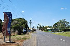
Entering Dookie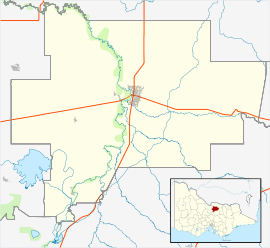
 Dookie
Population: 286 Postcode: 3646 Coordinates: 36°20′S 145°42′E / 36.333°S 145.7°ECoordinates: 36°20′S 145°42′E / 36.333°S 145.7°E Elevation: 189 m (620 ft) Location: - 220 km (137 mi) N of Melbourne
- 29 km (18 mi) E of Shepparton
- 42 km (26 mi) W of Benalla
LGA: City of Greater Shepparton State District: Shepparton Federal Division: Murray Mean max temp Mean min temp Annual rainfall 20.8 °C
69 °F9.4 °C
49 °F551.4 mm
21.7 inDookie (
 /ˈduːki/)[1] is a town in the Goulburn Valley region of Victoria, Australia. It is situated in a valley between Mount Major and Mount Saddleback. Dookie is a farming community. At the 2006 census, Dookie had a population of 286.[2]
Dookie is five minutes by car from Dookie College, jointly managed by the Goulburn Ovens Institute of TAFE and University of Melbourne since 2005.[3] Dookie has many sporting and community groups.
The Post Office opened around February 1878, was replaced by Dookie Railway Station office in 1888 when the railway arrived, which was then renamed Dookie in 1901. [4]
The town has an Australian rules football team Dookie United competing in the Picola & District Football League.
References
- ^ Macquarie Dictionary, Fourth Edition (2005). Melbourne, The Macquarie Library Pty Ltd. ISBN 1-876429-14-3
- ^ Australian Bureau of Statistics (25 October 2007). "Dookie (L) (Urban Centre/Locality)". 2006 Census QuickStats. http://www.censusdata.abs.gov.au/ABSNavigation/prenav/LocationSearch?collection=Census&period=2006&areacode=UCL214880&producttype=QuickStats&breadcrumb=PL&action=401. Retrieved 27 April 2010.
- ^ Fiona Davis, TAFE providors named in ag course turnaround, Stock and Land, 2 September 2005. Accessed 8 September 2008
- ^ Premier Postal History, Post Office List, https://www.premierpostal.com/cgi-bin/wsProd.sh/Viewpocdwrapper.p?SortBy=VIC&country=, retrieved 2008-04-11
Gallery
-

Gladstone Hotel
-

Park in the centre of town
-

Plains to the east of the town
-

St Mary's Roman Catholic church
Towns in the City of Greater Shepparton Arcadia • Congupna • Dookie • Grahamvale • Katandra West • Kialla • Lancaster • Lemnos • Merrigum • Mooroopna • Murchison • Orrvale • Shepparton • Shepparton East • Tallygaroopna • Tatura • Toolamba • Undera •
External links
- Lifestyle Dookie. Community website. Retrieved on 2007-03-01.
- Local history of Dookie
Categories:- Towns in Victoria (Australia)


Wikimedia Foundation. 2010.