- Interstate 19
Infobox road
state=AZ
type=I
route=19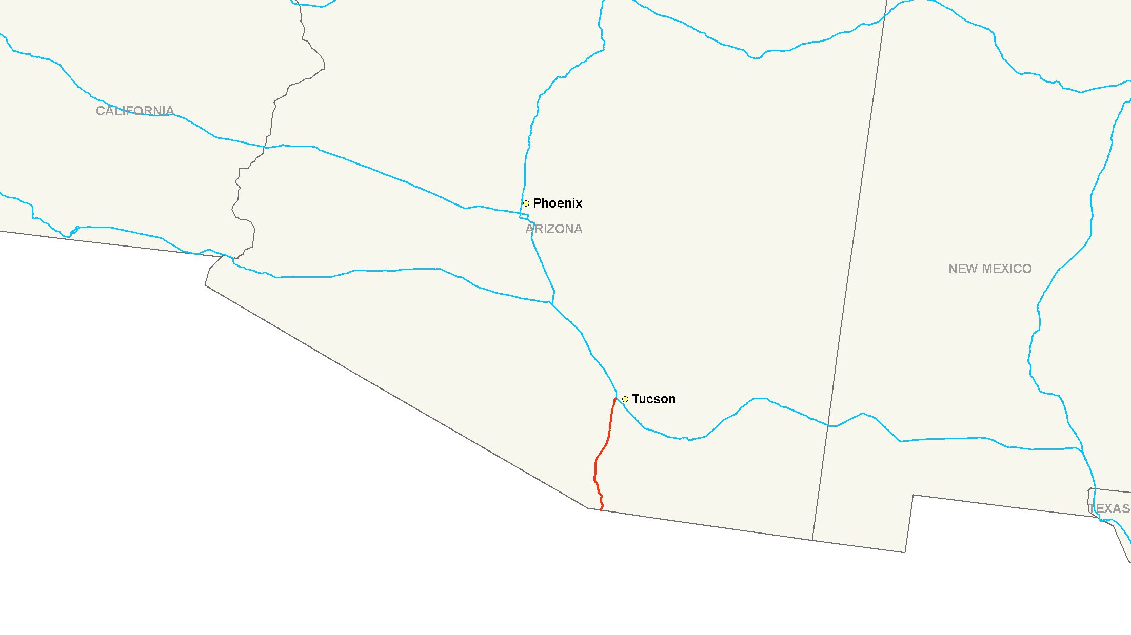
maint=Arizona Department of Transportation
length_mi=63.35
length_round=2
length_ref=cite web |url=http://tpd.az.gov/data/reports/2006SHSLog.pdf |title=2006 ADOT Highway Log |author=Arizona Department of Transportation |accessdate=2008-05-10]
established=
direction_a=South
terminus_a=
junction=
direction_b=North
terminus_b=jct|state=AZ|I|10 inTucson, AZ
previous_type=I
previous_route=17
next_type=I
next_route=40
commons=categoryInterstate 19 (I-19) is an intrastate
interstate highway located entirely within the state ofArizona . I-19 runs from Nogales, at the Mexican border to Tucson, at Interstate 10.cite web|publisher=Google Maps |url=http://maps.google.com/maps?f=d&hl=en&geocode=15839470934785341138,31.334684,-110.941493&saddr=W+Crawford+St%2FI-19+%4031.334684,+-110.941493&daddr=32.198712,-110.978565&mra=mi&mrsp=1,0&sz=16&sll=32.196678,-110.978479&sspn=0.008207,0.01442&ie=UTF8&ll=31.814563,-111.011353&spn=1.054928,1.845703&z=9|title=Overview Map of I-19|accessdate=2008-02-15]Route description
In
Nogales, Arizona , the southern terminus of I-19 is adjacent to the international port of entry, and southbound travelers can continue into Nogales, Sonora, Mexico, and connect with the northern terminus ofMexico Federal Highway 15 . I-19 initially heads west through Nogales before making the turn to head north. It interchanges with two other state highways near the southern end of the route, SR 189 at exit 4 and SR 289 at exit 12. As I-19 enters the Tucson city limits, it has an interchange at SR 86 at exit 99 before reaching its northern terminus at a junction with I-10.History
Nearly the entire route of I-19 follows, or is adjacent to, the former routing of U.S. Route 89 and the Santa Cruz River, which flows northward from Mexico, through Tucson and eventually disperses into the desert between Tucson and Phoenix. Most of the time, much of the river is dry, but heavy storms can cause it to overflow its banks.
The official "completion" date of the I-19 segment between Tucson (km 100) and Green Valley, Arizona (actually Helmet Peak Road at km 75) was February 12, 1972. A 1978 Project Report for the
Arizona Department of Transportation lists entire I-19 project as "completed," which includes segments between Green Valley and Nogales, Arizona.Interstate 19 is unique amongst US Interstates, because signed distances are given in
meter s (hundreds or thousands as distance-to-exit indications) orkilometer s (as distance-to-destination indications), and notmile s. Speed limit signs give speeds in miles-per-hour, however. According to the Arizona Department of Transportation (ADOT), metric signage was originally placed because of the "metric system push" in the United States at the time of the original construction of the highway. Fact|date=February 2007Recently, the Arizona Department of Transportation announced that they would convert metric signs back to
United States customary units in stages, replacing signs in specific areas of the freeway during construction projects in those areas. [http://www.azstarnet.com/dailystar/printDS/6429.php] This is due to the high cost of replacing all the metric signs at once. New signs were put into place between Exit 99 (Ajo Way) and Exit 101 (Interstate 10) in2004 after the completion of the new Interstate 10-Interstate 19 interchange.A recent reconstruction project at the Interstate's northern terminus with Interstate 10 in
Tucson, Arizona (at the interchange commonly called "The Crossing") was begun in 2002 and completed in August 2004. [ [http://web.archive.org/web/*/http://www.1019crossing.com/] ]Exit list
ee also
Business routes
*Interstate 19 Business from Green Valley to Sahuarita
*Interstate 19 Business inNogales, Arizona , runs from Nogales to the Mexican border.References
External links
* [http://www.arizonaroads.com/interstate/i19.html Arizona Roads]
Wikimedia Foundation. 2010.