- Crittenden Township, Champaign County, Illinois
-
Crittenden Township — Township — Location in Champaign County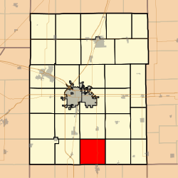 Champaign County's location in Illinois
Coordinates: 39°55′33″N 88°11′14″W / 39.92583°N 88.18722°WCoordinates: 39°55′33″N 88°11′14″W / 39.92583°N 88.18722°W Country United States State Illinois County Champaign Area - Total 36.59 sq mi (94.78 km2) - Land 36.59 sq mi (94.78 km2) - Water 0 sq mi (0 km2) 0% Elevation 659 ft (201 m) Population (2000) - Total 345 - Density 9.4/sq mi (3.6/km2) Time zone CST (UTC-6) - Summer (DST) CDT (UTC-5) GNIS feature ID 0428856 Crittenden Township is a township in Champaign County, Illinois, USA. As of the 2000 census, its population was 345[1].
Contents
History
Crittenden Township formed from part of Philo Township on an unknown date.
Geography
Crittenden Township covers an area of 36.59 square miles (94.8 km2). The streams of Black Slough and East Branch Embarras River run through this township.
Unincorporated towns
- Bongard
(This list is based on USGS data and may include former settlements.)
Cemeteries
The township contains four cemeteries: Immaculate Conception, Jessee, Kemp and Saint Marys.
Major highways
 Illinois State Route 130
References
- "Crittenden Township, Champaign County, Illinois". Geographic Names Information System, U.S. Geological Survey. http://geonames.usgs.gov/pls/gnispublic/f?p=gnispq:3:::NO::P3_FID:0428856. Retrieved 2010-01-04.
- United States Census Bureau cartographic boundary files
External links

Tolono Township Philo Township Sidney Township Pesotum Township 
Raymond Township  Crittenden Township

Tuscola Township, Douglas County Camargo Township, Douglas County Murdock Township, Douglas County Municipalities and communities of Champaign County, Illinois County seat: Urbana Cities 
Villages Townships Unincorporated
communitiesAugerville | Block | Bongard | Dailey | Deers | Dewey | Dickerson | Dillsburg | Fairland‡ | Flatville | Fulls | Gerald | Giblin | Glover | Jimtown | Lake of the Woods | Leverett | Lotus | Mayview | Mira | Parkville | Pauline | Penfield | Prospect | Rising | Rutherford | Sellers | Seymour | Sloan Station | Staley | State Road | Tipton | Tomlinson | Wilbur Heights
Footnotes ‡This populated place also has portions in an adjacent county or counties
Categories:- Townships in Champaign County, Illinois


Wikimedia Foundation. 2010.