- City of Tea Tree Gully
-
- This article is about the LGA in Adelaide. For the suburb of the same name, see Tea Tree Gully, South Australia.
City of Tea Tree Gully
South Australia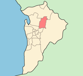
Population: 100,155(2009)[1] • Density: 999/km² (2,587.4/sq mi) Area: 95.21 km² (36.8 sq mi) Mayor: Miriam Smith Council Seat: Modbury Region: Metropolitan Adelaide State District: Little Para, Florey, Newland, Playford, Torrens, Wright Federal Division: Mayo, Makin, Sturt LGAs around City of Tea Tree Gully: City of Playford City of Playford City of Playford City of Salisbury City of Tea Tree Gully Adelaide Hills Council City of Port Adelaide Enfield City of Campbelltown Adelaide Hills Council The City of Tea Tree Gully is in the Australian state of South Australia, in the outer north-eastern suburbs of Adelaide. The city has a estimated population of 100,155 people and is one of the most populous local government divisions in Adelaide. The major business district in the city is at Modbury, where Tea Tree Plaza, the Civic Centre and the library are located.
Howard, Lord Florey, Australian pathogist and co-discoverer of penicillin, was a resident of the City of Tea Tree Gully. [1]
Contents
Suburbs and post codes
- Banksia Park - 5091
- Dernancourt - 5075
- Fairview Park - 5126
- Gilles Plains - 5086
- Golden Grove - 5125
- Gould Creek - 5114
- Greenwith - 5125
- Gulfview Heights - 5096
- Highbury - 5089
- Holden Hill - 5088
- Hope Valley - 5090
- Houghton - 5131
- Modbury - 5092
- Modbury Heights - 5092
- Modbury North - 5092
- Para Hills - 5096
- Redwood Park - 5097
- Ridgehaven - 5097
- St Agnes - 5097
- Salisbury East - 5109
- Salisbury Heights - 5109
- Surrey Downs - 5126
- Tea Tree Gully - 5091
- Upper Hermitage - 5131
- Valley View - 5093
- Vista - 5091
- Wynn Vale - 5127
- Yatala Vale - 5126
History
Tea Tree Gully was originally known as 'Steventon' as a local resident, John Stevens, was a major landowner in the area. Whilst the area name has changed, the name Steventon remains today as one of the electoral wards of the City of Tea Tree Gully.
The area was originally part of the Highercombe District Council, and Tea Tree Gully became the name of a smaller Council in October, 1858, when the original Highercombe District Council was split in two. When the two district councils were re-united in May, 1935, the new Council was named Tea Tree Gully and is known today as the City of Tea Tree Gully.
Geography
 Aerial image of the Golden Grove and Greenwith areas, looking north. Greenwith is to the north, and the border is Cobbler Creek, which is straddled by a treeline indicated by the upper red arrow. The southern border of Golden Grove is indicated approximately by the southern treeline marked by the arrow. The triangle in the southwestern corner of the photo is Surrey Downs, and to the southeastern corner is Fairview Park. Little Para Reservoir is the body of water. The light patches on the eastern part of the image are quarries. This is the northern part of the City of Tea Tree Gully.
The gully to which the city name refers actually exists and is known to be sizable as it provided a gradient negotiable only by bullock wagons travelling through the Mt. Lofty Ranges. Additionally the gully had permanent freshwater springs which promoted the growth of tea trees in the area - thus the eventual name 'Tea Tree Gully'.
The suburbs of Vista are adjacent to the 350ha Anstey Hill Recreation Park.
A detailed history of the District of Tea Tree Gully (1836-1976) was written by Mr Ian Auhl and published by Lynton Publications (Blackwood SA) in 1976. It has since been updated to more recent times
Sister cities
The City of Tea Tree Gully, has one sister city.[2] it is the:
 Asakuchi, Japan (April 2006)
References
- ^ Australian Bureau of Statistics (30 March 2010). "Regional Population Growth, Australia, 2008–09". http://www.abs.gov.au/ausstats/abs@.nsf/Latestproducts/3218.0Main%20Features72008-09?opendocument&tabname=Summary&prodno=3218.0&issue=2008-09&num=&view=. Retrieved 4 June 2010.
- ^ "Sister City Information". City of Tea Tree Gully. Archived from the original on 2007-08-29. http://web.archive.org/web/20070829114921/http://www.teatreegully.sa.gov.au/page?pg=1788&stypen=html. Retrieved 2008-01-02.
External links
- City of Tea Tree Gully
- City of Tea Tree Gully Library
- City of Tea Tree Gully community profile
- South Australia Central (State Government portal)
- Australian Local Government Association
- City of Tea Tree Gully: Suburb Boundaries at June 2004
Local Government Areas of South Australia Metropolitan Adelaide Adelaide · Adelaide Hills · Burnside · Campbelltown · Charles Sturt · Gawler · Holdfast Bay · Marion · Mitcham · Norwood Payneham & St Peters · Onkaparinga · Playford · Port Adelaide Enfield · Prospect · Salisbury · Tea Tree Gully · Unley · Walkerville · West TorrensEyre Peninsula Ceduna · Cleve · Elliston · Franklin Harbour · Kimba · Lower Eyre Peninsula · Port Augusta · Port Lincoln · Streaky Bay · Tumby Bay · Wudinna · WhyallaCentral Barossa · Barunga West · Clare and Gilbert Valleys · Copper Coast · Flinders Ranges · Goyder · Light · Mallala · Mount Remarkable · Northern Areas · Orroroo Carieton · Peterborough · Port Pirie · Wakefield · Yorke PeninsulaSouthern and Hills Murray Mallee Southeast Outback Categories:- Local Government Areas of South Australia
- Local Government Areas in Adelaide


Wikimedia Foundation. 2010.