- Churchill County, Nevada
-
This article is about the county in the US State of Nevada. For the county in the Australian state of Queensland, see County of Churchill, Queensland.
Churchill County, Nevada 
Seal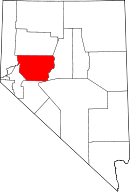
Location in the state of Nevada
Nevada's location in the U.S.Founded 1861 Seat Fallon Area
- Total
- Land
- Water
5,023 sq mi (13,010 km²)
4,929 sq mi (12,766 km²)
94 sq mi (243 km²), 1.88%PopulationEst.
- (2007)
- Density
27,190
5/sq mi (2/km²)Website www.churchillcounty.org Churchill County is a county located in the western U.S. state of Nevada. As of the 2000 census, the population was 23,982. As of July 1, 2007, the population of Churchill County was estimated at 27,190.[1] The county, named after Mexican-American War hero brevet Brigadier General Sylvester Churchill, was formed in 1861. Its seat is Fallon.
Churchill County is noteworthy in that it owns and operates the local telephone carrier, Churchill County Communications.
Contents
History
Churchill County was established in 1861 and named after Fort Churchill (which is now in Lyon County), which was named after General Sylvester Churchill, a Mexican-American War hero who was Inspector General of the U.S. Army in 1861. Churchill County was not organized until 1864, and its county seats were Bucklands (1861–64)which is now in Lyon County, La Plata (1864–68), Stillwater (1868–1904) and Fallon (1904–present). In the nineteenth century there were several attempts to eliminate Churchill County because of its small population, but Assemblyman Lemuel Allen was able to stop it on all occasions including convincing the Governor to veto the bill after it had been passed by both houses in 1875.
Railroads
The Eagle Salt Works Railroad ran for 13.5 miles (21.7 km), primarily on the original Central Pacific grade from Luva (2 miles (3.2 km) east of Fernley) to Eagle Salt Works.
The Central Pacific (the first transcontinental railroad) also ran through the county, although a portion of the original route has been shifted for a new route south of Wadsworth in favor of Fernley. The Central Pacific later became the Southern Pacific Railroad which was merged into Union Pacific in 1996.
Geography
Churchill County is in northwestern Nevada in the southwestern United States. According to the U.S. Census Bureau, the county has a total area of 5,023 square miles (13,009.5 km2), of which 4,929 square miles (12,766.1 km2) is land and 94 square miles (243.5 km2) (1.88%) is water.
Adjacent counties
- Lyon County, Nevada - west
- Washoe County, Nevada - northwest
- Pershing County, Nevada - north
- Lander County, Nevada - east
- Nye County, Nevada - southeast
- Mineral County, Nevada - south
National protected areas
- Fallon National Wildlife Refuge
- Stillwater National Wildlife Refuge
Demographics
As of the census[2] of 2000, there were 23,982 people, 8,912 households, and 6,461 families residing in the county. The population density was 5 people per square mile (2/km²). There were 9,732 housing units at an average density of 2 per square mile (1/km²). The racial makeup of the county was 84.20% White, 1.60% Black or African American, 4.78% Native American, 2.71% Asian, 0.23% Pacific Islander, 3.22% from other races, and 3.27% from two or more races. 8.66% of the population were Hispanic or Latino of any race.
There were 8,912 households out of which 37.20% had children under the age of 18 living with them, 57.70% were married couples living together, 10.40% had a female householder with no husband present, and 27.50% were non-families. 22.50% of all households were made up of individuals and 8.50% had someone living alone who was 65 years of age or older. The average household size was 2.64 and the average family size was 3.09.
In the county the population was spread out with 28.90% under the age of 18, 8.10% from 18 to 24, 28.70% from 25 to 44, 22.30% from 45 to 64, and 11.90% who were 65 years of age or older. The median age was 35 years. For every 100 females there were 100.60 males. For every 100 females age 18 and over, there were 99.10 males.
The median income for a household in the county was $40,808, and the median income for a family was $46,624. Males had a median income of $36,478 versus $25,000 for females. The per capita income for the county was $19,264. About 6.20% of families and 8.70% of the population were below the poverty line, including 10.80% of those under age 18 and 7.00% of those age 65 or over.
Cities and towns
- Dixie Valley
- Eastgate
- Fallon
- Fallon Station
- Hazen
- Lahontan
- Middlegate
- Nevada City
- Salt Wells
- Stillwater
- White Cloud City
See also
- National Register of Historic Places listings in Churchill County, Nevada
- USS Churchill County (LST-583)
References
- ^ 2006 Estimates by County
- ^ "American FactFinder". United States Census Bureau. http://factfinder.census.gov. Retrieved 2008-01-31.
External links

Washoe County Pershing County Lyon County 
Lander County  Churchill County, Nevada

Mineral County Nye County Municipalities and communities of Churchill County, Nevada City 
CDP Unincorporated
communitiesEastgate | Hazen | Lahontan | Middlegate | Salt Wells
Indian reservations Fallon Reservation | Walker River Indian Reservation
Ghost towns Dixie Valley | Nevada City | Stillwater | White Cloud City
 State of Nevada
Topics - Delegations
- Geography
- Government
- History
- People
- Transportation
- Visitor attractions
Society - Crime
- Demographics
- Economy
- Education
- Politics
Regions - Black Rock Desert
- Eagle Valley
- Great Basin
- Lake Mead
- Lake Tahoe
- Las Vegas Valley
- Mojave Desert
- Pahranagat Valley
- Sierra Nevada
Metro areas - Las Vegas-Paradise
- Reno-Sparks
- Carson City
Counties Cities and
communities- Alamo
- Amargosa Valley
- Austin
- Baker
- Battle Mountain
- Beatty
- Boulder City
- Caliente
- Carlin
- Carson City
- Elko
- Ely
- Enterprise
- Eureka
- Fallon
- Fernley
- Gardnerville Ranchos
- Gerlach
- Goldfield
- Hawthorne
- Henderson
- Incline Village
- Las Vegas
- Laughlin
- Lovelock
- Mesquite
- Minden
- North Las Vegas
- Pahrump
- Paradise
- Pioche
- Primm
- Rachel
- Reno
- Spanish Springs
- Sparks
- Spring Creek
- Spring Valley
- Stateline
- Summerlin South
- Sun Valley
- Sunrise Manor
- Tonopah
- Virginia City
- West Wendover
- Winnemucca
- Whitney
- Winchester
- Yerington
Former counties Categories:- Nevada counties
- Churchill County, Nevada
- 1861 establishments


Wikimedia Foundation. 2010.