- New Haven County, Connecticut
-
This article is about the county in Connecticut. For the city in Connecticut, see New Haven, Connecticut.
New Haven County, Connecticut 
Location in the state of Connecticut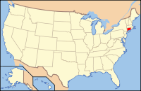
Connecticut's location in the U.S.Founded 1666 Seat none; formerly New Haven; since 1960 Connecticut counties no longer have a county government Largest city New Haven Area
- Total
- Land
- Water
862.02 sq mi (2,233 km²)
605.64 sq mi (1,569 km²)
256.38 sq mi (664 km²), 29.74%Population
- (2010)
- Density
862,477
1,423/sq mi (549.5/km²)Congressional districts 2nd, 3rd, 4th New Haven County is a county located in the south central part of the U.S. state of Connecticut. As of the 2010 Census, the county population is 862,477 making it the third most populated county in Connecticut. There are 1,340 people per square mile. [1] Two of the state's largest cities, New Haven (2nd) and Waterbury (5th), are part of New Haven County.
County governments were abolished in Connecticut in 1960. Thus, as is the case with all eight of Connecticut's counties, there is no county government, and no county seat. Until 1960, the city of New Haven was the county seat. In Connecticut, towns are responsible for all local government activities, including fire and rescue, snow removal and schools. In some cases, neighboring towns will share certain activities, e.g. schools, health, etc. New Haven County is merely a group of towns on a map, and has no specific government authority. The county Sheriff system was abolished by voters and replaced by State Judicial Marshals in 2000. As a result, the state judicial system in New Haven County is currently split into three judicial districts: New Haven, Ansonia-Milford, and Waterbury.
Contents
History
New Haven County was constituted by an act of the Connecticut General Court on May 10, 1666, along with Hartford County, Fairfield County, and New London County. The act establishing the county states:
- This Court orders that from the east bounds of Guilford
- vnto ye west bounds of Milford shalbe for future one County
- wch shalbe called the County of N: Hauen. And it is
- ordered that the County Court shalbe held at N: Hauen on
- the second Wednesday in March and on the second Wednesday
- in Nouember yearely.[2]
As established in 1666, New Haven County consisted of the towns of Milford, New Haven, and Guilford. The town of Wallingford was established in 1670 in unincorporated area north of New Haven and formally added to New Haven County in 1671. In 1675, the town of Derby was established in the area north of Milford. In 1686, the town of Waterbury was established, but was assigned as part of Hartford County. Waterbury was later transferred to New Haven County in 1728. In 1722, most of northwestern Connecticut (except for the town of Litchfield) was placed under the jurisdiction of New Haven County. Eight years later, in 1730, the eastern half of northwestern Connecticut was transferred to the jurisdiction of Hartford County. By mid-1738, with the exception of the towns of New Milford, Sharon, and Salisbury, the entire territory of northwestern Connecticut was under Hartford County. In 1751, Litchfield County was constituted consisting of all the towns in northwestern Connecticut. Between 1780 and 1807, several more towns were established along the northern boundary of New Haven County, resulting in the alteration of the limits of the county. The final boundary alteration leading to the modern boundary resulted from the establishment of the town of Middlebury on October 8, 1807.[3]
Geography
According to the 2000 census, the county has a total area of 862.02 square miles (2,232.6 km2), of which 605.64 square miles (1,568.6 km2) (or 70.26%) is land and 256.38 square miles (664.0 km2) (or 29.74%) is water.[4]
Geographic Features
The terrain is mostly flat near the coast, with low hills defining the rest of the area, rising significantly only in the north of the county. The highest elevation is close to the northernmost point in the county, found at two areas of approximately 1,050 feet (320 m) above sea level in the town of Wolcott. The lowest point is sea level.
Notable geographic landmarks include Mount Carmel ("Sleeping Giant"), West Rock and East Rock.
Adjacent counties
- Hartford County (north)
- Middlesex County (east)
- Fairfield County (west)
- Litchfield County (northwest)
New Haven county is bounded on the south by Long Island Sound.
Cities, towns, and villages*
 Map of New Haven County, Connecticut showing cities, boroughs, towns, and CDPs
- Ansonia (City)
- Beacon Falls (Town)
- Bethany (Town)
- Branford (Town)
- Cheshire (Town)
- Derby (City)
- East Haven (Town)
- Guilford (Town)
- Hamden (Town)
- Augerville (neighborhood)
- Centerville (Town Center)
- Dunbar Hill (neighborhood)
- Hamden Plains (neighborhood)
- Highwood (neighborhood)
- Mix District (neighborhood)
- Mount Carmel (neighborhood)
- Spring Glen (neighborhood)
- State Street (neighborhood)
- West Woods (neighborhood, aka Hamden Hills)
- Whitneyville (neighborhood)
- Madison (Town)
- Meriden (City)
- Middlebury (Town)
- Milford (City)
- Devon (village)
- Woodmont (Borough)
- Naugatuck (Borough)
- New Haven (City)
- Amity (neighborhood)
- Cedar Hill (neighborhood)
- City Point (neighborhood)
- Downtown (neighborhood)
- East Rock (neighborhood)
- Fair Haven (neighborhood)
- Fair Haven Heights (neighborhood)
- Long Wharf (neighborhood)
- Mill River (neighborhood)
- Quinnipiac Meadows (neighborhood)
- Westville (neighborhood)
- Wooster Square (neighborhood)
- North Branford (Town)
- Northford (a village of North Branford)
- North Haven (Town)
- Orange (Town)
- Oxford (Town)
- Prospect (Town)
- Seymour (Town)
- Southbury (Town)
- Wallingford (Town)
- Yalesville (village)
- Waterbury (City)
- West Haven (City)
- Wolcott (Town)
- Woodbridge (Town)
* Villages are named localities within towns but have no separate corporate existence from the towns they are in.
National protected area
Government and municipal services
As of 1960, counties in Connecticut do not have any associated county government structure. All municipal services are provided by the towns. In order to address issues concerning more than one town, several regional agencies that help coordinate the towns for infrastructure, land use, and economic development concerns have been established. Within the geographical area of New Haven County, the regional agencies are:
- South Central
- Central Naugatuck Valley (partly in Litchfield County)
- The Valley (partly in Fairfield County)
Judicial
The geographic area of the county is served by the three separate judicial districts: Ansonia-Milford, Waterbury, and New Haven. Each judicial district has a superior court located, respectively, in Milford, Waterbury, and New Haven.
Law enforcement
Law enforcement within the geographic area of the county is provided by the respective town police departments. Prior to 2000, a County Sheriff's Department existed for the purpose of executing judicial warrants, prisoner transport, and court security. These responsibilities have now been taken over by the Connecticut State Marshal System.
Fire protection
Fire protection in the county is provided by the towns. Several towns also have fire districts that provide services to a section of the town.
Founded in 1937, New Haven County has a county-wide fire-protection agency called "New Haven County Fire Emergency Plan" based in Hamden to "Coordinate Mutual Aid - Radio Problems, assist members of county at major incidents if requested, provide training".[1]
Water service
Water service is provided by a regional non-profit public corporation known as the South Central Connecticut Regional Water Authority. The Regional Water Authority supplies water to most of the towns within New Haven County, excluding the Waterbury area and the towns of Guilford and Madison. The Regional Water Authority is one of only two such county-wide public water service providers in the state.
Education
Education in the county area is usually provided by the individual town governments. Several less populated towns have joined together to form regional school districts. Bethany, Orange, and Woodbridge are part of Region 5; Middlebury and Southbury are part of Region 15; and Beacon Falls and Prospect are part of Region 16.
Demographics
Historical populations Census Pop. %± 1790 30,703 — 1800 32,162 4.8% 1810 37,064 15.2% 1820 39,616 6.9% 1830 43,847 10.7% 1840 48,619 10.9% 1850 65,588 34.9% 1860 97,345 48.4% 1870 121,257 24.6% 1880 156,523 29.1% 1890 209,058 33.6% 1900 269,163 28.8% 1910 337,282 25.3% 1920 415,214 23.1% 1930 463,449 11.6% 1940 484,316 4.5% 1950 545,784 12.7% 1960 660,315 21.0% 1970 744,948 12.8% 1980 761,337 2.2% 1990 804,219 5.6% 2000 824,008 2.5% 2010 862,477 4.7% [5][6][7] At the 2000 census[8], there were 824,008 people, 319,040 households, and 210,566 families residing in the county. The population density was 1,361 per square mile (525/km²). There were 340,732 housing units at an average density of 563 per square mile (217/km²). The racial makeup of the county was 79.40% White, 11.32% Black or African American, 0.25% Native American, 2.33% Asian, 0.04% Pacific Islander, 4.51% from other races, and 2.16% from two or more races. 10.09% of the population were Hispanic or Latino of any race. 24.5% were of Italian, 12.3% Irish, 6.0% Polish, 5.7% English and 5.6% German ancestry according to Census 2000. 8.73% of the population reported speaking Spanish at home, while 2.05% speak Italian.[2]
There were 319,040 households of which 31.20% had children under the age of 18 living with them, 48.60% were married couples living together, 13.60% had a female householder with no husband present, and 34.00% were non-families. 28.20% of all households were made up of individuals and 11.00% had someone living alone who was 65 years of age or older. The average household size was 2.50 and the average family size was 3.08.
The age distribution was 24.50% under the age of 18, 8.70% from 18 to 24, 30.00% from 25 to 44, 22.40% from 45 to 64, and 14.50% who were 65 years of age or older. The median age was 37 years. For every 100 females there were 92.50 males. For every 100 females age 18 and over, there were 88.70 males.
The median household income was $48,834, and the median family income was $60,549. Males had a median income of $43,643 versus $32,001 for females. The per capita income for the county was $24,439. About 7.00% of families and 9.50% of the population were below the poverty line, including 13.00% of those under age 18 and 7.70% of those age 65 or over.
Colleges and universities
New Haven county serves as a center of advanced learning, with several noted educational institutions located within its borders centered on the city of New Haven. These include:
- Albertus Magnus College
- Gateway Community College
- Naugatuck Valley Community College
- Paier College of Art
- Post University
- Quinnipiac University
- Southern Connecticut State University
- University of New Haven
- Yale University
New Haven county organizations
See also
- List of Registered Historic Places in New Haven County, Connecticut
- Greater New Haven
- National Register of Historic Places listings in New Haven County, Connecticut
References
- ^ http://2010.census.gov/2010census/data/index.php
- ^ "CCR: Volume 02, Page 39". http://www.colonialct.uconn.edu/ViewPageBySequentialID.cfm?v=02&p=39&c=4&StartVolume=1&StartPage=1. Retrieved 2008-06-17.[dead link]
- ^ Newberry Library -- Connecticut Atlas of Historical County Boundaries
- ^ "Census 2000 U.S. Gazetteer Files: Counties". United States Census. http://www.census.gov/tiger/tms/gazetteer/county2k.txt. Retrieved 2011-02-13.
- ^ http://www.census.gov/population/www/censusdata/cencounts/files/ct190090.txt
- ^ http://factfinder2.census.gov/faces/tableservices/jsf/pages/productview.xhtml?pid=DEC_10_PL_QTPL&prodType=table
- ^ http://mapserver.lib.virginia.edu/
- ^ "American FactFinder". United States Census Bureau. http://factfinder.census.gov. Retrieved 2008-01-31.
External links
- New Haven County Sheriff's Department
- New Haven County Marshals Association
- New Haven County Fire Emergency Plan
- National Register of Historic Places listing for New Haven Co., Connecticut

Litchfield County Hartford County Fairfield County 
Middlesex County  New Haven County, Connecticut

Long Island Sound Municipalities and communities of New Haven County, Connecticut Cities 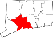
Towns Beacon Falls | Bethany | Branford | Cheshire | East Haven | Guilford | Hamden | Madison | Middlebury | Naugatuck* | North Branford | North Haven | Orange | Oxford | Prospect | Seymour | Southbury | Wallingford | Wolcott | Woodbridge
*Consolidated borough and town
Borough Unincorporated
communitiesDevon | Fair Haven | Heritage Village | Northford | Quaker Farms | Short Beach | South Britain | Stony Creek | Waterville | Westville | Yalesville
 State of Connecticut
Topics - Index
- Culture
- Constitution
- Delegations
- Elections
- Geography
- Government
- History
- Images
- People
- Visitor Attractions
Regions Counties - Fairfield
- Hartford
- Litchfield
- Middlesex
- New Haven
- New London
- Tolland
- Windham
Cities Places Categories:- Connecticut counties
- New Haven County, Connecticut
- 1666 establishments


Wikimedia Foundation. 2010.