- County Route 106 (Rockland County, New York)
-
County Route 106
Route information Length: 7.8 mi (12.6 km) Existed: 1982 – present Major junctions West end:  CR 106 at the Orange County line in Harriman State Park
 Palisades Parkway in Stony Point
East end: 
 US 9W / US 202 in Stony Point
Highway system Numbered highways in New York
Interstate • U.S. • N.Y. (former) • Reference • County (Rockland)County Route 106 (CR 106) is the continuation of Orange County Route 106 in Rockland County, New York. The route is 7.8 miles (12.6 km) long and heads east–west through Harriman State Park. The route originated as New York State Route 210 and as County Highway 416 back in the 1920s and 1930s. In 1982, NY 210 was decertified and replaced by CR 106 in Orange and Rockland Counties. CR 106 intersects with several county highways in Rockland County along the way. There are also many intersections with trails in Harriman State Park.
CR 106 is only one of two routes in Rockland County to keep its numbering from Orange County, with the other being County Route 72. CR 106 had one spur route, CR 106A, which was recently decommissioned.
Contents
Route description
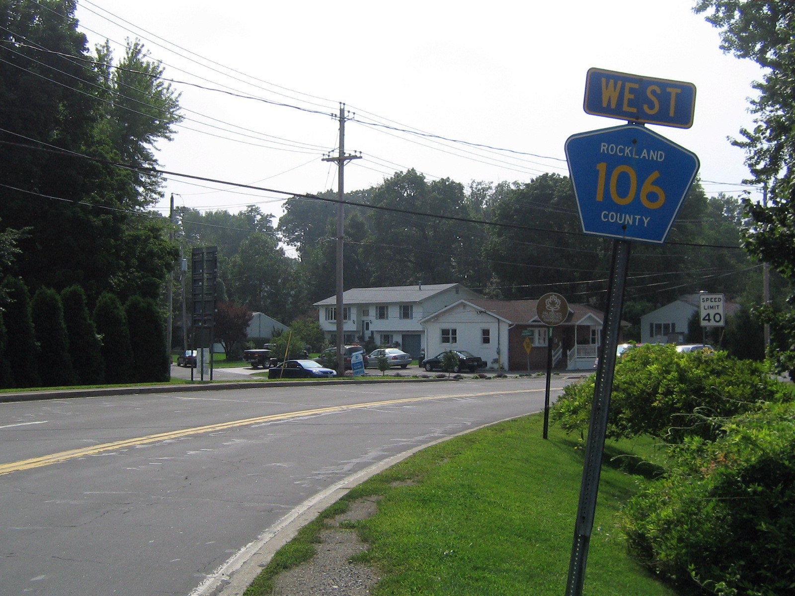
 CR 106 begins here in Stony Point, and heads east providing an intersection with the Palisades Parkway.
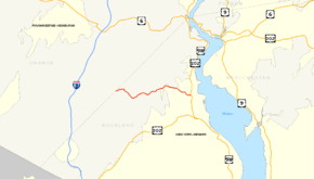
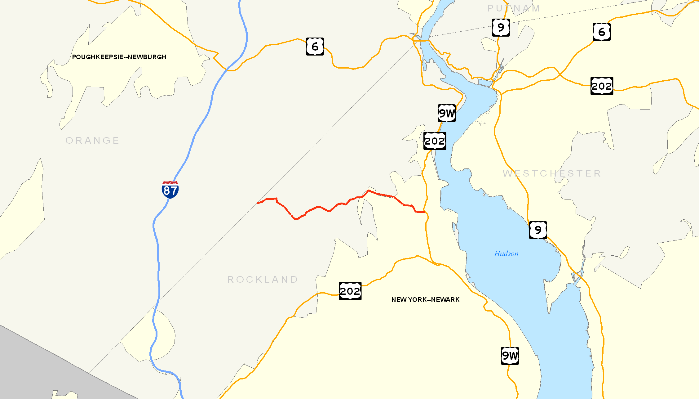
CR 106 runs through Harriman State Park into Stony Point.[1] CR 106 begins at the Orange County line in Harriman State Park as a continuation of Orange County Route 106, and ends at US 9W/US 202 in Stony Point. Orange County Route 106 has a junction with Seven Lakes Drive just after the Rockland County line. The route proceeds through the state park before ending at NY 17 and NY 17A. CR 106 is only one of two county routes that are shared by Rockland and Orange County. The other is CR 72.[1]
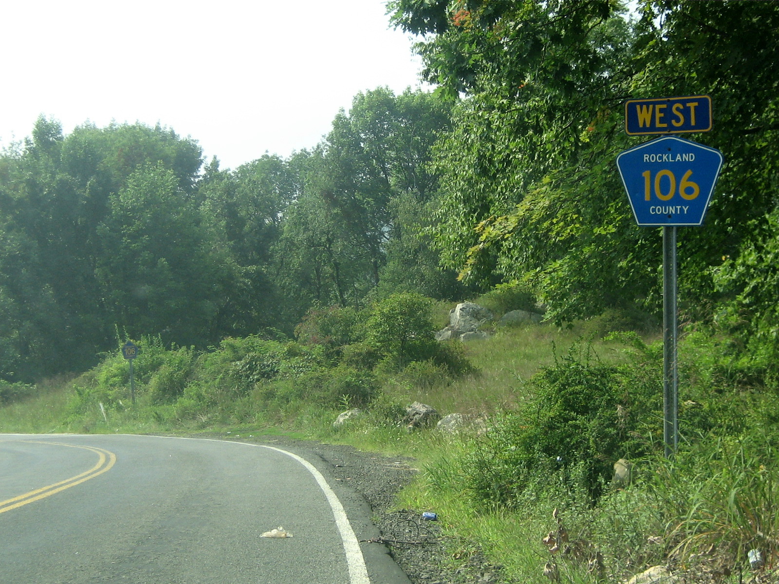
 CR 106's western terminus at the Rockland/Orange County line.
Rockland CR 106 begins right after Orange CR 106's traffic circle with Seven Lakes Drive near Lake Kanawauke.[1] CR 106 proceeds east from here providing a border between Harriman State Park (to the west) and Bear Mountain State Park (to the east). It then intersects Lake Welch Parkway, a seasonal road which provides a route to Lake Welch Beach on the northern side of the lake. Then, CR 106 splits Lake Welch in two different locations on the southern side of the lake. CR 106 then begins its trek out of Harriman State Park and into the town of Stony Point.[1]
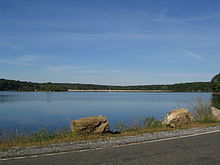 A view of the northern portion of Lake Welch and Lake Welch Beach from CR 106 as it splits the lake.
Immediately after entering Stony Point, CR 106 intersects CR 98 where CR 106 makes a left turn. CR 106 then proceeds east toward its intersection with the Palisades Parkway. This is at Exit 15 and is the last residential exit northbound on the PIP, with everything north of this point being exits within Harriman and Bear Mountain.
Just after its intersection with the PIP, the road intersects two former Rockland County Routes (CR 106A & CR 69).[1] Also, at this point CR 106 enters the village limits of Stony Point, and becomes a 55-mile-per-hour (89 km/h), highway with extra lanes in some places. The highway intersects CR 108, CR 47, and CR 33 as Central Drive. CR 106 comes to an end shortly after these intersections at US 9W/US 202 in downtown Stony Point, about a mile west from the Hudson River and the Stony Point Marina.[1]
History
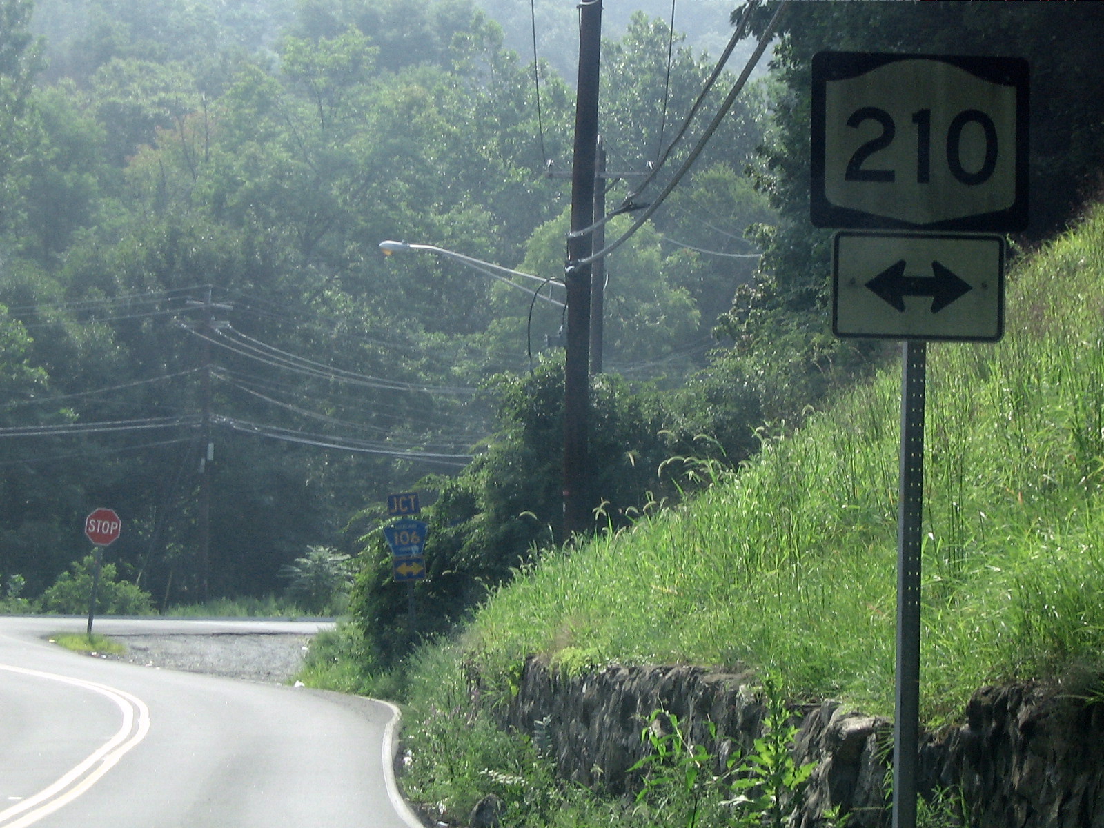
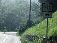 A few NY 210 shields still stand in Rockland County on side roads approaching CR 106.
CR 106 originated in 1824, when the road was chartered for the New Turnpike and headed from Monroe to Haverstraw.[2] Back in the 1820s, what is now Southfields was known as Monroe. The New Turnpike started at a nail factory in Monroe to a crossing over the Ramapo River, and progressed eastward, passing Lake Stahahe (then known as Car Pond). The turnpike continued eastward, meeting the Old Turnpike at a fork in the road. At the fork, part of the road became NY 210 in the 1930 New York State Route renumbering. In 1910, when the park opened, the road became known as the Southfields Road. Three years later, it became part of the Seven Lakes Drive. Three more years later, the route became known as County Highway 416. In 1919 and 1920, the western section of the road was reconstructed. After a bridge was built to cross a river in 1923, a new route, making up part of the original Warwick Turnpike, became NY 17A.[2]
The responsibility for maintaining NY 210 was turned over the county in 1982. The road was replaced with CR 106.[2][3]
CR 106A
- CR 106A - Route 106A was a 0.1 miles (0.2 km) spur which began at CR 106, ending at a dead end just before reaching CR 69 in Stony Point.[4]
Major intersections
The entire route is in Rockland County.
Location Mile[1] Destinations Notes Harriman State Park 0.00 CR 106 (Kanawauke Road)Continuation into Orange County 1.3  Lake Welch Parkway
To Lake Welch Beach Stony Point 3.4  CR 98 (Gate Hill Road)
3.5  CR 98A (Old Gate Hill Road)
4.3  CR 83 (Blanchard Road)
4.9 Palisades ParkwayExit 15 (PIP) 5.4 Swim Club Road Formerly CR 106A 5.6 Cedar Falls Road Formerly CR 69 6.4  CR 108 (Old Route 210)
6.8  CR 47 (Reservoir Road / Thiells Road)
7.5  CR 33 (Central Highway)
7.8 US 9W / US 202 (South Liberty Drive)1.000 mi = 1.609 km; 1.000 km = 0.621 mi See also
- List of county routes in Rockland County, New York (76–118A)
- County Route 106 (Orange County, New York)
References
- ^ a b c d e f g Google Maps. Overview Map of Rockland CR 106 (Map). http://maps.google.com/maps?f=d&hl=en&geocode=10841106416064691604,41.233671,-74.111710%3B13240468048414765983,41.226337,-73.986998&saddr=41.233736,-74.109607&daddr=Central+Dr%2FRT-210+%4041.226340,+-73.987000&mrcr=0&mrsp=0&sz=15&mra=dme&sll=41.230767,-74.10965&sspn=0.014395,0.029182&ie=UTF8&ll=41.230831,-74.057121&spn=0.115157,0.233459&z=12&om=1. Retrieved September 22, 2007.
- ^ a b c Myles, William J. (1999). Harriman Trails, A Guide and History. New York, New York: The New York-New Jersey Trail Conference.
- ^ New York State Department of Transportation (1991). Westchester & Rockland county map (Map). Cartography by New York State Department of Transportation.
- ^ Google Maps. Overview Map of Rockland CR 106A (Map). http://maps.google.com/maps?hl=en&q=from:RT-106A/Swim+Club+Rd+%4041.239340,+-74.026610+to:+RT-106A/Swim+Club+Rd+%4041.240760,+-74.024980&um=1&ie=UTF-8&sa=N&tab=wl. Retrieved January 11, 2008.
Categories:- County routes in Rockland County, New York
- Harriman State Park (New York)


Wikimedia Foundation. 2010.