- Meades Ranch, Kansas
-
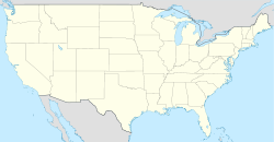
 Meades RanchMeades Ranch in north-central Kansas is near the center of the "lower 48" states.
 Triangulation station at Meade's Ranch, ca 1940
Meades Ranch is a location in Kansas, United States that was designated as the geodetic base point for the North American Datum of 1927 (NAD 27).
Contents
Location
It is located at 39°13′26.71218″N 98°32′31.74604″W / 39.2240867167°N 98.5421516778°W (39.224087, -98.542152, NAD83),[1] twelve miles (19 km) north of Lucas, Kansas, twenty miles (38 km) south of Downs, Kansas, and nine miles (14 km) southwest of Tipton, Kansas. A roadside marker describing Meades Ranch is located seventeen miles (27 km) north-northwest of Meades Ranch in a park just east of the junction of U.S. 24 and U.S. 281 in northeastern Osborne, Kansas.[2] Meades Ranch is about 40 miles (64 km) south of the geographic center of the forty-eight contiguous U.S. states which is near Lebanon, Kansas.
Reference ellipsoid
Meades Ranch was the reference point for almost all land survey measurements in the United States from 1927 until the establishment of the North American Datum of 1983 (NAD 83) and the World Geodetic System of 1984 (WGS84). NAD 27 was based on the Clarke ellipsoid of 1866. A reference ellipsoid is an attempt to closely describe mathematically the actual shape of the earth — the geoid. Calculations for map projections are performed using the parameters of the ellipsoid. The geoid, being irregular, is impossible to precisely model mathematically. For the purpose of the NAD 27, the geoidal height at Meades Ranch was assumed to be zero so that the geoid (mean sea level) and the ellipsoid intersect at that point.[3]
In popular culture
This geodetic center is featured in the 2006 documentary film Manhattan, Kansas by Tara Wray, which is about her reconciliation with her mentally unstable mother Evie Wray. Evie is shown searching for the Geodetic Center, the finding of which she says will bring about world peace.[4][5]
See also
References
External links
Categories:- Cartography by country
- Geodesy
- Geography of Kansas
- Geography of the United States
- Geography of Osborne County, Kansas


Wikimedia Foundation. 2010.