- Montgomery Canal
-
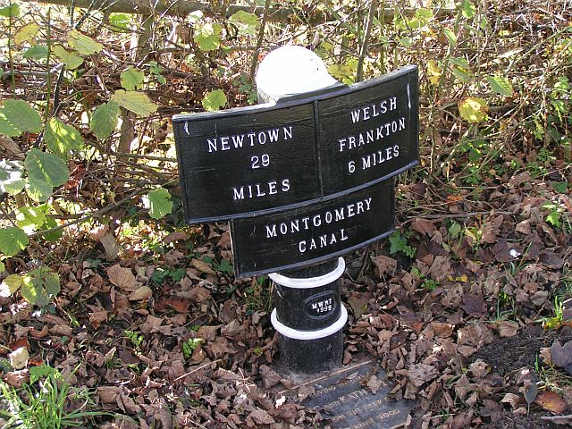
Montgomery Canal Montgomery Canal milepost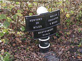
Former names Montgomeryshire Canal/Llanymynech Branch of the Ellesmere Canal Modern name Montgomery Canal Original owner The Company of Proprietors of the Montgomeryshire Canal Principal engineer John Dadford Other engineer(s) Thomas Dadford Junior/Thomas Dadford senior/Josias Jessop/John Williams/George W.Buck Date of act 1794 Date completed 1821 Date closed 1944 Date restored 1996 (ongoing) Maximum boat length 70 ft 0 in (21.34 m) Maximum boat beam 6 ft 10 in (2.08 m) Branch(es) Weston Branch (dis.) Branch of Llangollen Canal Locks 24 (originally 26)
(Graham Palmer lock was added at restoration)Maximum height above sea level 265 ft (81 m) Status Under Restoration Navigation authority British Waterways The Montgomery Canal (or Montgomeryshire Canal), known colloquially as "The Monty", is a partially restored canal in Powys, in eastern Wales, and in northwest Shropshire, in western England. Originally planned to run from Llanymynech to Newtown via Welshpool, the canal is today considered to run 33 miles (53 km) from the Llangollen Canal (at Frankton Junction) to Newtown.
Originally known as the Montgomeryshire Canal, after the former county of Montgomeryshire, along with the adjoining Llanymynech Branch of the Ellesmere Canal, the canal fell in to disuse following a breach in 1936, and was officially abandoned in 1944. With the revival of canal use in the late 20th century, the canal became known as the Montgomery Canal, which was considered to include the Llanymynech Branch of the Ellesmere Canal.
At present only 7 miles (11 km) of the northern section, from Frankton Junction to Gronwyn Wharf, a short stretch at Llanymynech, and a central section of the canal around Welshpool are navigable, though restoration work continues to expand this. The canal does not, and never did, go to the town of Montgomery.
Contents
History
 Frankton Staircase Lock
 Maesbury Marsh
 Memorial stone to Graham Palmer, founder of the Waterway Recovery Group, located adjacent to Graham Palmer Lock on the Montgomery Canal
The Montgomeryshire Canal was devised with a different purpose from most other canals of the time. Whereas other canals could generate sufficient revenue from cargo carrying to be financially viable, the Montgomeryshire was planned to serve a more rural area, which would not offer such opportunities. Instead the primary purpose of the canal was to transport lime for agricultural purposes, which would allow the Upper Severn Valley to become better agricultural land. As a result, the promoters of the canal included local landowners who hoped to achieve a return on their investment through greater crop yields, rather than relying upon share dividends.
The proposal of a canal from Llanymynech to Welshpool was made in 1792, to extend the Llanymynech Branch of the Ellesmere Canal, which was itself still then only a proposal. By 1793 it had been decided that the canal should continue through to Newtown. The canal was authorised in 1794 by an act of parliament entitled "An act for making a navigable Canal from or near Porthywain Lime Rocks in the parish of Llanyblodwell, in the county of Salop, to or near Newtown, in the county of Montgomery, and also certain collateral Cuts from the said Canal." The company was authorised to raise £72,000 from shares, and a further £20,000 if required.[1] John Dadford was appointed Engineer,[2] while his brother Thomas Dadford Junior was appointed his assistant.
By 1797, 16 miles (26 km) had been built from Llanymynech to Garthmyl, stopping 7 miles (11 km) short of Newtown. During construction, both the Vyrnwy Aqueduct and the Berriew Aqueduct had difficulties. John Dadford had resigned, and William Jessop was called in to advise. John Dadford was later replaced with Thomas Dadford senior.
A lack of capital and income prevented completion of the canal, and it remained with Garthmyl as its terminus for 20 years. With an estimated cost for the canal between Garthmyl and Newtown of £28,268,[2] shareholders feared they might lose their investment if the canal were completed, so a separate company was set up to build the remainder of the canal through to Newtown. In reality, this second company had many shareholders in common with the original company. In order to limit the risk to shareholders' dividends, it was required that the new section of canal be generating profit at least equal to that of the existing section before any merger of the two companies could take place. In 1815 an act of parliament was passed, to authorise the raising £40,000 in new shares to complete the canal. The new section of canal was known as the Western Branch of the Montgomeryshire Canal, the original section being known as the Eastern Branch.[3]
The Western Branch was planned by Josias Jessop, to include six locks of eight feet each, with the cut being 4 feet 6 inches deep, and 15 feet wide at the bottom. John Williams was appointed as resident engineer. The Western branch was completed in 1821.
As a result of the Western Branch needing to be profitable in order to allow the branches to merge, a higher tonnage charge was imposed on the Western Branch.[2]
In 1821 a further act of parliament was obtained, in order to alter the line of the Tanat feeder, and to make a navigable cut from the Guildfield Branch. This act also allowed the consolidation of the Eastern and Western branches with the consent of the proprietors of each, and clarified that the commencement of the Eastern branch was to be taken as the distance of thirty five yards from the sill of the upper gate of the higher of the two Carreghofa locks.[2] This alteration to the line of the Tanat feeder resulted in the feeder now supplying the pound above the Carreghofa locks, whereas it previously fed the canal below the locks.
In 1847 the Eastern Branch was purchased by the Shropshire Union Railways and Canal Company, and became part of the Shropshire Union network. In 1850 the Western Branch was also purchased by the Shropshire Union Railways and Canal Company. Bridge numbers on the Montgomery sections of the canal continue on from the Llanymynech Branch of the Ellesmere Canal to reflect this. Today, bridge numbers on the Montgomery Canal continue on from Llangollen Canal bridge numbers at Frankton Junction, with the first bridge on the Montgomery Canal (Lockgate Bridge) being therefore bridge number 71 and not number 1. The Llangollen Canal has, because of this, two separate series of bridge numbering, with one ending and the other beginning at Frankton Junction.
Partly due to the late arrival of railways in the area, traffic gradually increased and the Montgomery Canal became profitable. It remained so until after the First World War, after which it began making heavy losses. The Shropshire Union Railways and Canal Company was bought out by the London, Midland and Scottish Railway in 1922 and the canal became increasingly run-down.
In 1936 a breach occurred near Frankton Junction, below Lockgate Bridge. Despite a statutory duty to maintain the canal, the London, Midland and Scottish Railway decided to abandon it. In 1944 an Act of Abandonment was passed by parliament, stating that the waterway had not been used for some years.
Restoration
Since 1969 when the canal through Welshpool was threatened by a proposed road bypass, the canal has been partially restored for use by pleasure boaters. In some places the canal has been filled in, roads have been built over the channel, bridges have been lowered, and infrastructure such as pipes and manhole covers have been built in the canal bed, presenting several obstacles to restoration. The section from Freestone Lock to Newtown is dry, and no longer in British Waterways ownership.
In 1987 the locks at Frankton Junction were restored and officially reopened.
In 1996 the 4 miles (6 km) section from Frankton Junction to Queen's Head was reopened.
In 2001 work was started on the restoration of Newhouse Lock, with an estimated cost of £104,000. Soon after work started on the lock, it became evident that there were structural problems which had not been apparent when the first engineering inspection had been carried out. The costs were reappraised and a revised estimate of £250,000 was produced. The restoration was completed on schedule in 2006, and the lock was opened officially on 25 June 2006 by Lembit Opik, M.P., in conjunction with the Annual Montgomery Dinghy Dawdle. This completed the restoration of all of the locks on the section of the canal owned by British Waterways, and was the eleventh lock to be restored by Shropshire Union Canal Society.
In 2003 the 3 miles (5 km) section from Queen's Head to Gronwen Wharf was reopened. In October 2007 the 800 metres (875 yd) section from Gronwen Wharf to Redwith Bridge was filled with water, but is not open to navigation by motorised vessels.
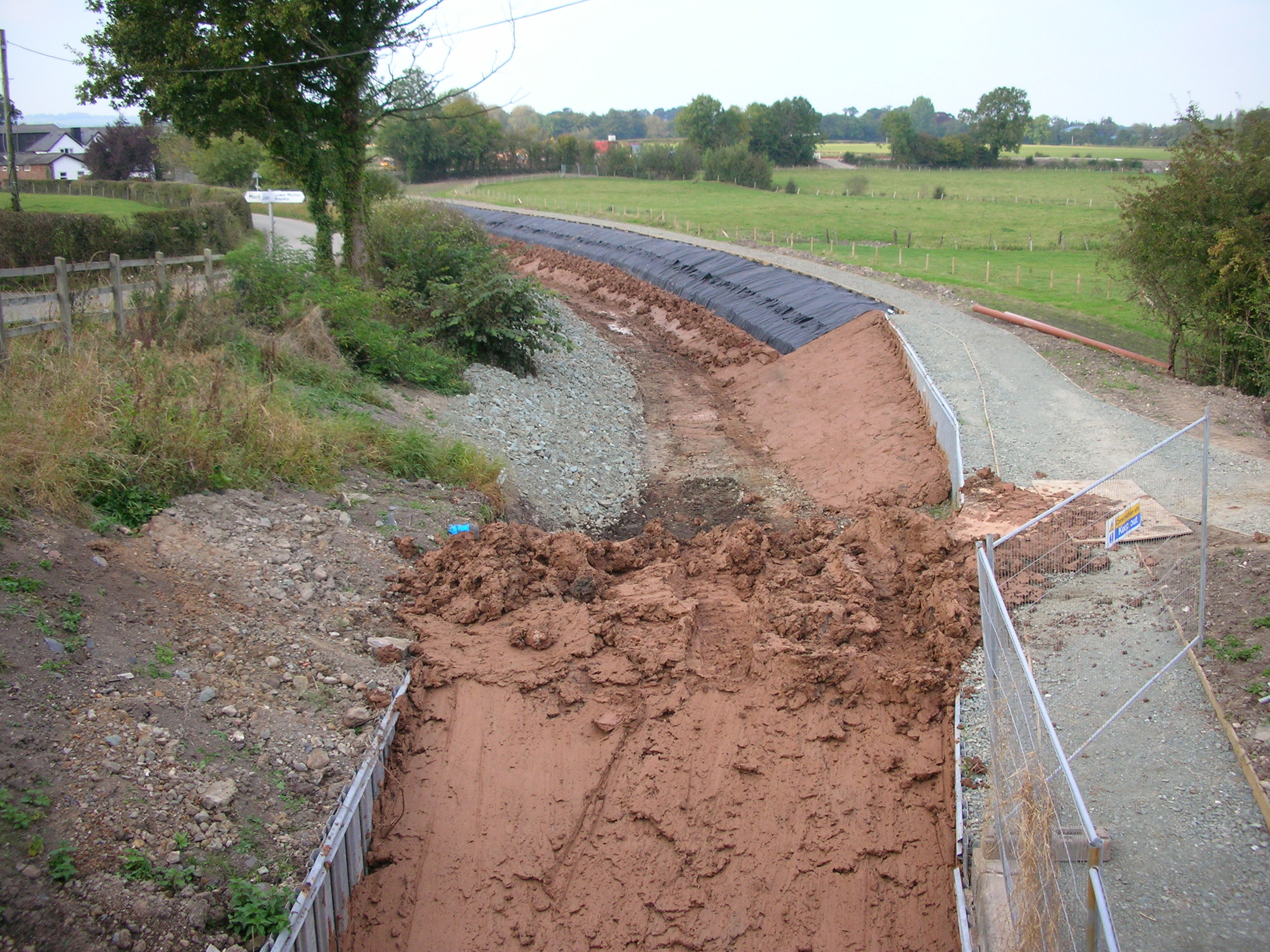
In October 2007 restoration was started on the 400 metres (437 yd) section from Redwith Bridge to Pryce's Bridge.
In 2007 restoration of Crickheath Wharf was started by the Shropshire Union Canal Society, though in 2008 work was postponed due to land ownership issues.
Restoration is being carried out by a partnership of the Montgomery Waterway Restoration Trust and British Waterways.
-

Restoration near Redwith Bridge, July 2007
-

Restoration near Crickheath Wharf, August 2007
-

Puddle clay lining and temporary end stop at Redwith Bridge, October 2007
Architecture
The lock gear on the Eastern Branch of the Montgomeryshire were of a different design to those on other canals. Whereas most other canal locks have culverts in the side walls to fill and empty the lock, with paddles opening and closing vertically, the locks on the Montgomeryshire were designed with a culvert in the base of the canal, with the paddle sliding horizontally over the culvert. During operation this can lead to a large whirlpool being observed. In order to operate the paddle, the winding gear is purely a geared design, rather than rack and pinion. An effect of this is that there is no pawl to be operated, and the paddles cannot be accidentally dropped shut. The paddle gear was designed by George W. Buck, who was appointed Engineer of the Eastern branch in 1819, and Clerk to the Western branch in 1832.
Many of the lock gates on the Montgomeryshire Canal were replaced with cast iron gates. These gates were curved, with tubular cast iron balance beams. The last surviving pair were removed from Welshpool and taken to Stoke Bruerne Canal Museum in the early 1970s.
Nature Conservation
In the years following the closure of the canal wildlife flourished. The whole of the Welsh section and parts of the English section (notably the section from the Aston Locks to Keeper's Bridge) were designated as Sites of Special Scientific Interest (SSSI). The notable wildlife includes Floating Water Plantain and Grass-wrack Pondweed.
In order to preserve the wildlife, nature reserves have been created at points along the canal. These include Rednal Basin, most of the Weston Branch and a specially constructed reserve alongside the Aston Locks. Some winding holes have been given over to nature, with the one adjacent to Crofts Mill Lift Bridge having had boat barriers installed, and the one adjacent to Park Mill Bridge allowed to be partially overgrown. There is a maximum of 1250 boats per year allowed passage on the navigable section in England (ie that part connected to the Llangollen Canal). In addition there are stricter speed restrictions than normally found on British canals, with speed limits of 2 and 3 mph for example on the navigable and connected part.
Towpath
The towpath of almost all the canal is used as a footpath. The section between Pool Quay Lock and Newtown forms part of the Severn Way. Shorter sections south of Llanymynech and Pool Quay are followed by the Offa's Dyke Path.
Route
Llanymynech Branch of the Ellesmere Canal
Llanymynech Branch of the Ellesmere Canal Legend
Frankton Junction (Llangollen Canal) 
Frankton (Top) Staircase Lock (2-chamber) 
Frankton (Middle) Lock Frankton (Bottom) Lock 
Weston Arm (rest of Branch now a nature reserve/in-filled) 
71 Lockgate Bridge Graham Palmer Lock 
Hawkswood Winding Hole 
(New) Perry Aqueduct 
73 Keeper's Bridge (dismantled) 
Rednal Basin (disused - now a nature reserve) 
Railway Bridge 
74 Heath House Bridge 75 Corbett's Bridge Queen's Head Winding Hole 76 Queen's Head Bridge 
76A (New A5 Bridge) Aston Top Lock Aston Middle Lock Aston Bottom Lock 77 Red Bridge Park Mill Bridge Winding Hole 78 Park Mill Bridge (partially overgrown) 79 Maesbury Marsh Bridge 80 Spiggots (or Spiket's) Bridge 
81 Crofts Mill Lift Bridge 
Mill Arm (or Peate's Branch) Gronwyn Wharf Winding Hole - limit of navigation 
82 Gronwyn (or Gronwen) Bridge 
82A New Lift Bridge 
Limit of restored canal (northern section) 
83 Redwith Bridge (B4396) 
84 Pryce's (or Price's) Bridge 
Crickheath Wharf Winding Hole 85 Crickheath Bridge 
86 Schoolhouse Bridge (dropped bridge) 87 Waen Wen Bridge 88 Pant Bridge 91 Old Rail Road Bridge 
Limit of restored canal (middle section) New Winding Hole Llanymynech Wharf arm 
Llanymynech Wharf arm 92 Llanymynech Bridge (A483) - Wales-England border Llanymynech Winding Hole 
Carreghofa Lane (barrier to navigation) 93 Walls Bridge 
Carreghofa (or Wern) Aqueduct 94 Causeway Lane 
Junction with the Montgomeryshire Canal This section was originally a branch of the Ellesmere Canal, but is today considered the first section of the Montgomery Canal. The section of the canal from Frankton Junction to Gronwen Wharf (just north of Bridge 82) is navigable by narrowboat.
A lockkeeper looks after Frankton Locks, as the canal pound between the locks is small, and water levels vary greatly as the locks are worked. Alongside the locks are several canal buildings, including a boatbuilder's house. The last boatbuilder to live here was a relative of the late L.T.C. Rolt.
The now-infilled Weston Branch, which terminated at Weston Lullingfields, branches off between Frankton Locks and Lockgate Bridge. Only a short section remains, used for mooring, with a British Waterways amenity block alongside.
The canal passes through a peat bog, which has been drained since the construction of the canal. This lowering of the water level has meant that during restoration the canal had to be lined to prevent leakage, and a new lock was required to lower the water level. This lock was named Graham Palmer Lock, after the founder of the Waterway Recovery Group.
The Perry Aqueduct crosses the River Perry, and was replaced during restoration. The old aqueduct was a three-arch aqueduct, but due to the lowered water level the new aqueduct was built as a single span to avoid impeding the river's flow.
Rednal Basin was originally used for transshipment between the canal and the Great Western Railway. Although the link to the basin still exists, the basin itself is unnavigable. At Queen's Head the canal passes under both the old and the new A5 road. There are mooring spaces and some British Waterways buildings at Queen's Head. Following on from Queen's Head are the three Aston Locks. The top lock has a nature reserve alongside, built during restoration.
The canal passes through Maesbury Marsh, a village built largely alongside the canal. An environmentally friendly building, incorporating a Post Office, shop, tearoom and accommodation was built alongside the canal near the village (just to the west of Spiggots Bridge) in 2006. Mooring is available along sections of the canal at Maesbury Marsh. Bridge 81 is a lift bridge, which requires a windlass to operate, and immediately to its west the Mill Arm (or Peate's Branch) has been restored for much of its length, giving access to a boatyard and private moorings.
The section of the canal from Gronwen Wharf to Redwith Bridge (No. 83) was re-opened in October 2007, though is not navigable by powered craft as Gronwen Wharf is the final winding hole on this navigable section of the canal. The newly-planted vegetation along this stretch also needs establishing. Therefore Gronwen Wharf remains as the general limit of navigation. Redwith Bridge had been lowered since the canal's closure, but has recently been rebuilt and is now capable of taking narrowboats underneath once again.
The section of the canal from Redwith Bridge to Llanymynech is dry and partially infilled. Restoration is gradually taking place from Redwith Bridge to Crickheath Wharf (located just north of Bridge 85), which will be the next winding hole to be available when this section of canal is restored. Through Pant the canal ran alongside the Oswestry and Newtown Railway, which later became part of the Cambrian Railways network. The Cambrian Railways Trust has restored a short section of the line between Llynclys and Pant, and has plans to open a halt at Penygarreg Lane adjacent to the canal.
The section of the canal from Llanymynech to Carreghofa is in water, though Carreghofa Lane now crosses the canal just to the north of Walls Bridge (No. 93) and this new crossing (built after the canal's closure) obstructs the canal. Since 2006, the short section between the new winding hole (located between Llanymynech and Pant) through Llanymynech is navigable and the wharf at Llanymynech has been restored. A second winding hole to the east of Llanymynech Bridge (No. 92) allows for boats to traverse this section of the canal and turn-around at either end. As the canal passes underneath Llanymynech Bridge it passes from Shropshire, England into Powys, Wales. Canal trips are provided on this Llanymynech stretch by the narrowboat George Watson Buck.[4]
Wern Aqueduct was built after the canal was originally opened, to allow a newly-constructed branch of the Shropshire and Montgomeryshire Railway to pass below. A temporary diversion of the canal was put in place to allow construction of the aqueduct, and the entrances to the diversion remain visible.
A feeder from the River Tanat, enters the canal above Carreghofa Locks. Built in 1822 by the Montgomeryshire Canal Company, it originally fed water between the locks, so that none could enter the Ellesmere Canal. When the canals were united the feeder was diverted to enter the canal above the locks, so that the lowest pound of the former Ellesmere Canal also gained from the feeder.
The end of the Llanymynech Branch of the Ellesmere Canal joins end-on to the Eastern Branch of the Montgomeryshire Canal at Carreghofa Locks.
Eastern Branch
Eastern Branch LegendJunction with the Llanymynech Branch of the Ellesmere Canal Carreghofa Top Lock 95 Carreghofa Bridge Carreghofa Bottom Lock 96 Williams Bridge site River Vyrnwy Aqueduct 97 Pentreheylin Bridge 98 Pentreheylin Hall Bridge 99 Parsons Bridge 100 Clafton (Canal House) Bridge 101 Maerdy (Rhysnant) Bridge 102 Maerdy Bridge site 103 Arddleen Bridge site Northern Limit of Navigation (Welshpool Section) 104 Dragon Bridge Guilsfield Arm Burgedin Top Lock 105 Burgedin Bridge Burgedin Bottom Lock 106 Wern Red Bridge 107 Gwern Middle Bridge 108 Tanhouse Bridge 109 Bank Lock Bridge 
Bank Lock Cabin Lock 110 Crowther Hall Lock Bridge Crowther Hall Lock 111 Pool Quay Lock Bridge Pool Quay Lock 112 Abbey Lift (Chain) Bridge 113 Abbey Footbridge 114 The Moors (Farm) Bridge 115 Buttington Bridge 
Heulwen Trust Wharf 116 Gungrog Bridge 117 Gallowstree Bank Bridge 118 Clerks Bridge 
Lledan Brook Aqueduct 119 Severn Street Bridge Welshpool Town Lock 120 Whitehouse Bridge Belan Lower Lock 121 Belan Locks Bridge Belan Upper Lock 122 Sweeps Bridge 123 Chapel Bridge 124 Wernllwyd Bridge Brithdir Lock 125 Brithdir Bridge Brithdir Aqueduct 126 Luggy Bridge 127 Cefn Rallt Bridge Berriew (Rectory) Lock 128 Long Bridge Berriew Aqueduct 129 Refail (Efail-Fach) Bridge Southern Limit of Navigation (Welshpool Section) Junction with the Western section of the Montgomeryshire Canal The section of the canal from Carreghofa to Arddleen is in water, though several bridges have been lowered.
Between the two Carreghofa Locks was a side pond, necessary as the pound between the locks is short.
Near the Vyrnwy Aquedect arches were built in the embankment of the canal, to provide protection from flooding of the River Vyrnwy. The aqueduct itself has been repaired and strengthened in the 1820s, 1890s and 1970s. It sometimes can be seen to leak into the River Vyrnwy, though the leaks self-heal. Unlike the nearby Chirk Aqueduct and Pontcysyllte Aqueduct, which have a cast iron trough, the Vyrnwy Aqueduct is built of stone and is puddled. The weight of this structure led to it being strengthened with tie bars and girders in the 1820s.
Bridges 102 and 103 carry a major road and have been lowered since the canal was closed. In order to restore navigation, lowering of the pound by addition of an extra lock has been proposed.
The section of the canal from Arddleen to Refail (Efail-Fach) Bridge is navigable.
The Guilsfield Arm never actually reached Guilsfield. The arm was 2.25 miles (3.6 km) long, with a wharf at its terminus. It was level, with no locks or tunnels, which was achieved by a cutting 600 feet long and up to 20 feet deep. Today the arm is cut off from the main line by a lowered bridge. A short section has been made into a nature reserve, and beyond that the arm is dry.
The pound below Burgedin Bottom Lock is the sump pound of the canal, the Eastern Branch of the Montgomeryshire being filled by lockings from the Ellesmere, the Tanat feeder at Carreghofa, and a feeder from the River Rhiw at Berriew.
The canal through Welshpool was one of the first sections to be restored in 1969, when it was proposed that the route of the canal be used for a bypass. Welshpool Town Lock had gates made of cast iron when the canal was closed. These were removed, taken to Stoke Bruerne Canal Museum and replaced by gates of a standard design.
Western Branch
Western Branch LegendJunction with the Eastern section of the Montgomeryshire Canal 130 Cefn Garthmyl Bridge 131 Chain Garthmyl Bridge 132 Nag's Head Bridge site Trwstllewelyn Aqueduct 133 Trwstllewelyn Bridge 134 Brynllwyn Bridge 135 Penllwyn Bridge 136 Halfway Bridge site 137 Bunkers Hill Bridge 138 Sadlers Footbridge 139 Sadlers Turnbridge 140 Abernant Bridge 141 Dairy Bridge site 142 Red House Turn Bridge 143 Glashafren Bridge 144 Bryn Turn Bridge 145 Brynderwyn Wharf Bridge 146 Brynderwyn Lock Bridge Brynderwyn Lock 147 Brynderwyn New Road Bridge A5 Road crossing 148 Byles Lock Bridge Byles Lock 149 Newhouse Lock Bridge Newhouse Lock 150 Newhouse (Wood) Bridge 151 Aberbechan Kiln Bridge 152 Aberbechan Road Bridge 153 Freestone Bridge Freestone Lock 
154 Dolfor Lock Bridge 
Dolfor Lock 155 Dolfor Bridge site 156 Port House Turn Bridge site 157 Rock Lock Bridge site Rock Lock site 
Newtown Pumphouse 158A Newtown Pumphouse Footbridge 159 Foundry Bridge site 160 Waggon Bridge site 
Newtown Wharf The section of the canal from Refail (Efail-Fach) Bridge to Freestone Lock is in water, though several bridges have been lowered. This includes bridges of the A483, which runs in the same direction as the canal, traversing it in places.
Between bridges 145 and 146 the towpath briefly changes side of the canal. This is to accommodate a wharf.
Several of the bridges on this section of canal are made from cast iron, from nearby Brymbo.
Below bridge 153, water enters the canal from the Penarth Weir on the River Severn. The section of the canal from Freestone Lock to Newtown is largely filled-in, and the basin in Newtown has been built on.
The Newtown Pumphouse raised water from the River Severn to the canal, initially using an undershot water wheel to operate two bucket pumps. This was supplemented by a steam engine for times when the waterwheel failed to provide sufficient power. In time this arrangement was replaced by a diesel powered pump.
Points of interest
Point Coordinates
(Links to map resources)OS Grid Ref Notes Frankton Junction 52°52′49″N 2°56′13″W / 52.8804°N 2.9369°W Llangollen Canal/Montgomery Canal junction Carreghofa Locks 52°46′27″N 3°06′24″W / 52.7743°N 3.1068°W Ellesmere Canal/Eastern Branch of the Montgomeryshire junction Guilsfield Arm 52°43′28″N 3°06′31″W / 52.7244°N 3.1085°W Garthmyl 52°35′18″N 3°11′40″W / 52.5883°N 3.1944°W Eastern/Western Branch of the Montgomeryshire junction See also
References
- ^ Priestly, Joseph (1831). Historical Account of the Navigable Rivers, Canals, and Railways, of Great Britain. Longman, Rees, Orme, Brown & Green. pp. 455–456.
- ^ a b c d Priestly, Joseph (1831). Historical Account of the Navigable Rivers, Canals, and Railways, of Great Britain. Longman, Rees, Orme, Brown & Green. p. 457.
- ^ Priestly, Joseph (1831). Historical Account of the Navigable Rivers, Canals, and Railways, of Great Britain. Longman, Rees, Orme, Brown & Green. p. 456.
- ^ Llanymynech info
- Denton, John Horsley (1984). Montgomeryshire Canal and the Llanymynech Branch of the Ellesmere Canal. Lapal Publications. ISBN 0950923818.
- Waterways World (2005). Canal Guide 2 - Llangollen and Montgomery Canals. Waterways World Ltd. ISBN 187000289X.
External links
- Pete’s Montgomery Canal web-site, incorporating the Montgomery Waterway Restoration Trust
- The Official Website of the Maesbury Canal Festival
Categories:- Canals in Shropshire
- Canals in Wales
- Buildings and structures in Powys
- Visitor attractions in Shropshire
- Sites of Special Scientific Interest in Montgomery
- Sites of Special Scientific Interest in Shropshire
- Transport in Powys
- Shropshire Union Canal
-


Wikimedia Foundation. 2010.