- English Channel
-
For the racehorse, see English Channel (horse).
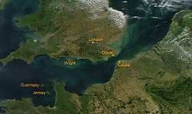 Satellite view of the English Channel
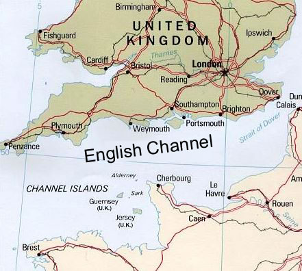
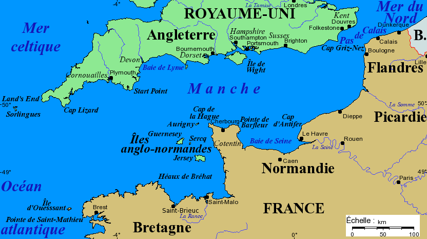
The English Channel (French: la Manche, Breton: Mor Breizh, Cornish: Mor Bretannek), often referred to simply as the Channel, is an arm of the Atlantic Ocean that separates southern England from northern France, and joins the North Sea to the Atlantic. It is about 560 km (350 mi) long and varies in width from 240 km (150 mi) at its widest to 34 km (21 mi) in the Strait of Dover.[1] It is the smallest of the shallow seas around the continental shelf of Europe, covering an area of some 75,000 km2 (29,000 sq mi).[2]
Contents
Geography
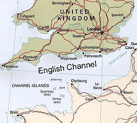 Map of the English Channel
The International Hydrographic Organization defines the limits of the English Channel as follows:[3]
On the West. A line joining Isle Vierge (48°38′23″N 4°34′13″W / 48.63972°N 4.57028°W) to Lands End (50°04′N 5°43′W / 50.067°N 5.717°W).
On the East. The Southwestern limit of the North Sea.
The IHO defines the southwestern limit of the North Sea as "a line joining the Walde Lighthouse (France, 1°55'E) and Leathercoat Point (England, 51°10'N)".[3] The Walde Lighthouse is 6 km east of Calais (50°59′06″N 1°55′00″E / 50.985°N 1.9166667°E), and Leathercoat Point is at the north end of St Margaret's Bay, Kent (51°10′00″N 1°24′00″E / 51.1666667°N 1.4°E).
The Strait of Dover, at the Channel's eastern end is its narrowest point, while its widest point lies between Lyme Bay and the Gulf of Saint Malo near its midpoint.[1] It is relatively shallow, with an average depth of about 120 m (390 ft) at its widest part, reducing to a depth of about 45 m (148 ft) between Dover and Calais. From there eastwards the adjoining North Sea continues to shallow to about 26 m (85 ft) in the Broad Fourteens where it lies over the watershed of the former land bridge between East Anglia and the Low Countries. It reaches a maximum depth of 180 m (590 ft) in the submerged valley of Hurds Deep, 30 mi (48 km) west-northwest of Guernsey.[4] The eastern region along the French coast between Cherbourg and the mouth of the Seine river at Le Havre is frequently referred to as the Bay of the Seine (French: Baie de Seine).[5]
There are several major islands in the Channel, the most notable being the Isle of Wight off the English coast, and the Channel Islands, British Crown Dependencies off the coast of France. The Isles of Scilly off the far southwest coast of England are not generally counted as being in the Channel. The coastline, particularly on the French shore, is deeply indented; several small islands close to the coastline, including Chausey and Mont Saint-Michel, are within French jurisdiction. The Cotentin Peninsula in France juts out into the Channel, and the Isle of Wight creates a small parallel channel known as the Solent in English waters. The Celtic Sea is to the west of the Channel.
The Channel is of geologically recent origins, having been dry land for most of the Pleistocene period. It is thought to have been created between 450,000 and 180,000 years ago by two catastrophic glacial lake outburst floods caused by the breaching of the Weald–Artois anticline, a ridge that held back a large proglacial lake in the Doggerland region, now submerged under the North Sea. The flood would have lasted for several months, releasing as much as one million cubic metres of water per second. The cause of the breach is not known but may have been an earthquake or the build-up of water pressure in the lake. The flood carved a large bedrock-floored valley down the length of the Channel, leaving behind streamlined islands and longitudinal erosional grooves characteristic of catastrophic megaflood events.[6][7] It destroyed the isthmus that connected Britain to continental Europe, although a land bridge across the southern North Sea would have existed intermittently at later times after periods of glaciation resulted in lower sea levels.[8]
For the UK Shipping Forecast the Channel is divided into the following areas, from the west:
Name
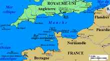 Map with French nomenclature
The name "English Channel" has been widely used since the early 18th century, possibly originating from the designation "Engelse Kanaal" in Dutch sea maps from the 16th century onwards. It has also been known as the "British Channel".[9][10] Prior to then it was known as the British Sea, and it was called the "Oceanus Britannicus" by the 2nd-century geographer Ptolemy. The same name is used on an Italian map of about 1450, which gives the alternative name of "canalites Anglie"—possibly the first recorded use of the "Channel" designation.[11]
The French name "(la) Manche" has been in use since at least the 17th century.[2] The name is usually said to refer to the Channel's sleeve (French: "manche") shape. However, it is sometimes claimed to derive from a Celtic word meaning "channel" that is also the source of the name for The Minch, in Scotland.[12] In Spain and most Spanish speaking countries the Channel is referred to as "El Canal de la Mancha". In Portuguese it is known as "Canal da Mancha". (This is not a translation from French: in Portuguese and Spanish, "mancha" means "stain", while the word for sleeve is "manga" - which prompts an early phonetic bad translation from French). Other languages also use this name, such as Greek (Κανάλι της Μάγχης) and Italian (la Manica). Germans translate to “Ärmelkanal”, i. e. sleeve channel.
History
Before the end of the Devensian glaciation (the most recent ice age) around 10,000 years ago, the British Isles were part of continental Europe. During this period the North Sea and almost all of the British Isles were covered with ice. The sea level was about 120 m lower than it is today, and the channel was an expanse of low-lying tundra, through which passed a river which drained the Rhine and Thames towards the Atlantic to the west. As the ice sheet melted, a large freshwater lake formed in the southern part of what is now the North Sea. As the meltwater could still not escape to the north (as the northern North Sea was still frozen) the outflow channel from the lake entered the Atlantic Ocean in the region of Dover and Calais.
This precious stone set in the silver sea,
Which serves it in the office of a wall
Or as a moat defensive to a house,
Against the envy of less happier lands.William Shakespeare, Richard II (Act II, Scene 1)The Channel has been the key natural defence for Britain, halting invading armies while in conjunction with control of the North Sea allowing Britain to blockade the continent.[citation needed] The most significant failed invasion threats came when the Dutch and Belgian ports were held by a major continental power, e.g. from the Spanish Armada in 1588, Napoleon during the Napoleonic Wars, and Nazi Germany during World War II. Successful invasions include the Roman conquest of Britain, the Norman Conquest in 1066 and the invasion and conquest of Britain by Dutch troops under William III in 1688, while the concentration of excellent harbours in the Western Channel on Britain's south coast made possible the largest invasion of all time, the Normandy landings in 1944. Channel naval battles include the Battle of Goodwin Sands (1652), the Battle of Portland (1653), the Battle of La Hougue (1692) and the engagement between USS Kearsarge and CSS Alabama (1864).
In more peaceful times the Channel served as a link joining shared cultures and political structures, particularly the huge Angevin Empire from 1135 to 1217. For nearly a thousand years, the Channel also provided a link between the Modern Celtic regions and languages of Cornwall and Brittany. Brittany was founded by Britons who fled Cornwall and Devon after Anglo-Saxon encroachment. In Brittany, there is a region known as "Cornouaille" (Cornwall) in French and "Kernev" in Breton[13] In ancient times there was also a "Domnonia" (Devon) in Brittany as well.
In February 1684 (New style), ice formed on the sea in a belt 3 miles (4.8 km) wide off the coast of Kent and 2 miles (3.2 km) wide on the French side.[14][15]
Route to the British Isles
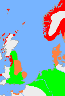 The approximate extent of Old Norse and related languages in the early 10th century around the North Sea. The red area is the distribution of the dialect Old West Norse, the orange area Old East Norse, and the green area the other Germanic languages with which Old Norse still retained some mutual intelligibility
Diodorus Siculus and Pliny[16] both suggest trade between the rebel celtic tribes of Armorica and Iron Age Britain flourished. In 55 BC Julius Caesar invaded, claiming that the Britons had aided the Veneti against him the previous year. He was more successful in 54 BC, but Britain was not fully established as part of the Roman Empire until completion of the invasion by Aulus Plautius in 43 AD. A brisk and regular trade began between ports in Roman Gaul and those in Britain. This traffic continued until the end of Roman rule in Britain in 410 AD, after which the early Anglo-Saxons left less clear historical records.
In the power vacuum left by the retreating Romans, the Germanic Angles, Saxons, and Jutes began the next great migration across the North Sea. Having already been used as mercenaries in Britain by the Romans, many people from these tribes crossed during the Migration Period, conquering and perhaps displacing the native Celtic populations.[17]
Norsemen and Normans
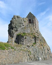 The Hermitage of St Helier lies in the bay off St. Helier and is accessible on foot at low tide
The attack on Lindisfarne in 793 is generally considered the beginning of the Viking Age. For the next 250 years the Scandinavian raiders of Norway, Sweden, and Denmark dominated the North Sea, raiding monasteries, homes, and towns along the coast and along the rivers that ran inland. According to the Anglo-Saxon Chronicle they began to settle in Britain in 851. They continued to settle in the British Isles and the continent until around 1050.[18]
The fiefdom of Normandy was created for the Viking leader Rollo (also known as Robert of Normandy). Rollo had besieged Paris but in 911 entered vassalage to the king of the West Franks Charles the Simple through the Treaty of St.-Claire-sur-Epte. In exchange for his homage and fealty, Rollo legally gained the territory he and his Viking allies had previously conquered. The name "Normandy" reflects Rollo's Viking (i.e. "Northman") origins.
The descendants of Rollo and his followers adopted the local Gallo-Romantic language and intermarried with the area’s inhabitants and became the Normans – a Norman French-speaking mixture of Scandinavians, Hiberno-Norse, Orcadians, Anglo-Danish, and indigenous Franks and Gauls.
Rollo's descendant William, Duke of Normandy became king of England in 1066 in the Norman Conquest culminating at the Battle of Hastings, while retaining the fiefdom of Normandy for himself and his descendants. In 1204, during the reign of King John, mainland Normandy was taken from England by France under Philip II, while insular Normandy (the Channel Islands) remained under English control. In 1259, Henry III of England recognised the legality of French possession of mainland Normandy under the Treaty of Paris. His successors, however, often fought to regain control of mainland Normandy.
With the rise of William the Conqueror the North Sea and Channel began to lose some of their importance. The new order oriented most of England and Scandinavia's trade south, toward the Mediterranean and the Orient.
Although the British surrendered claims to mainland Normandy and other French possessions in 1801, the monarch of the United Kingdom retains the title Duke of Normandy in respect to the Channel Islands. The Channel Islands (except for Chausey) are a Crown dependency of the British Crown. Thus the Loyal Toast in the Channel Islands is La Reine, notre Duc ("The Queen, our Duke"). The British monarch is understood to not be the Duke of Normandy in regards of the French region of Normandy described herein, by virtue of the Treaty of Paris of 1259, the surrender of French possessions in 1801, and the belief that the rights of succession to that title are subject to Salic Law which excludes inheritance through female heirs.
French Normandy was occupied by English forces during the Hundred Years' War in 1346–1360 and again in 1415–1450.
From the reign of Elizabeth I, English foreign policy concentrated on preventing invasion across the Channel by ensuring no major European power controlled the potential Dutch and Flemish invasion ports. Her climb to the pre-eminent sea power of the world began in 1588 as the attempted invasion of the Spanish Armada was defeated by the combination of outstanding naval tactics by the English under command of Charles Howard, 1st Earl of Nottingham with Sir Francis Drake second in command, and the following stormy weather. Over the centuries the Royal Navy slowly grew to be the most powerful in the world.[19]
The building of the British Empire was possible only because the Royal Navy exercised unquestioned control over the seas around Europe, especially the Channel and the North Sea. During the Seven Years' War, France attempted to launch an invasion of Britain. To achieve this France needed to gain control of the Channel for several weeks, but was thwarted following the British naval victory at the Battle of Quiberon Bay in 1759.
Another significant challenge to British domination of the seas came during the Napoleonic Wars. The Battle of Trafalgar took place off the coast of Spain against a combined French and Spanish fleet and was won by Admiral Horatio Nelson, ending Napoleon's plans for a cross-Channel invasion and securing British dominance of the seas for over a century.
First World War
The exceptional strategic importance of the Channel as a tool for blockade was recognised by the First Sea Lord Admiral Fisher in the years before World War I. "Five keys lock up the world! Singapore, the Cape, Alexandria, Gibraltar, Dover."[20] However on July 25, 1909 Louis Blériot successfully made the first Channel crossing from Calais to Dover in an aeroplane. Blériot's crossing signalled the end of the Channel as a barrier-moat for England against foreign enemies.
Because the Kaiserliche Marine surface fleet could not match the British Grand Fleet, the Germans developed submarine warfare, which was to become a far greater threat to Britain. The Dover Patrol was set up just before war started to escort cross-Channel troopships and to prevent submarines from accessing the Channel, thereby obliging them to travel to the Atlantic via the much longer route around Scotland.
On land, the German army attempted to capture Channel ports (see "Race to the Sea"), but although the trenches are often said to have stretched "from the frontier of Switzerland to the English Channel", they reached the coast at the North Sea. Much of the British war effort in Flanders was a bloody but successful strategy to prevent the Germans reaching the Channel coast.
On 31 January 1917, the Germans restarted unrestricted submarine warfare leading to dire Admiralty predictions that submarines would defeat Britain by November,[21] the most dangerous situation Britain faced in either World War.
The Battle of Passchendaele in 1917 was fought to reduce the threat by capturing the submarine bases on the Belgian coast, though it was the introduction of convoys and not capture of the bases that averted defeat. In April 1918 the Dover Patrol carried out the famous Zeebrugge Raid against the U-boat bases. The naval blockade effected via the Channel and North Sea was one of the decisive factors in the German defeat in 1918.[22]
Second World War
 British radar facilities during the Battle of Britain 1940
During the Second World War, naval activity in the European theatre was primarily limited to the Atlantic. The early stages of the Battle of Britain[23] featured air attacks on Channel shipping and ports, and until the Normandy landings (with the exception of the Channel Dash) the narrow waters were too dangerous for major warships. Despite these early successes against shipping, the Germans did not win the air supremacy necessary for a cross Channel invasion.
The Channel subsequently became the stage for an intensive coastal war, featuring submarines, minesweepers, and Fast Attack Craft.[24]
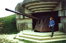 150 mm World War II German gun emplacement in Normandy.
Dieppe was the site of an ill-fated raid by Canadian and British armed forces. More successful was the later Operation Overlord (D-Day), a massive invasion of German-occupied France by Allied troops. Caen, Cherbourg, Carentan, Falaise and other Norman towns endured many casualties in the fight for the province, which continued until the closing of the so-called Falaise gap between Chambois and Montormel, then liberation of Le Havre.
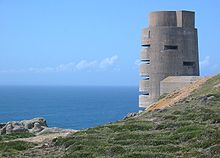 As part of the Atlantic Wall, between 1940 and 1945 the occupying German forces and the Organisation Todt constructed fortifications round the coasts of the Channel Islands such as this observation tower at Les Landes, Jersey
The Channel Islands were the only part of the British Commonwealth occupied by Germany (excepting the part of Egypt occupied by the Afrika Korps at the time of the Second Battle of El Alamein, which was a protectorate and not part of the Commonwealth). The German occupation of 1940–1945 was harsh, with some island residents being taken for slave labour on the Continent; native Jews sent to concentration camps; partisan resistance and retribution; accusations of collaboration; and slave labour (primarily Russians and eastern Europeans) being brought to the islands to build fortifications.[citation needed] The Royal Navy blockaded the islands from time to time, particularly following the liberation of mainland Normandy in 1944. Intense negotiations resulted in some Red Cross humanitarian aid, but there was considerable hunger and privation during the occupation, particularly in the final months, when the population was close to starvation. The German troops on the islands surrendered on 9 May 1945, a few days after the final surrender in mainland Europe.
Population
The Channel is densely populated on both shores, with major ports and resorts having a combined population of over 3.5 million people. The most significant towns and cities along the Channel (each with more than 20,000 inhabitants, ranked in descending order; populations are the urban area populations from the 1999 French census, 2001 UK census, and 2001 Jersey census) are as follows:
England

- Brighton–Worthing–Littlehampton: 461,181 inhabitants, made up of:
- Portsmouth: 442,252, including
- Gosport: 79,200
- Bournemouth & Poole: 383,713
- Southampton: 304,400
- Plymouth: 243,795
- Torbay (Torquay): 129,702
- Hastings–Bexhill: 126,386
- Eastbourne: 106,562
- Bognor Regis: 62,141
- Folkestone–Hythe: 60,039
- Weymouth: 56,043
- Dover: 39,078
- Exmouth: 32,972
- Falmouth–Penryn: 28,801
- Ryde: 22,806
- St Austell: 22,658
- Seaford: 21,851
- Falmouth: 21,635
- Penzance: 20,255
France
- Le Havre: 248,547 inhabitants
- Calais: 104,852
- Boulogne-sur-Mer: 92,704
- Cherbourg: 89,704
- Saint-Brieuc: 85,849
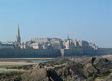
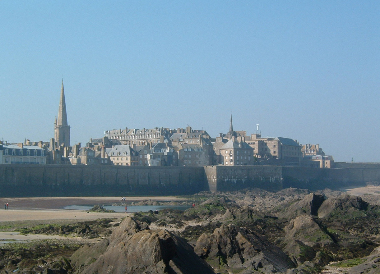
- Saint-Malo: 50,675
- Lannion–Perros-Guirec: 48,990
- Dieppe: 42,202
- Morlaix: 35,996
- Dinard: 25,006
- Étaples–Le Touquet-Paris-Plage: 23,994
- Fécamp: 22,717
- Eu–Le Tréport: 22,019
- Trouville-sur-Mer–Deauville: 20,406
- Berck: 20,113
Channel Islands
- Saint Helier: 28,310 inhabitants
- Saint Peter Port: 16,488 inhabitants
Shipping
The Channel has traffic on both the UK-Europe and North Sea-Atlantic routes, and is the world's busiest seaway, with over 500 ships per day.[25] Following an accident in January 1971 and a series of disastrous collisions with wreckage in February,[26] the Dover Traffic Separation System (TSS)[27] the world's first radar controlled TSS was set up by the International Maritime Organization. The scheme mandates that vessels travelling north must use the French side, travelling south the English side. There is a separation zone between the two lanes. [28]
In December 2002 the MV Tricolor, carrying £30m of luxury cars sank 32 km (20 mi) northwest of Dunkirk after collision in fog with the container ship Kariba. The cargo ship Nicola ran into the wreckage the next day. There was no loss of life.[citation needed]
The shore-based long range traffic control system was updated in 2003 and there is a series of Traffic Separation Systems in operation.[29] Though the system is inherently incapable of reaching the levels of safety obtained from aviation systems such as the Traffic Collision Avoidance System, it has reduced accidents to one or two per year.[citation needed]
Marine GPS systems allow ships to be preprogrammed to follow navigational channels accurately and automatically, further avoiding risk of running aground, but following the fatal collision between Dutch Aquamarine and Ash in October 2001, Britain's Marine Accident Investigation Branch (MAIB) issued a safety bulletin saying it believed that in these most unusual circumstances GPS use had actually contributed to the collision.[30] The ships were maintaining a very precise automated course, one directly behind the other, rather than making use of the full width of the traffic lanes as a human navigator would.
A combination of radar difficulties in monitoring areas near cliffs, a failure of a CCTV system, incorrect operation of the anchor, the inability of the crew to follow standard procedures of using a GPS to provide early warning of the ship dragging the anchor and reluctance to admit the mistake and start the engine led to the MV Willy running aground in Cawsand bay, Cornwall in January 2002. The MAIB report makes it clear that the harbour controllers were informed of impending disaster by shore observers before the crew were themselves aware.[31] The village of Kingsand was evacuated for three days because of the risk of explosion, and the ship was stranded for 11 days.[32][33][34]
Ecology
As a busy shipping lane, the Channel experiences environmental problems following accidents involving ships with toxic cargo and oil spills.[35] Indeed over 40% of the UK incidents threatening pollution occur in or very near the Channel.[36] One of the most infamous was the MSC Napoli, which with nearly 1700 tonnes of dangerous cargo was controversially beached in Lyme Bay, a protected World Heritage Site coastline. The ship had been damaged and was en route to Portland Harbour when much nearer harbours were available.
Transportation
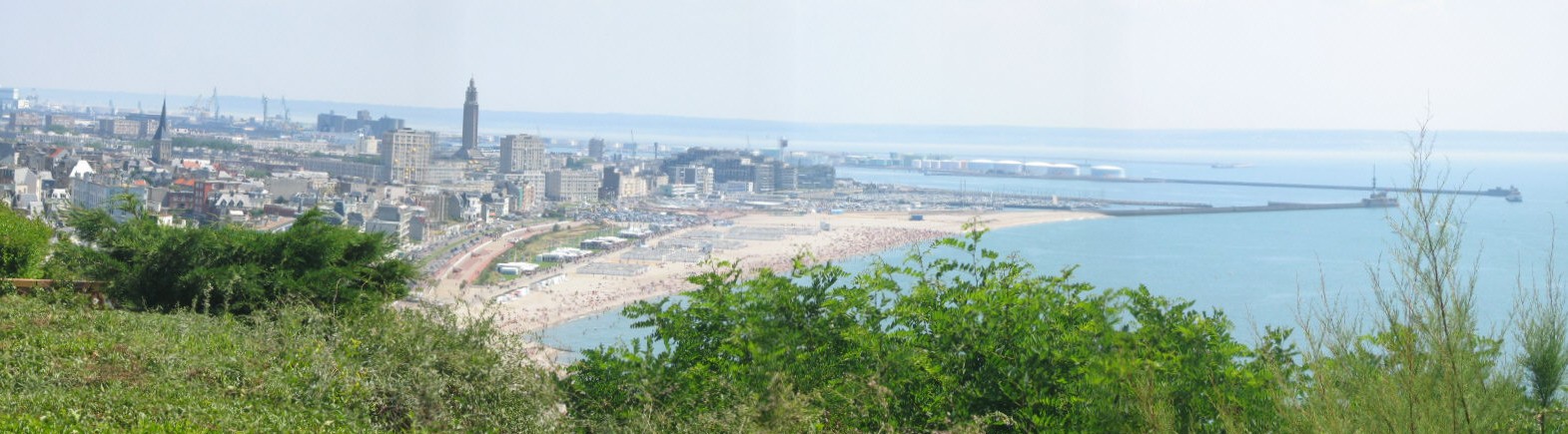
 The beach of Le Havre and a part of the rebuilt city
Ferry
Main article: Channel PortsImportant ferry routes are:
- Dover-Calais
- Dover-Boulogne
- Dover-Dunkerque
- Newhaven-Dieppe
- Portsmouth-Caen (Ouistreham)
- Portsmouth-Cherbourg
- Portsmouth-Le Havre
- Portsmouth-Saint Malo
- Portsmouth-Jersey & Guernsey
- Poole-Saint Malo
- Poole-Cherbourg
- Weymouth-Saint Malo
- Plymouth-Roscoff
Channel Tunnel
Many travellers cross beneath the Channel using the Channel Tunnel, first proposed in the early 19th century and finally realised in 1994, connecting the UK and France by rail. It is now routine to travel between Paris or Brussels and London on the Eurostar train. Cars can also be carried on special trains between Folkestone and Calais.
Economy
Tourism
The coastal resorts of the Channel, such as Brighton and Deauville, inaugurated an era of aristocratic tourism in the early 19th century, which developed into the seaside tourism that has shaped resorts around the world. Short trips across the Channel for leisure purposes are often referred to as Channel Hopping.
Culture and languages
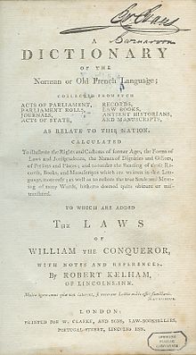 Kelham's Dictionary of the Norman or Old French Language (1779), dealing with England's Law French, a cross-Channel relic
The two dominant cultures are English on the north shore of the Channel, French on the south. However, there are also a number of minority languages that are or were found on the shores and islands of the English Channel, which are listed here, with the Channel's name following them.
- Celtic Languages
- Germanic languages
Dutch previously had a larger range, and extended into parts of modern-day France. For more information, please see French Flemish.
- Romance languages
- French - "La Manche"
- Gallo
- Norman, including the Channel Island vernaculars:
- Anglo-Norman (extinct, but fossilised in certain English law phrases)
- Auregnais (extinct)
- Cotentinais - "Maunche"
- Guernesiais - "Ch'nal"
- Jèrriais - "Ch'na"
- Sercquais
- Picard
Most other languages tend towards variants of the French and English forms, but notably Welsh has "Môr Udd".
Notable channel crossings
As one of the narrowest but most famous international waterways lacking dangerous currents, the Channel has been the first objective of numerous innovative sea, air and human powered crossing technologies.
By boat
Pierre Andriel crossed the English Channel aboard the Élise, ex the Scottish p.s. "Margery" in March 1816, one of the earliest sea going voyages by steam ship.
The paddle steamer Defiance, Captain William Wager, was the first steamer to cross the Channel to Holland, arriving there on 9 May 1816.[37]
On June 10, 1821 English-built paddle steamer Rob Roy was the first passenger ferry to cross channel. The steamer was purchased subsequently by the French postal administration and renamed Henri IV and put into regular passenger service a year later. It was able to make the journey across the Straits of Dover in around three hours.[49]
In June 1843 because of difficulties with Dover harbour, the South Eastern Railway company developed the Boulogne-sur-Mer-Folkestone route as an alternative to Calais-Dover. The first ferry crossed under the command of Captain Hayward.[50]
The Mountbatten class hovercraft (MCH) entered commercial service in August 1968, initially between Dover and Boulogne but later also Ramsgate (Pegwell Bay) to Calais. The journey time Dover to Boulogne was roughly 35 minutes, with six trips per day at peak times. The fastest crossing of the English Channel by a commercial car-carrying hovercraft was 22 minutes, recorded by the Princess Anne MCH SR-N4 Mk3 on 14 September 1995,[51] for the 10:00 am service[citation needed].
The youngest recorded sailors to cross the Channel were a team of eight with ages ranging from 7 to 16 on 18 July 2010. They sailed their single-handed RS Tera dinghies 27 miles from Dover to Boulogne in 5 hours and were tracked by Dover Coastguard Radar, who retain a record of the passage. They were from three UK clubs: Castle Cove SC, Dabchicks SC and Downs SC.
By swimming
Main article: List of successful English Channel swimmersThe sport of Channel swimming traces its origins to the latter part of the 19th century when Captain Matthew Webb made the first observed and unassisted swim across the Strait of Dover, swimming from England to France on 24-25 August 1875 in 21 hours 45 minutes.
In 1927, at a time when fewer than ten swimmers had managed to emulate the feat and many dubious claims were being made, the Channel Swimming Association (CSA) was founded to authenticate and ratify swimmers' claims to have swum the Channel and to verify crossing times. The CSA was dissolved in 1999 and was succeeded by two separate organisations: CSA (Ltd) and the Channel Swimming and Piloting Federation (CSPF). Both observe and authenticate cross-Channel swims in the Strait of Dover. The Channel Crossing Association was set up at about this time to cater for unorthodox crossings.
The team with the most number of Channel swims to its credit is the International Sri Chinmoy Marathon Team, with 35 crossings by 25 members (by 2005).[52]
By the end of 2005, 811 people had completed 1,185 verified crossings under the rules of the CSA, the CSA (Ltd), the CSPF and Butlins.
The number of swims conducted under and ratified by the Channel Swimming Association to 2005 was 982 by 665 people. This includes 24 two-way crossings and three three-way crossings.
The number of ratified swims to 2004 was 948 by 675 people (456 men, 214 women). There have been 16 two-way crossings (9 by men and 7 by women). There have been three three-way crossings (2 by men and 1 by a woman). (It is unclear whether this last set of data is comprehensive or CSA only.)
The Strait of Dover is the busiest stretch of water in the world. It is governed by International Law as described in this document.[53] It states,, "However, in exceptional cases the French Maritime Authorities may grant authority for unorthodox craft to cross French territorial waters within the Traffic Separation Scheme when these craft set off from the British coast, on condition that the request for authorisation is sent to them with the opinion of the British Maritime Authorities". It is therefore theoretically possible to hire a non CSA or CS&PF pilot boat when swimming the channel, though it would be difficult to convince the MCA to endorse the trip.
The CCA, CSA and CS&PF are the organisations escorting channel swims, because their pilots have the experience, qualifications and equipment to guarantee the safety of the swimmers they escort.
The fastest verified swim of the Channel was by the Bulgarian Petar Stoychev on 24 August 2007, in 6 hours 57 minutes 50 seconds.
By car
On 16 September 1965 two Amphicars crossed from Dover to Calais. One was crewed by two Army Officers, Captain Mike Bailey REME and Captain Peter Tappenden RAOC, the other by Tim Dill-Russell and Sgt Joe Minto RASC. The crossing took 7 hours 20 minutes. Conditions in mid channel were up to force 5. The cars went on to the Frankfurt Motor Show of that year where they were put on display.[54]
In 2007 the presenters of the BBC programme Top Gear (Jeremy Clarkson, Richard Hammond and James May) "drove" across the Channel from England to France. They did it by designing 'Amphibious Cars' which could be driven on land and also operate in water. After four attempts - twice failing to leave Dover Harbour - they reached the coast of France in a Nissan pick-up with an outboard motor and oil drums attached to the back to aid stability in the open water.[46] The other two vehicles that attempted the crossing (a Triumph Herald with a sail and a Volkswagen Campervan with a propeller attached to the flywheel) both sank.
Clarkson believed it might be possible to break the world record for crossing the channel in this manner, but the team were unsuccessful.[55]
The Daily Mail claimed that the BBC received criticism from the coastguard who claimed that they had not been told that the stunt was going to take place, and allegedly branded it "completely irresponsible", despite the aired episode showing the co-operation of the coastguard.[56]
See also
- Doggerland
- Booze cruise
- Phoenix breakwaters
- List of firsts in aviation
- List of successful English Channel swimmers
References
- ^ a b "English Channel". The Columbia Encyclopedia, 2004.
- ^ a b "English Channel." Encyclopædia Britannica 2007.
- ^ a b "Limits of Oceans and Seas, 3rd edition + corrections". International Hydrographic Organization. 1971. pp. 42 [corrections to page 13] and 6. http://www.iho-ohi.net/iho_pubs/standard/S-23/S23_1953.pdf. Retrieved 25 September 2010.
- ^ "English Channel." The Hutchinson Unabridged Encyclopedia including Atlas. 2005.
- ^ File:Allied Invasion Force.jpg + French map of Channel
- ^ Gupta, Sanjeev; Jenny S. Collier, Andy Palmer-Felgate & Graeme Potter (2007). "Catastrophic flooding origin of shelf valley systems in the English Channel". Nature 448 (7151): 342–345. Bibcode 2007Natur.448..342G. doi:10.1038/nature06018. PMID 17637667. http://www.nature.com/nature/journal/v448/n7151/full/nature06018.html. Retrieved 2007-07-18. Lay summary – msnbc.com (2007-07-18).
- ^ "GPG Cambridge.ac Physics Today, Sonar mapping suggests that the English Channel was created by two megafloods, (extract of Gupta Potter), Freely downloadabe PDF" (PDF). http://www.qpg.geog.cam.ac.uk/research/projects/englishchannelfloods/physicstoday.pdf. Retrieved 2010-04-27.
- ^ Professor Bryony Coles. "The Doggerland project". University of Exeter. http://humanities.exeter.ac.uk/archaeology/research/projects/title,89282,en.html. Retrieved 3 January 2011.
- ^ "Jonathan Potter: Map : The British Channel". Jpmaps.co.uk. http://www.jpmaps.co.uk/map/id.22553. Retrieved 2010-04-27.
- ^ "A chart of the British Channel, Jefferys, Thomas, 1787". Davidrumsey.com. 1999-02-22. http://www.davidrumsey.com/maps6489.html. Retrieved 2010-04-27.
- ^ "Map Of Great Britain, Ca. 1450", Collect Britain
- ^ Room A. Placenames of the world: origins and meanings, p. 6.
- ^ cf. "Kernow", the Cornish for Cornwall.
- ^ Hermann Flohn, Roberto Fantechi, The Climate of Europe, past, present, and future, 1984, ISBN 90-277-1745-1, p.46
- ^ PastPresented,info: The Great Frost of 1683-4
- ^ "History Compass". History Compass. http://www.history-compass.com/images/store/HICO/chapters/523.pdf. Retrieved 2010-04-27.[dead link]
- ^ "Germany The migration period". http://www.britannica.com/eb/article-58084/Germany. Retrieved 2007-07-24.
- ^ Nick Attwood MA. "The Holy Island of Lindisfarne - The Viking Attack". http://www.lindisfarne.org.uk/793/index.htm. Retrieved 2007-07-24.
- ^ britishbattles.com (2007). "The Spanish Armada: Sir Francis Drake". http://www.britishbattles.com/spanish-war/spanish-armada.htm. Retrieved 2007-07-24.
- ^ Geoffrey Miller. The Millstone: Chapter 2. http://www.manorhouse.clara.net/book3/chapter2.htm. Retrieved 2008-11-01. quoting Fisher, Naval Necessities I, p. 219
- ^ "U-Boat warfare at the Atlantic during World War I". German Notes. Archived from the original on 2008-06-12. http://web.archive.org/web/20080612084614/http://www.germannotes.com/hist_ww1_uboat.shtml. Retrieved 2008-11-01.
- ^ "His Imperial German Majesty's U-boats in WWI: 6. Finale". uboat.net. http://uboat.net/history/wwi/part6.htm. Retrieved 2009-09-13.
- ^ "Fact File: Battle of Britain". BBC. http://www.bbc.co.uk/ww2peopleswar/timeline/factfiles/nonflash/a1057330.shtml?sectionId=2&articleId=1057330. Retrieved 2008-11-01.
- ^ Campaigns of World War II, Naval History Homepage. "Atlantic, WW2, U-boats, convoys, OA, OB, SL, HX, HG, Halifax, RCN ...". http://www.naval-history.net/WW2CampaignsStartEurope.htm. Retrieved 2007-07-24.
- ^ "The Dover Strait". Maritime and Coastguard Agency. 2007. http://www.mcga.gov.uk/c4mca/mcga07-home/emergencyresponse/mcga-searchandrescue/mcga-hmcgsar-sarsystem/channel_navigation_information_service__cnis_/the_dover_strait.htm. Retrieved 2008-10-08.
- ^ "History of CNIS". Maritime and Coastguard Agency. 2007. http://www.mcga.gov.uk/c4mca/mcga07-home/emergencyresponse/mcga-searchandrescue/mcga-hmcgsar-sarsystem/channel_navigation_information_service__cnis_/history_of_cnis.htm. Retrieved 2008-11-01.
- ^ "Dover Strait TSS". Maritime and Coastguard Agency. http://www.mcga.gov.uk/c4mca/mcga07-home/emergencyresponse/mcga-searchandrescue/mcga-hmcgsar-sarsystem/channel_navigation_information_service__cnis_/dops_-_dover_strait_tss_chartlet.htm. Retrieved 2008-11-01.
- ^ "World Marine Guide - English Channel". http://www.worldmarineguide.com/marina/united-kingdom/uk-south-coast/article-english-channel. Retrieved 5 August 2011.
- ^ Chartlets published by the Maritime and Coastguard Agency
- ^ "Safety Bulletin 2" (PDF). Marine Accident Investigation Branch. 2001. http://www.maib.gov.uk/cms_resources/SB_%202_2001_%20Ash_and_Dutch_Aquamarin.pdf. Retrieved 2008-11-01.
- ^ "Report on the Investigation of the grounding of MV Willy" (PDF). Marine Accident Investigation Branch. October 2002. http://www.maib.gov.uk/cms_resources/willy.pdf. Retrieved 2008-11-01.
- ^ "Picture gallery: Cornwall's stranded tanker". London: BBC. 5 January 2002. http://news.bbc.co.uk/1/hi/england/1742910.stm. Retrieved 2008-11-01.
- ^ "Salvage team hunts for leak". London: BBC. 6 January 2002. http://news.bbc.co.uk/1/hi/england/1745945.stm. Retrieved 2008-11-01.
- ^ "Stranded tanker safe in port". London: BBC. 14 January 2002. http://news.bbc.co.uk/1/hi/england/1759670.stm. Retrieved 2008-11-01.
- ^ "Tanker wreck starts leaking oil". London: BBC. 1 February 2006. http://news.bbc.co.uk/1/hi/world/europe/guernsey/4668664.stm. Retrieved 2008-11-01.
- ^ "Annual Survey of Reported Discharges". Maritime and Coastguard Agency. 2006. http://www.mcga.gov.uk/c4mca/pacops_final_report_2006.pdf. Retrieved 2008-11-01.
- ^ a b Dawson, Charles (February 1998). "P. S. Defiance, the first steamer to Holland, 9 May 1816". The Mariner's Mirror (The Society for Nautical Research) 84 (1): 84.
- ^ Humphreys, Roy (2001). Kent Aviation, a Century of Flight. Stroud: Sutton Publishing. p. 189. ISBN 0-7509-2790-9.
- ^ Severo, Richard (December 1, 2003). "Gertrude Ederle, the First Woman to Swim Across the English Channel, Dies at 98". New York Times. http://www.nytimes.com/2003/12/01/sports/gertrude-ederle-the-first-woman-to-swim-across-the-english-channel-dies-at-98.html. Retrieved 2009-08-11. "Gertrude Ederle, who was called America's best girl by President Calvin Coolidge in 1926 after she became the first woman to swim across the English Channel, died yesterday at a nursing home in Wyckoff, N.J. She was 98."
- ^ "Channel Flight By Autogiro. Spanish Airman's Success." The Times (London). Wednesday, 19 September 1928. Issue 45002, col F, p. 14.
- ^ "Channel Crossed by Glider." The Times (London). Saturday, 20 June 1931. Issue 45854, col F, p. 12.
- ^ Verifiable in Hovercraft Club of Great Britain Records and Archives.
- ^ "Wales on Britannia: Facts About Wales & the Welsh". Britannia.com. http://www.britannia.com/celtic/wales/facts/facts7.html. Retrieved 2010-04-27.
- ^ Stuart Waterman (July 27, 2006). "Rinspeed "Splash" sets English Channel record". Autoblog. http://www.autoblog.com/2006/07/27/rinspeed-splash-sets-english-channel-record/. Retrieved 2008-11-01.
- ^ "Inflatable Drag". http://www.stupidsteve.co.uk/inflatable.html. Retrieved 2008-11-01.
- ^ a b "1996 Nissan Truck [D21] in "Top Gear, 2002–2010"". IMCDb.org. http://imcdb.org/vehicle_132991-Nissan-Pickup-D21-1996.html. Retrieved 2010-04-27.
- ^ "Pilot completes jetpack challenge". London: BBC. 26 September 2008. http://news.bbc.co.uk/1/hi/uk/7637327.stm. Retrieved 2008-11-01.
- ^ American crosses Channel carried by helium balloons, The Guardian, accessed 28 May 2010
- ^ The History of the Channel Ferry
- ^ [1] Channel ferries & ferry ports
- ^ "Hovercraft deal opens show". London: BBC News. 15 June 1966. http://news.bbc.co.uk/onthisday/hi/dates/stories/june/15/newsid_3025000/3025267.stm. Retrieved 2008-11-01.
- ^ "Sri Chinmoy Marathon Team Channel Swim List". http://www.srichinmoyraces.org/channel/channel_swimmers/channel_swimmers_list. Retrieved 2008-11-01.
- ^ "Unorthodox Crossing of the Dover Strait Traffic Separation Scheme". Maritime and Coastguard Agency. http://www.mcga.gov.uk/c4mca/mcga07-home/emergencyresponse/mcga-searchandrescue/mcga-hmcgsar-sarsystem/channel_navigation_information_service__cnis_/dops_-_all-sar_cnis_unorthodox_crossings.htm. Retrieved 2008-11-01.
- ^ Autocar article entitled Cars Ahoy published 10 December 1965
- ^ BBC Top Gear Series 10 Episode 2
- ^ "Coastguards' fury as Top Gear stars attempt to 'drive' across the Channel | Mail Online". Dailymail.co.uk. 2007-07-20. http://www.dailymail.co.uk/tvshowbiz/article-469782/Coastguards-fury-Top-Gear-stars-attempt-drive-Channel.html. Retrieved 2010-04-27.
External links
Date Crossing Participant(s) Notes 7 January 1785 First crossing by air (in balloon, from Dover to Calais) Jean Pierre François Blanchard (France)
John Jeffries (US)— 15 June 1785 First air crash
(in combination hydrogen / hot-air balloon)Pilâtre de Rozier (France) Pierre Romain (France) Attempted crossing similar to Blanchard/Jeffries March 1816 the French paddle steamer Elise (ex Scottish-built Margery or Margory) was the first steamer to cross the Channel. 9 May 1816 Paddle steamer Defiance, Captain William Wager, was the first steamer to cross the Channel to Holland [37] 10 June 1821 Paddle steamer Rob Roy, first passenger ferry to cross channel. The steamer was purchased subsequently by the French postal administration and renamed Henri IV. June 1843 First ferry connection through Folkestone-Boulogne Commanding officer Captain Hayward 25 August 1875 First person known to swim the channel (Dover to Calais, 21 hrs, 45 min) Matthew Webb (UK) Attempted crossing on 12 August the same year; forced to abandon swim because of strong winds/rough sea conditions 27 March 1899 First radio transmission across the Channel (from Wimereux to South Foreland Lighthouse) Guglielmo Marconi (Italy) 25 July 1909 First person to cross the channel in a heavier-than-air aircraft (the Blériot XI) (Calais to Dover, 37 minutes) Louis Blériot (France) Encouraged by £1000 prize offered by the Daily Mail for first successful flight across the Channel June 1910 First person to make a double crossing of the Channel in a heavier-than-air aircraft (a Short Wright biplane).[38] Charles Stewart Rolls (UK) From Swingfield Downs, Kent to Sangatte, France, returning to Eastchurch, Kent. 23 August 1910 First aircraft flight with passengers John Bevins Moisant (US) Passengers were mechanic Albert Fileux and Moisant's cat. 16 April 1912 First woman to fly across the Channel (Dover to Calais, 59 minutes) Harriet Quimby (US) Her accomplishment did not receive much media attention, as the RMS Titanic sank the evening before. 23 August 1926 First woman to swim across the channel (Cap Gris Nez to Kingsdown, 14 hours 39 minutes) Gertrude Ederle (US) Five men had swum the channel before Ederle. Ederle beat their best time by two hours, creating a record for a female swimmer that stood until Florence Chadwick swam it in 13 hours 20 minutes in 1950.[39] 18 September 1928 First flight across the Channel by autogyro Juan de la Cierva (SPA) Achieved as part of the first flight by autogyro between London and Paris.[40] 19 June 1931 First crossing in a glider Lissant Beardmore (UK) Aero-tow from Lympne to an altitude of 14,000 feet (4,300 m). Landed at Saint-Inglevert Airfield, Pas-de-Calais.[41] 25 July 1959 Hovercraft crossing (Calais to Dover, 2 hours 3 minutes) SR-N1 Sir Christopher Cockerell was on board 22 August 1972 First solo hovercraft crossing (same route as SR-N1; 2 hours 20 minutes[42]) Nigel Beale (UK) 1974 Coracle (13½ hours) Bernard Thomas (UK) As part of a publicity stunt, the journey was undertaken to demonstrate how the Bull Boats of the Mandan Indians of North Dakota could have been copied from Welsh coracles introduced by Prince Madog in the 12th century.[43] 12 June 1979 First human-powered aircraft to fly over the Channel
(in 55-pound (25 kg) Gossamer Albatross)Bryan Allen (US) Won a £100,000 Kremer Prize; Allen pedalled for three hours 14 September 1995 Fastest crossing by hovercraft, 22 minutes by "Princess Anne" MCH SR-N4 MkIII Craft was designed as a ferry 1997 First vessel to complete a solar-powered crossing using photovoltaic cells. SB Collinda — 14 June 2004 New record time for crossing in amphibious vehicle (the Gibbs Aquada, two-seater open-top sports car) Richard Branson (UK) Completed crossing in 1 hour 40 minutes 6 seconds - previous record was 6 hours. 31 July 2003 Crossing in a 20-mile (32 km) long freefall using a wingsuit and a carbon fibre wing Felix Baumgartner (Austria) 26 July 2006 New record time for crossing in hydrofoil car (the Rinspeed Splash, two-seater open-top sports car) Frank M. Rinderknecht (SUI) Completed crossing in 3 hours 14 minutes[44] 25 September 2006 First crossing on a towed inflatable object (not a powered inflatable boat) Stephen Preston (UK) Completed crossing in 180 min[45] July 2007 BBC Top Gear presenters drive to France in amphibious cars. Jeremy Clarkson, Richard Hammond, James May (UK) Completed the crossing in a 1996 Nissan D21 pick-up (the "Nissank"), fitted with a Honda outboard engine.[46] 26 September 2008 First crossing with a jetpack Yves Rossy (SUI) Crossing completed in less than ten minutes[47] 12 March 2010 First crossing by water ski Christine Bleakley (UK) Completed in just over 1 hour 40 minutes. She completed the challenge for BBC Sport Relief, falling eight times during the crossing. 28 May 2010 First crossing by helium balloon Jonathan Trappe (US) Completed in 4 hours. He crossed the Channel dangling beneath a cloud of coloured helium balloons and controlled his altitude by cutting the balloons free one by one, with a pair of scissors.[48] 18 July 2010 First crossing by RS Tera Children aged 7 to 16 from CCSC, DSC and Downs SC (UK) Crossing made in single-handed 9' sailing dinghies. Dover to Boulogne (27 miles) in 5 hours. 20 August 2011 First Crossing by Sea Scooters A four-man relay team from Scarborough, North Yorkshire, headed by Heath Samples LL.B Hons, crossed from Shakespeare Beach to Wissant. It took 12 hours 26 minutes 39 seconds. It set a new Guinness World Record. 
Wikimedia Commons has media related to: English Channel - Full Channel swim lists and swimmer information
- Oceanus Britannicus or British Sea
- Channel swimmers website
- Archives of long distance swimming
- Sponsor David Walliam's Sport Relief swim
- Channel Swimming and Piloting Federation
- Channel Swimming Association
- World War II Eye Witness Account - Audio Recording Air Battle over the English Channel (1940)
Categories:- English Channel
- France–United Kingdom border
- International straits


Wikimedia Foundation. 2010.