Lillestrøm Station

Lillestrøm Station

Infobox Norwegian station
name = Lillestrøm


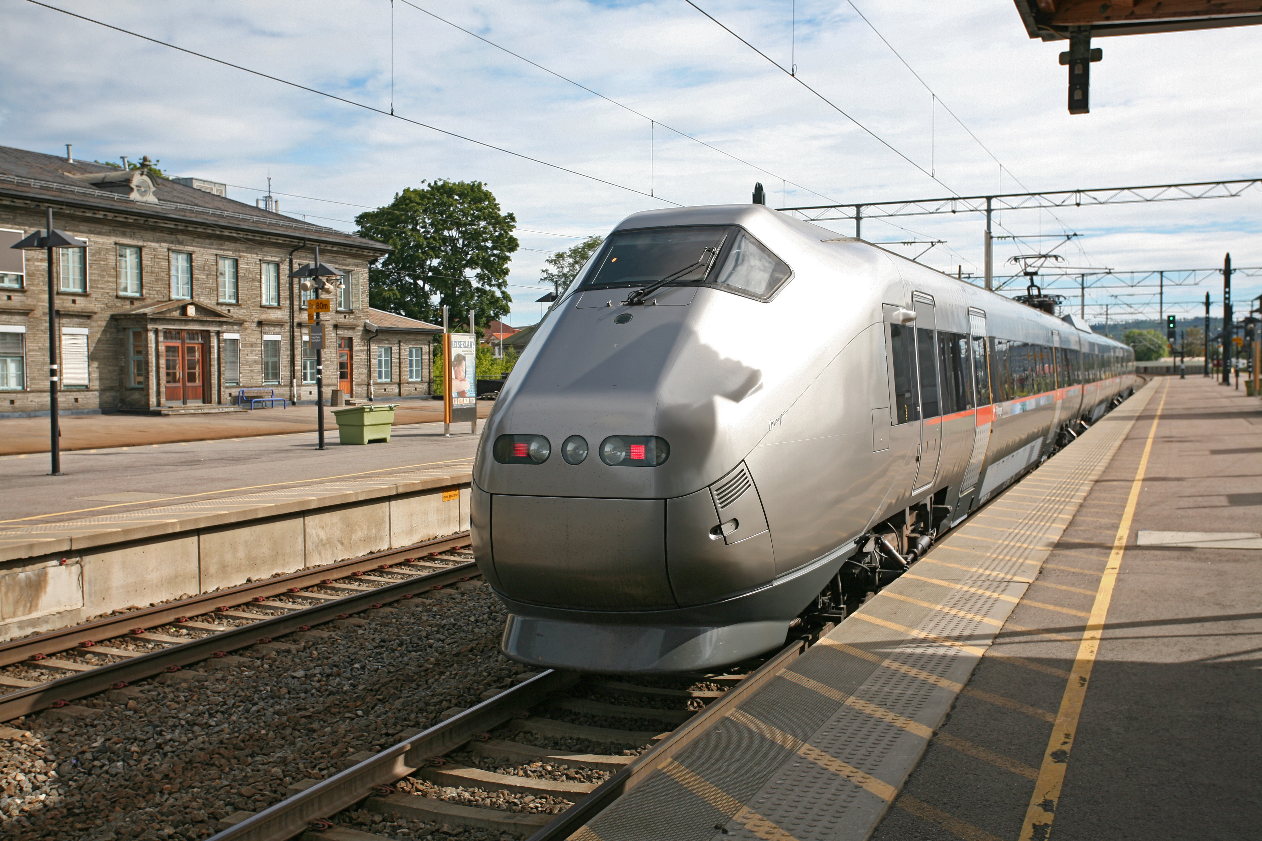
caption = Airport Express Train at Lillestrøm Station
locale = Lillestrøm
municipality = Skedsmo
line = Gardermobanen
Hovedbanen
Kongsvingerbanen
distance = 20.95 km
elevation = 109.0 m asl
coordinates =
start = 1854
architect =
platforms = 4
owner = Jernbaneverket
operator = Norges Statsbaner
Flytoget
SJ
t-bane =
line1 =
line2 =
line3 =
line4 =
line5 =
line6 =
airport =
tram =
bus = Yes|

Lillestrøm is a railway station located at Lillestrøm in Skedsmo, Norway. The station serves as the main transportation hub of the eastern parts of Greater Oslo and all trains east of Oslo stop at Lillestrøm. The station is located on both Hovedbanen, Gardermobanen and is the terminus of Kongsvingerbanen.

The station served local, regional, airport express and express trains. It is also the terminus for the local trains between Lillestrøm and Asker.

History

The station was built as part of Hovedbanen, Norway's first railway, and opened in 1854. When the new Gardermobanen from Oslo via Oslo Airport, Gardermoen to Eidsvoll opened in 1998 the station was completely renovated and became the only stop for the Airport Express east of Oslo.

Nsb next line
line = Hovedbanen
prestation = Sagdalen
poststation = Frogner
Nsb next line
line = Gardermobanen
prestation = Oslo S
poststation = Kløfta
Nsb next line
line = Kongsvingerbanen
prestation = "terminus"
poststation = Tuen
Nsb next express
prespan = yes
trondheim = yes
stockholm = yes
pretrondheim = Oslo S
posttrondheim = Oslo Airport
poststockholm = Sørumsand
Nsb next regional
preairport = Oslo S
postairport = Oslo Airport
prevestfold = Oslo S
postvestfold = Oslo Airport
Nsb next local oslo
line400 = yes
prespan400 = 1
postspan400 = 1
pre400 = Sagdalen
post400 = "termius"
line440 = yes
prespan440 = 3
postspan440 = 1
pre440 = Oslo S
post440 = Frogner
line450 = yes
postspan450 = 1
post450 = Leirsund
line460 = yes
postspan460 = 1
post460 = Tuen


Wikimedia Foundation. 2010.

Игры ⚽ Нужно сделать НИР?

Look at other dictionaries:

  • Lillestrøm — Infobox Settlement name =Lillestrøm official name = other name = native name = nickname = settlement type =Unincorporated city total type = motto = imagesize = image caption = mapsize = map caption = mapsize1 = map caption1 = image dot dot… …   Wikipedia

  • Oslo Airport Station — For the military air base, see Gardermoen Air Station. Oslo Airport Oslo Airport Express Train platform Location Place Gardermoen Municipality …   Wikipedia

  • Bryn railway station (Oslo) — Infobox Norwegian station name = Bryn caption = locale = Bryn municipality = Oslo line = Hovedbanen distance = 3.89 km elevation = 78.3 m coordinates = start = 1858 architect = platforms = 2 owner = Jernbaneverket operator = Norges Statsbaner t… …   Wikipedia

  • Oslo Central Station — Location Place Jernbanetorget Municipality Oslo Coordinates …   Wikipedia

  • Nationaltheatret Station — For the Oslo Metro station above, see Nationaltheatret (station). Nationaltheatret Class 71 train Location Place Vika, Sentrum …   Wikipedia

  • Lysaker Station — ] In 2007 09 the owner and operator Jernbaneverket is renovating the station, but there is a controversy whether the station should remain in a curve.The station is located between Skøyen, to the east, and Stabekk. When the new Askerbanen is… …   Wikipedia

  • Alna railway station — Infobox Norwegian station name = Alna caption = locale = Alna municipality = Oslo line = Hovedbanen Alnabanen distance = 6.87 km elevation = coordinates = start = 1971 architect = platforms = 2 owner = Jernbaneverket operator = Norges Statsbaner… …   Wikipedia

  • Nyland Station — Nyland Location Place Grorud Municipality Oslo Line(s) …   Wikipedia

  • Sagdalen Station — Infobox Norwegian station name = Sagdalen caption = locale = Strømmen municipality = Skedsmo line = Hovedbanen distance = 19.05 km elevation = coordinates = start = 1938 architect = platforms = 2 owner = operator = Norges Statsbaner iata = t bane …   Wikipedia

  • Tuen Station — Infobox Norwegian station name = Tuen caption = locale = Fetsund municipality = Fet line = Kongsvingerbanen distance = 24.40 km elevation = coordinates = start = 1932 architect = platforms = 1 owner = operator = Norges Statsbaner t bane = line1 …   Wikipedia

Share the article and excerpts

Direct link
Do a right-click on the link above
and select “Copy Link”