- Oxton, Merseyside
-
Coordinates: 53°22′51″N 3°02′54″W / 53.3807°N 3.0483°W
Oxton 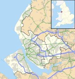
 Oxton
Oxton
Oxton shown within MerseysidePopulation 14,066 (2001 Census)[1] OS grid reference SJ303876 Metropolitan borough Wirral Metropolitan county Merseyside Region North West Country England Sovereign state United Kingdom Post town BIRKENHEAD/PRENTON Postcode district CH42, CH43 Dialling code 0151 Police Merseyside Fire Merseyside Ambulance North West EU Parliament North West England UK Parliament Birkenhead List of places: UK • England • Merseyside Oxton is a suburb of Birkenhead, on the Wirral Peninsula, England. Administratively it is a ward of the Metropolitan Borough of Wirral. Originally a village in its own right, it became part of the Municipal Borough of Birkenhead upon its creation in 1877. Before local government reorganisation on 1 April 1974, it was part of the County Borough of Birkenhead, within the county of Cheshire.
The Royal Mail redefined Oxton in 2003, as being within Prenton (which is in fact a geographically separate suburb of Birkenhead) instead of Birkenhead.
Contents
History
The name Oxa-tún derives from Old Norse, meaning "a farm or enclosure where oxen are kept". By 1278, the name had been adapted into Old English as Oxeton and was recorded as Oxon in 1549.[2]
Oxton was once one of the most affluent areas in England mainly due to its proximity to Liverpool and the fact that along with various other Merseyside locations, it was a favourite residential area for wealthy Liverpool merchants and tradesmen of the time. Oxton Village is a mainly early Victorian era settlement with fine sandstone and brick built houses, many of which now form part of a conservation area designated in April 1979 and administered by the Metropolitan Borough of Wirral.[3] Some of these buildings have been designated by English Heritage as Grade II listed.
A significant part of the land on which Oxton is situated was part of the Estate of the Earl of Shrewsbury - this has been commemorated over the years in many of the road names, which bear the family names and titles of the various Earls; Alton Road, Beresford Road, Chetwynd Road, Ingestre Road, Shrewsbury Road, Talbot Road, Waterford Road and Wexford Road. The oldest pub in Oxton Village is called the 'Shrewsbury Arms' (presumably for the same reason) and the bar which is now known as the 'Oxton Bar and Terrace' was formerly the 'Talbot Hotel'.
Christ Church opened in 1849[4] and has a Father Willis organ,[5] installed in 1888.
Education
Independent and selective Birkenhead School was exclusively a boys' school from its founding in 1860 until 2000, when its Sixth Form became co-educational. It became fully co-educational in 2008. Birkenhead High School was formally an independent selective school for girls but became a state-funded all-ability Academy school in 2009.[6] Both changes are driven by falling numbers of pupils in the schools as a result of the abolition of the Assisted Places Scheme. Despite this both schools maintain their place around the top of the Wirral A Level results.
In addition Prenton Preparatory School lies in the heart of the Conservation Area and Oxton St Saviour's is the local primary school. A number of other schools lie just outside the boundary of Oxton, including St. Anselm's College, Redcourt Preparatory School and Townfield Primary School.
Sport
Oxton Sports Club is also located here. Founded in 1875 as Oxton Cricket Club,[7] other sports played at the club include tennis, lacrosse, squash and bowls.
Demographics
At the 2001 Census, the population of Oxton was 14,066, consisting of 6,680 males and 7,386 females.[1]
Some 2005 demographic statistics of area CH43, which encompasses the geographical area of Oxton, Claughton and parts of Bidston and Noctorum, (total CH43 population (2005): 36,443) are:
Median Age 39 % Retirees 21.9% % Unemployed 4.4% Total Migrants 3,497 % Total Migrants 9.6% Average distance travelled to fixed place of work 12km Governance
Oxton is part of the Birkenhead parliamentary constituency. Frank Field MP (Labour) is therefore Oxton's parliamentary representative.
Local Councillors
After reorganisation in 2004, Oxton forms an electoral ward of the Metropolitan Borough of Wirral, with an electorate of 11,237 (as of 6 May 2010).[8]
Metropolitan Borough of Wirral: Oxton Ward Councillor Party S.E. Kelly Liberal Democrat A. Brighouse Liberal Democrat Mrs Patricia Williams Liberal Democrat 2010 local elections
The results of the Local Election for Oxton Ward on 6 May 2010 were:[8]
Confirmed candidates for United Kingdom local elections, 2010 Party Candidate Votes % ±% Labour David Stephen BARDEN 2,310 31.85 Green Garnette Mary BOWLER 276 3.81% Liberal Democrat Alan BRIGHOUSE 2,941 40.55 Conservative Tina MCDONNELL 1,425 19.65 UKIP Catherine Mary WILLIAMS 301 4.15 Electorate: 11,237; Turnout: 65.1%; Majority: 631
Notable connections
- Sir Leslie Patrick Abercrombie - town planner, commemorated with an English Heritage blue plaque on Village Road, Oxton.
- Dominic Byrne - BBC Radio 1 newsreader and part of the Chris Moyles Breakfast Show team, used to live in the village.
- Michael Chan - Baron Chan of Oxton in the County of Merseyside.
- Elvis Costello - singer/songwriter, lived briefly in Oxton.
- Nicola Horlick - businesswoman.
- Penny Hughes - businesswoman.
- Miles Kane - music artist in the band The Rascals and working with Alex Turner in The Last Shadow Puppets.
- Charlie Landsborough - singer/songwriter.
- Pete Price - radio DJ and talk show host.
- Patricia Routledge - actress, famous for the BBC television sitcom Keeping Up Appearances. From Tranmere, but went to school in Oxton.
- F. E. Smith, 1st Earl of Birkenhead - lawyer and politician, portrayed as "Lord Birkenhead" in the film Chariots of Fire.
- Colonel Philip Toosey - officer played by Alec Guinness in the film Bridge over the River Kwai.
- Fraiche - Merseyside's first Michelin starred restaurant.
References
- ^ a b 2001 Census: Oxton, Office for National Statistics, http://neighbourhood.statistics.gov.uk/dissemination/LeadKeyFigures.do?a=7&b=5941378&c=oxton&d=14&e=16&g=361496&i=1001x1003x1004&m=0&enc=1, retrieved 2 July 2007
- ^ Oxton, National Museums Liverpool, http://www.liverpoolmuseums.org.uk/maritime/exhibitions/magical/placenames/oxton.asp, retrieved 11 July 2010
- ^ Conservation Areas, Metropolitan Borough of Wirral, http://www.wirral.gov.uk/my-services/environment-and-planning/built-conservation/conservation-areas, retrieved 11 July 2010
- ^ Christ Church, Oxton, Birkenhead, Church of England, http://www.achurchnearyou.com/birkenhead-christ-church/, retrieved 11 September 2009
- ^ 'Father Willis' organ, Christ Church, http://www.christchurch.birkenhead.net/pages/Organ/history.htm, retrieved 11 September 2009
- ^ School prepares to make historic move, Wirral Globe, 8 November 2007, http://www.wirralglobe.co.uk/search/display.var.1819178.0.school_prepares_to_make_historic_move.php, retrieved 14 January 2008
- ^ Club History, Oxton Sports Club, http://www.oxtonsportsclub.com/club-history/, retrieved 11 July 2010
- ^ a b Election Result for Oxton Ward, Metropolitan Borough of Wirral, 6 May 2010, http://www.wirral.gov.uk/election/results/2010-05-06/Oxton.shtm, retrieved 11 July 2010
External links
- Oxton Village Online
- The Oxton Society
- The Oxton Artists
- The Oxton Society: Oxton In History, by John Green (2006) Word document Acrobat pdf file
Categories:- Towns and villages in Wirral (borough)

Wikimedia Foundation. 2010.