- DG postcode area
-
Coordinates: 55°04′08″N 3°36′29″W / 55.069°N 3.608°W
Dumfries postcode area 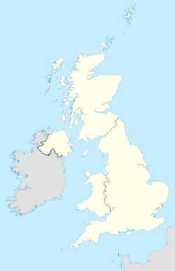
 DG
DGPostcode area DG Postcode area name Dumfries Post towns 14 Postcode districts 15 Postcode sectors 35 Postcodes (live) 6,727 Postcodes (total) 7,341 Statistics as at October 2006 [1] The DG postcode area, also known as the Dumfries and Galloway postcode area,[2] is a group of postcode districts around Annan, Canonbie, Castle Douglas, Dalbeattie, Dumfries, Gretna, Kirkcudbright, Langholm, Lockerbie, Moffat, Newton Stewart, Sanquhar, Stranraer and Thornhill in Scotland. The postcode area also includes a few addresses just over the border in Cumbria, England.
Contents
Coverage
The approximate coverage of the postcode districts:
Postcode district Post town Coverage Local authority area DG1 DUMFRIES DG2 DUMFRIES DG3 THORNHILL DG4 SANQUHAR DG5 DALBEATTIE DG6 KIRKCUDBRIGHT DG7 CASTLE DOUGLAS DG8 NEWTON STEWART DG9 STRANRAER DG10 MOFFAT DG11 LOCKERBIE DG12 ANNAN DG13 LANGHOLM DG14 CANONBIE DG16 GRETNA Adjacent areas
Adjacent postcode areas KA ML TD 
 DG
DG 

CA Clockwise from the east, the adjacent postcode areas are: , CA (City of Carlisle), KA (Kilmarnock), ML (Motherwell), TD (Galashiels).
See also
References
- ^ "National Statistics Postcode Directory" (PDF). Office for National Statistics Postcode Directory (November 2006). Office for National Statistics. November 2006. http://www.statistics.gov.uk/geography/downloads/NSPDVersionNotes.pdf. Retrieved 2009-05-29.
- ^ Royal Mail, Address Management Guide, (2004)
Postcode areas in the United Kingdom, Channel Islands and Isle of Man AB AL B BA BB BD BH BL BN BR BS BT BX CA CB CF CH CM CO CR CT CV CW DA DD DE DG DH DL DN DT DY E EC EH EN EX FK FY G GIR GL GU GY HA HD HG HP HR HS HU HX IG IM IP IV JE KA KT KW KY L LA LD LE LL LN LS LU M ME MK ML N NE NG NN NP NR NW OL OX PA PE PH PL PO PR RG RH RM S SA SE SG SK SL SM SN SO SP SR SS ST SW SY TA TD TF TN TQ TR TS TW UB W WA WC WD WF WN WR WS WV YO ZE
Related lists: Postal counties · Post towns · Postcode districts · London postal district Categories:- Postcode areas covering Scotland
- Post and philately stubs

Wikimedia Foundation. 2010.