- Dzungaria
-
For empire established by the Dzungar people, see Zunghar Khanate.
Dzungaria 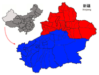 Dzungaria
Chinese name Traditional Chinese 準噶爾 Simplified Chinese 准噶尔 Transcriptions Mandarin - Hanyu Pinyin Zhǔngá'ěr Mongolian name Mongolian Зүүнгарын нутаг Russian name Russian Джунгария Romanization Dzhungariya Uyghur name Uyghur جوڭغار
JonggharDzungaria, also called Zungaria, is a geographical region in northwest China corresponding to the northern half of Xinjiang. It covers approximately 777,000 km2 (300,000 sq mi), lying mostly within Xinjiang, and extending into western Mongolia and eastern Kazakhstan. Formerly the term could cover a wider area, depending on temporary political boundaries.
Contents
Etymology
The name Dzungaria is a corruption of the Mongolian term "Züün Gar" or "Jüün Gar" depending on the dialect of Mongolian used. "Züün"/"Jüün" means "left" and "Gar" means "hand". The name originates from the notion that the Western Mongols are on the left hand side when the Mongol Empire began its division into East and West Mongols. After this fragmentation, the western Mongolian nation was called "Zuun Gar". Today, the cradle of this former nation retains its name: Zungaria.
Dzungarian Basin
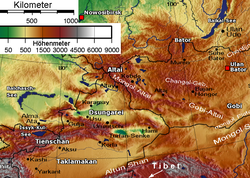 Physical map showing the separation of Dzungaria and the Tarim Basin (Taklamakan) by the Tien Shan Mountains
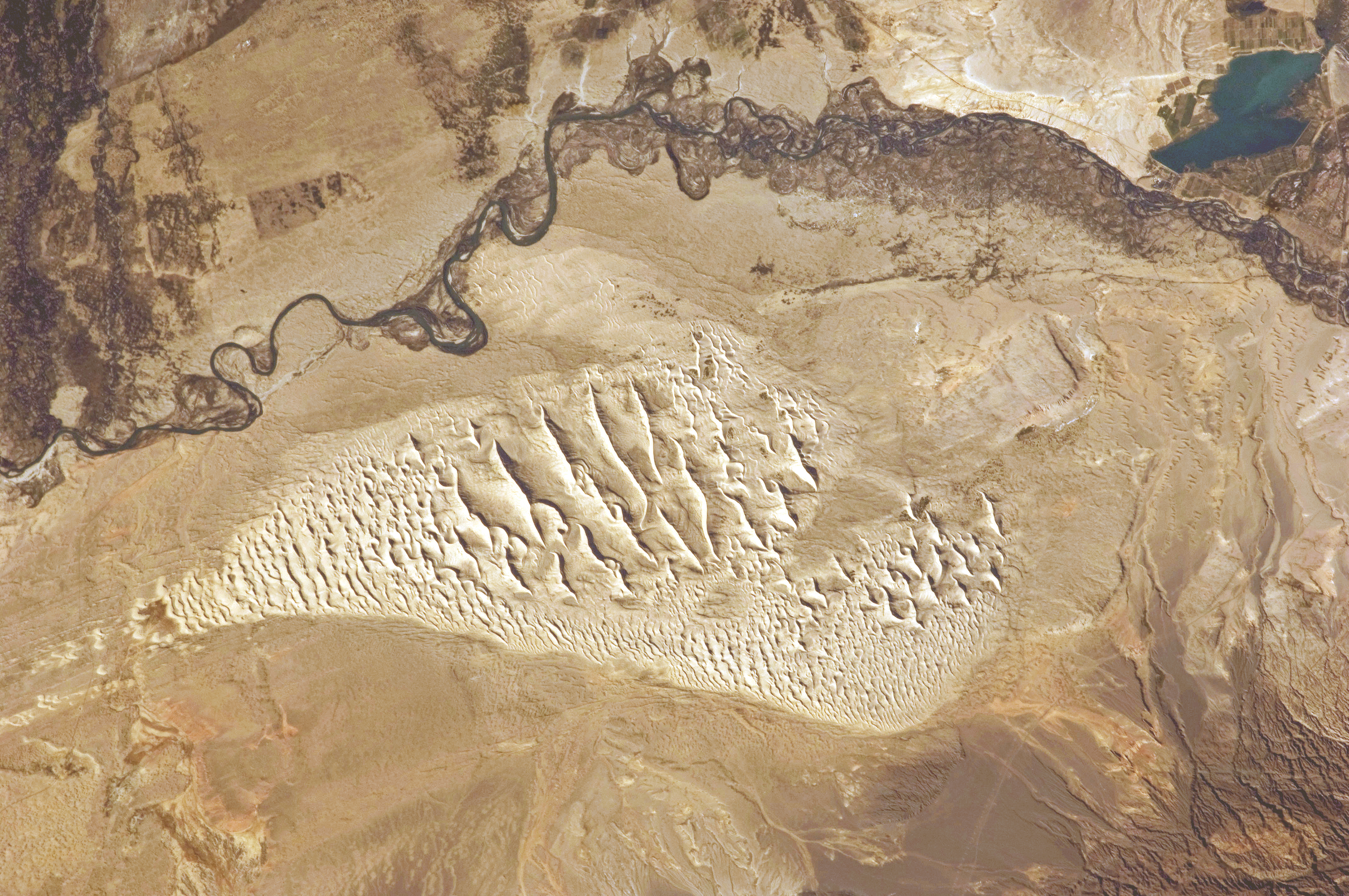
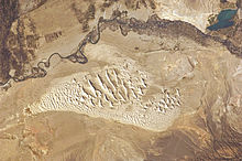 This photograph taken by an astronaut on the ISS highlights a sand dune field within the Burqin-Haba River-Jimunai Desert.
The core of Dzungaria is the triangular Dzungarian Basin (also Junggar Basin) with its central Gurbantunggut Desert. It is bounded by the Tien Shan to the south, the Altai Mountains to the northeast and the Tarbagatai Mountains to the northwest. The three corners are relatively open. The northern corner is the valley of the upper Irtysh River. The western corner is the Dzungarian Gate with its railroad (opened in 1990). The eastern corner leads to Gansu and the rest of China. In the south an easy pass leads from Ürümqi to the Turfan Depression. In the southwest the Borohoro Mountains branch of the Tian Shan separates the basin from the upper Ili River.
The extensive Dzungarian Basin is in the Xinjiang Uyghur Autonomous Region in northwestern China. It is surrounded by mountains. The basin is located between the Mongolian Altai Mountains and Tian Shan to the south.[1] The basin is similar to the larger Tarim Basin on the southern side of the Tian Shan Range. Only a gap in the mountains to the north allows moist air masses to provide the basin lands with enough moisture to remain semi-desert rather than becoming a true desert like most of the Tarim Basin, and allows a thin layer of vegetation to grow. This is enough to sustain populations of wild camels, jerboas, and other wild species.[2]
The Dzungarian Basin is a structural basin with thick sequences of Paleozoic-Pleistocene rocks with large estimated oil reserves.[3] The Gurbantunggut Desert, China’s second largest, is in the center of the basin.[4] Aibi Lake is the basin's catchment center.
The cold climate of nearby Siberia influences the climate of the Dzungarian Basin, making the temperature colder—as low as −4 °F (−20 °C)—and providing more precipitation, ranging from 3 to 10 inches (76 to 250 mm), compared to the warmer, drier basins to the south. Runoff from the surrounding mountains into the basin supplies several lakes. The ecologically rich habitats traditionally included meadows, marshlands, and rivers. However most of the land is now used for agriculture.[2]
It is a largely steppe and semi-desert basin surrounded by high mountains: the Tian Shan (ancient Mount Imeon) in the south and the Altai in the north. Geologically it is an extension of the Paleozoic Kazakhstan Block and was once part of an independent continent before the Altai mountains formed in the late Paleozoic. It does not contain the abundant minerals of Kazakhstan and may have been a pre-existing continental block before the Kazakhstan Block was formed.
Ürümqi, Yining and Karamai are the main cities; other smaller oasis towns dot the piedmont areas.
Prehistory
Dzungaria and its derivatives are used to name a number of pre-historic animals[5] hailing from the rocky outcrops located in an eponymous sedimentary basin of that region, the Junggar Basin.
- Dsungaripterus weii (pterosaur)
- Junggarsuchus sloani (crocodylomorph)
A recent notable find, in February 2006, is the oldest tyrannosaur fossil unearthed by a team of scientists from George Washington University who were conducting a study in the Dzungarian Basin. The species, named Guanlong, lived 160 million years ago, more than 90 million years before the famed Tyrannosaurus rex.[citation needed]
Ecology
Dzungaria is home to a semi-desert steppe ecoregion known as the Dzungarian Basin semi-desert. The vegetation consists mostly of low scrub of Anabasis brevifolia. Taller shrublands of saxaul bush (Haloxylon ammodendron) and Ephedra przewalskii can be found near the margins of the basin. Streams descending from the Tian Shan and Altai ranges support stands of poplar (Populus diversifolia) together with Nitraria roborovsky, N. sibirica, Achnatherum splendens, tamarisk (Tamarix sibirimosissima), and willow (Salix ledebouriana).
The northeastern portion of the Dzungarian Basin semi-desert lies within Great Gobi National Park, and is home to herds of Asian wild ass (Equus hemionus) and goitered gazelle (Gazella subgutturosa), and wild Bactrian camels (Camelus ferus).
The basin was one of the last habitats of Przewalski's Horse (Equus przewalskii), which is now extinct in the wild.
History
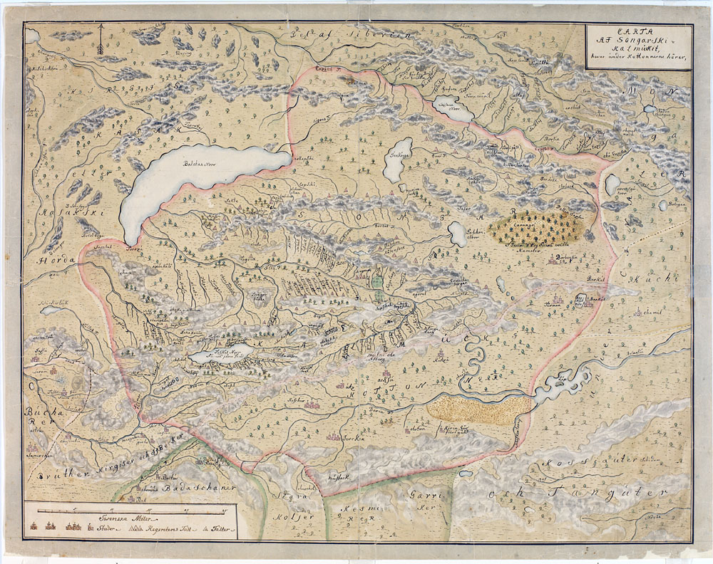
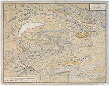 Johan Gustaf Renat's map of Dzungaria, ca 1744.
One of the earliest mentions of the Dzungaria region occurs when the Han Dynasty dispatched an explorer to investigate lands to the west, using the northernmost Silk Road trackway of about 2,600 kilometres (1,600 mi) in length, which connected the ancient Chinese capital of Xi'an to the west over the Wushao Ling Pass to Wuwei and emerged in Kashgar.[6]
Istämi of the Göktürks received the lands of Dzungaria as an inheritance after the death of his father in the latter half of the sixth century AD.[7]
Dzungaria is named after a Mongolian kingdom which existed in Central Asia during the seventeenth and eighteenth centuries. It derived its name from the Dzungars, who were so called because they formed the left wing (züün, left; gar, hand) of the Mongolian army, self-named Oirats. Dzungar power reached its height in the second half of the 17th century, when Kaldan (also known as Galdan Boshigtu Khan), repeatedly intervened in the affairs of the Kazakhs to the west, but it was completely destroyed by the Qing government about 1757–1759. It has played an important part in the history of Mongolia and the great migrations of Mongolian stems westward.
Since 1761, its territory fell mostly to the Qing dynasty (Xinjiang and north-western Mongolia) and partly to Russian Turkestan (earlier Kazakh state provinces of Semirechye- Jetysu and Irtysh river).
Its widest limit included Kashgar, Yarkand, Khotan, the whole region of the Tian Shan, and in short the greater proportion of that part of Central Asia which extends from 35º to 50º N and from 72º to 97º E.
As a political or geographical term Dzungaria has practically disappeared from the map; but the range of mountains stretching north-east along the southern frontier of the Jeti-su, as the district to the south-east of Lake Balkhash preserves the name of Dzungarian Alatau. It also gave name to Dzungarian Hamsters.
Dzungaria and the Silk Road
A traveler going west from China must go either north of the Tien Shan through Dzungaria or south of the Tien Shan through the Tarim Basin. Trade usually took the south side and migrations the north. This is most likely because the Tarim leads to the Ferghana Valley and Iran, while Dzungaria leads only to the open steppe. The difficulty with south side was the high mountains between the Tarim and Ferghana. There is also another reason. The Taklamakan is too dry to support much grass, and therefore nomads when they are not robbing caravans. Its inhabitants live mostly in oases formed where rivers run out of the mountains into the desert. These are inhabited by peasants who are unwarlike and merchants who have an interest in keeping trade running smoothly. Dzungaria has a fair amount of grass, few towns to base soldiers in and no significant mountain barriers to the west. Therefore trade went south and migrations north.[8]
People
The population consists of Kazakhs, Kyrgyz, Mongols, Uyghurs and Han Chinese. Since 1953 there has been a massive influx of Han Chinese to work on water conservation and industrial projects, especially the Karamay oil fields.
Economy
Wheat, barley, oats, and sugar beets are grown, and cattle, sheep, and horses are raised. The fields are irrigated with melted snow from the permanently white-capped mountains.
Dzungaria has deposits of coal, iron, and gold, as well as large oil fields.
References
- ^ "Junggar Basin". Encyclopedia Britannica. http://www.britannica.com/eb/article-9031692/Junggar-Basin. Retrieved 2008-02-13.
- ^ a b "Junggar Basin semi-desert (PA1317)". National Geographic. http://www.nationalgeographic.com/wildworld/profiles/terrestrial/pa/pa1317.html. Retrieved 2008-02-13.
- ^ "Geochemistry of oils from the Junggar Basin, Northwest China". AAPG Bulletin, GeoScience World. 1997. http://aapgbull.geoscienceworld.org/cgi/content/abstract/81/11/1926. Retrieved 2008-02-13.
- ^ "Junggar Basin semi-desert (PA1317)". World Wildlife Organization. http://www.worldwildlife.org/wildworld/profiles/terrestrial/pa/pa1317_full.html. Retrieved 2008-02-13.
- ^ Nature, Nature Publishing Group, Norman Lockyer, 1869
- ^ Silk Road, North China, C.Michael Hogan, the Megalithic Portal, ed. A. Burnham
- ^ The Empire of the Steppes: A History of Central Asia, By René Grousset
- ^ Grosset, 'The Empire of the Steppes', p xxii,
Sources
 This article incorporates text from a publication now in the public domain: Chisholm, Hugh, ed (1911). Encyclopædia Britannica (11th ed.). Cambridge University Press.
External links
Xinjiang topics General Geography Cities • Tian Shan • Dzungarian Basin • Tarim Basin • Gurbantünggüt Desert • Kumtag Desert • Taklimakan Desert • Turpan Depression • Karakoram Mountains • Altai Mountains • Tian Shan • Kunlun Shan • Pamir Mountains • Torugart Pass • Karakoram PassEducation Culture Cuisine Dapanji • Sangza • Samsa • Youtazi • Pamirdin • Xurpa • Tohax • Tunurkawab • Chinese Islamic cuisineVisitor attractions Apak Khoja and Xiang Fei Tomb • Flaming Mountains • Jiaohe Ruins • Gaochang • Grand Bazaar, Ürümqi • Id Kah Mosque • Karakul Lake • Kizil Caves • Ruins of NiyaCategories:- Deserts and xeric shrublands
- Ecoregions of China
- Ecoregions of Asia
- Geography of Mongolia
- Geography of Xinjiang
- Flora of Xinjiang
- Deserts of China
- Deserts of Mongolia
- Environment of Mongolia
- Kalmykia
- Altai
- Sites along the Silk Road
- Palearctic


Wikimedia Foundation. 2010.