- Grant County, Wisconsin
-
Grant County, Wisconsin 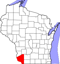
Location in the state of Wisconsin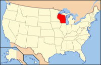
Wisconsin's location in the U.S.Founded information needed Seat Lancaster Largest city Platteville Area
- Total
- Land
- Water
1,183 sq mi (3,065 km²)
1,148 sq mi (2,973 km²)
35 sq mi (92 km²), 3.1%Population
- (2000)
- Density
49,597
43/sq mi (17/km²)Time zone Central: UTC-6/-5 Website www.co.grant.wi.gov/ Grant County is a county located in the U.S. state of Wisconsin. As of 2000, the population was 49,597. Its county seat is Lancaster.[1] Estimates for 2008 show a population of 49,238.[2] Grant County also is in the tri-state area with Illinois, Iowa, and Wisconsin, and is crossed by travelers commuting to Madison from a number of eastern Iowan cities, and by residents of northern Illinois traveling to the Twin Cities or La Crosse, Wisconsin.
Contents
Geography
According to the U.S. Census Bureau, the county has a total area of 1,183 square miles (3,064.0 km2), of which 1,148 square miles (2,973.3 km2) is land and 35 square miles (90.6 km2) (3.1%) is water.
Major highways
 U.S. Highway 18
 U.S. Highway 151
 U.S. Highway 61
 Highway 35 (Wisconsin)
 Highway 11 (Wisconsin)
 Highway 80 (Wisconsin)
 Highway 81 (Wisconsin)
 Highway 133 (Wisconsin)
Adjacent counties
- Crawford County, Wisconsin - north
- Richland County, Wisconsin - northeast
- Iowa County, Wisconsin - east
- Lafayette County, Wisconsin - east
- Jo Daviess County, Illinois - southeast
- Dubuque County, Iowa - south
- Clayton County, Iowa - west
Demographics
 2000 Census Age Pyramid for Grant County.
Historical populations Census Pop. %± 1900 38,881 — 1910 39,007 0.3% 1920 39,044 0.1% 1930 38,469 −1.5% 1940 40,639 5.6% 1950 41,460 2.0% 1960 44,419 7.1% 1970 48,398 9.0% 1980 51,736 6.9% 1990 49,264 −4.8% 2000 49,597 0.7% 2010 51,208 3.2% WI Counties 1900-1990 As of the census[3] of 2000, there were 49,597 people, 18,465 households, and 12,390 families residing in the county. The population density was 43 people per square mile (17/km²). There were 19,940 housing units at an average density of 17 per square mile (7/km²). The racial makeup of the county was 98.23% White, 0.52% Black or African American, 0.13% Native American, 0.46% Asian, 0.01% Pacific Islander, 0.14% from other races, and 0.50% from two or more races. 0.56% of the population were Hispanic or Latino of any race. 52.0% were of German, 9.2% English, 8.8% Irish, 6.6% American and 6.4% Norwegian ancestry according to Census 2000.
There were 18,465 households out of which 30.50% had children under the age of 18 living with them, 56.10% were married couples living together, 7.50% had a female householder with no husband present, and 32.90% were non-families. 26.00% of all households were made up of individuals and 12.10% had someone living alone who was 65 years of age or older. The average household size was 2.51 and the average family size was 3.03.
In the county, the population was spread out with 23.70% under the age of 18, 14.60% from 18 to 24, 24.80% from 25 to 44, 21.60% from 45 to 64, and 15.30% who were 65 years of age or older. The median age was 36 years. For every 100 females there were 103.00 males. For every 100 females age 18 and over, there were 102.00 males.
Cities, villages, and towns
 Grant County Courthouse, Armand D. Koch, architect, 1902
- Bagley (village)
- Beetown (town)
- Bloomington (town)
- Bloomington (village)
- Blue River (village)
- Boscobel (city)
- Cassville (town)
- Cassville (village)
- Castle Rock (town)
- Clifton (town)
- Cuba City (partially) (city)
- Dickeyville (village)
- Ellenboro (town)
- Fennimore (city)
- Glen Haven (town)
- Harrison (town)
- Hazel Green (town)
- Hazel Green (partially) (village)
- Hickory Grove (town)
- Jamestown (town)
- Lancaster (city)
- Liberty (town)
- Lima (town)
- Little Grant (town)
- Livingston (village)
- Marion (town)
- Millville (town)
- Montfort (village)
- Mount Hope (town)
- Mount Hope (village)
- Mount Ida (town)
- Muscoda (town)
- Muscoda (village)
- North Lancaster (town)
- Paris (town)
- Patch Grove (town)
- Patch Grove (village)
- Platteville (town)
- Platteville (city)
- Potosi (town)
- Potosi (village)
- Smelser (town)
- South Lancaster
- Tennyson (village)
- Waterloo (town)
- Watterstown (town)
- Wingville (town)
- Woodman (town)
- Woodman (village)
- Wyalusing (town)
Unincorporated communities
- Annaton
- Arthur
- Bigpatch
- British Hollow
- Brodtville
- Burton
- Centerville
- Cornelia
- Ellenboro
- Elmo
- Fair Play
- Five Points
- Flora Fountain
- Georgetown
- Glen Haven
- Hickory Grove
- Hurricane
- Kieler
- Lancaster Junction
- Louisburg
- McCartney
- Millville
- Mount Ida
- Prairie Corners
- Rockville
- Rutledge
- Saint Rose
- Sandy Hook
- Sinsinawa
- Stitzer
- Union
- Wyalusing
Government and infrastructure
The Wisconsin Secure Program Facility (WSPF), a Wisconsin Department of Corrections prison for men, is located in Boscobel in Grant County.[4][5]
See also
- National Register of Historic Places listings in Grant County, Wisconsin
- Upper Mississippi River National Wildlife and Fish Refuge
References
- ^ "Find a County". National Association of Counties. http://www.naco.org/Counties/Pages/FindACounty.aspx. Retrieved 2011-06-07.
- ^ http://www.census.gov/popest/counties/CO-EST2008-07.html 2008 US Census County Population Estimates for Wisconsin
- ^ "American FactFinder". United States Census Bureau. http://factfinder.census.gov. Retrieved 2008-01-31.
- ^ "Boscobel city, Wisconsin." U.S. Census Bureau. Retrieved on October 10, 2010.
- ^ "Wisconsin Secure Program Facility." Wisconsin Department of Corrections. Retrieved on October 10, 2010.
External links

Crawford County Richland County Clayton County, Iowa 
Iowa County and Lafayette County  Grant County, Wisconsin

Dubuque County, Iowa Jo Daviess County, Illinois Municipalities and communities of Grant County, Wisconsin Cities Boscobel | Cuba City‡ | Fennimore | Lancaster | Platteville

Villages Bagley | Bloomington | Blue River | Cassville | Dickeyville | Hazel Green‡ | Livingston‡ | Montfort‡ | Mount Hope | Muscoda‡ | Patch Grove | Potosi | Tennyson | Woodman
Towns Beetown | Bloomington | Boscobel | Cassville | Castle Rock | Clifton | Ellenboro | Fennimore | Glen Haven | Harrison | Hazel Green | Hickory Grove | Jamestown | Liberty | Lima | Little Grant | Marion | Millville | Mount Hope | Mount Ida | Muscoda | North Lancaster | Paris | Patch Grove | Platteville | Potosi | Smelser | South Lancaster | Waterloo | Watterstown | Wingville | Woodman | Wyalusing
CDPs Glen Haven | Kieler | Sandy Hook
Unincorporated
communitiesAnnaton | Arthur | Bigpatch | British Hollow | Brodtville | Burton | Centerville | Cornelia | Ellenboro | Elmo | Fair Play | Five Points | Flora Fountain | Georgetown | Hickory Grove | Hurricane | Lancaster Junction | Louisburg | McCartney | Millville | Mount Ida | Prairie Corners | Rockville | Rutledge | Saint Rose | Sinsinawa | Stitzer | Union | Wyalusing
Footnotes ‡This populated place also has portions in an adjacent county or counties
Categories:- Wisconsin counties
- Grant County, Wisconsin
- Wisconsin counties on the Mississippi River


Wikimedia Foundation. 2010.