- Door County, Wisconsin
-
Door County, Wisconsin 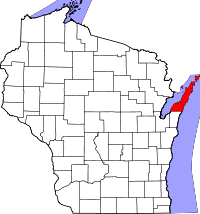
Location in the state of Wisconsin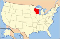
Wisconsin's location in the U.S.Founded 1851 Seat Sturgeon Bay Area
- Total
- Land
- Water
2,370 sq mi (6,138 km²)
483 sq mi (1,250 km²)
1,887 sq mi (4,888 km²),Population
- (2000)
- Density
27,961
57.92/sq mi (22/km²)Time zone Central: UTC-6/-5 Website www.co.door.wi.gov  Door County Government Center
Door County is a county in the U.S. state of Wisconsin. As of 2000, the population was 27,961. Its county seat is Sturgeon Bay. Door County is a popular vacation and tourist destination, especially for residents of Wisconsin and Illinois.
The county is named after the strait between the Door Peninsula and Washington Island. The dangerous passage, which is now scattered with shipwrecks, was known to early French explorers and local Native Americans. Because of the natural hazards of the strait, where the waters of Green Bay meet the open body of Lake Michigan, they gave it the French appellation Porte des Morts Passage, which in English means the "Door to the Way to Death," or simply, "Death's Door."
Contents
Geography
The county has a total area of 2,370 square miles, the largest county in Wisconsin, of which 483 square miles of it is land and 1,887 square miles of it (79.63%) is water. The county also has 298 miles of shoreline. Suffolk County, New York, on Long Island (980 miles) and Barnstable County, Massachusetts, which includes Cape Cod (550 miles)[citation needed], Chippewa County, Michigan (456 miles),[1] and Keweenaw County, Michigan (424 miles) [2] have more. This is one of the reasons that locals and tourists alike refer to the area as the Cape Cod of the Midwest. The county covers the majority of the Door Peninsula. With the completion of the Sturgeon Bay Shipping Canal in 1881, the northern half of the peninsula, in actuality, became an island.
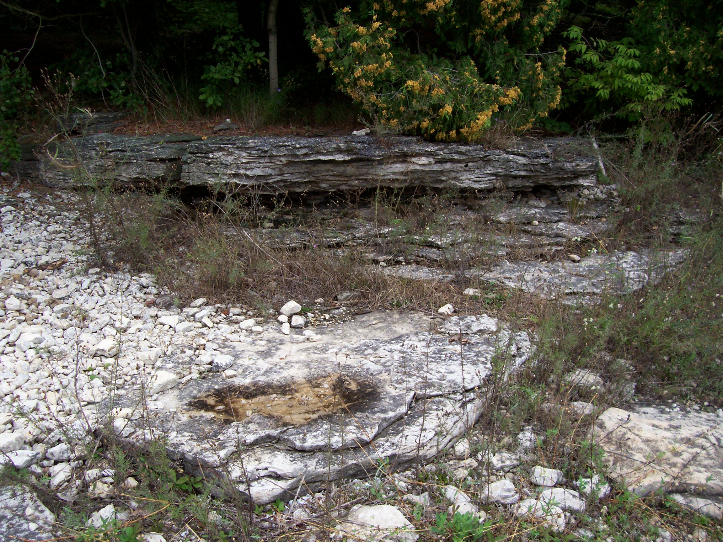
Limestone outcroppings of the Niagara Escarpment are visible on both shores of the peninsula, but are larger and more prominent on the Green Bay side as seen at the Bayshore Blufflands. Progressions of dunes have created much of the rest of the shoreline, especially on the easterly side. Flora along the shore provides clear evidence of plant succession. The middle of the peninsula is mostly flat or rolling cultivated land. Soils overlaying the dolomite bedrock are very thin in the northern half of the county; 39% of the County is mapped as having less than three feet to bedrock. Beyond the northern tip of the peninsula, the partially submerged ridge forms a number of islands that stretch to the Garden Peninsula in the Upper Peninsula of Michigan. The largest of these islands is Washington Island. Most of these islands form the Town of Washington.
-

Door County Sign on Highway 57
-

Cave Point County Park
-

Outcroppings at Newport State Park approximately 10 feet (3 m) from Lake Michigan
Major highways
 Highway 42 (Wisconsin)
 Highway 57 (Wisconsin)
Adjacent County
- Kewaunee County, Wisconsin - South
- Oconto County, Wisconsin - West, water boundary only, across Green Bay
- Marinette County, Wisconsin - North-West, water boundary only, across Green Bay
- Menominee County, Michigan - North-West, water boundary only, across Green Bay
- Delta County, Michigan - North, water boundary only, across Green Bay
National protected areas
- Gravel Island National Wildlife Refuge
- Green Bay National Wildlife Refuge
History
The Door County peninsula has been inhabited for about 11,000 years. Artifacts from an ancient village site at Nicolet Bay Beach have been dated to about 400 BC. This site was occupied by various cultures until about 1300 AD.
The 18th and 19th centuries saw the immigration and settlement of pioneers, mariners, fishermen and farmers, with the first white settler being Increase Claflin.[3] Economic sustenance came from lumbering and tourism.
During the 18th century, Door County was actually referred to as "Death's Door territory" by the French, the water strait between what is now the Door Peninsula and Washington Island is very hazardous for navigating ships. This led to (and continues to cause) many vessels being damaged and shipwrecks, hence the name.
During the 19th century, various groups of Native Americans occupied the area that would become Door County and its islands. Beginning in mid-century, these Indians, mostly Potawatomi, were removed from the peninsula by the federal government under the Indian Removal Act of 1830. Later in the 19th century there was a fairly large-scale immigration of Belgian Walloons, who populated a small region in the county.
A Civilian Conservation Corps camp was established at Peninsula State Park during the Great Depression. In the summer of 1945, Fish Creek was the site of a German POW camp, under an affiliation with a base camp at Fort Sheridan, Illinois.[4] The prisoners engaged in construction projects, cut wood, and picked cherries in Peninsula State Park and the surrounding area. Eagle Bluff Lighthouse was constructed in Peninsula State Park in 1868 on orders from President Andrew Johnson, at a cost of $12,000. It was restored by the Door County Historical Society in 1964, and opened to the public.
Demographics
 2000 Census Age Pyramid for Door County.
Historical populations Census Pop. %± 1860 2,948 — 1870 4,919 66.9% 1880 11,645 136.7% 1890 15,082 29.5% 1900 17,583 16.6% 1910 18,711 6.4% 1920 19,073 1.9% 1930 18,182 −4.7% 1940 19,095 5.0% 1950 20,870 9.3% 1960 20,685 −0.9% 1970 20,106 −2.8% 1980 25,029 24.5% 1990 25,690 2.6% 2000 27,961 8.8% 2010 27,785 −0.6% 1900-1990 1860–1890 As of the census[5] of 2000, there were 27,961 people, 11,828 households, and 7,995 families residing in the county. The population density was 58 people per square mile (22/km²). There were 19,587 housing units at an average density of 41 per square mile (16/km²). The racial makeup of the county was 97.84% White, 0.19% Black or African American, 0.65% Native American, 0.29% Asian, 0.01% Pacific Islander, 0.33% from other races, and 0.69% from two or more races. 0.95% of the population were Hispanic or Latino of any race. 39.4% were of German and 10.3% Belgian ancestry according to Census 2000. A small pocket of Walloon speakers is the only Walloon-language region outside of Wallonia and its immediate neighborhood.
There were 11,828 households out of which 26.90% had children under the age of 18 living with them, 58.10% were married couples living together, 6.50% had a female householder with no husband present, and 32.40% were non-families. 28.10% of all households were made up of individuals and 12.70% had someone living alone who was 65 years of age or older. The average household size was 2.33 and the average family size was 2.84.
In the county, the population was spread out with 22.10% under the age of 18, 6.10% from 18 to 24, 25.40% from 25 to 44, 27.70% from 45 to 64, and 18.70% who were 65 years of age or older. The median age was 43 years. For every 100 females there were 97.10 males. For every 100 females age 18 and over, there were 94.50 males.
Tourism
 Door County Fairgrounds
 Cherry tree
 Fish Boil platter
Although Door County has a year-round population of about 28,000, it experiences a tourist explosion each summer between Memorial Day and Labor Day, as the Lake Michigan spring gives way to a beautiful three month summer. Most businesses are specifically targeted to visitors, and close during the "off season." Throughout the summer, the population of Door County can reach as high as 250,000. The majority of tourists and summer residents come from the metropolitan areas of Milwaukee, Chicago, Madison, and the Twin Cities.[6] The area is known as "the Cape Cod of the Midwest".[6]
Door County is home to five of Wisconsin's state parks: Newport State Park, northeast of Ellison Bay; Peninsula State Park, along more than six miles (10 km) of the Green Bay shoreline; Potawatomi State Park, along Sturgeon Bay; Rock Island State Park, off the tip of the Door Peninsula; and Whitefish Dunes State Park, along Lake Michigan. These five parks are known as "five jewels in the crown." They offer visitors recreational opportunities that include sightseeing, hiking, camping, swimming, fishing, and snowmobiling. Many small businesses surrounding these parks offer moped or bicycle rentals.
Door County has 12 lighthouses. Most were built during the 19th century and are listed in the National Register of Historic Places: Baileys Harbor Range Lights, Cana Island Lighthouse, Chambers Island Lighthouse, Eagle Bluff Lighthouse, Pilot Island Lighthouse, Plum Island Range Lights, Pottawatomie Lighthouse, and Sturgeon Bay Canal Lighthouse. The other lighthouses in the county are: Baileys Harbor Lighthouse, Boyer Bluff Light, Sherwood Point Lighthouse, and the Sturgeon Bay Canal North Pierhead Light.
Fish boils, offered at many Door County restaurants, are a popular meal for tourists. Potatoes, onions and whitefish from the local waters are cooked in a large kettle over a wood fire. At the end of the cooking, the cook throws fuel oil or kerosene on the fire. This "flame up" causes the water to boil over. The fish and vegetables are served with melted butter. This meal is traditionally followed by cherry pie, a traditional dessert in the area.
Door County prides itself on its cherry orchards, and a history of cherry growing that dates back to the 19th century. Soil and weather conditions - warm days and cool nights - influenced by Lake Michigan and Green Bay have created an ideal environment for growing these fruits. Many of the cherry orchards offer "pick your own cherries" along with more traditional pre-picked containers. Today with around 2,200 acres (8.9 km2) of cherry orchards and another 1,000 acres (4.0 km2) of apple orchards, Door County is filled with blossoms in the spring and richly decorated with the fruits in the late summer and fall. Montmorency cherries are usually picked from mid-July to early- to mid-August. Early varieties of apples, such as Paula Reds, are harvested as early as late August. Golden Delicious are harvested through mid-October.[7] Cherry and apple stands can be found along many of Door County's country roads when in season. A variety of cherry products can be found in retail outlets in the county. Door County has five wineries and one microbrewery.[8]
Airports
- Door County Cherryland Airport (KSUE), located 3 miles west of Sturgeon Bay, Wisconsin
- Ephraim-Fish Creek Airport (3D2), located 1 mile southwest of Ephraim, Wisconsin
City, villages, and towns
 Door County, Wisconsin from the 1895 U.S. Atlas
- Baileys Harbor
- Brussels
- Clay Banks
- Egg Harbor (town)
- Egg Harbor
- Ephraim
- Forestville (town)
- Forestville
- Gardner
- Gibraltar
- Jacksonport
- Liberty Grove
- Nasewaupee
- Sevastopol
- Sister Bay
- Sturgeon Bay
- Union
- Washington
Unincorporated communities
- Baileys Harbor
- Brussels
- Carlsville
- Carnot
- Detroit Harbor
- Ellison Bay
- Fish Creek
- Gills Rock
- Idlewild
- Rosiere (partial)
- Rowleys Bay
- Salona
- Shoemaker Point
- Valmy
- Vignes
- Washington
- West Jacksonport
- Whitefish Bay
See also
References
- ^ "MEDC - Economic Profiler - Chippewa County"
- ^ "Keweenaw Tourism Profile"
- ^ Door County's First Settler, Hjalmar Holand, History of Door County, Wisconsin (1917)
- ^ "POW Camps in the USA"
- ^ "American FactFinder". United States Census Bureau. http://factfinder.census.gov. Retrieved 2008-01-31.
- ^ a b Lyttle, Bethany (2008-09-11). "‘The Cape Cod of the Midwest’". New York Times. http://www.nytimes.com/2008/09/12/greathomesanddestinations/12mark.html?partner=rssnyt&emc=rss. Retrieved 2008-09-25.
- ^ Apple & Cherry Orchards: Door County Wisconsin
- ^ [peninsula.http://www.doorcounty.com/do/wineries-breweries.aspx "Door County Wisconsin Wineries & Breweries"
External links
- Door County official government website
- Door County Finder
- Door County Visitor Bureau
- Northeast Wisconsin Historical County Plat Maps & Atlases University of Wisconsin Digital Collections Center
- History of Door County, Wisconsin (1881)
- History of Door County, Wisconsin, The County Beautiful (1917)
- Peninsula Pulse independent newspaper

Lake Michigan Green Bay 
Lake Michigan  Door County, Wisconsin

Kewaunee County Municipalities and communities of Door County, Wisconsin County seat: Sturgeon Bay City 
Villages Towns Baileys Harbor | Brussels | Clay Banks | Egg Harbor | Forestville | Gardner | Gibraltar | Jacksonport | Liberty Grove | Nasewaupee | Sevastopol | Sturgeon Bay | Union | Washington
CDPs Baileys Harbor | Ellison Bay | Little Sturgeon
Unincorporated
communitiesBrussels | Carlsville | Carnot | Detroit Harbor | Fish Creek | Gills Rock | Idlewild | Institute | Jacksonport | Juddville | Kolberg | Maplewood | Namur | North Bay | Northport | Peninsula Center | Rosiere‡ | Rowleys Bay | Salona | Shoemaker Point | Valmy | Vignes | Washington | West Jacksonport | Whitefish Bay
Footnotes ‡This populated place also has portions in an adjacent county or counties
Categories:- Wisconsin counties
- Door County, Wisconsin
- 1851 establishments in the United States
- Important Bird Areas of the United States
-


Wikimedia Foundation. 2010.